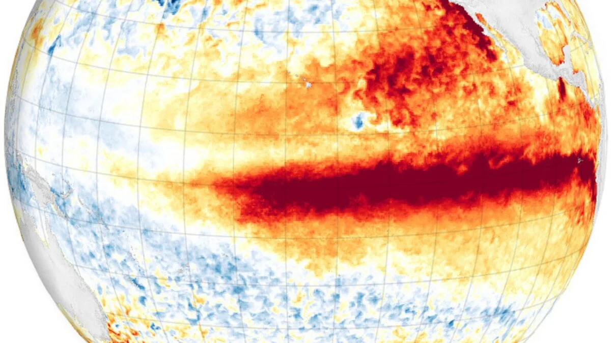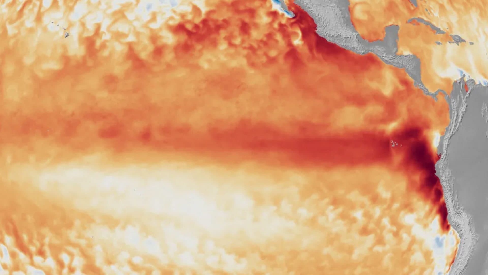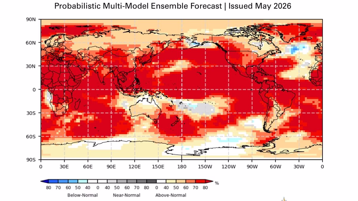
Forecasters are predicting probabilities of sea surface temperatures (SST) over 2°C in the monitored region of the Nino in the Pacific. When that level is reached, NOAA calls it a “very strong” El Nino or super El Nino.
| Photo Credit:
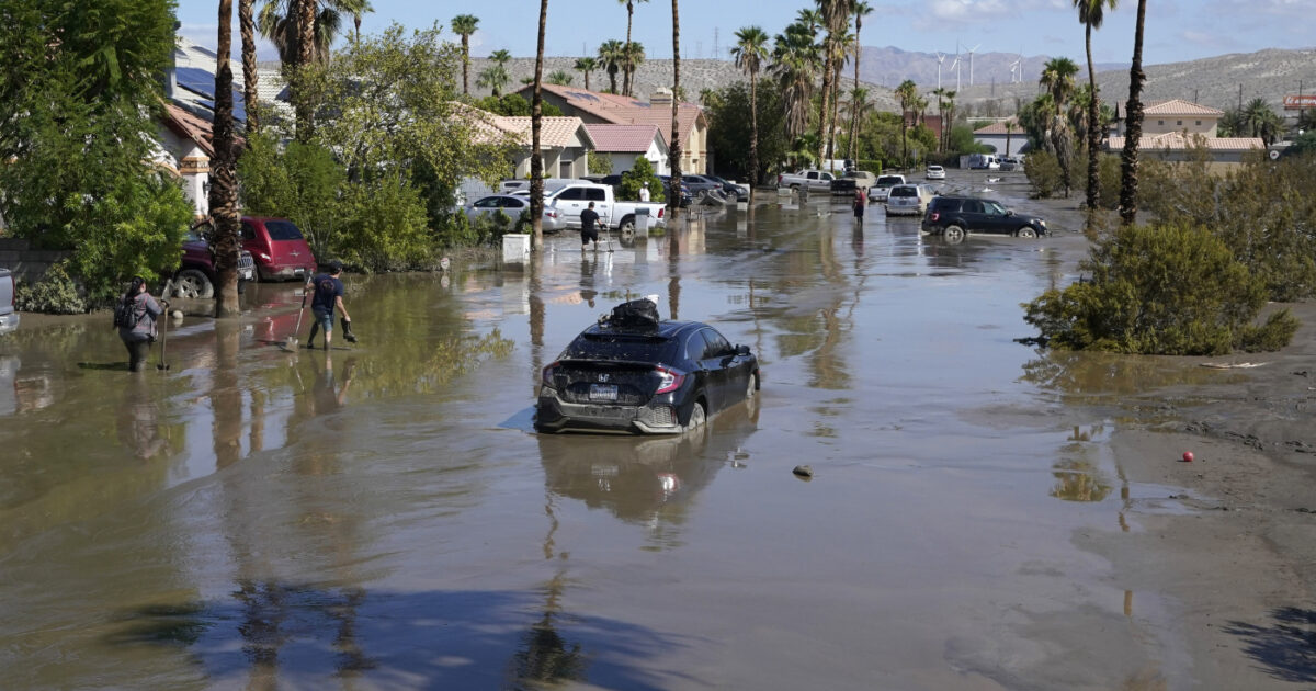
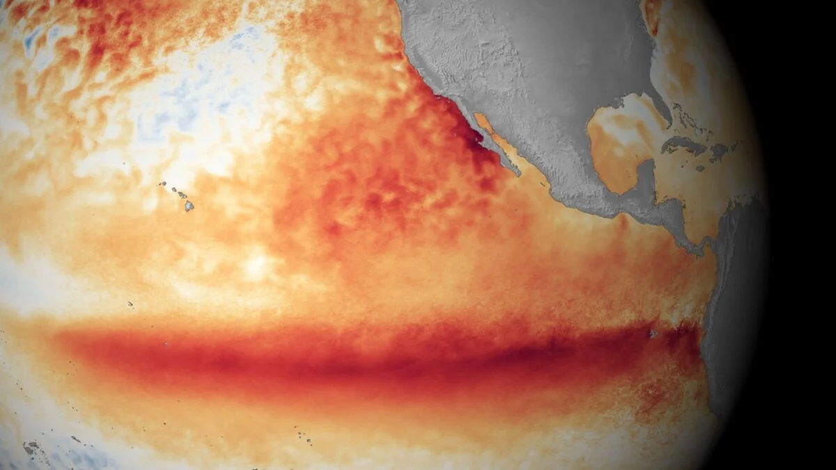
Drought-bearing El Nino, whose onset has been declared by various global weather organisations, has 60 per cent chance of becoming a Super El Nino, the National Weather Service (NWS) of the US weather agency National Oceanic and Atmospheric Administration’s (NOAA) has said.Announcing the onset of El Nino — the return of a climate phenomenon that can reshape weather patterns across the globe — the NWS said warming of Pacific Ocean waters is expected to intensify over the course of the year, with a 63 per cent chance of it reaching “very strong” levels by winter.Forecasters are predicting probabilities of sea surface temperatures (SST) rising over 2°C in the monitored region of the Nino in the Pacific. When that level is reached, NOAA calls it a “very strong” El Nino or super El Nino.The NWS made no mention of the Indian Ocean Dipole (IOD), since it does not track developments in the Indian Ocean.Indian Ocean DipoleJapanese weather body JAMSTEC said on Thursday the tropical Indian Ocean is now in a neutral state. A positive Indian Ocean Dipole (IOD) event is predicted by the model in boreal midsummer, July.A positive IOD can bring additional moisture to India, often aiding monsoon rains even in an El Nino year. IOD is a climate phenomenon driven by changes in sea temperatures in the Indian Ocean. Its positive, negative and neutral phases can influence the Indian monsoon.The development comes on the heels of the India Meteorological Department (IMD) lowering its forecast for the South-West Monsoon to receive 90 per cent of the long-period average rainfall. The monsoon has arrived 3 days late this year on the Kerala coast on June 4.Pacific PulseNOAA also watches the atmosphere over this part of the Pacific for a pattern called the “Walker Circulation", a giant east-to-west movement of air driven by the temperature and pressure differences between the warm western and cool eastern oceans. El Nino is declared when the Walker Circulation collapses and warmer water moves east towards South America.The latest weekly Nino-3.4 index value was +0.7°C, while the Nino-4 (westernmost) and Nino-1+2 (easternmost) indices were +0.7°C and +2.1°C, respectively.NWS said the equatorial subsurface temperature index (averaged between 180° and 100°W) has decreased over the past month, but well-above-average subsurface temperatures persisted across the central and eastern equatorial Pacific.Published on June 12, 2026