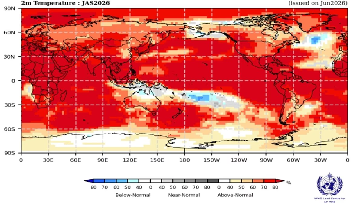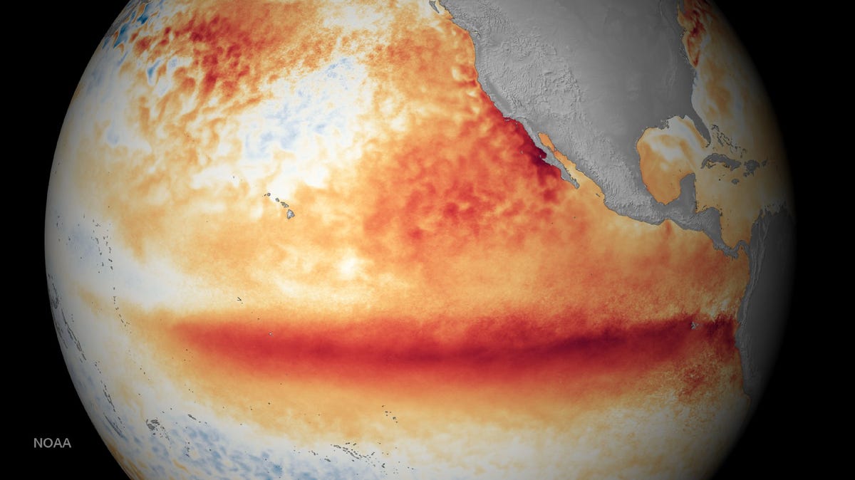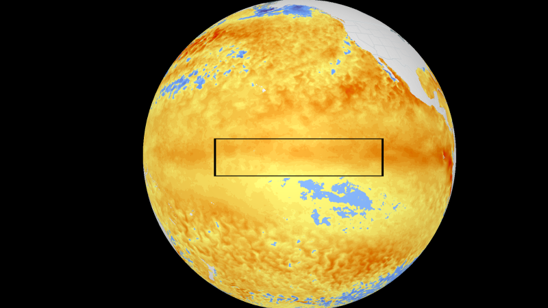
A powerful Super El Niño could be developing in the Pacific Ocean, and forecasters say it may have major consequences for weather patterns across the United States and beyond. New seasonal forecast data from the European Centre for Medium-Range Weather Forecasts (ECMWF) suggests the climate phenomenon is strengthening rapidly. Scientists are keeping a close eye on the on the tropical Pacific Ocean, predicting the emergence of an intense, “Super” El Niño that would be among the stronger events on record.Forecasters say El Niño is likely to intensify quickly over the tropical Pacific in the months ahead, potentially reaching exceptionally strong levels by the time it peaks later this year between late fall and early winter.ALSO READ: Germany sick leave policyWhat is a Super El Niño?A Super El Niño is an exceptionally strong El Niño event characterized by unusually high sea surface temperatures in the tropical Pacific. According to reports, due to the “super” El Niño, parts of the Pacific are expected to be about 3°C warmer than average by the end of 2026.ALSO READ: Quote of the Day by ShakiraAlthough there is no official universal threshold, meteorologists generally reserve the term for the strongest events, such as those seen in 1982-83, 1997-98 and 2015-16. In 2015-16, a “super” El Niño pushed more than 36 million people across east and southern Africa into hunger.These powerful episodes release vast amounts of heat into the atmosphere and are often associated with widespread weather extremes, including floods, droughts and record-breaking temperatures.Why is Super El Niño making headlines?According to the latest ECMWF seasonal forecasts, sea surface temperatures in the central Pacific Ocean are rising sharply, increasing the likelihood of an exceptionally strong El Niño event."The latest data from the ECMWF's plume of forecast members is surging toward the top of the charts, confirming that a monster El Niño is rapidly locking into place," the FOX Forecast Center said.While El Niño forms in the Pacific Ocean, its effects are felt thousands of kilometres away through changes in atmospheric circulation and storm tracks. Forecasters predict that the event is expected to reach its peak strength between November and January, making the upcoming Northern Hemisphere winter a key period to watch.What could it mean for the US this winter?Meteorologists say some of the most significant impacts of El Niño are typically felt during the winter months rather than summer. Forecast models indicate increased chances of above-average precipitation across large parts of the eastern United States. This particular El Niño is expected to reach peak strength from November through January.A stronger subtropical jet stream could steer more storm systems across the southern and eastern regions, raising the likelihood of wetter-than-normal winter conditions.More rain and flooding risk in CaliforniaThe West Coast, particularly California, could see a significant increase in storm activity. Meteorologists say a wider and more active Pacific jet stream may direct more storms toward the region."For California, this setup raises the risk of atmospheric rivers, potentially bringing heavy rain to the lowlands and a high threat of flooding," the FOX Forecast Center said.Atmospheric rivers are long corridors of concentrated moisture in the atmosphere that can deliver enormous amounts of rainfall over short periods.Pacific Northwest may see a different outcomeNot every part of the western US is expected to become wetter. Forecasters say much of the Pacific Northwest could end up warmer and drier than average if the primary storm track remains pinned south of Oregon.This could leave parts of Washington and Oregon with fewer winter storms than California and the Southwest.Could Super El Niño lead to more extreme weather globally?Scientists say a strong El Niño can influence weather patterns far beyond the United States.Possible impacts include:Increased flooding in some regionsSevere drought in othersMore frequent and intense heatwavesAgricultural disruptionsCoral reef stress and marine ecosystem damageHigher global average temperaturesLate last week, the WMO released a statement warning that El Niño is projected to rapidly intensify during the July to September period, bringing with it broad shifts in weather patterns around the globe.“El Niño conditions are already underway and are forecast to strengthen rapidly into a strong event,” WMO Secretary-General Celeste Saulo said in a statement. “This will intensify the risk of heatwaves on land and marine heatwaves in many regions of the world,” she said.What happens after a Super El Niño?One aspect that has attracted attention among climate scientists is what often follows an exceptionally strong El Niño.According to the FOX Forecast Center, there have been five recorded Super El Niño events since 1970, and each was followed by a relatively rapid transition toward either neutral conditions or La Niña, the opposite phase of the climate cycle.La Niña typically cools Pacific Ocean temperatures and can produce weather patterns that differ dramatically from those associated with El Niño. However, scientists caution that every event is unique, and future conditions will depend on how ocean and atmospheric patterns evolve.
Super El Niño 2026 could be even stronger than expected: California could face flooding while the US braces for a harsh winter
A powerful Super El Niño is developing in the Pacific Ocean. Forecasters predict this climate phenomenon will intensify rapidly in coming months. This event may bring significant weather pattern changes across the United States. California could experience increased storm activity and flooding risks. Global weather extremes like droughts and heatwaves are also anticipated.
807 words~4 min read