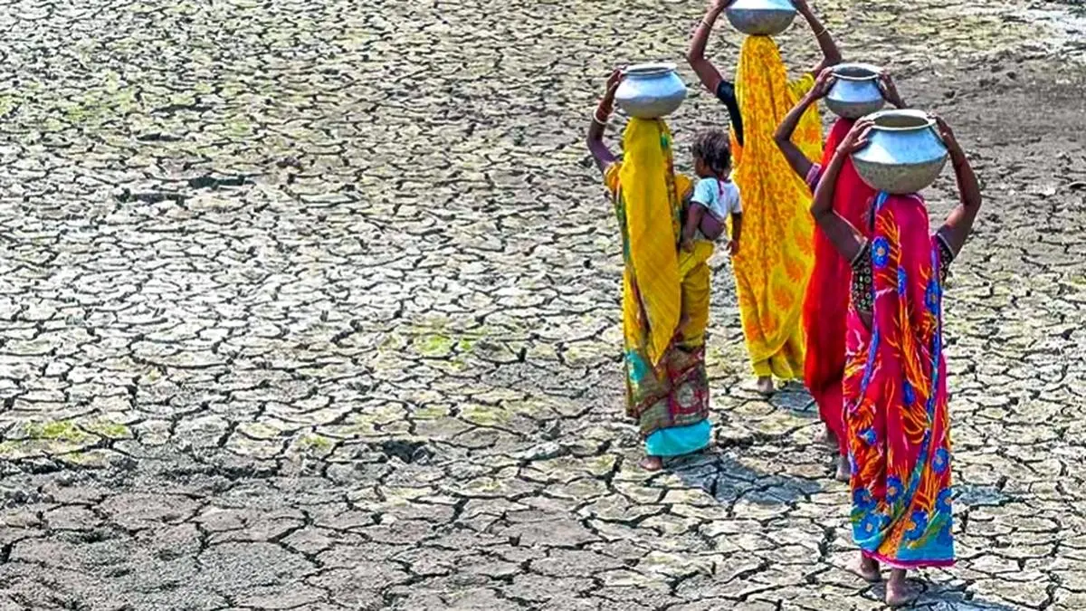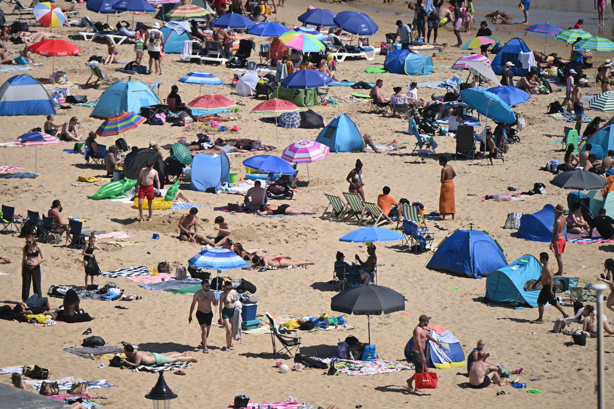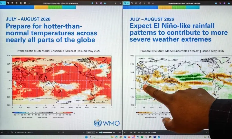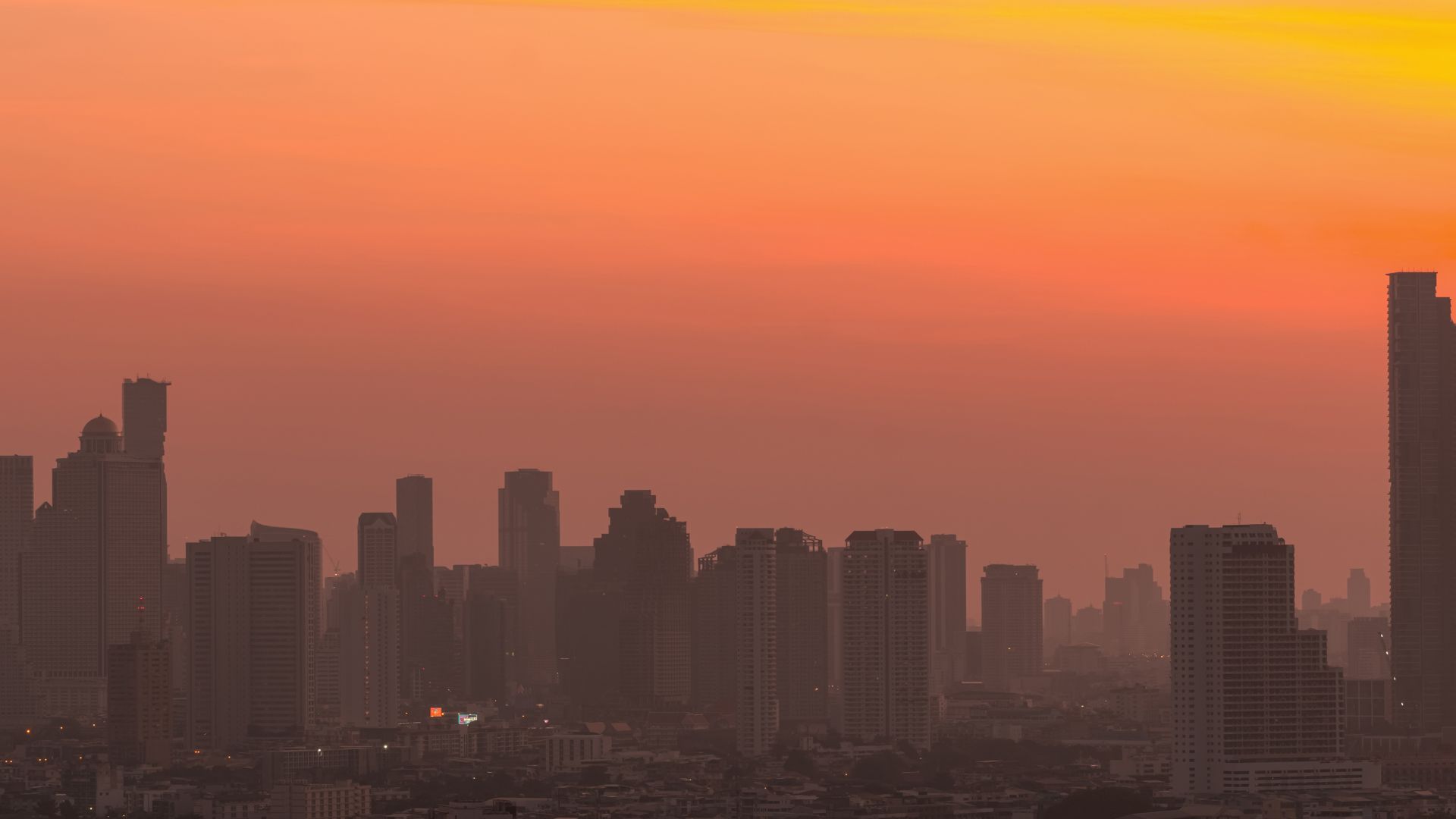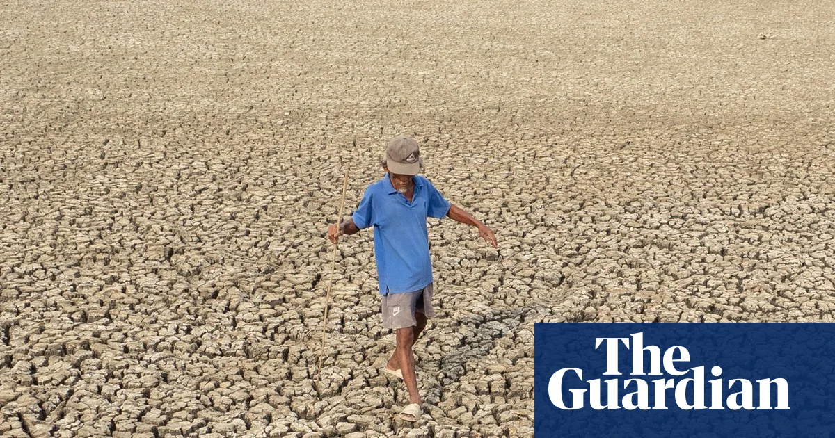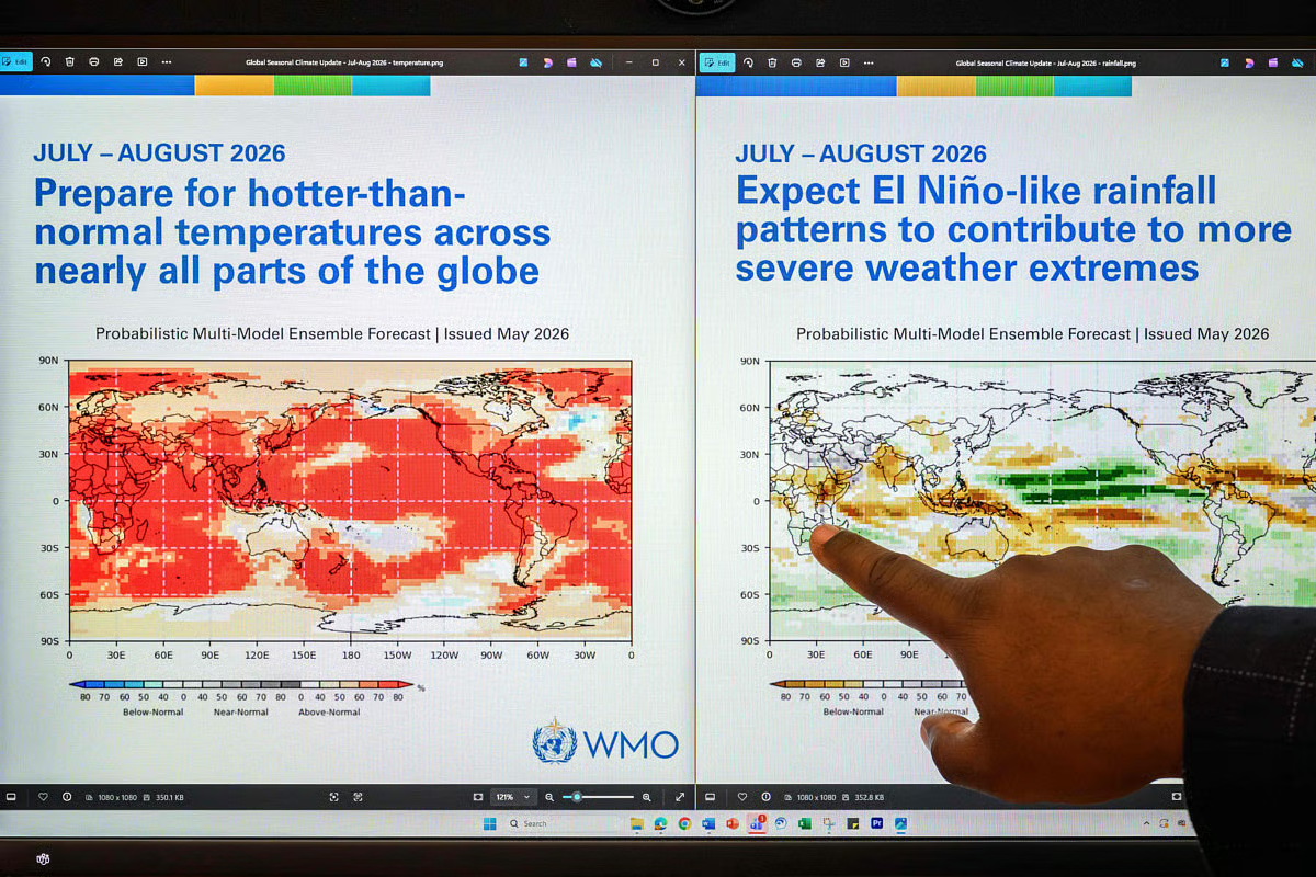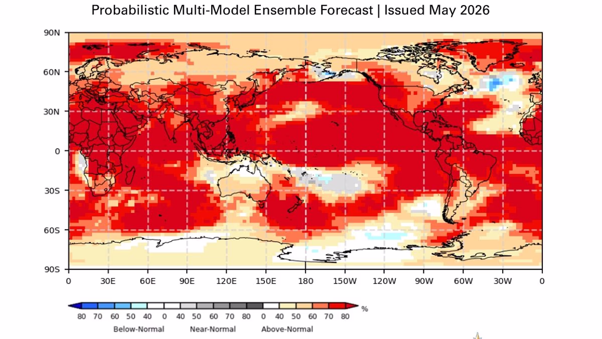
A Super El Niño is on its way, and is almost certain to arrive this summer. That's according to scientists from the World Meteorological Organisation (WMO), who warn there's now an 80 per cent likelihood of an El Niño event during June–August 2026, and a 90 per cent chance this will continue until at least November. Worryingly, the experts predict the rare climate event will bring extreme heat 'nearly everywhere'. 'The science is clear: El Niño is arriving on our doorstep in the coming months with 90% certainty,' said UN Secretary–General António Guterres.'The world must treat it as the urgent climate warning it is. 'El Niño conditions will pour fuel on the fire of a warming world. 'Impacts will hit even harder, travel even farther, and cross borders with devastating speed. 'The only effective response is climate action equal to the crisis – ending the addiction to fossil fuels, accelerating the shift to renewables, protecting the most vulnerable, and delivering early warning systems for all.' A Super El Niño is on its way, and is almost certain to arrive this summer. That's according to scientists from the World Meteorological Organisation (WMO), who warn there's now an 80 per cent likelihood of an El Niño event during June–August 2026, and a 90 per cent chance this will continue until at least November During the El Niño part of the cycle, warm waters that build up in the Pacific spread out and raise the Earth's average surface temperature. This heat ends up escaping into the atmosphere, raising our planet's temperature for monthsThe El Niño–Southern Oscillation is a natural climate pattern which cycles between a hot El Niño and a cool La Niña phase every two to seven years.During the El Niño part of the cycle, warm waters that build up in the Pacific spread out and raise the Earth's average surface temperature.This heat ends up escaping into the atmosphere, raising our planet's temperature for months.This cycle has been going on for hundreds of thousands of years. However, current signs point to this year being one of the strongest El Niño patterns ever recorded.From late April to mid–May, the sea–surface temperature in the central–eastern Equatorial Pacific – the area used as a monitoring reference – was approaching El Niño thresholds, according to the WMO.These increasing surface temperatures are being fed by unusually warm subsurface water in the tropical Pacific. Temperatures down there are a whopping 6°C above average – providing a 'substantial resevoir' of heat, the WMO explains. While each El Niño varies, the event typically brings increased rainfall in parts of southern South America, the southern United States, parts of the Horn of Africa and central AsiaWhat's more, the Southern Oscillation Index – the atmospheric component of El Niño – is also consistent with developing El Niño conditions.So, what does this mean for us? While each El Niño varies, the event typically brings increased rainfall in parts of southern South America, the southern United States, parts of the Horn of Africa and central Asia. In contrast, there will be drier conditions over Central America, northern South America, the Caribbean, Australia, Indonesia, and parts of southern Asia.Meanwhile, scientists say there's a strong chance 2026 will be the hottest year ever recorded.That could mean beating the record set in 2024, when global warming exceeded 1.5°C (2.7°F) above the pre–industrial average for the first time.While its effects on the UK are yet to be determined, meteorologists say El Niño's intensity will likely be comparable to the 1997/98 event which saw global temperatures reach their highest on record.During its development, the UK experienced an exceptionally hot, sunny and humid August characterised by heatwaves.The average maximum temperature at Heathrow in August 1997 was 25.8°C (78.4°F), with a top temperature of 31.5°C (88.7°F) reached.However, while the phenomenon typically brings warmer and drier conditions to the UK during summer months, it also increases the likelihood of colder winters.WMO Secretary–General Celeste Saulo said: 'We need to prepare for a potentially strong El Niño event – which will exacerbate drought and heavy rainfall and increase the risk of heatwaves both on land and in the ocean. 'The most recent El Niño, in 2023–24, was one of the five strongest on record and it played a role in the record global temperatures we saw in 2024.'The WMO community will be carefully monitoring conditions in the coming months to inform decision–making by governments, humanitarian agencies and climate–sensitive sectors. 'Advance seasonal forecasts and early warnings are vital to save lives and cushion the impact on our economies and our communities.'WHAT IS THE EL NINO PHENOMENON IN THE PACIFIC OCEAN?El Niño and La Niña are the warm and cool phases (respectively) of a recurring climate phenomenon across the tropical Pacific - the El Niño-Southern Oscillation, or 'ENSO' for short.The pattern can shift back and forth irregularly every two to seven years, and each phase triggers predictable disruptions of temperature, winds and precipitation. These changes disrupt air movement and affect global climate. ENSO has three phases it can be: El Niño: A warming of the ocean surface, or above-average sea surface temperatures (SST), in the central and eastern tropical Pacific Ocean. Over Indonesia, rainfall becomes reduced while rainfall increases over the tropical Pacific Ocean. The low-level surface winds, which normally blow from east to west along the equator, instead weaken or, in some cases, start blowing the other direction from west to east. La Niña: A cooling of the ocean surface, or below-average sea surface temperatures (SST), in the central and eastern tropical Pacific Ocean. Over Indonesia, rainfall tends to increase while rainfall decreases over the central tropical Pacific Ocean. The normal easterly winds along the equator become even stronger.Neutral: Neither El Niño or La Niña. Often tropical Pacific SSTs are generally close to average.Source: Climate.gov
Scientists warn there's an 80% chance of Super El Niño this summer
The World Meteorological Organisation warn there's now an 80 per cent likelihood of an El Niño event during June-August 2026, and a 90 per cent chance this will continue until at least November.
960 words~4 min read