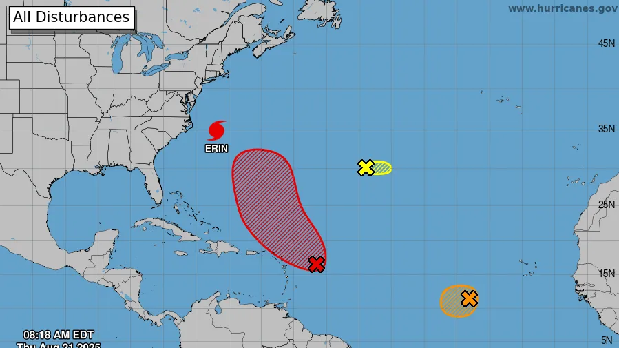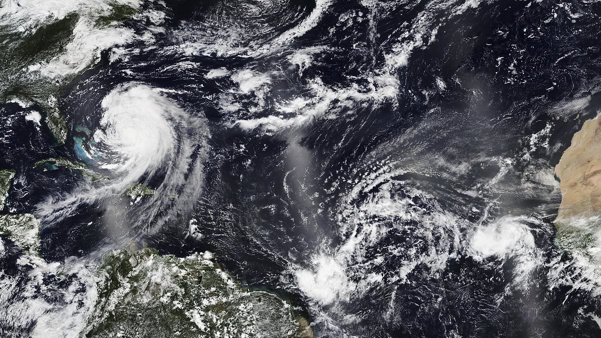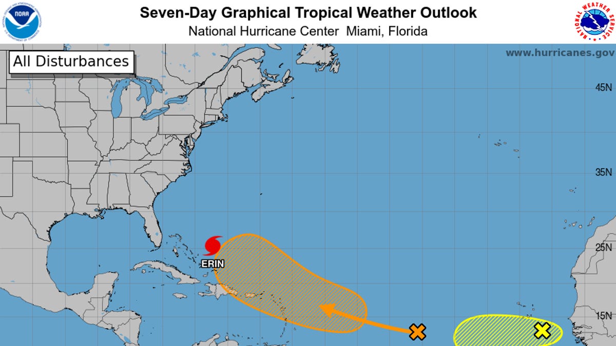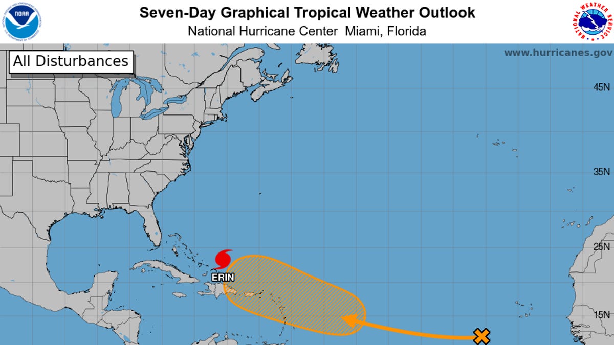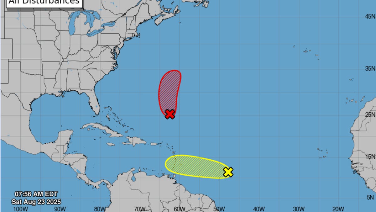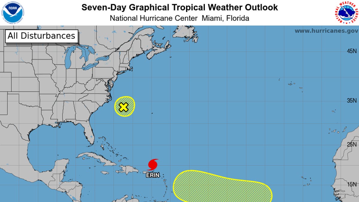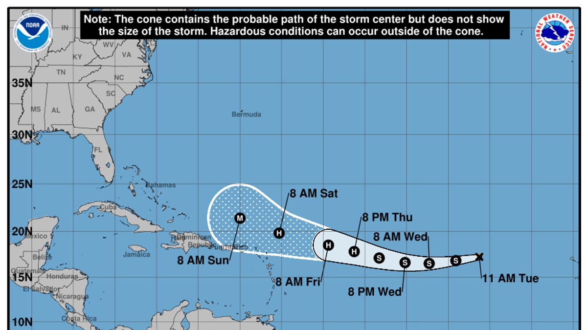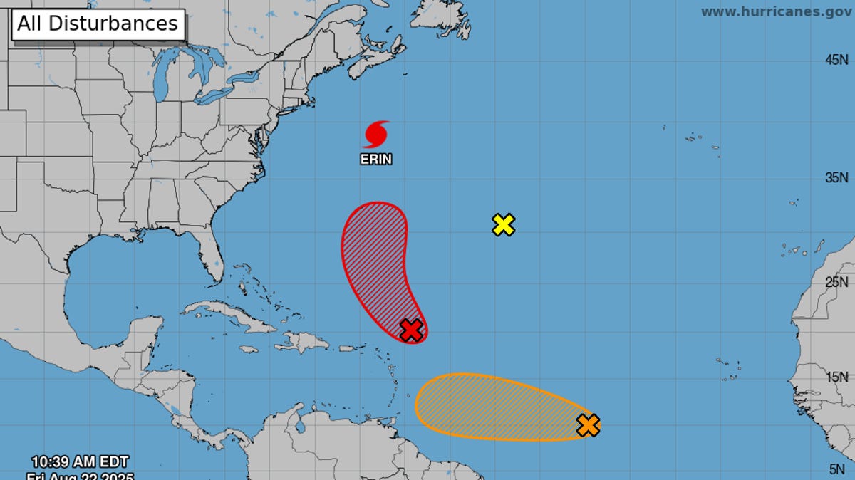
As Hurricane Erin moves out to sea, forecasters on Aug. 22 are keeping watch on three other areas of disturbed weather in the Atlantic Ocean, including one that could become Tropical Storm Fernand over the next few days. Fortunately, none of the systems appear likely to directly affect the United States, though Bermuda could see some impacts from what's expected to be Fernand.
Meteorologists looking past the current slate of nascent storms see a potential lull in activity for the final few days of August, which is nearing what's typically the most active time of the hurricane season.
Beyond that, activity in the Atlantic may pick up again in September, according to AccuWeather hurricane expert Alex DaSilva. "Atmospheric conditions in the Atlantic are forecast to become more conducive for tropical development heading into the first and second weeks of September. The climatological peak of the Atlantic hurricane season is Sept. 10.
"We expect the second half of the hurricane season to be more active than the first half,” he said.
So far in 2025, five named storms have formed in the Atlantic basin. A typical season sees 14 storms, according to Colorado State University, which is predicting a total of 16 storms this year.