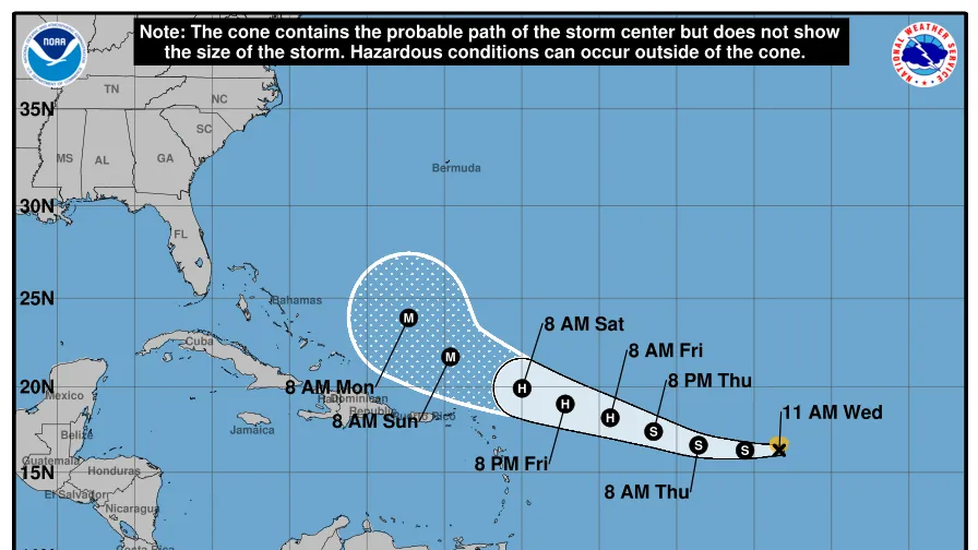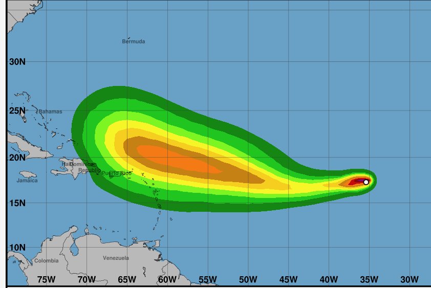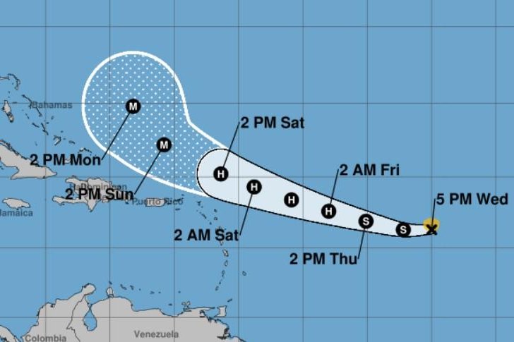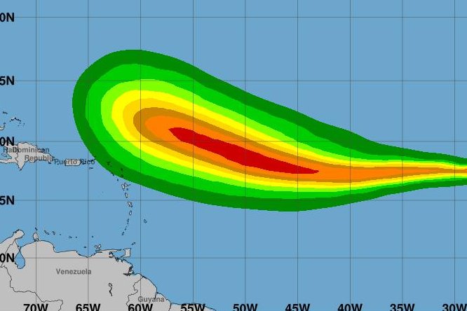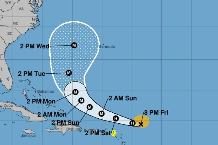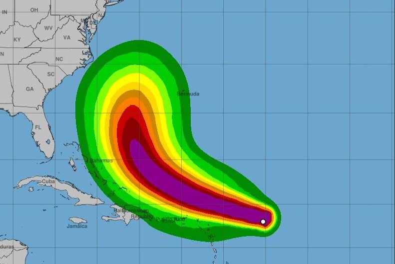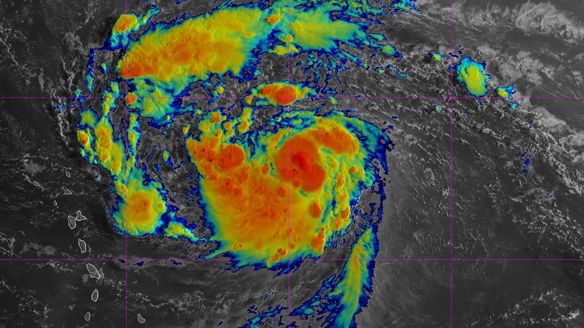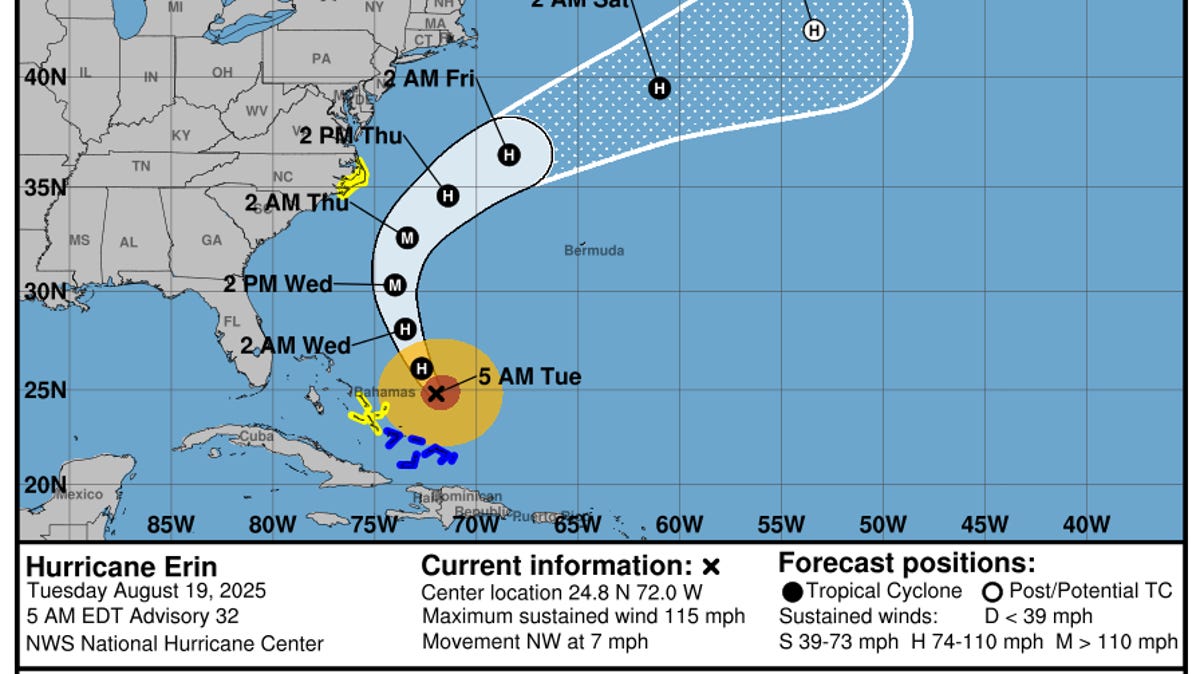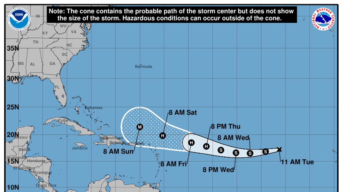
Tropical Storm Erin is moving quickly across the Atlantic Ocean and is expected to strengthen over the few days, according to the National Hurricane Center.
In a 11 a.m. ET advisory on Tuesday, Aug. 12, the hurricane center said Erin was located about 820 miles west of the Cabo Verde Islands with maximum sustained winds near 45 mph with higher gusts. Forecasters said Erin is moving west at 23 mph, and this motion is expected to continue for the next several days.
"Gradual strengthening is forecast over the next several days, and Erin is expected to become a hurricane in the next couple of days," the hurricane center said in the advisory.
A windspeed forecast from the hurricane center says Erin could become a hurricane on Thursday, Aug. 14.
Federal meteorologists added that the official intensity forecast "shows Erin becoming a major hurricane in around 5 days." A major hurricane is a term used for cyclones that are rated a Category 3 or higher, indicating they have damaging winds over 110 mph.