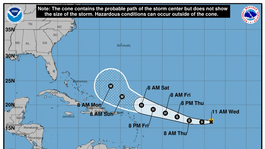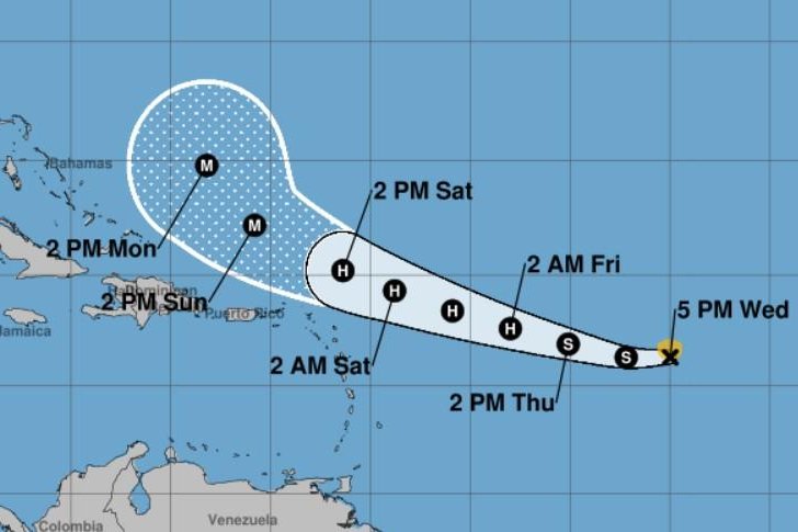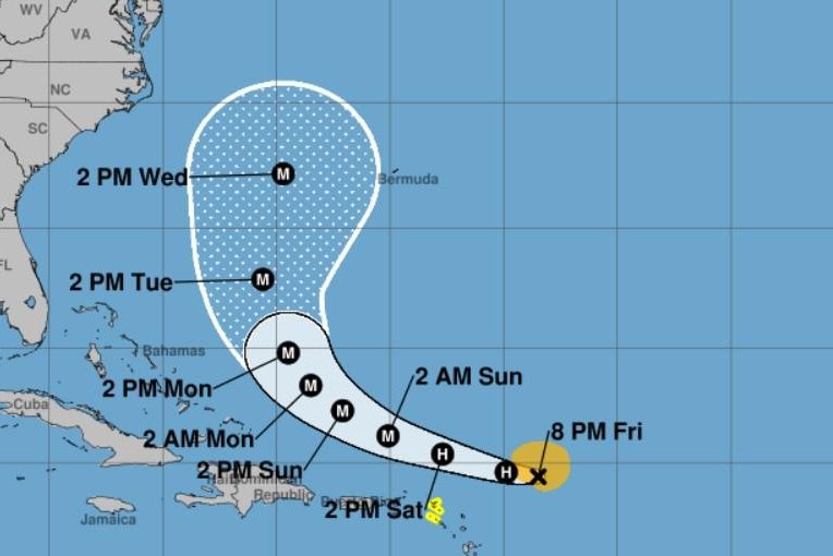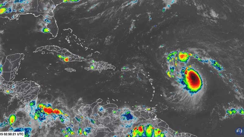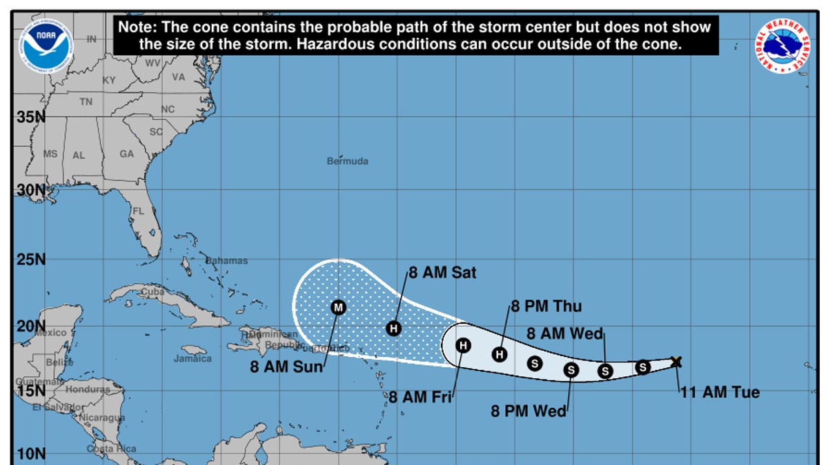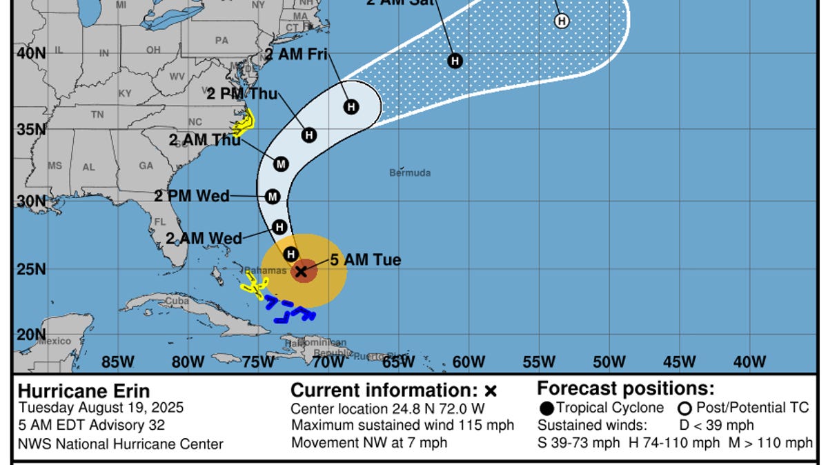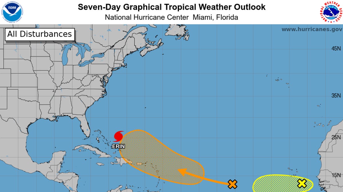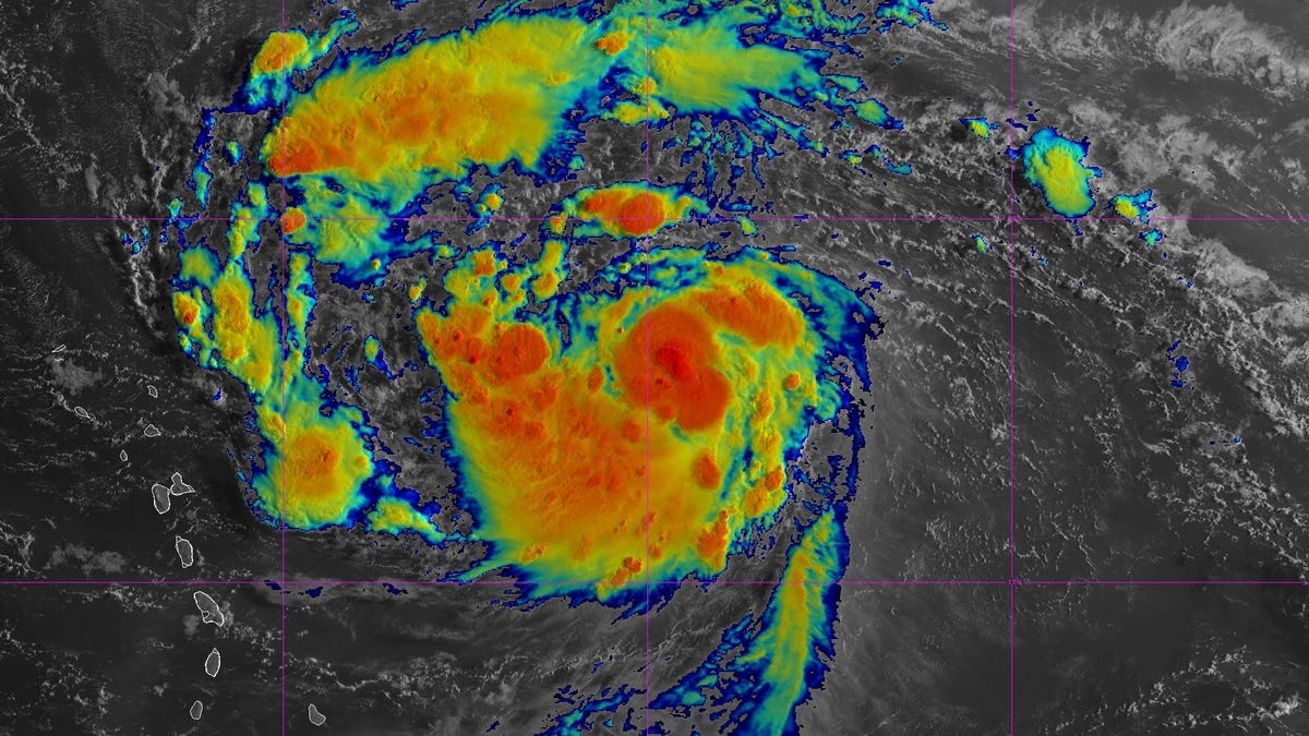
Tropical Storm Erin is continuing to pick up strength as it moves northwest across the Atlantic, with forecasters expecting the storm to officially strengthen into a hurricane on Friday, Aug. 15, according to the National Hurricane Center.
The hurricane center issued an advisory at 5 a.m. ET on Aug. 15 that said Erin is moving toward the west-northwest near 17 mph and that this motion is expected to continue into the weekend. The center of the storm is likely to move near or just north of the northern Leeward Islands over the weekend.
Forecasters said maximum sustained winds are near 70 mph with higher gusts and that steady strengthening is expected during the next few days.
"Erin is forecast to become a hurricane later today and could become a major hurricane by this weekend," the hurricane center said in the advisory. A major hurricane is a term used for cyclones rated a Category 3 or higher with sustained wind speeds over 110 mph.
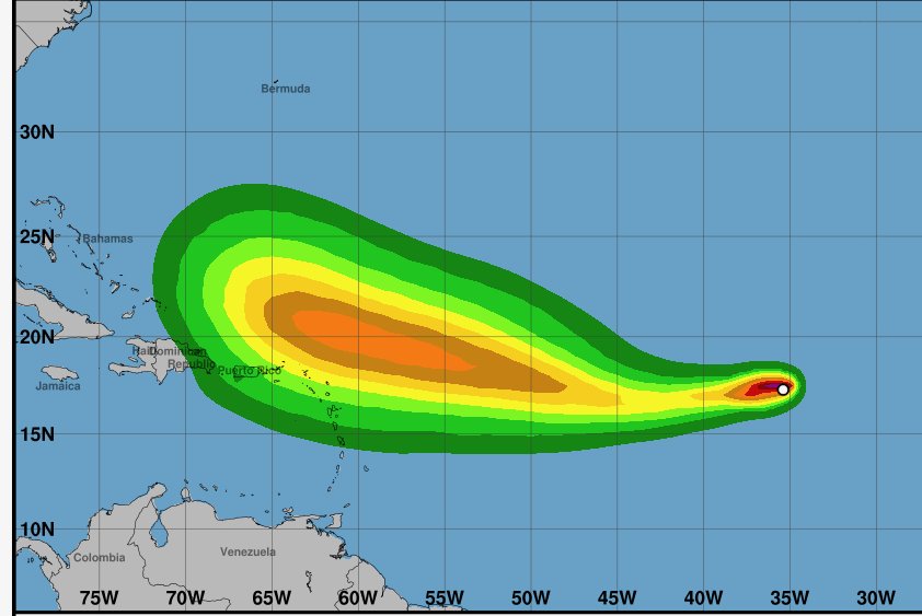
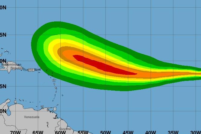
Erin is expected to produce areas of heavy rainfall beginning late Friday, Aug. 15, and continuing through the weekend across the northernmost Leeward Islands, the U.S. and British Virgin Islands, as well as southern and eastern Puerto Rico. Rainfall totals of 2 to 4 inches, with isolated totals of 6 inches, are expected, and this rainfall may lead to isloated flash and urban flooding, along with landslides and mudslides, according to hurricane center forecasters.