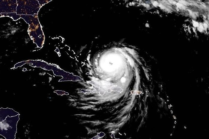
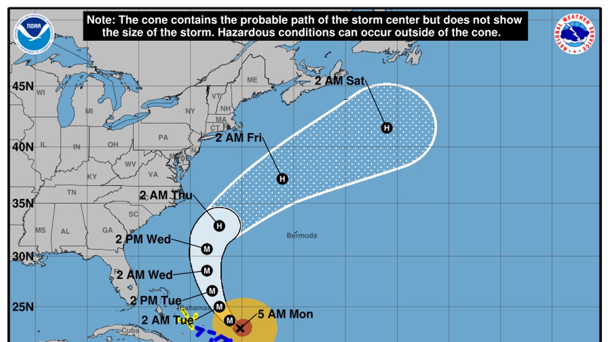
Hurricane Erin is continuing to spin in the Atlantic Ocean, bringing with it life-threatening surf and rip currents along the beaches of the Bahamas, much of the east coast of the United States, Bermuda and Atlantic Canada.
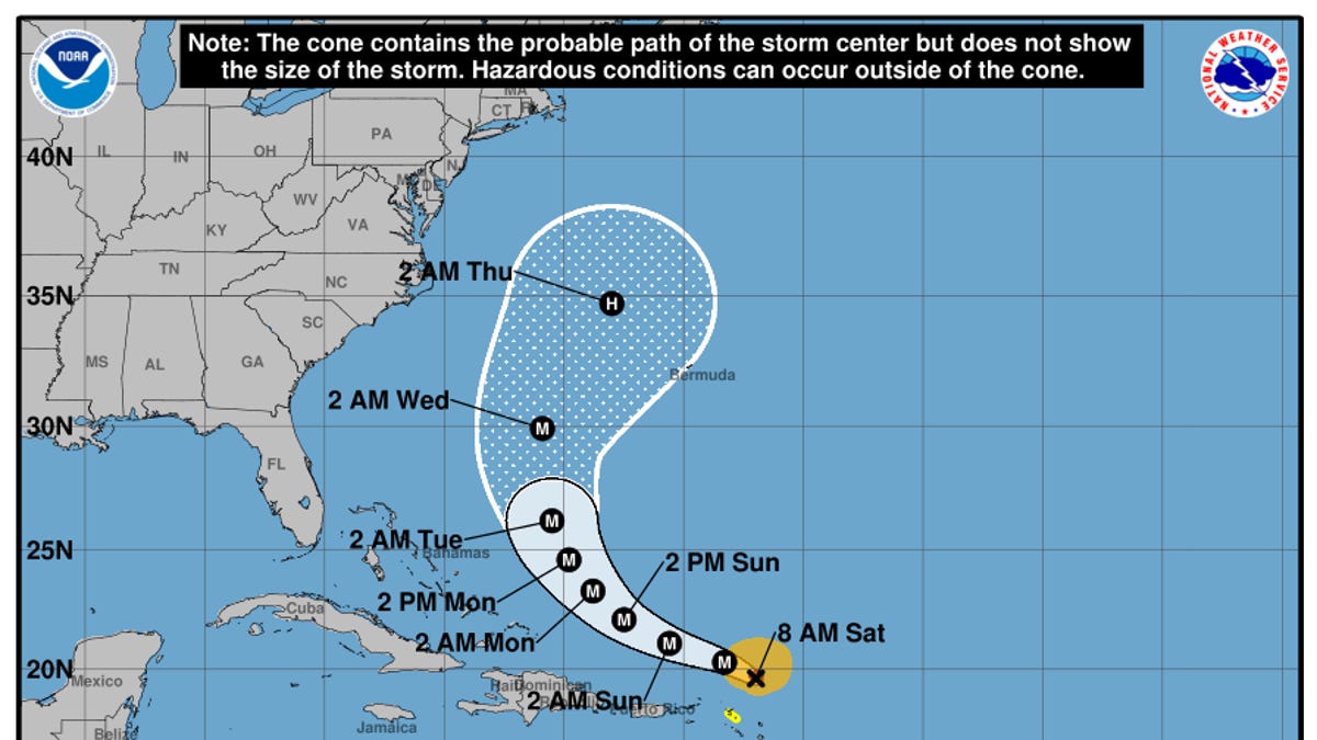
According to a 5 a.m. ET advisory from the National Hurricane Center on Aug. 18, Erin is located about 915 miles south-southeast of Cape Hatteras, North Carolina, with maximum sustained winds near 130 mph with higher gusts, making it a Category 4 hurricane on the Saffir-Simpson scale.
The hurricane center said some additional strengthening is expected throughout the day and even with weakening forecast beginning Monday night, Aug. 18, Erin will remain a "large and dangerous major hurricane" through the middle of this week.
On the forecast track, the NHC said the core of Erin is expected to pass to the east of the southeastern Bahamas Aug. 18 and move between Bermuda and the east coast of the United States by the middle of the week.
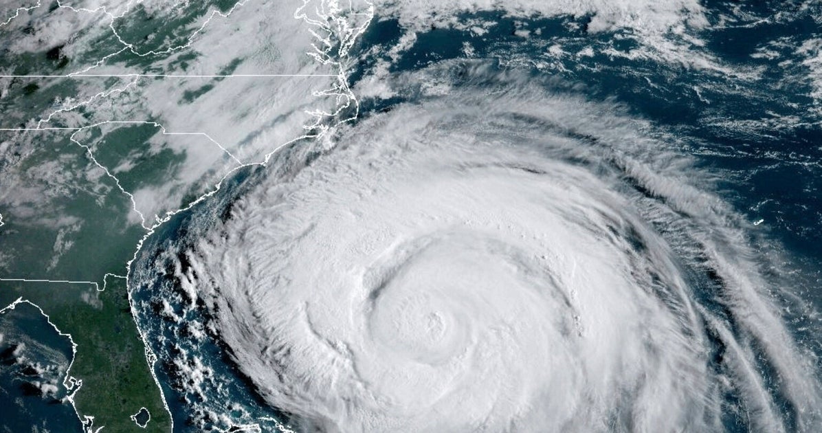
Federal forecasters warned those with interests in the Outer Banks of North Carolina and Bermuda to monitor the storm as those areas could soon face winds associated with Erin's outer rainbands.