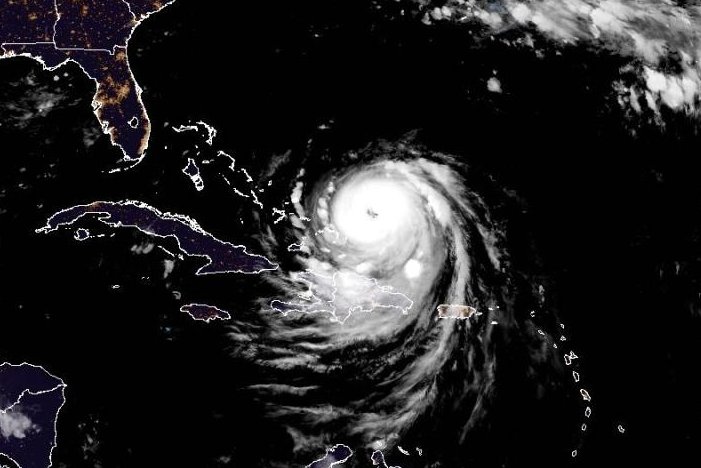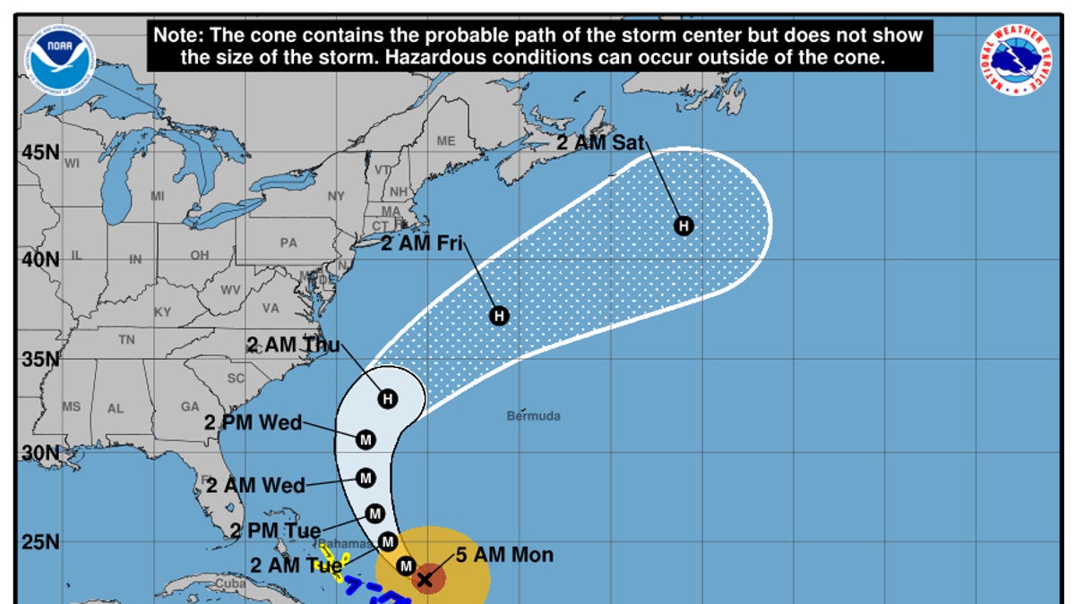
Hurricane Erin reintensified on Monday, Aug. 18, and is expected to strengthen further as it threatens the Bahamas and Hispaniola with possible flooding and is forecast to bring life-threatening surf conditions to the eastern U.S. coast this week.
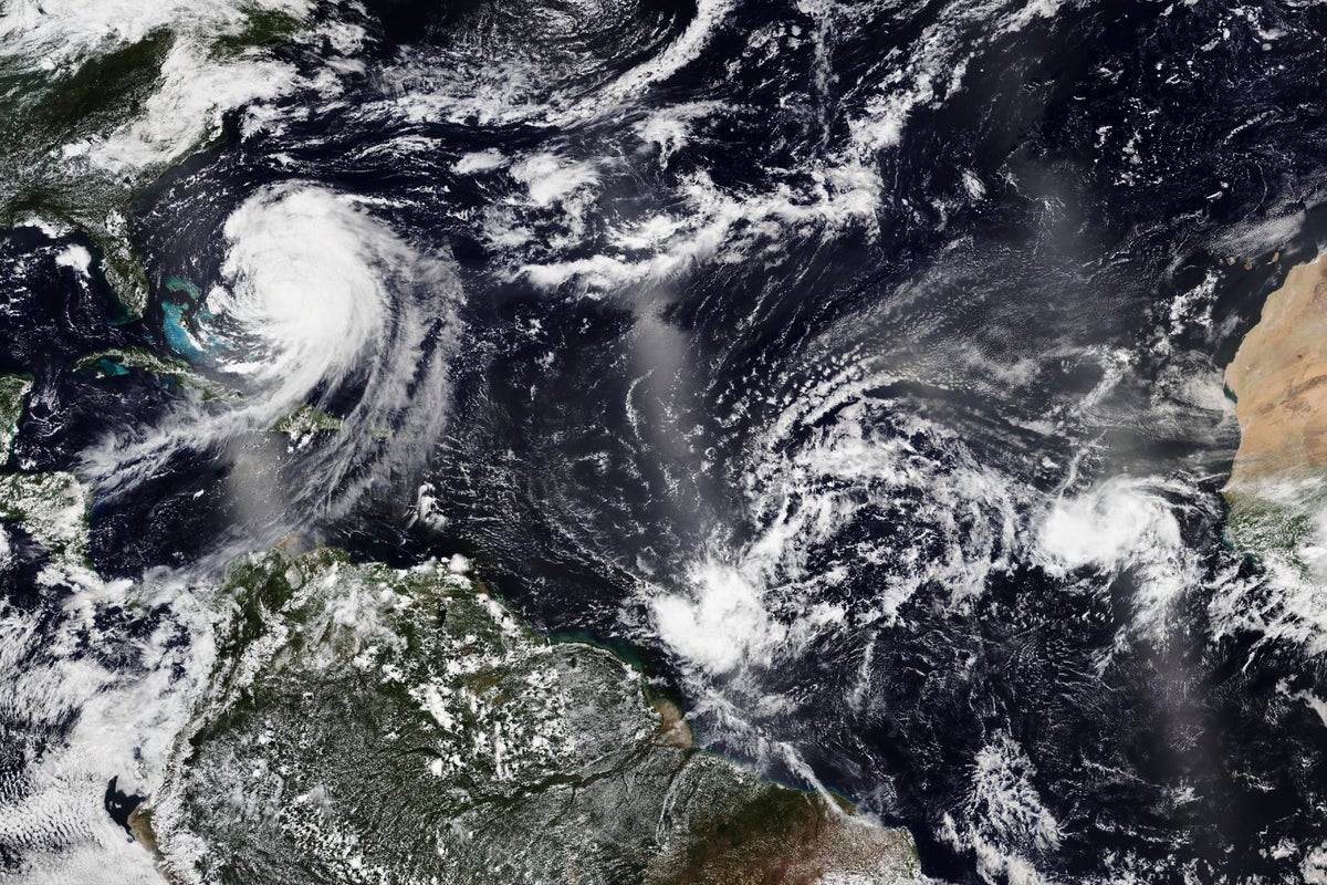
Overnight, the storm strengthened into a Category 4 storm with sustained winds of 130 mph, according to a 5 a.m. ET advisory from the National Hurricane Center, which noted that "additional strengthening is expected today" as forecasts show the storm gradually turning north on a path that will send it between the U.S. and Bermuda over the coming days.
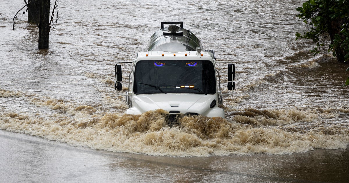
Erin, the first hurricane to form this Atlantic season and the first to become a major storm, was located 105 miles north-northeast of the Grand Turk Island and about 915 miles south-southeast of Cape Hatteras, North Carolina, a barrier island that was placed under a mandatory evacuation as local officials anticipated coastal flooding as early as Aug. 19.
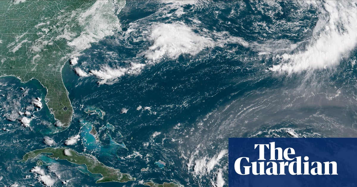
Tropical storm warnings were in place Aug. 18 for the Turks and Caicos Islands as well as parts of the Bahamas. Forecasters said the islands were at risk of "flash and urban flooding," according to the hurricane center.
Federal forecasters warned those with interests in the Outer Banks of North Carolina and Bermuda to monitor the storm as those areas could soon face winds associated with Erin's outer rainbands. Erin was expected to produce life-threatening surf and rip currents along the beaches of the U.S., Bermuda and Atlantic Canada for several days.