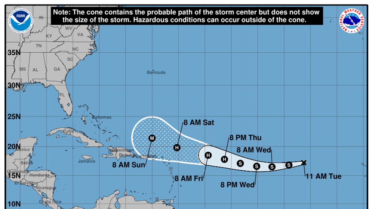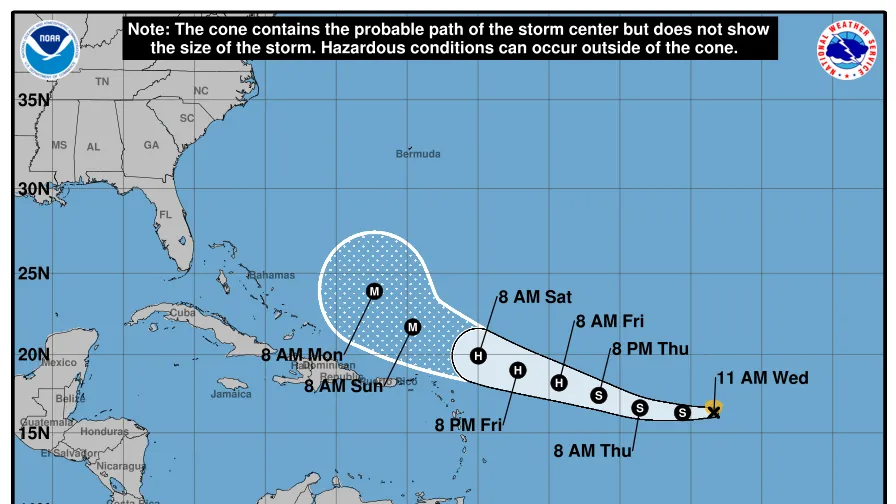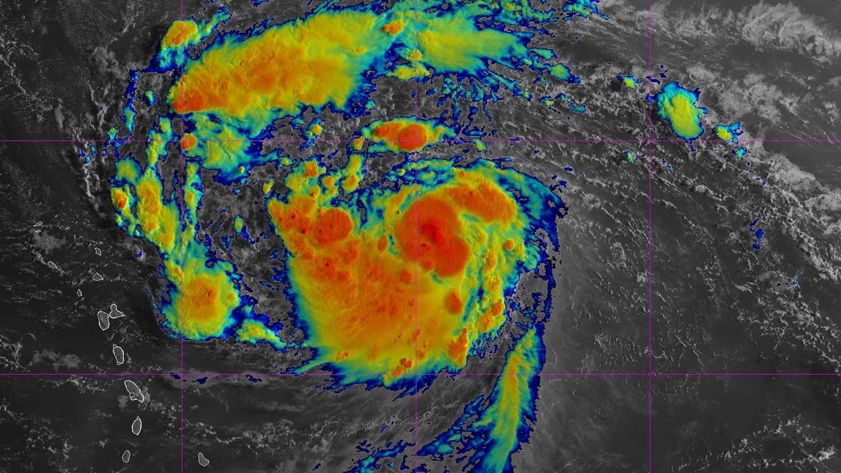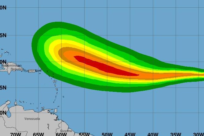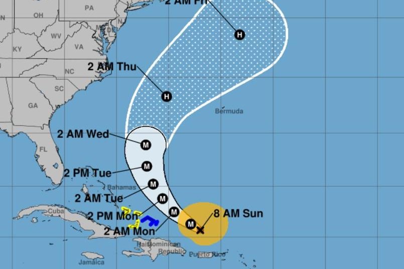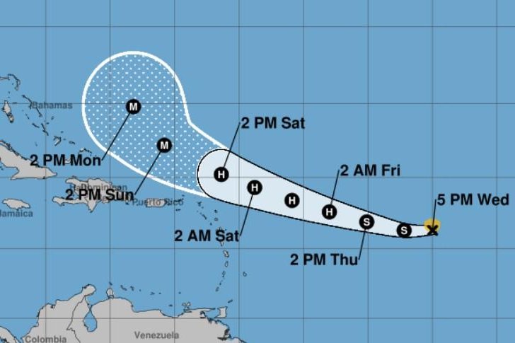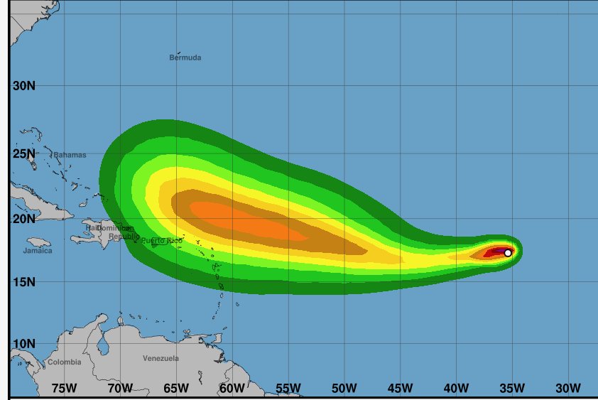
Aug. 12 (UPI) -- Tropical Storm Erin is still moving quickly westward and is forecast to become a hurricane in a few days over the central tropical Atlantic, the National Hurricane Center said on Tuesday.
Erin was still in the eastern Atlantic and had maximum sustained winds of 45 mph and was moving west at 23 mph, according to the NHC in the 10 a.m. EDT update. There are no warnings or coastal watches in effect. But those in the northern Leeward Islands, the Virgin Islands and Puerto Rico should monitor Erin's progress.
Erin is about 2,800 miles from the U.S. East Coast. Forecasters expect westward movement to continue through early Thursday, the NHC said. It's expected to move in a west-northwestward motion late Thursday and into the weekend.
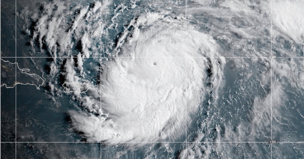
Little change in strength is expected through Tuesday night, thanks to moderate water temperatures, but gradual strengthening is forecast to begin on Wednesday. Erin could become a hurricane by late Thursday, when it's predicted to sweep north of the Virgin Islands and Puerto Rico, and it could become a major hurricane by early Sunday.
The National Weather Service in Jacksonville said "swells from distant Erin will increase the rip current risk beginning Sunday at area beaches."