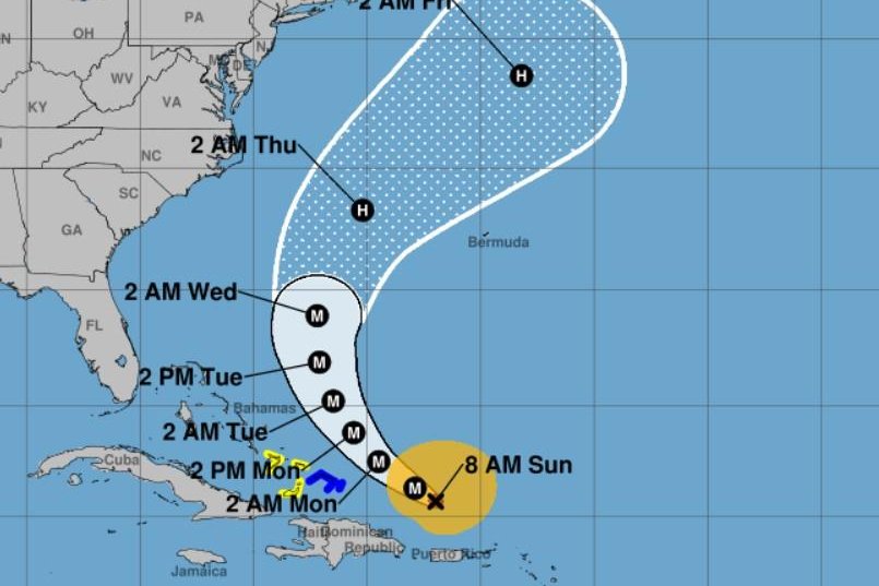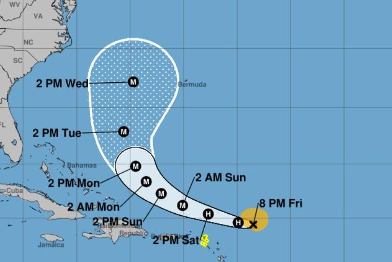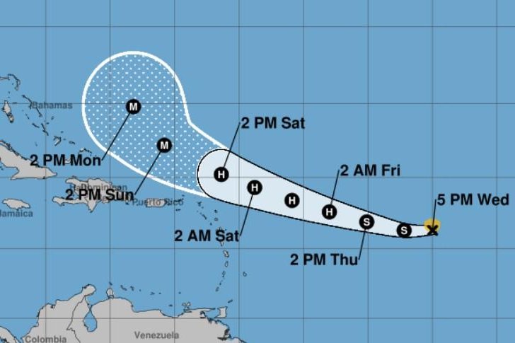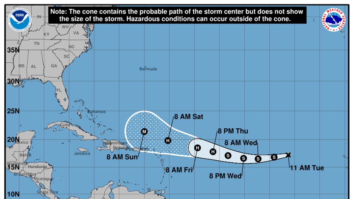
Hurricane is predicted pick up steam toward Florida before veering away from the US mainland
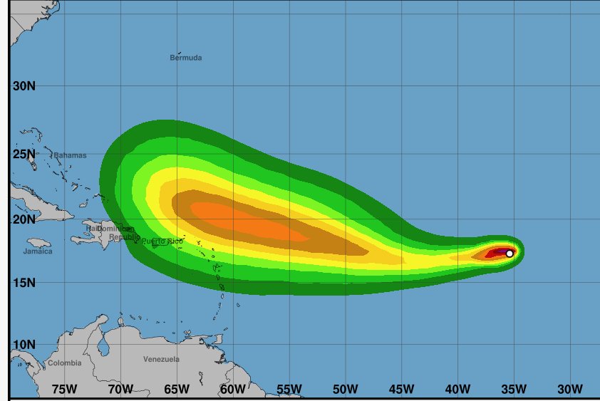
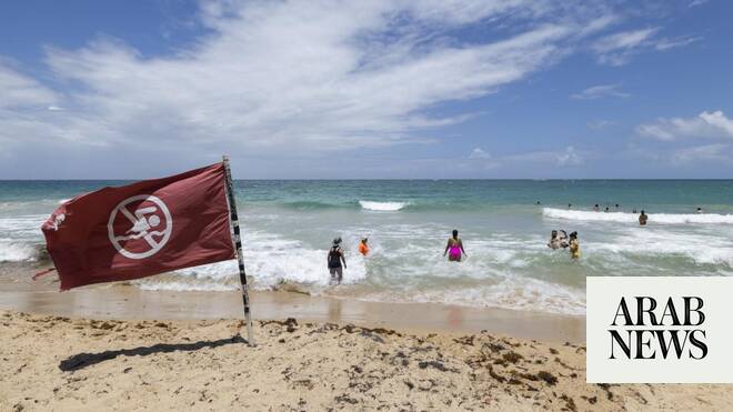
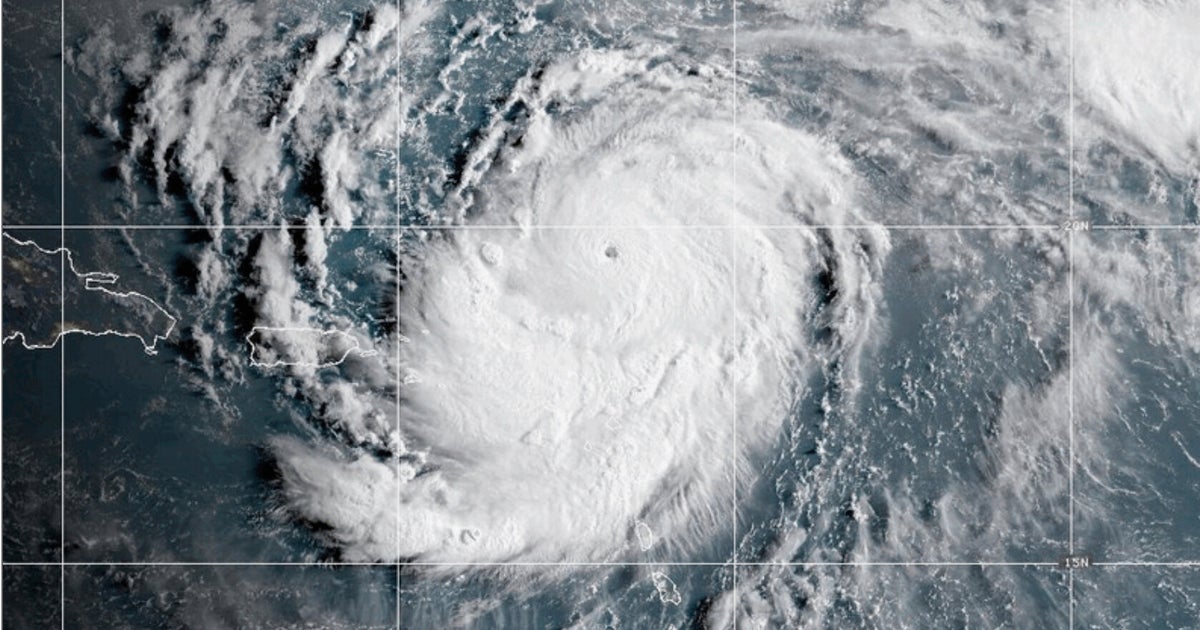
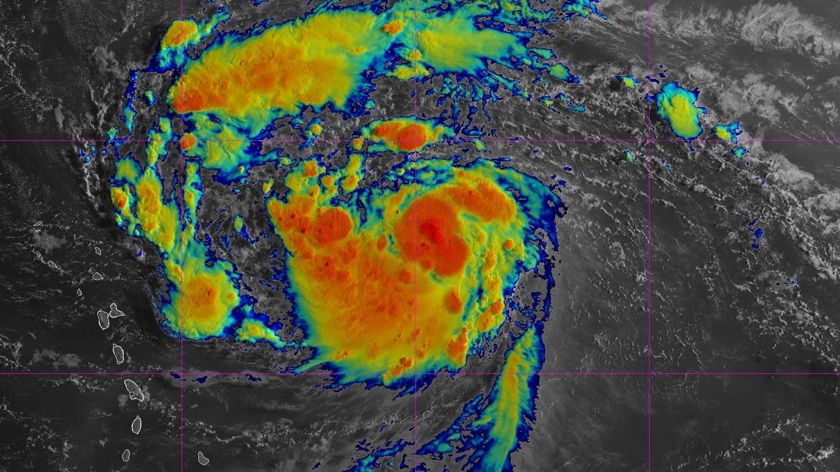
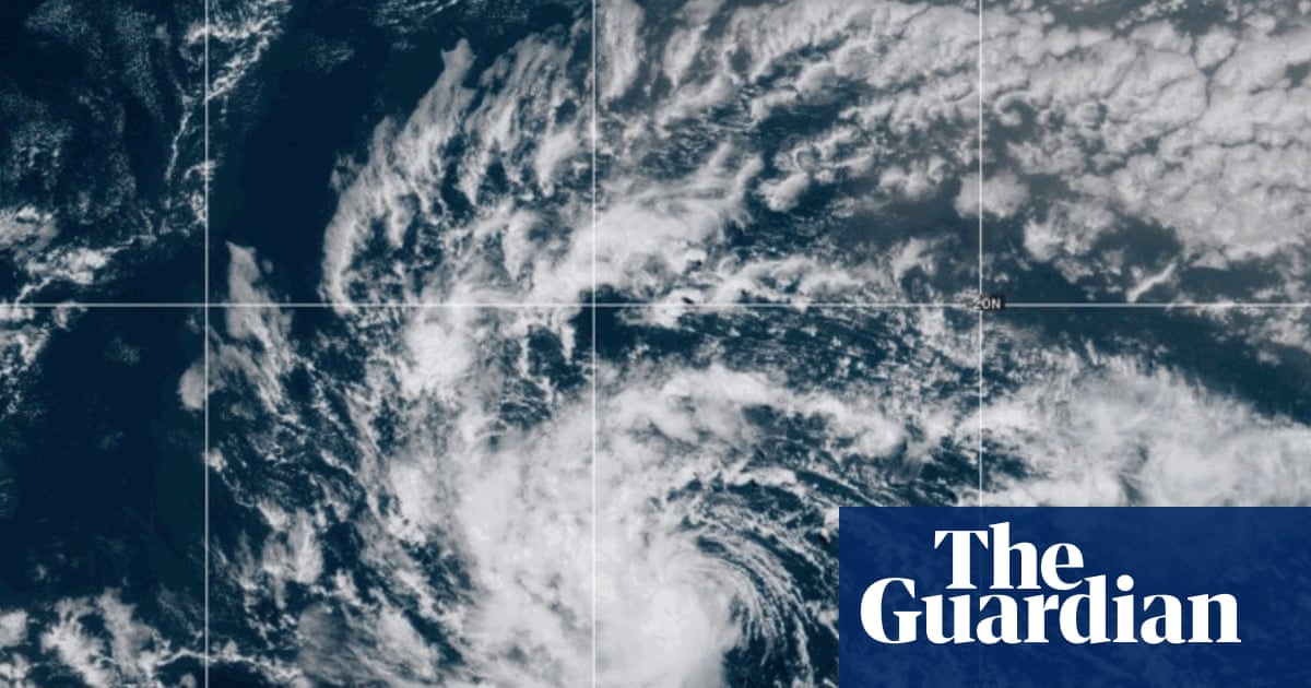
A tropical storm sped up to become Hurricane Erin mid-morning on Friday, as it approached Puerto Rico and the Virgin Islands, bringing heavy rains that could cause flooding and landslides on its way to becoming a major Atlantic hurricane.
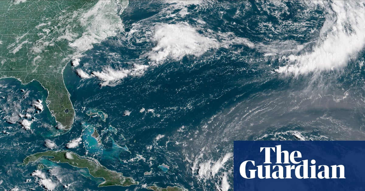
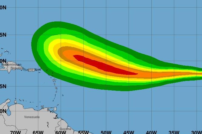
The huge storm was swirling across the Caribbean and is ultimately expected to head towards Florida, picking up speed over warm ocean water, before ultimately veering away from the US mainland.
The National Hurricane Center (NHC) in Miami reported on X that Erin, the fifth named storm of the Atlantic hurricane season, was several hundred miles east of the northern Leeward Islands, with maximum sustained winds of 70mph.
It had been expected to strengthen into a hurricane by Friday early afternoon but reached the designation a little earlier, as it approached the north-east Caribbean, prompting forecasters to warn of possible flooding and landslides, and strengthen into a major category 3 storm late this weekend.