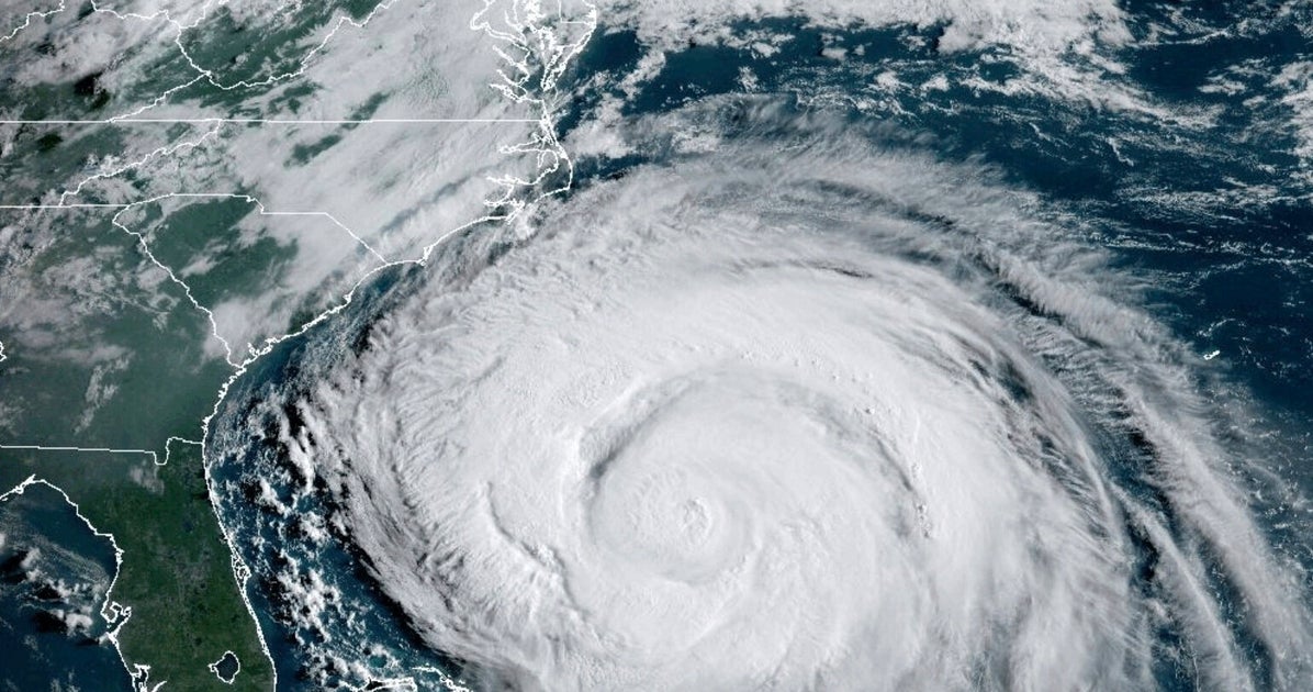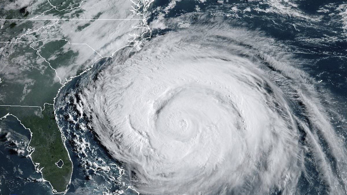
Hurricane Erin could see 16ft waves crashing into Britain in the coming days as the huge US storm barrels across the Atlantic.
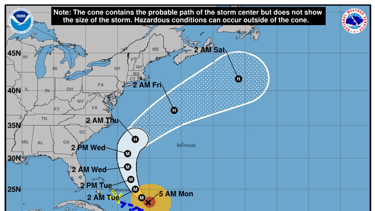
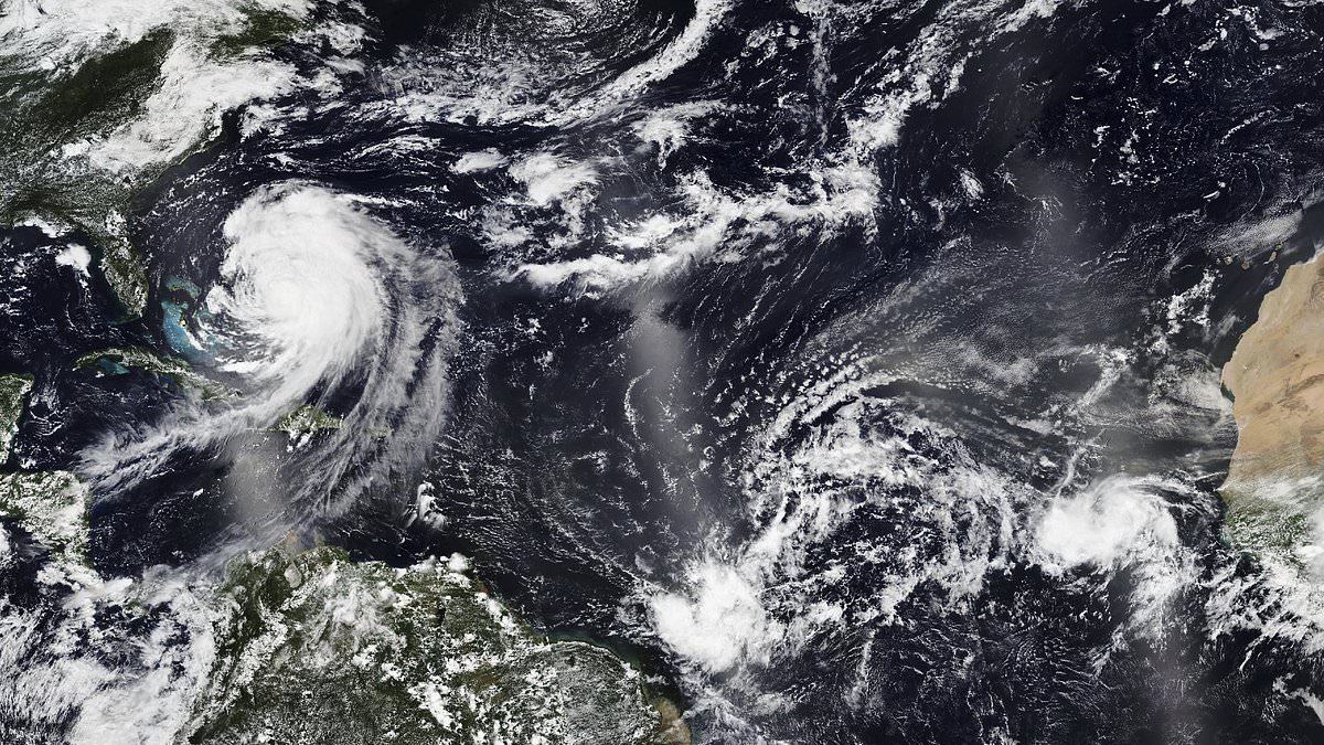
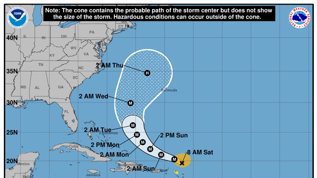
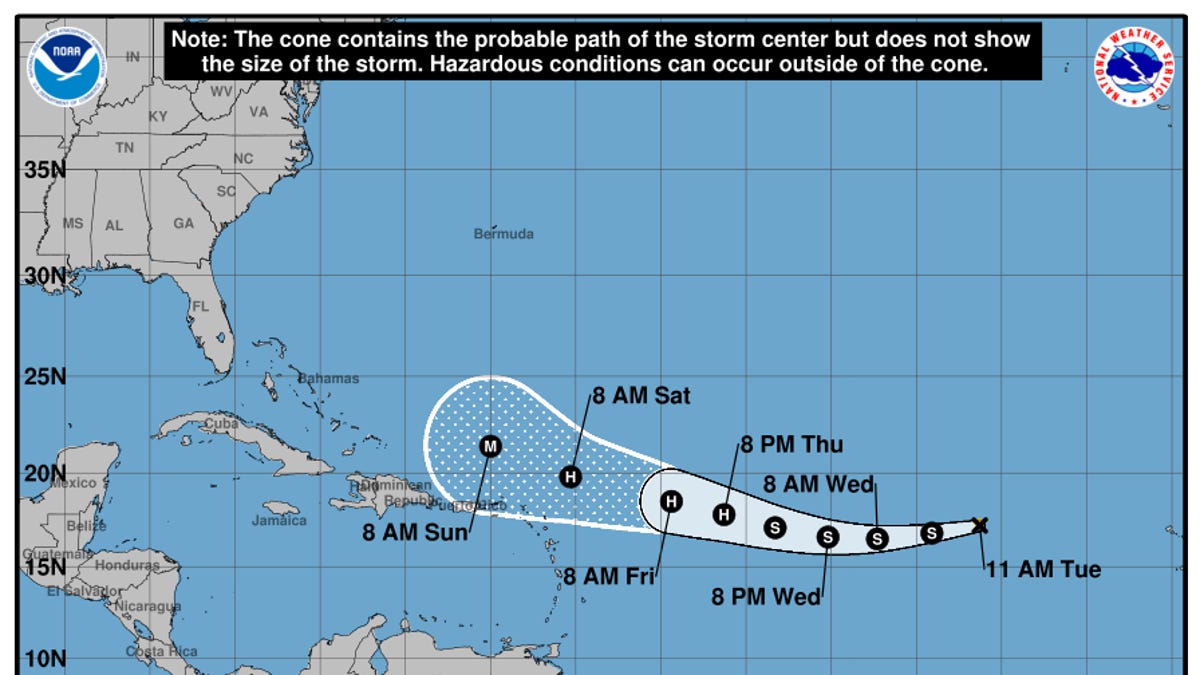
Forecasters are tracking the potential impact of Erin, which underwent a 'remarkable' 24-hour transition from a tropical storm to a 160mph Category 5 'monster' last weekend.
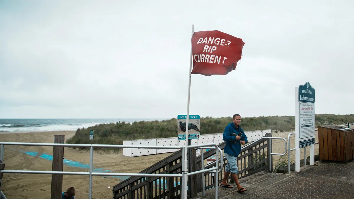
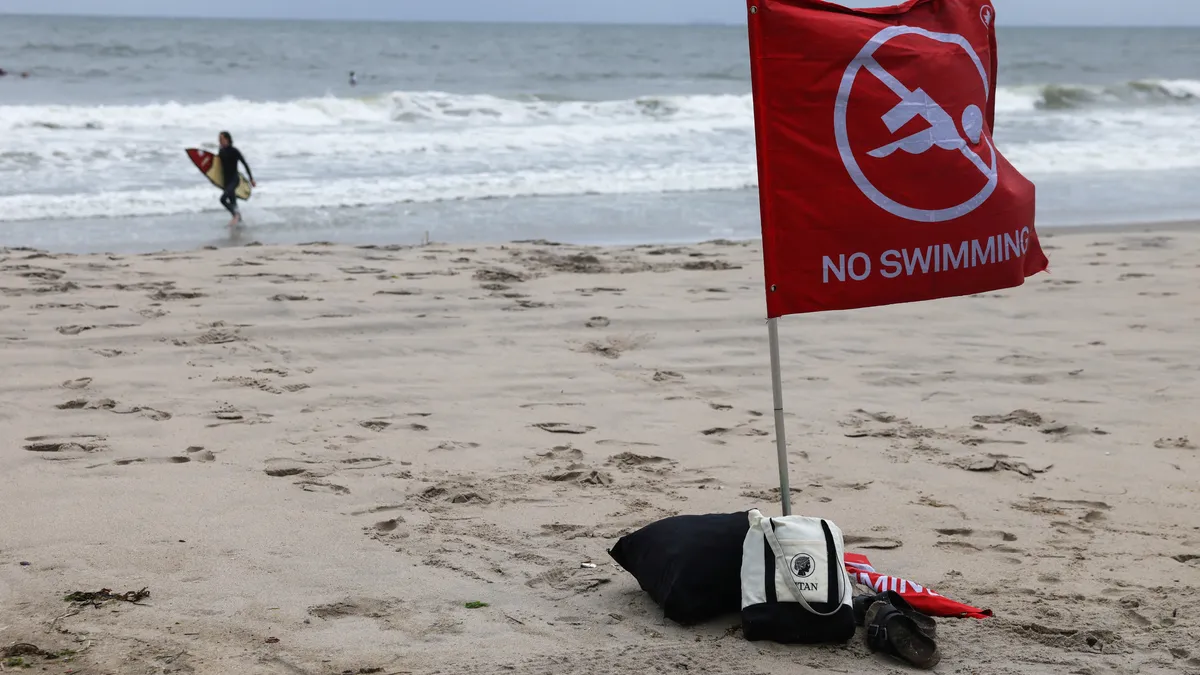
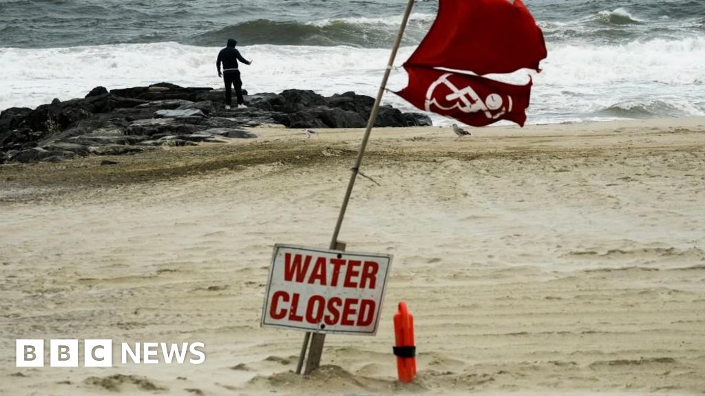
The storm, now ranked Category 2, is expected to generate large breaking waves of 8 to 16ft and life-threatening rip currents along the eastern coast of the US through Friday evening.
Now, the Met Office has warned that remnants of Hurricane Erin are set to bring 'very large waves' to the UK, with those visiting the coast warned of an increased danger.
Met Office meterologist Tom Morgan said that it is 'too early' to provide specific details about which regions will experience the windiest and wettest weather.