Show Caption
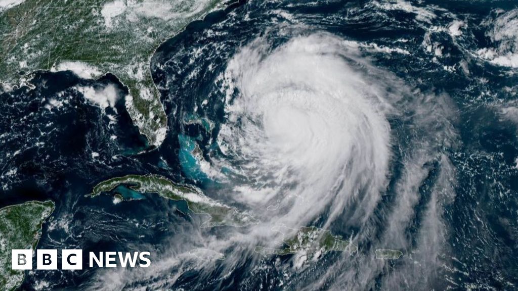
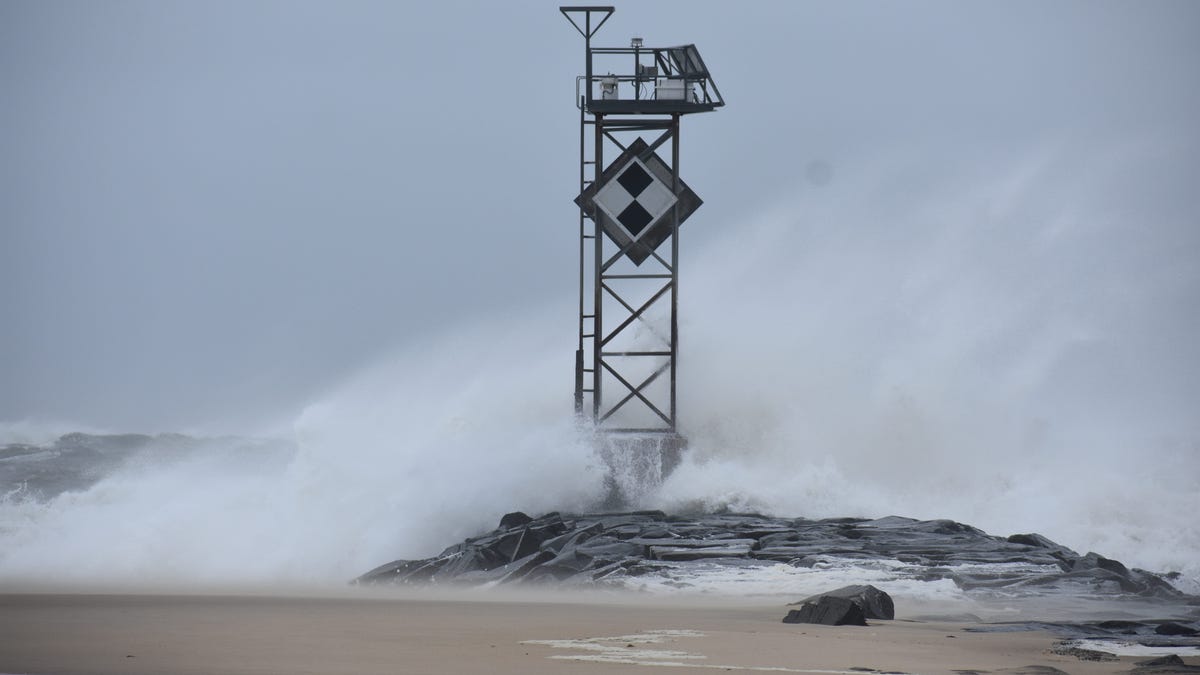
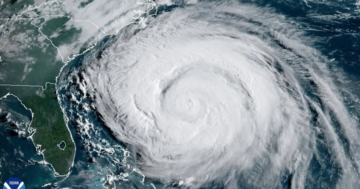
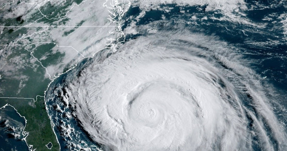
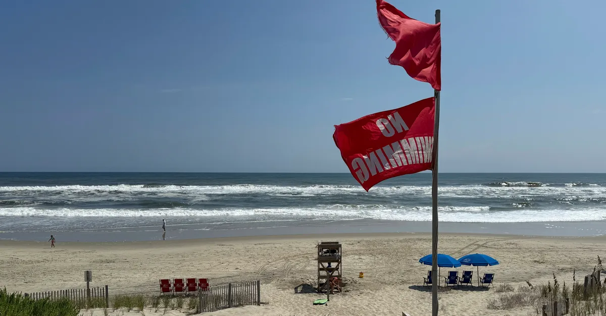
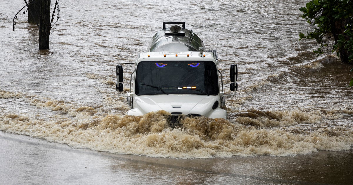
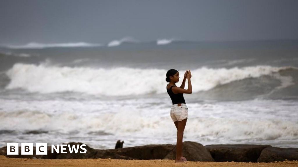
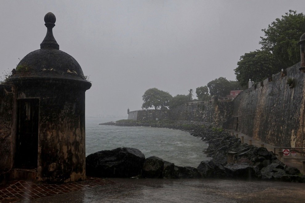
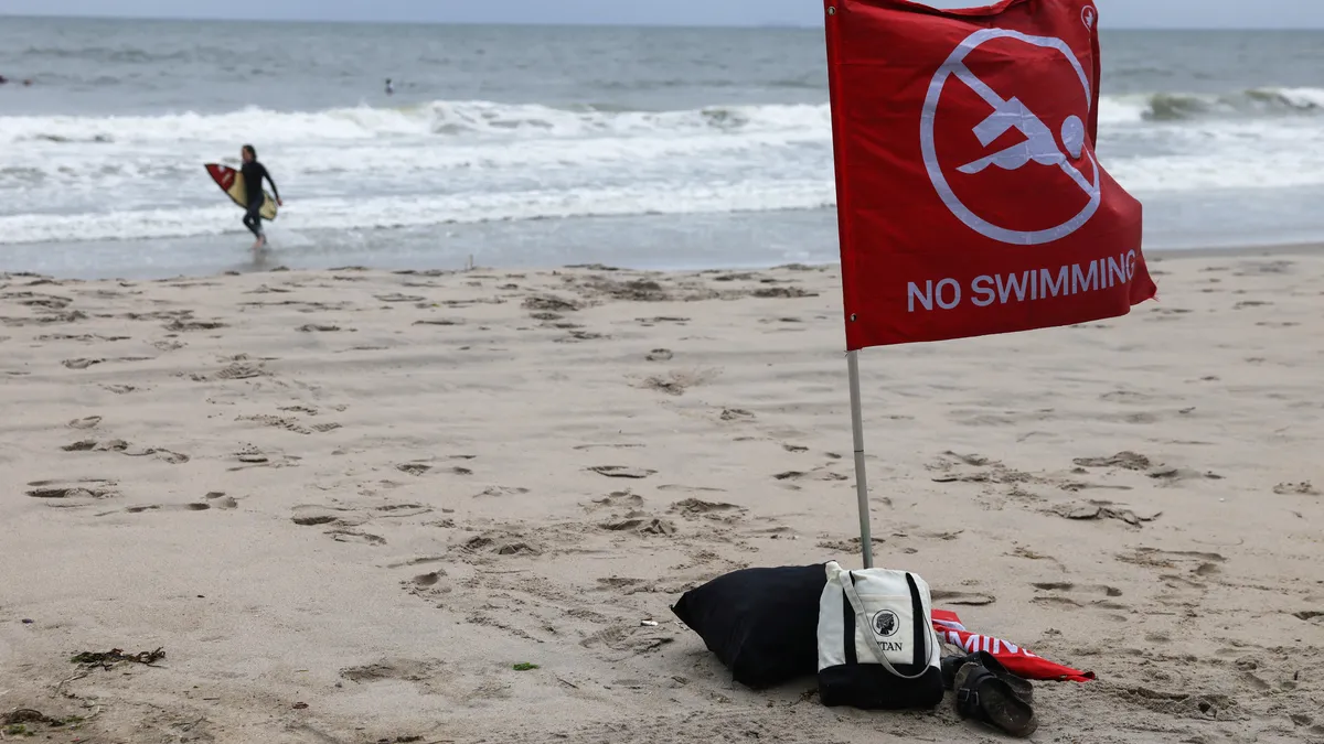
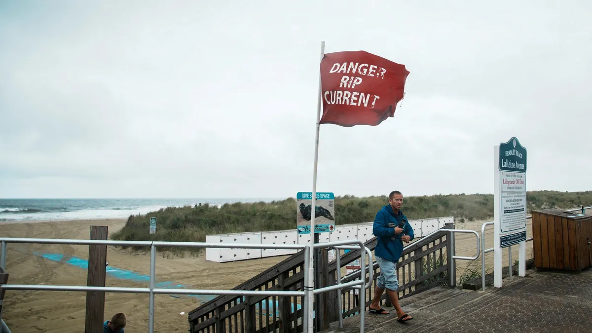
Hurricane Erin drifted away from the U.S. mainland on Thursday afternoon after making its closest approach off the North Carolina coast, but it was still unleashing powerful waves and rip currents, threatening beachfront homes and flooding roads as authorities urged people to stay out of the water.Erin, a large Category 2 hurricane, made a turn to the northeast and was picking up speed as it pulled away. It should gradually weaken to a post-tropical cyclone by Saturday, but not before making an impact on most of the Atlantic coast up to southeastern Canada, forecasters said.By 11 p.m. ET, the National Hurricane Center said Erin was passing between New England and Bermuda. The agency noted that Erin remained a "very large system," and was forecast to move over the western Atlantic through early Friday before passing south of Atlantic Canada on Friday and Saturday.The hurricane center had warned that roads in the low-lying barrier islands would become impassable, with waves of 15 to 20 feet crashing ashore.Major flooding was forecast at more than a half-dozen tidally influenced locations along the mid-Atlantic coast, including at Duck, North Carolina, around the entrance to the Chesapeake Bay, and at Lewes, Delaware, as the storm surge from Erin flowed into communities. The National Weather Service said flooding at some of these locations would pose a "significant threat" to property and life, necessitating evacuations.On Chesapeake Bay at the Bay Bridge Tunnel, the tide is forecast to reach 6 feet high, which could cause extensive flooding, presenting a threat to property and life, weather service records show. The severe flooding would extend inland, inundating waterfront and shoreline homes and businesses and requiring some areas to be evacuated.Developments:∎ As of the National Hurricane Center's 11 p.m. ET update, Erin was about 365 miles north-northwest of Bermuda, moving east-northeast near 22 mph and carrying sustained winds close to 100 mph.∎ Dare County, which encompasses the middle part of the Outer Banks, said in a bulletin that the towns of Buxton and Hatteras were among the most impacted by the hurricane.∎ A portion of Highway 12, a crucial artery in the Outer Banks, remained closed because of flooding exacerbated by the Thursday evening high tide. The National Weather Service said after those waters recede, "conditions will slowly improve, although the next couple high tides could bring continuing significant impacts to Dare County.''∎ Despite Erin's trajectory away from land, parts of Virginia's coast were still getting wind gusts of 30 to 45 mph and wave heights of 11 to 15 feet around 3 p.m. Thursday, according to the weather service office in Wakefield, Virginia.∎ The National Hurricane Center said it is monitoring two other areas for tropical development in the Atlantic. "One has a 70% and the other 40% chance in the next 7 days," the National Hurricane Center said.Flooding reported along East CoastOn the Outer Banks, at a gauge on the beach at Duck, North Carolina, the National Weather Service said the high water level at high tide on Thursday reached 6.97 inches. The water level was about 9 inches below the previous record, set in 2003 during Hurricane Isabel.Water washing over dunes left Highway 12 impassable in the "typical vulnerable areas," according to the weather service. Though the highest tides wind down, significant impacts still could occur along beaches in Dare County.In New Jersey, coastal flooding closed U.S. 40 in both directions in Pleasantville, near Atlantic City, the weather service said. Flooding also closed lanes of a road in North Wildwood, New Jersey. And in Ocean City, flooding began in coastal areas before high tide arrived, flooding 8th and 9th streets near the boardwalk.In Delaware, the water washed over the tops of dunes and caused some beach erosion on the north side of Indian River Inlet in Sussex, according to the weather service. The weather service also continued to warn of potential flooding during high tide on the southern end of Queens, Nassau, and eastern Suffolk in New York.Erin's wind field extended more than 500 milesBy the time Erin's center reached its closest point to the U.S. mainland on Thursday, the mean diameter of its storm-force wind field stretched 529 miles, not quite double what it had been 72 hours earlier, according to a USA TODAY analysis of data provided by the hurricane center. The mean diameter of its hurricane-force winds, safely away from shore, was 172 miles.Still, the storm was stirring up a much larger area of the Atlantic, as Erin's winds helped create seas of 10 feet or more across an ocean area of 943 miles in diameter. Hurricane Erin brings danger of widespread flooding, high surfThe 8.7-foot tide predicted for Oyster, Virginia, would send water levels up by 2 to 3 feet above dry ground. Weather service data shows the flooding would extend inland, reaching homes and businesses and making some roads impassable. Tropical storm and storm-surge warnings were in place along the North Carolina coastline. Flooding is expected to peak during high tide around 7 p.m. Thursday.In New Jersey, swimming and other water activities were prohibited on beaches, with high surf and rip current warnings in effect through Aug. 22, the weather service said.Another storm could come on the heels of ErinEven before Erin exits, its successor may be churning in the Atlantic.The National Hurricane Center is monitoring three weather disturbances in the ocean, and the one farthest west has the potential to develop into a tropical storm that would be called Fernand. Weather activity related to what's now still a tropical wave hundreds of miles east of the Leeward Islands hasn't changed much for hours, the National Hurricane Center said Thursday morning.But it added that "environmental conditions appear conducive for further development of this system, and a tropical depression is likely to form this weekend while it moves near or to the north of the northern Leeward Islands."− Doyle RiceHuge waves, storm surge batter Outer Banks from Hurricane ErinAt 9 a.m. on Aug. 21, a buoy roughly 12 miles east of Buxton on the Outer Banks reported that the highest one-third of waves occurring there averaged 15.1 feet. Earlier, a buoy about 170 miles east of Cape Hatteras and just to the west of Erin's estimated center position reported an average wave height of 32 feet among its highest waves, according to the National Oceanographic and Atmospheric Administration.Those big waves, combined with storm surge, are causing "significant flooding" along the Outer Banks and Highway 12, the main artery through the islands. The Atlantic Ocean began washing over the highway on Wednesday, pushing up over some dunes and cutting channels through piles of sand established to help protect the highway.On the opposite side of the island from the ocean, "minor to moderate" flooding has occurred on the sound side of the islands. The National Weather Service said the flooding is expected to continue through Thursday night, but rough surf could continue for several days.Sustained wind reports from the Outer Banks on the morning of Thursday were between 25 mph and 40 mph, with higher gusts at various weather stations along the barrier island chain, some as high as 54 mph, according to the weather service.Hurricane Erin brings widespread coastal flood advisories in New York CityCoastal flooding from Hurricane Erin is expected across much of New York City’s waterfront, possibly impacting homes, streets, and businesses from Thursday to Friday, city officials warned.Advisories were in place across the five boroughs, with flooding of as much as 2 1/2 feet expected on the evening of Thursday in parts of southern Queens with high tide, the city Emergency Management said on X. In Queens, officials expect widespread flooding of low-lying properties, roads, and basements near waterfronts. Flooding would continue with Friday’s high tides.Manhattan, Brooklyn, the Bronx, and Staten Island are projected to see 1 to 2 feet of inundation beginning the evening of Thursday and into Friday, city alerts warned.Officials advised people near coastal areas to move cars to higher ground before high tide, and to protect basements, which are often converted into apartments that can be threatened by flooding.− Eduardo Cuevas, USA TODAYAerials show Hurricane Erin tidal storm surge striking North CarolinaAerial footage shows Hurricane Erin’s tidal surge flooding Buxton, NC as evacuations and swim bans are issued.State-by-state Erin forecast detailsThe weather service and state officials have provided the following information:New York: Widespread dune erosion and beach flooding are likely with successive high tides through Friday morning, with waves of up to 15 feet or more and higher-than-normal tides. Gusts up to 40 mph are possible, with the highest winds expected along eastern Long Island.State officials advised residents to prepare for the possibility of dangerous conditions along beaches and coastal communities. New York Mayor Eric Adams directed the closing of all beaches for swimming on Wednesday and Thursday.New Jersey/Delaware: Tropical storm-force gusts are possible along the coast on Thursday, with breaking waves of 7 to 11 feet.Maryland: Higher tides could lead to coastal flooding. Coastal flood advisories were issued, including a flood warning for Annapolis, where flooding is expected in the low-lying historic community.Virginia: Minor or isolated coastal flooding is expected through the weekend.Hurricane Erin trackerThis forecast track shows the most likely path of the center of the storm. It does not illustrate the full width of the storm or its impacts, and the center of the storm is likely to travel outside the cone up to 33% of the time.Contributing: Reuters