HomeAI · summaries
Storia in 5 fonti
What's next for hurricane season after Erin? Several systems are brewing.
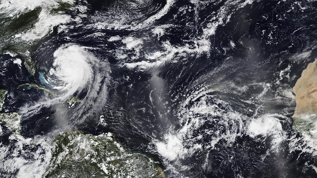
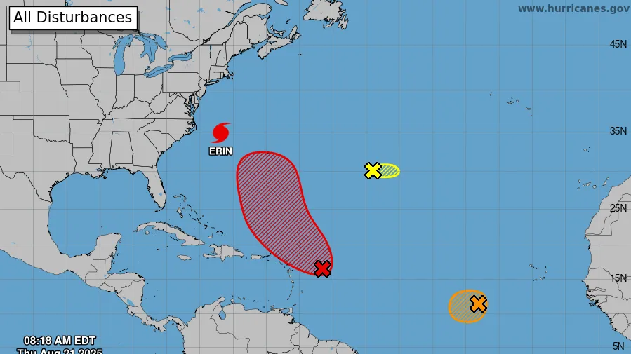
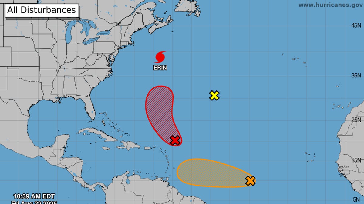
As Hurricane Erin moves out to sea, forecasters on Aug. 22 are keeping watch on three other areas of disturbed weather in the Atlantic Ocean.
Confronto fonti
5 prospettive sulla stessa storiaTimeline cronologica
- ·
usatoday.com
Hurricane Erin leads a train of tropical activity. Are more storms coming?
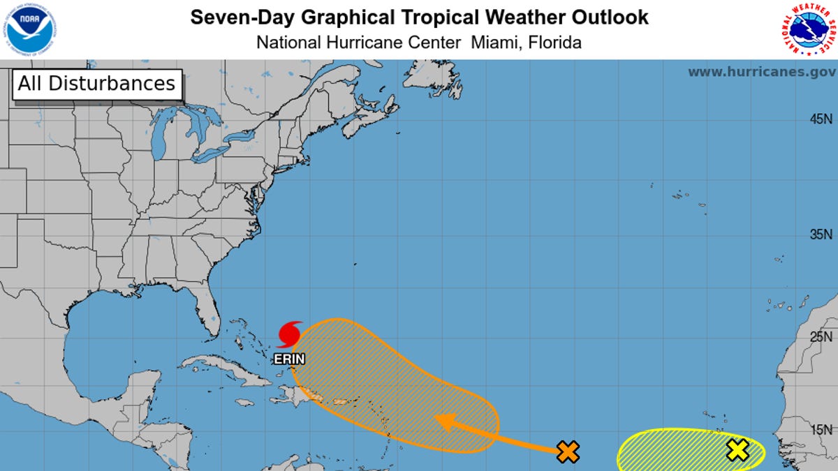
Forecasters are monitoring two other tropical systems in the Atlantic Ocean on Aug. 19 as the heart of the 2025 hurricane season approaches.
- ·
arabnews.com

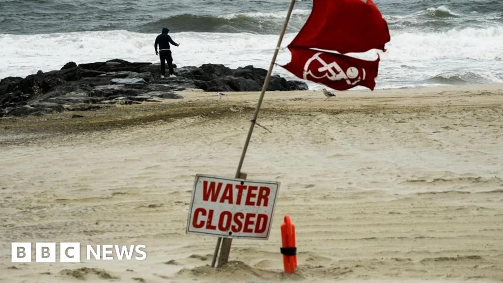
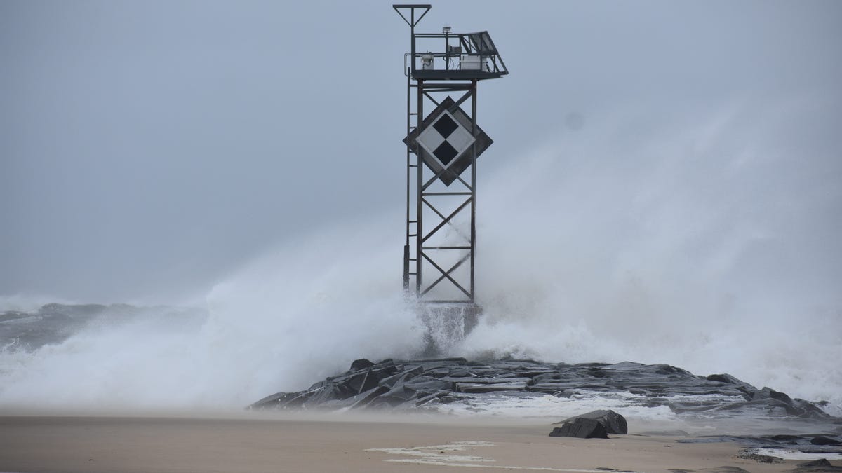
Hurricane Erin churns up dangerous waves and closes beaches along US East Coast
RODANTHE, N.C.: Hurricane Erin churned slowly toward the eastern US on Tuesday, stirring up treacherous waves that already have led to dozens of water rescues and shut down…