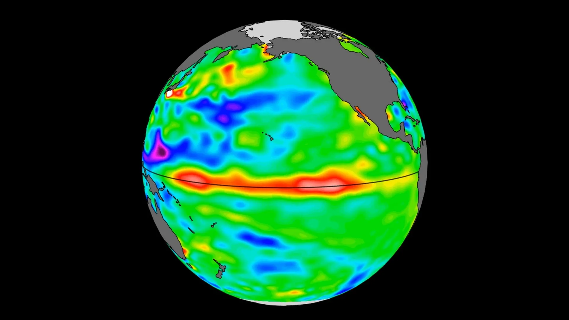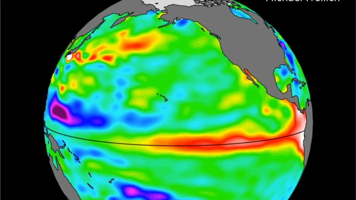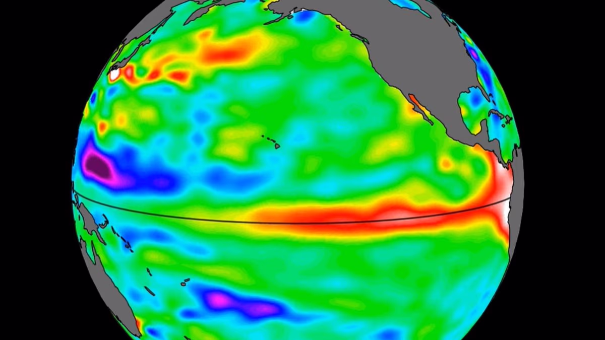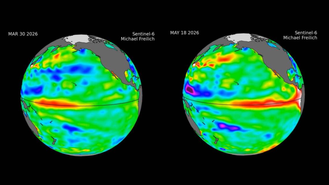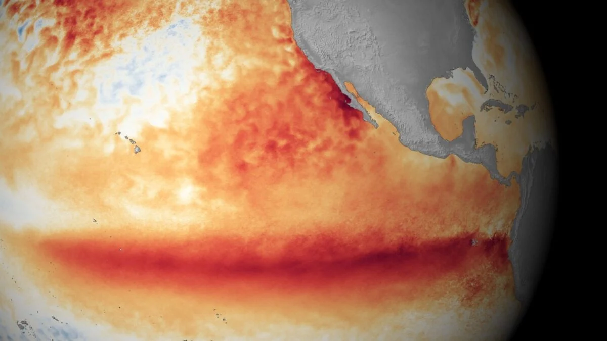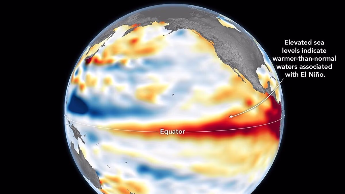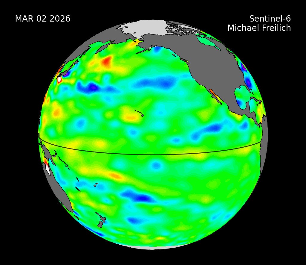
Sea level height data from the international Sentinel-6 Michael Freilich satellite collected from March to May 2026 show higher, warmer water moving from the western Pacific Ocean to just off the coast of Colombia, Ecuador, and Peru. This phenomenon is known as a warm Kelvin wave, signified in this animation of the data by yellow, orange, red, and white. The emergence of Kelvin waves in the early part the year is a signal that an El Niño event is likely to follow.
In early 2026, measurements from Sentinel-6 Michael Freilich showed a small Kelvin wave forming around Micronesia in late January and dissipating by mid-February. The wave shown in the animation emerged in early March, then moved east over time. By mid-May, the seas around Peru were more than 5.9 inches (15 centimeters) higher than long-term averages. Because water expands as it warms, a rise in elevation of an area of the ocean indicates increasing temperature.
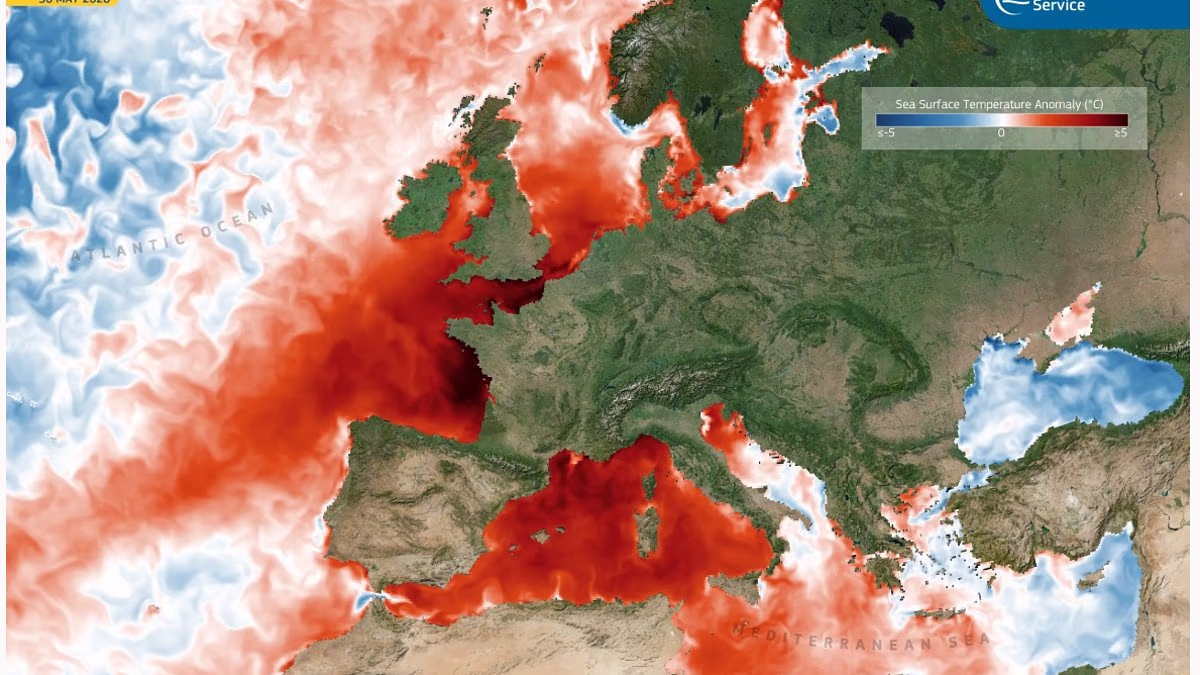
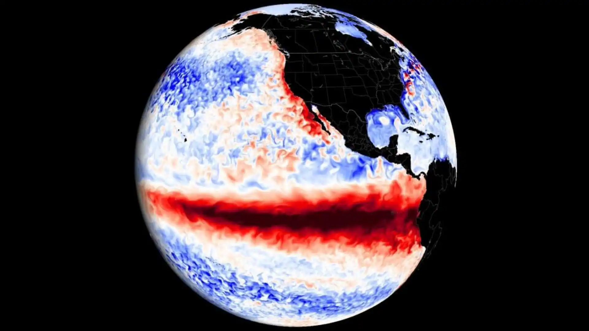
The additional heat at the sea surface can change the circulation patterns of energy, water, and air in the atmosphere, which can affect weather. El Niños can cause heavy precipitation in some regions and deficits in others, influencing daily life and commerce around the world.