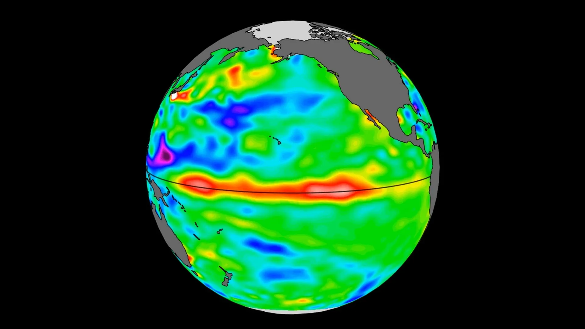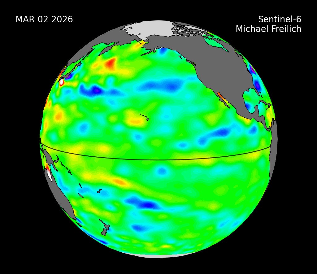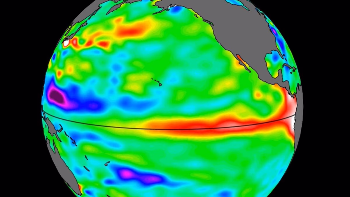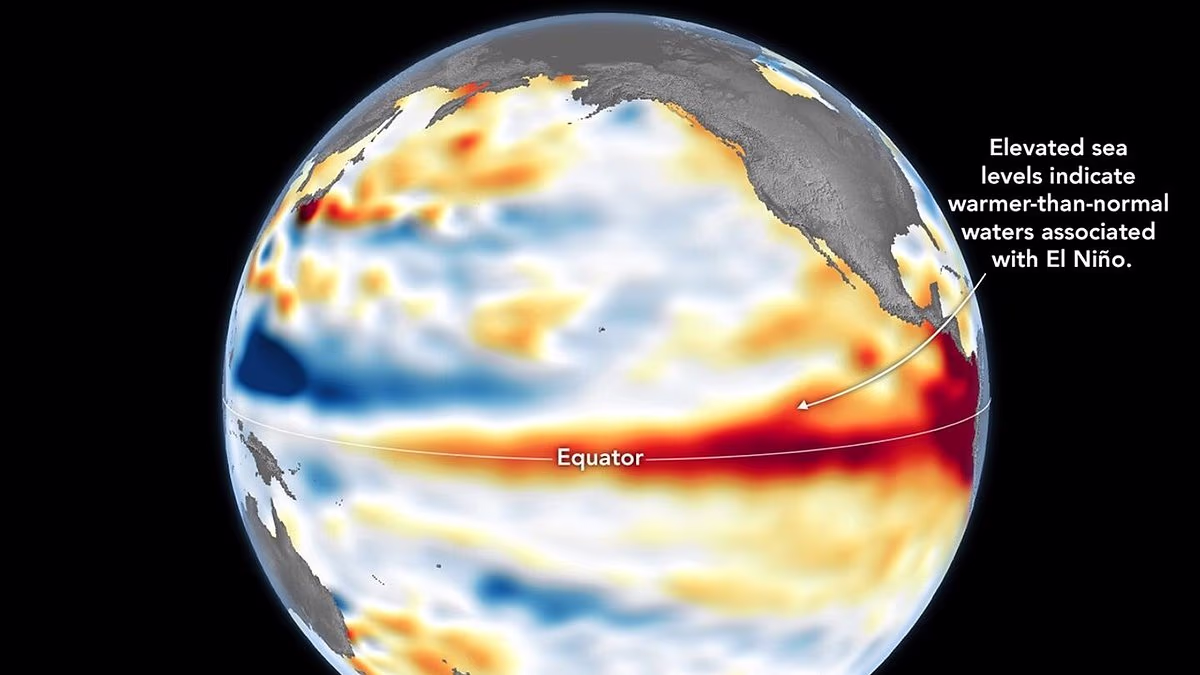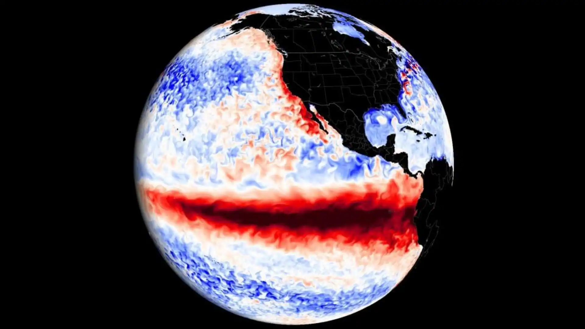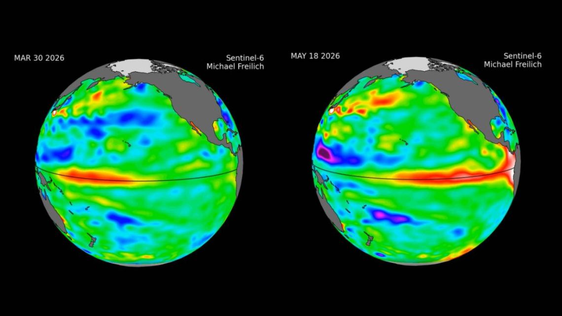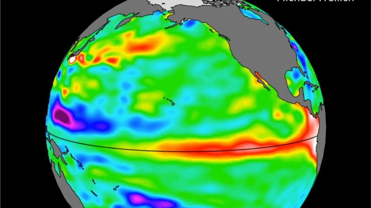
For months, meteorologists have been tracking the development of El Niño, warning that this year’s event could be one of the strongest on record. While the Pacific remains in an ENSO-neutral state for now, new satellite data suggests the transition to El Niño is imminent. Sea level measurements taken by the Sentinel-6 Michael Freilich satellite, developed in partnership between several American and European agencies, show higher, warmer water moving eastward across the Pacific Ocean. You can see this phenomenon—known as a warm Kelvin wave—in the animation below, signified as a white, red, orange, and yellow blob tracking east along the equator. This pulse of warm water is a well-known precursor to El Niño. The wave shown in the animation emerged in early March and reached the northwestern coast of South America in May. According to NASA, satellite data indicates that the waters around Peru were more than 5.9 inches (15 centimeters) higher than the long-term average by mid-May. Because water expands as it warms, this increase in sea surface height indicates an increase in sea surface temperature.
The data comes as meteorological agencies grow increasingly confident that El Niño will take hold within the next several weeks. This is the warm phase of the El Niño-Southern Oscillation (ENSO), a recurring climate pattern that has enormous influence over global temperatures and weather patterns. The latest report from the United Nations’ World Meteorological Organization urges nations to prepare for a “potentially strong” event, which would significantly increase the risk of extreme storms, flooding, droughts, and heatwaves.