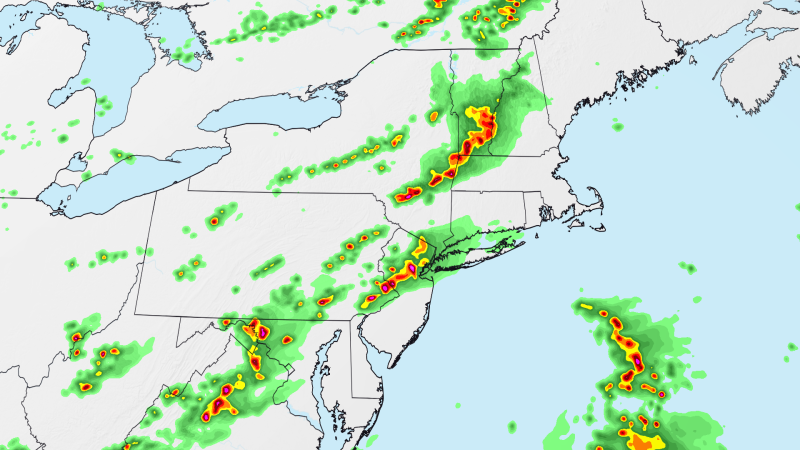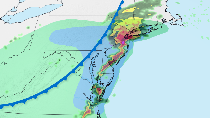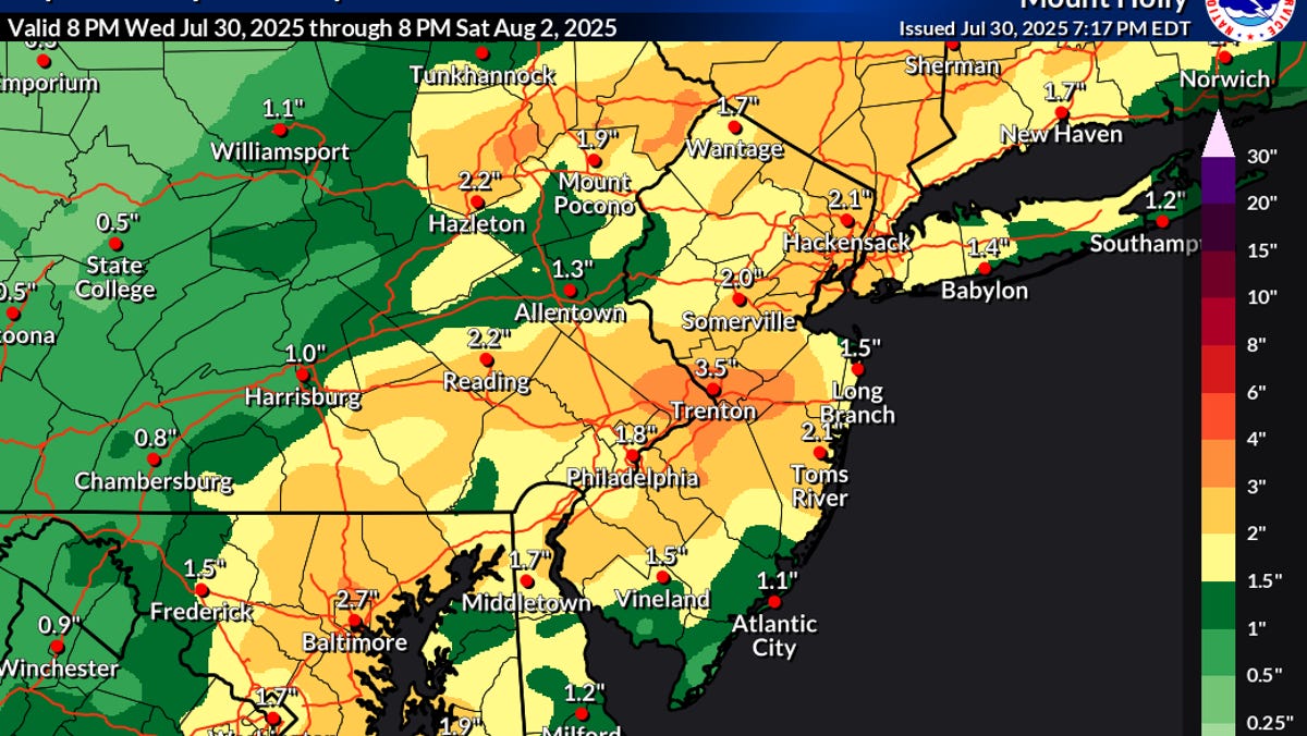
Major flash flooding brought a river onto the road in New York. (GIF: @WeatherMonitors)Flash flooding hit parts of the US Northeast and Mid-Atlantic on Thursday after repeated storms dumped heavy rain across the region, triggering water rescues in New Jersey and flooding near Newark Liberty International Airport. More storms were expected into early Friday morning, some potentially severe with damaging wind gusts and perhaps a tornado, while additional rainfall could raise the flood risk in areas already saturated by Thursday’s rain.Severe storm risk continues into FridayNortheastern Pennsylvania, Washington, DC, Baltimore and northern Virginia were included in a Level 2 of 5 severe-storm risk zone. The severe-weather threat was expected to ease by midnight as the strongest storms weakened, reducing the risk of damaging wind gusts, isolated hail and tornadoes, although rain could continue into early Friday morning.Areas farther east could see another spell of showers and thunderstorms on Friday, extending from southern New England to parts of Delaware and Maryland. While those storms were not expected to pose a significant flooding threat, the risk could increase if they passed over areas already soaked by Thursday’s downpours, news agency Cable News Network reported.Thursday’s rainfall was expected to reach about 1 to 2 inches across much of the region, with considerably higher amounts possible where successive heavy storms passed over the same locations. Parts of New Jersey had already recorded such higher totals.New Jersey gets up to 6 inches of rainThe concern over further rainfall followed flash flooding in parts of New Jersey on Thursday.Southwestern New Jersey received 4 to 6 inches of rain during the afternoon as storms stalled over the area for just a few hours.Gloucester County Emergency Management spokesperson Andrew Halter said a “large number” of water rescues took place around Glassboro and nearby Harrison Township.Farther north, near Newark Liberty International Airport, police reported “extreme flooding” across Elizabeth and surrounding areas.Nearly 2 inches of rain an hourPennsylvania was also hit by intense rainfall. Pottstown, about an hour northwest of Philadelphia, recorded rainfall rates approaching 2 inches per hour, while areas south of Philadelphia saw rates exceeding 1 inch per hour.New York City came under a flash flood warning earlier Thursday evening.The latest flooding followed repeated bouts of flash flooding across the region over the summer. Just the previous Thursday, torrential storms flooded roads in New York City and New Jersey and disrupted air travel across the busy corridor.Cold front fuels another round of stormsSoutheastern Pennsylvania saw the first storms late Thursday morning, before the system spread northeast towards parts of New Jersey and New York City.Later Thursday afternoon, as a cold front moved out of the Ohio Valley towards the Northeast, another cluster of storms formed farther west along the spine of the Appalachian Mountains.That round had the greatest potential to turn severe through the evening. By mid-afternoon, severe conditions had already developed in a few storms in Upstate New York and around the West Virginia-Virginia border.
US Northeast floods: New Jersey gets up to 6 inches of rain, ‘extreme flooding’ near Newark airport
Flash flooding hit parts of the US Northeast and Mid-Atlantic on Thursday after repeated storms dumped heavy rain across the region, triggering water rescues in New Jersey and flooding near Newark Liberty International Airport. More storms were expected into early Friday morning, some potentially severe with damaging wind gusts and perhaps a tornado, while additional rainfall could raise the flood risk in areas already saturated by Thursday’s rain.
488 words~2 min read