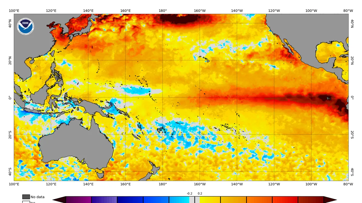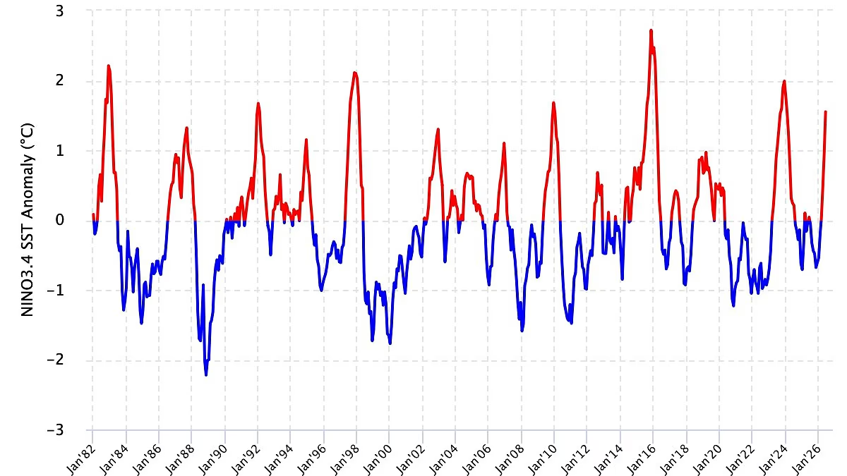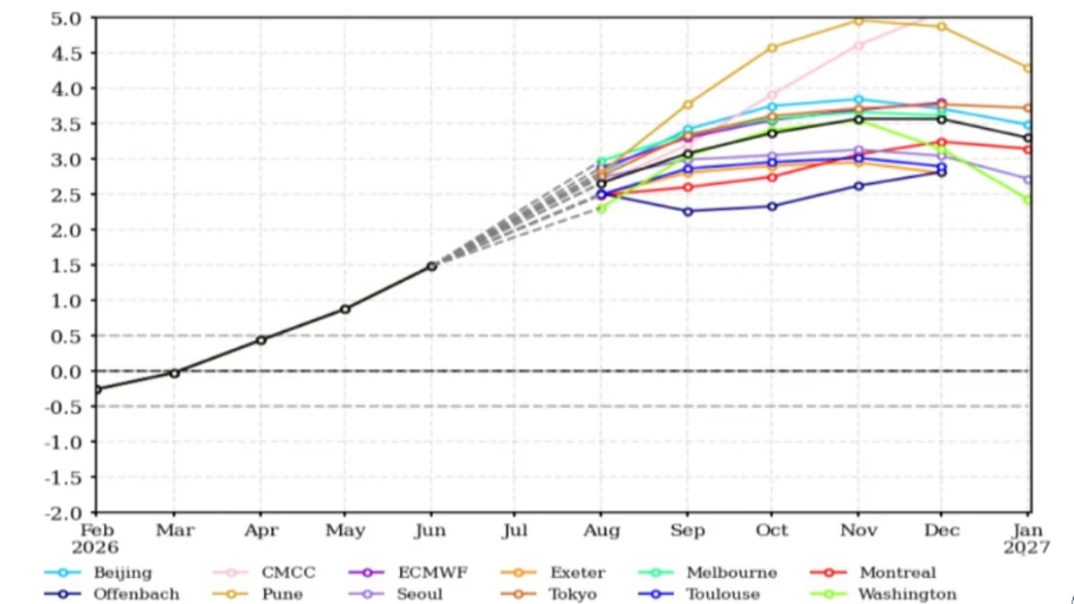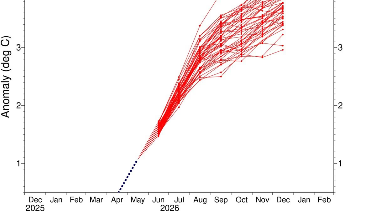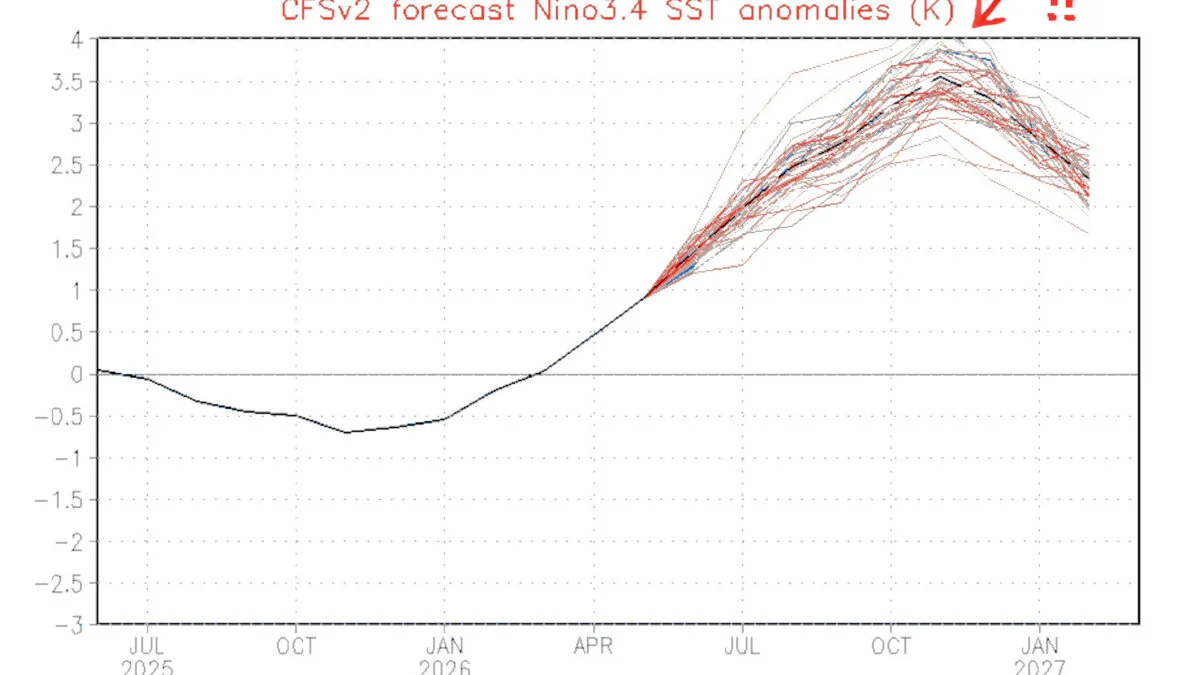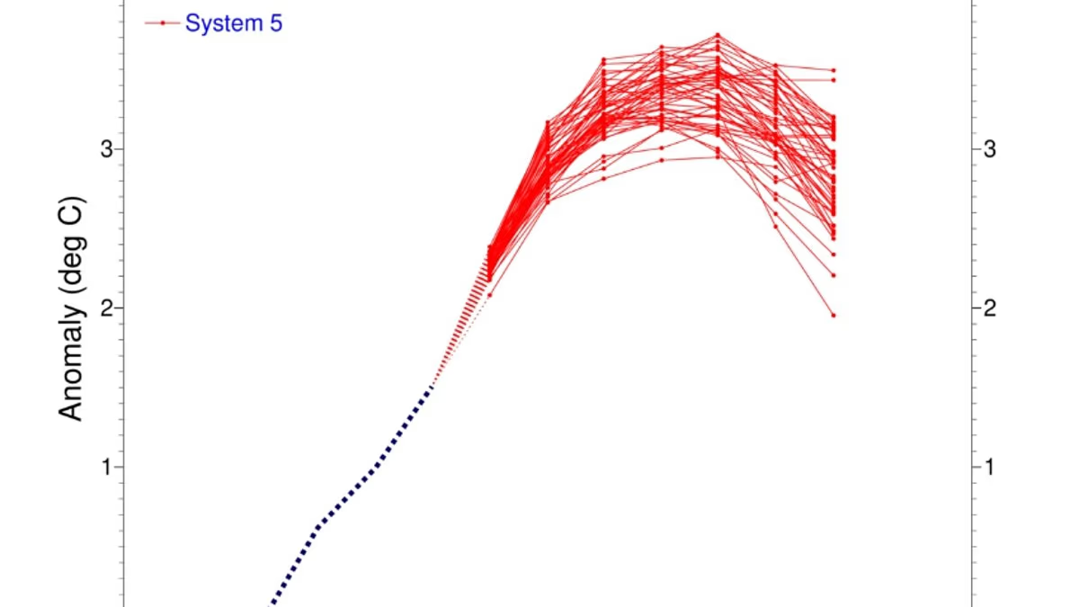
Super El Niño is evolving and could become one of the strongest events on record, scientists have warned.New measurements show that El Niño conditions are strengthening across the tropical Pacific, with sea surface temperatures (SST) showing a steady upward trend.Models reveal a 'clear and sustained increase', with the latest data showing the sea surface in this region is now 2.7°C above average.And the majority of indicators are pointing towards a 'very strong event' that could have far–reaching impacts across the globe.'The 2026 El Niño event continues to intensify across the central–eastern equatorial Pacific,' a blog written by Columbia University's Center for Climate Systems Research team reads.'The traditional Niño 3.4 index shows a clear and sustained increase, with the most recent seasonal mean reaching +1.51 °C during May–July 2026 and the July monthly value increasing to +2.03 °C.'The latest weekly Niño 3.4 index, centered on August 12, 2026, reached +2.7 °C.'Together, these observations indicate that El Niño is strengthening further and evolving toward a very strong event.' New measurements show that El Niño conditions are strengthening across the tropical Pacific, with sea surface temperatures (SST) showing a steady upward trend Models reveal a 'clear and sustained increase', with the latest data showing the sea surface in the equatorial Pacific is now 2.7°C above average The experts said further evidence of El Niño's strengthening comes from beneath the ocean's surface.They explained a 'pronounced reservoir' of 'exceptional heat' has developed across the equatorial Pacific.Temperatures at depths of up to 490ft (150m) are exceeding average values by more than 8°C in some areas.'This substantially increased subsurface heat content provides a strong source of energy for continued surface warming and further El Niño intensification,' they said.'If this evolution continues, the 2026 El Niño could emerge as one of the strongest events in the historical ENSO record.'They added: 'The mid–August 2026 intensity assessment provides a striking indication of the exceptional strength of the ongoing El Niño event.'Recent analysis predicts that El Niño conditions will strengthen further during 2026 – and could even persist into early 2027.Models show that the probability of El Niño persisting through until March is 100 per cent, while there's a 94 per cent chance the climate pattern will remain in place until May. Indicators are pointing towards a 'very strong event' that could have far–reaching impacts across the globe This comes after global ocean temperatures hit a record high in a worrying sign that the Super El Niño is strengthening How can marine heatwaves harm your health? Accelerating tropical storms, which trigger outbreaks of disease due to dead animals and stagnant water Intensifying heatwaves on land, sparking respiratory and cardiac issues Algal blooms can lead to skin–irritating rashes for swimmers and dangerous conditions for people with compromised immune systemsTriggering poisonous contamination of seafood Increasing mental health issues, such as anxiety, grief and post–traumatic stress disorder According to the World Meteorological Organisation, the phenomenon can bring above–normal temperatures in 'nearly all parts of the globe' this summer.The strongest heat signals are forecast across southern and western North America, Central America, the Caribbean, Europe, North Africa, and much of Asia.In the Southern Hemisphere, warmer–than–normal conditions are also expected across many areas.Northern South America is likely to see the strongest warming, while Southern Africa is forecast to experience widespread above–normal temperatures.In Australia, warmer conditions are mainly expected along the western, southern, and eastern coasts.Tropical regions around the world are also forecast to be hotter than normal, especially Equatorial Africa and parts of Southeast Asia and the Maritime Continent.However, looking ahead, the Met Office predicts the El Niño could cause a cold and wet winter for Brits.'Its impacts here in the UK are typically indirect, but it can increase the likelihood of more unsettled conditions later in the year, including a higher chance of milder, wetter and windier weather during autumn and early winter,' it explained. 'El Niño can also be associated with colder and calmer late winter periods in the UK.'
Models confirm Super El Niño is EVOLVING
Super El Niño is evolving and could become one of the strongest events on record, scientists have warned.
969 words~4 min read