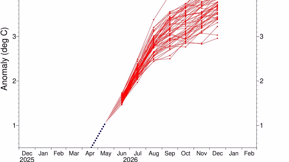
Chances of a “super” El Niño are rising as several climate models predict off-the-charts increases in Pacific sea surface temperatures by the fall. Meteorologists are growing increasingly concerned about what this could mean for global temperatures, extreme weather, and food security. The latest projections from the National Oceanic and Atmospheric Administration, visualized in the chart below, all show sea surface temperatures rising at least 4.5 degrees Fahrenheit (2.5 degrees Celsius) above average by November. Some shoot over the top of the Y-axis, predicting temperature increases of more than 7.2 degrees F (4 degrees C) by that month. That’s well into super El Niño territory. Looking at the graphic below and seeing the temperature values bleed over the top, I’m prompted to paraphrase from Jaws: Hey NOAA—you’re gonna need a bigger chart.
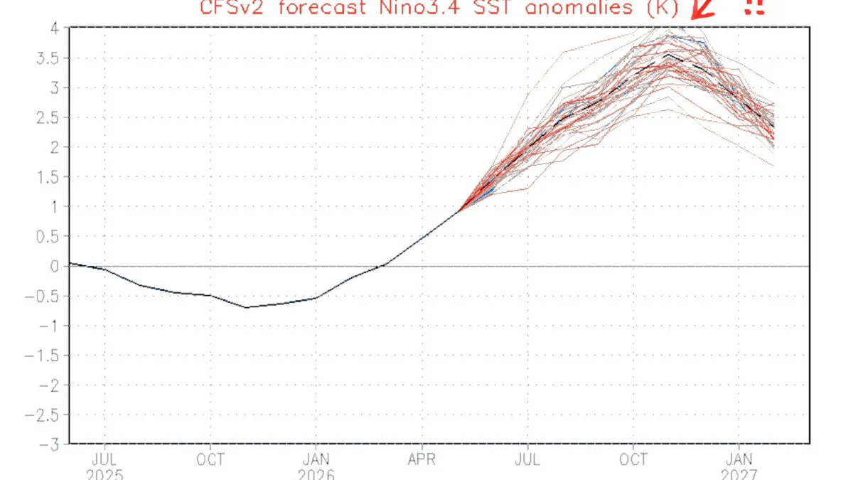
An ensemble forecast for El Niño conditions through January 2027. Each line represents a different model’s projection, charting how high Pacific sea surface temperatures in the Niño 3.4 region could rise above average over time. © NOAA/NWS/NCEP/CPC By comparison, the latest ensemble forecast from the European Centre for Medium-Range Weather Forecasts is less damning, but still concerning. This chart shows several models approaching a temperature increase of 7.2 degrees F (4 degrees C) by November, with the most extreme projection topping out at about 6.8 degrees F (3.8 degrees C). That’s still way above the threshold for a very strong El Niño.