3 min readPhotophoretic Tracers for Near-Space Remote Sensing at 30-100 km Altitudes Loura HallJul 21, 2026 Article
Benjamin SchaferRarified Technologies, Inc.
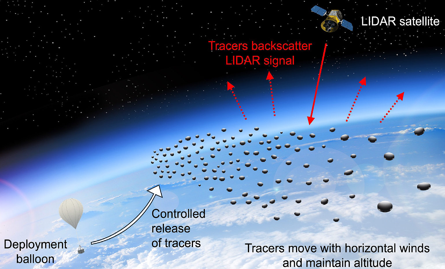
We propose a new approach to atmospheric sensing at 30-100 km altitudes using photophoretically levitating tracers. These lightweight structures harness sunlight to remain suspended for up to months at controlled altitudes and can be remotely tracked by satellite-based lidar or radar. Unlike natural aerosols, these tracers are designed to provide strong and tunable backscatter at standard remote sensing wavelengths, enabling passive, persistent, and altitude-selective measurements of wind, temperature, and pressure in a region that is critically under-measured by existing systems.
This concept addresses a major gap in current sensing capabilities. The mesosphere and upper stratosphere play a key role in atmospheric dynamics, space-domain awareness, space weather, and high-altitude platform navigation. Despite the importance of this region, data collection remains a challenge. Near-space is too high for sustained balloon flight and too low for satellites to orbit. Concentrations of extant atmospheric species are also too low for remote sensing techniques such as lidar and radar. Photophoretic tracers offer a new solution: a persistent, stratified sensor layer of non-toxic, inert backscattering points that require no onboard power, propulsion, or control. These tracers can be deployed via high-altitude balloons or rockets and autonomously reach their target altitudes based on their geometry and coatings.