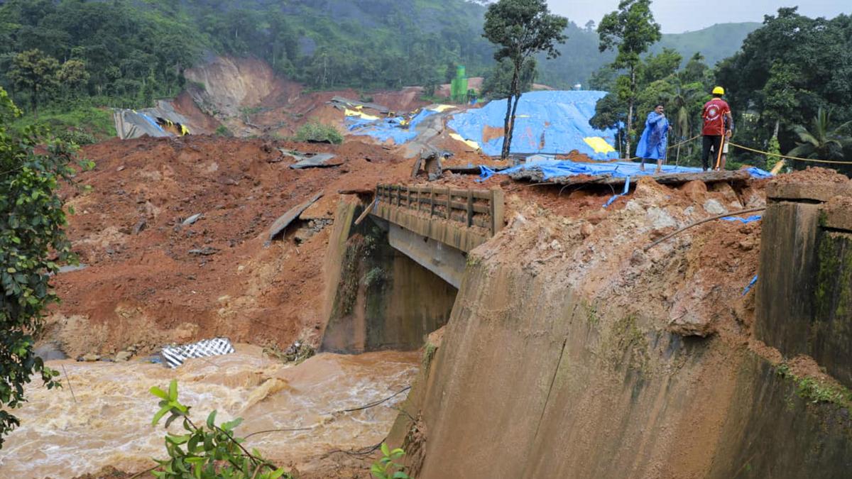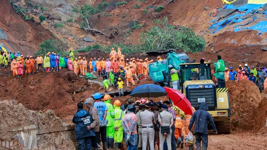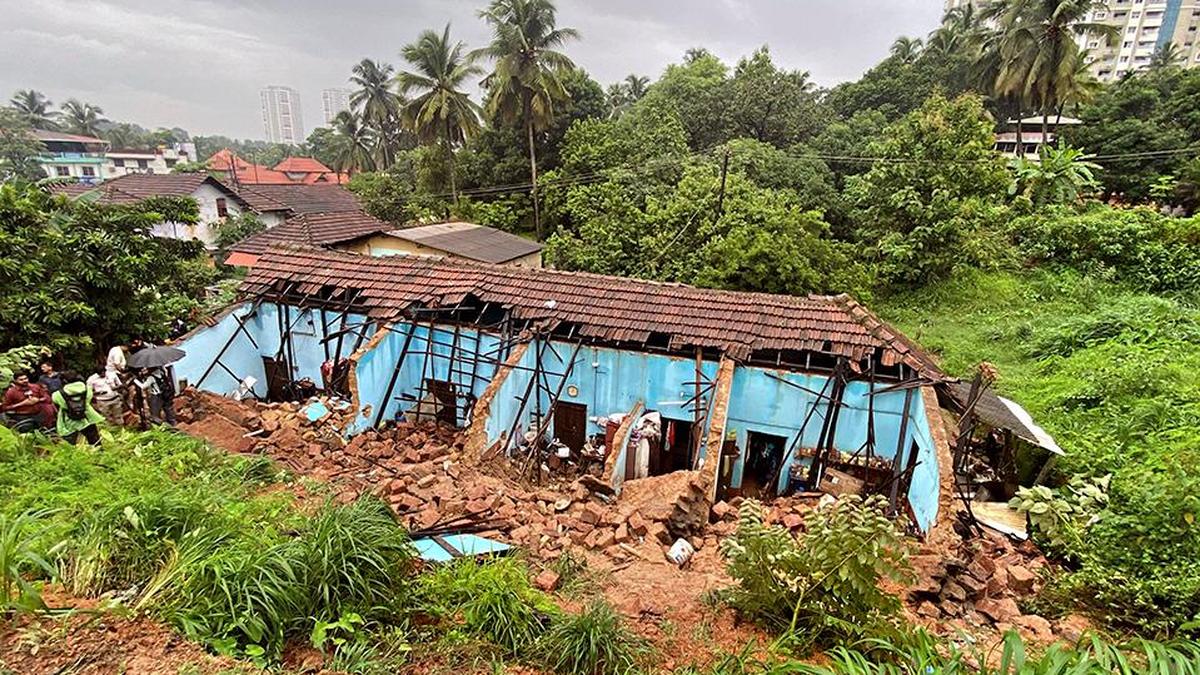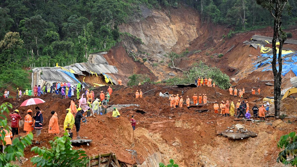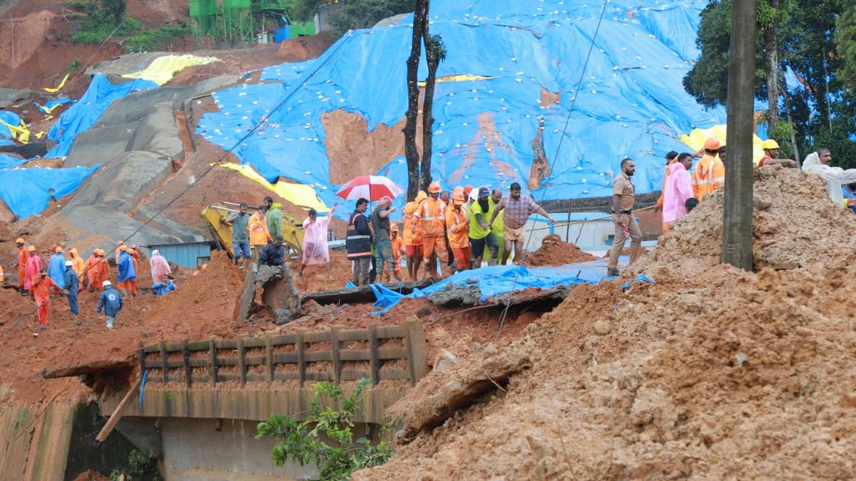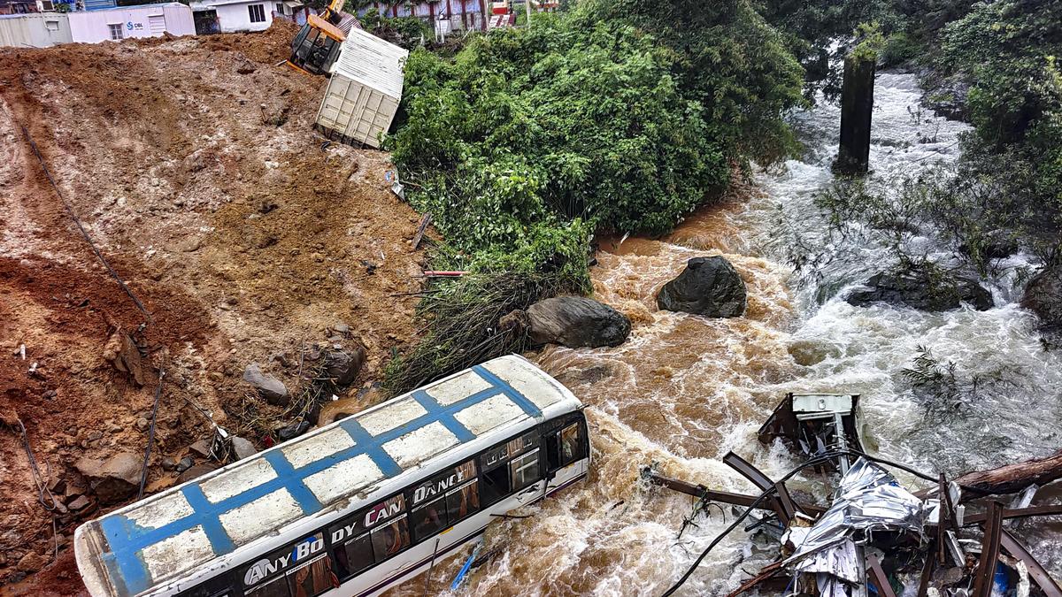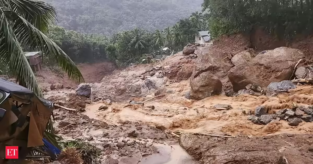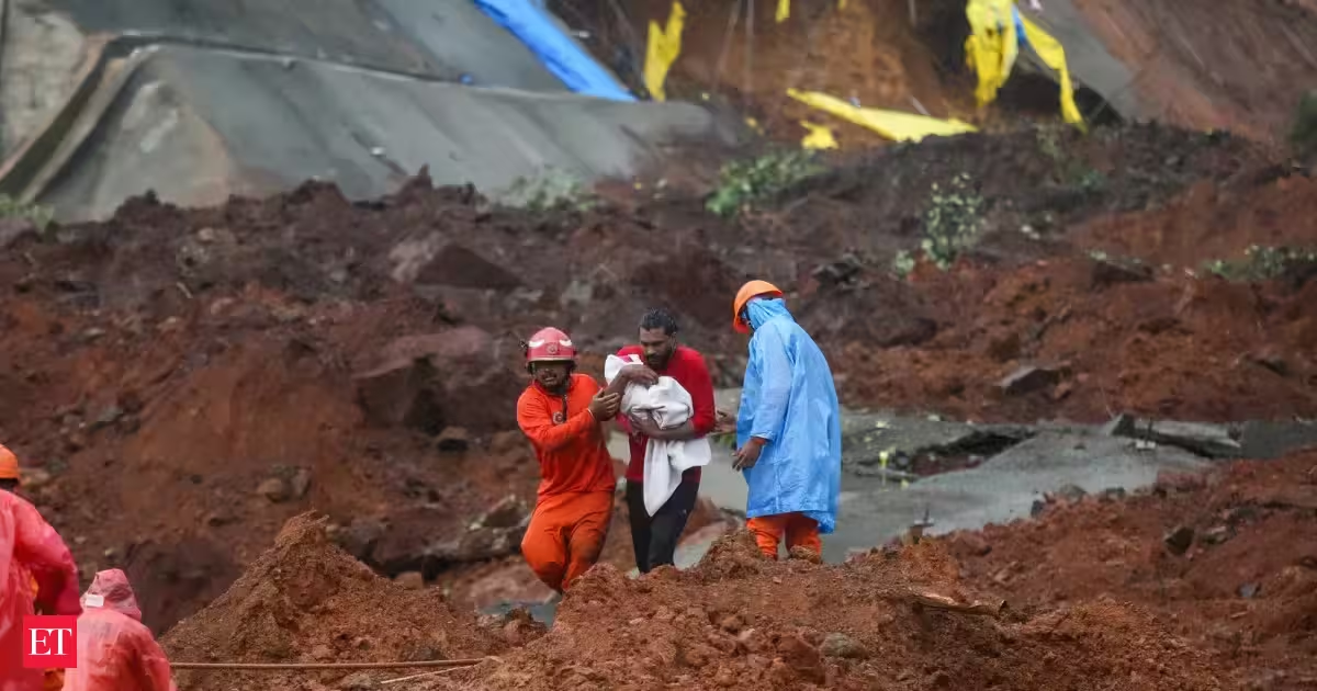
Wayanad is a landscape structurally holding its breath. For anyone tracking the changing terrain of the Western Ghats, this picturesque high-range district in Kerala has rapidly transitioned from a misty haven into a zone of cascading ecological crises.The most recent warning shot echoed through the valleys last week at the construction site of the multi-crore Anakkampoyil–Kalladi–Meppadi twin-tube tunnel road project near Meenakshi Bridge.Following a relentless deluge of over 225 millimetres of rain, a massive mountain flank gave way, burying labor camps, heavy machinery, and engineering staff under feet of suffocating slush.Also Read | Suspend Wayanad tunnel work pending fresh study: Congress leader; CPI(M) says it shouldn't be derailedSix lives were lost and two individuals remain missing.The VD Satheesan-led state govt classified the event as a tragic consequence of unscientific development, pointing out that massive mounds of excavated earth had been left stacked right at the mouth of the tunnel before the monsoon arrived.This disaster occurred just two years after the deadliest landslide event in Kerala’s recorded history.In July 2024, a terrifying cloudburst triggered a massive structural collapse high above the tea plantation village of Mundakkai. Sometime past midnight, a hyper-concentrated avalanche of boulders, uprooted forests, and liquid mud swept down the valley, completely erasing the downstream village of Chooralmala.Also Read | Wayanad landslide death toll rises to 6The catastrophic failure left over 420 people dead or permanently missing, rewriting the map of the district overnight.However, the precedent for these twin tragedies had already been set earlier.During the severe floods of August 2019, an entire hillside dropped over a plantation community in Puthumala, located just a few kilometres away from Mundakkai. Heavy water saturation sheared off a massive block of earth, instantly killing 17 people and burying workers' quarters and a local temple under a sea of red mud.Even further back, the historic pan-Kerala floods of August 2018 served as the ultimate prelude.During that catastrophic summer, Wayanad sustained nearly 250 minor-to-medium landslides and widespread land subsidence. Massive casualties were averted only because the district administration executed a proactive evacuation of over 30,000 mountain residents.A fragile blueprintThese recurring disasters are profoundly interconnected.They cluster around the Meppadi panchayat and the surrounding Camel's Hump mountain range, sharing the exact same structural foundation.Millions of years of heavy tropical weathering have turned the top layer of these mountains into a thick, porous, clay-heavy soil that rests precariously on a slick, hard bedrock base.When intense monsoon rains hit the mountain peaks, the water does not merely run off the surface. Instead, it saturates the loose topsoil and creates a hidden subterranean hazard known as soil piping.Water seeping underground eats away at the internal dirt layers, forming secret, hollow pipelines beneath the surface. As the downpour continues, water pressure builds up dramatically inside these hidden tubes.Eventually, the internal pipes burst simultaneously across the ridge, causing the entire hillside to liquefy and slide off its smooth rock base like wet snow off a tin roof.The tragedy of Wayanad's geography is also that what happens on one mountain peak rarely stays there.The entire region is tied together by a complex hydrologic network of steep mountain streams that feed directly into major river channels like the Punnapuzha and Iruvanjippuzha.These rivers act as connected water highways.When a cloudburst hits the high ridges, the water channels down through the valleys with immense velocity.Because the underground water tables and surface streams are interconnected across this continuous basin, a structural weakness or flash flood in one valley directly spikes the soil water pressure in the neighbouring valleys.A landslide that begins high up in a forested, bowl-shaped hill quickly gathers momentum, using the natural river pathways as acceleration ramps to blast through residential and commercial areas miles downstream.The policy limboCompounding the physical instability of the mountains is a deep administrative and political conflict centred around how, and where, humanity should build.Wayanad is officially classified within the Ecologically Sensitive Area (ESA) framework of the Western Ghats, a biological treasure house meant to be protected from high-impact development.Yet, the pressure to build all-weather transit corridors has led to a dangerous policy paradox.The state’s infrastructure ambitions have consistently pushed past these ecological boundaries, turning the high-range district into a testing ground for heavy engineering in a region that cannot support it.The central flashpoint is the Rs 2,134-crore Anakkampoyil–Kalladi–Meppadi Twin-Tube Tunnel Road project. Spearheaded to bypass the congested, landslide-prone Thamarassery Ghat road and provide rapid connectivity between Kozhikode and Wayanad, the 8.7-kilometer mega-project requires extensive, deep-rock blasting.Government review records from the State-Level Expert Appraisal Committee (SEAC) reveal that environmental clearances were heavily debated, primarily because nearly 80% of the twin tunnels slice directly beneath 17 hectares of protected forest land.Geologists have long warned that executing high-intensity blasting in this specific corridor is equivalent to an engineered catastrophe; the excavation works destabilise the internal rock stress, fracture the sub-surface strata, and accelerate the devastating structural failures that culminated in the deadly 2026 Kalladi site collapse.This aggressive infrastructure push operates in direct friction with local conservation mandates.While the Supreme Court and federal environmental ministries have tried to enforce a strict one-kilometre Eco-Sensitive Zone (ESZ) buffer surrounding the Wayanad Wildlife Sanctuary to restrict heavy construction, these protections face intense pushback.Local communities frequently mistake these defensive ecological boundaries for restrictive commercial Special Economic Zones (SEZs), fearing a loss of agricultural land rights and local livelihoods.This ongoing friction has trapped Wayanad in an incredibly dangerous state of limbo.While defensive local politics and administrative delays stall critical, region-wide ecological regulations, high-impact infrastructure projects continue to cut, blast, and poke at an already unstable mountain system.
Wayanad Landslides: The hills are alive, but have a warning
Wayanad faces escalating ecological crises and deadly landslides. Recent disasters highlight unscientific development and policy conflicts. Heavy rains saturate porous soil, causing catastrophic hillside liquefaction. Infrastructure projects destabilize the mountain system, increasing risks. This region grapples with environmental protection and development pressures.
919 words~4 min read