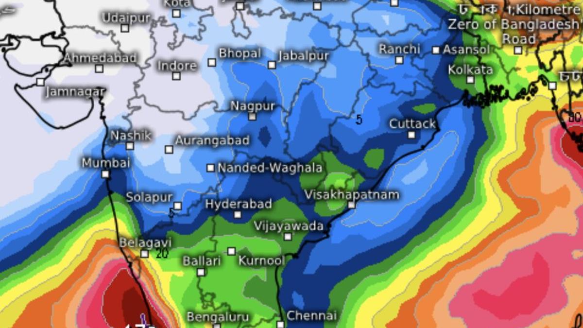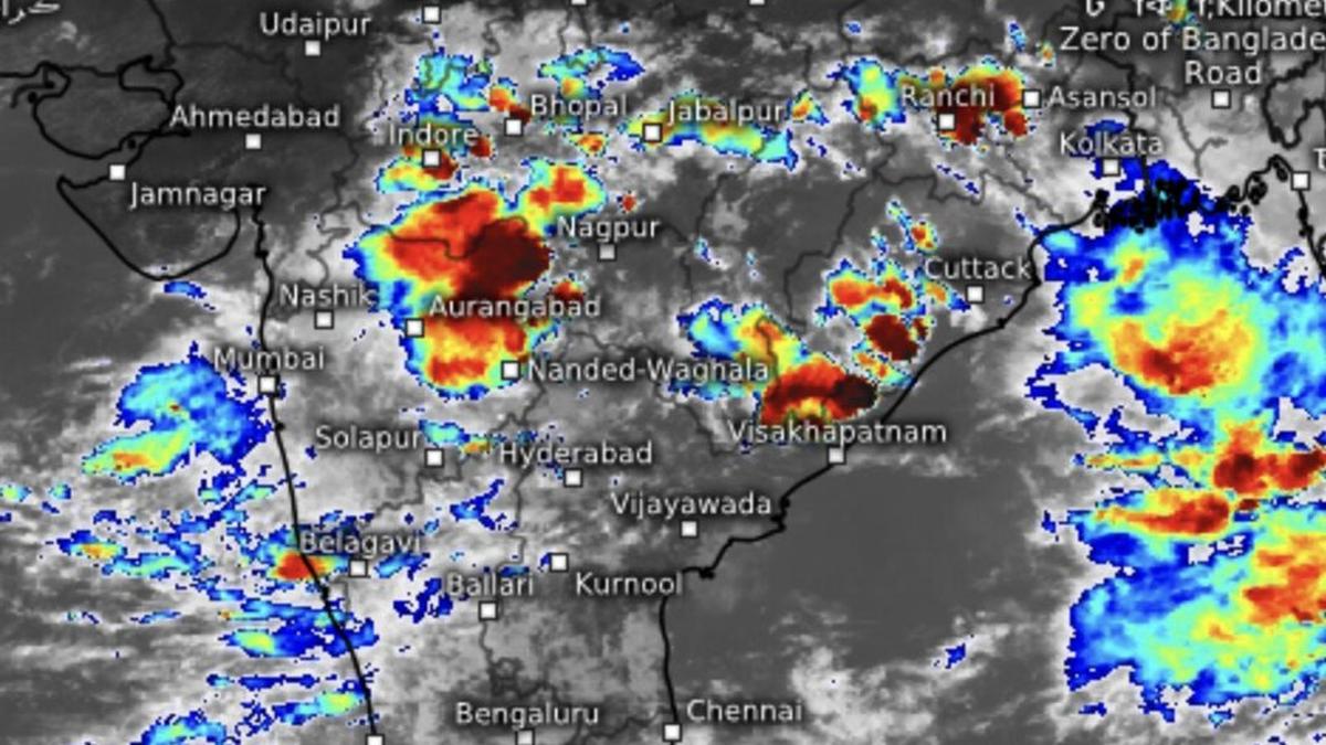
The first monsoon depression threatens to swamp West Bengal, Odisha, Chhattisgarh, East Madhya Pradesh, Konkan-Mumbai and Gujarat with fresh heavy rain (in red and yellow) into second week of July.
| Photo Credit:
www.meteologix.com/in
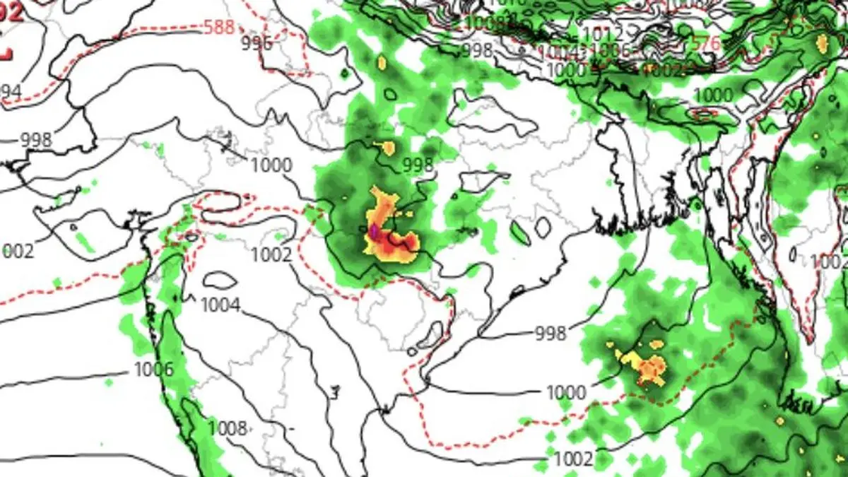
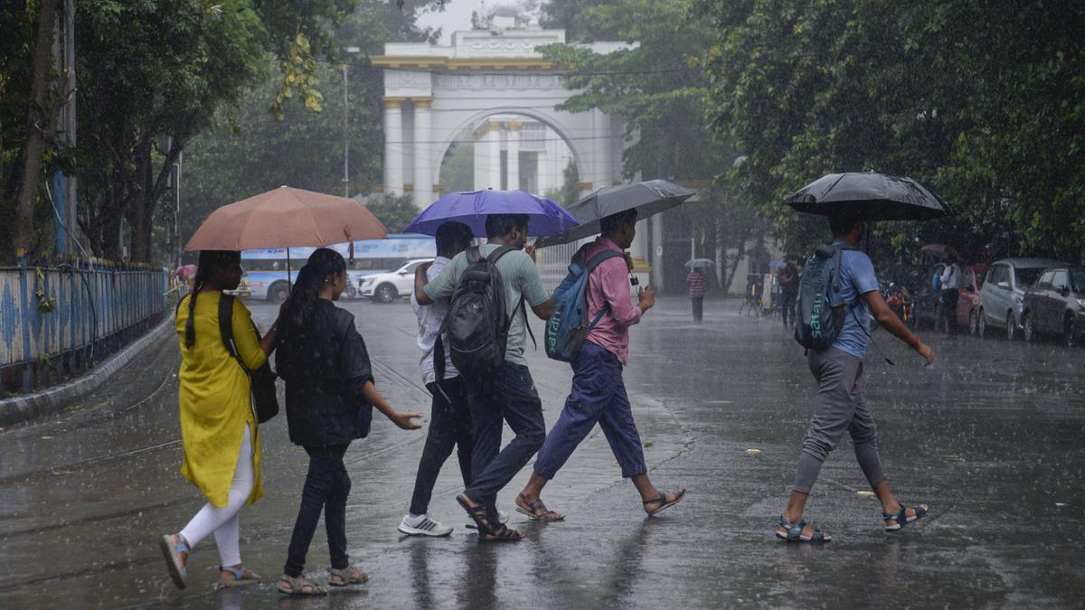
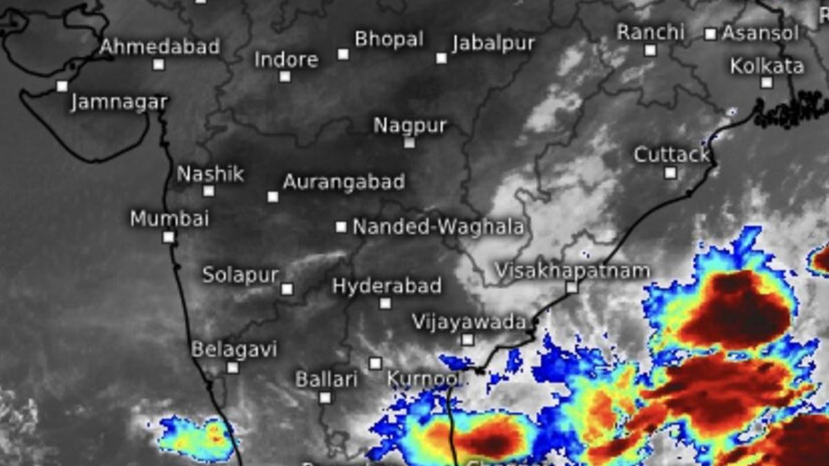
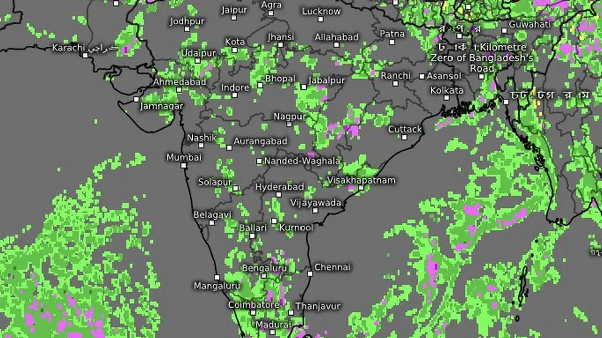
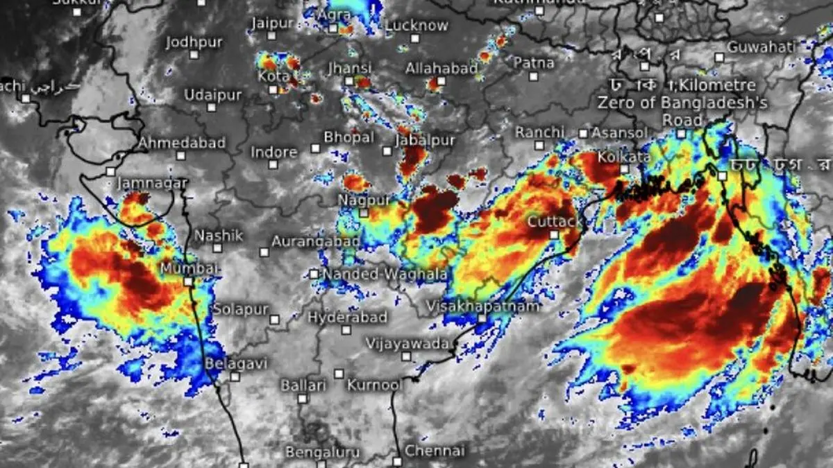
The monsoon has shifted into a higher gear with the season’s first depression forming over the north-west Bay of Bengal, promising a prolonged spell of heavy to very heavy rain across Odisha, West Bengal and adjoining Chhattisgarh before spreading its influence deep into Central India, West India and North-West India.On Sunday morning, the India Meteorological Department (IMD) located the depression about 50 km south-southeast of Balasore, 60 km north-east of Chandbali, and 60 km south-southwest of Digha. Its proximity to the coast may limit further intensification, but not its rain-making power.Depression to cross coastIf anything, the opposite may happen. The system is expected to move slowly, allowing it to draw a steady stream of moisture from the Bay and continuously feed the monsoon trough. That should keep the rain engine running through the week. The IMD expects the depression to cross the north Odisha coast between Chandbali and Digha, close to Balasore, on Monday.Fresh wet spellWeather models indicate the system may gradually weaken inland before interacting with an approaching western disturbance. The rare east-west coupling is likely to unleash another round of heavy rain over already waterlogged parts of West Madhya Pradesh, Gujarat and the Konkan, including Mumbai, early this week. The pounding is expected to last until Thursday, by when the monsoon is likely to complete its advance over remaining parts of Rajasthan, covering the entire country.Rain deficit crashesThe rain revival has already made a dramatic dent in the seasonal shortfall. The rainfall deficit over the monsoon core zone of Central India has shrunk by nearly 17 percentage points in less than a week to 23 per cent below normal, while the all-India deficit has narrowed by 13 percentage points to 27 per cent below normal. The gap is expected to close further over the coming days before stabilising .Beyond this week, however, the rain belt is forecast to shift north towards the Himalayan foothills, allowing deficits to build again over parts of Central India as rainfall there tapers off.Rains may taperThe IMD said this (Sunday) morning conditions remain favourable for the monsoon to advance into remaining parts of Haryana and Punjab and more areas of Rajasthan, including West Rajasthan, over next four days. Thereafter, rainfall is expected to ease across much of Peninsular India and the west coast, while the focus shifts to the North-East, Bihar, Uttar Pradesh, Uttarakhand, Himachal Pradesh and Jammu-Kashmir-Ladakh, leaving Central India with only scattered, incidental showers. Published on July 5, 2026