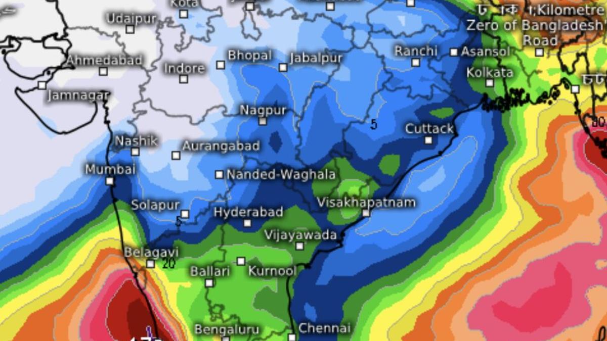
Angry thunderheads (red in colour) were approaching Odisha and West Bengal coasts as monsoon remained subdued over much of the west coast on Thursday, signalling closure of the onset phase
| Photo Credit:
www.meteologix.com/in
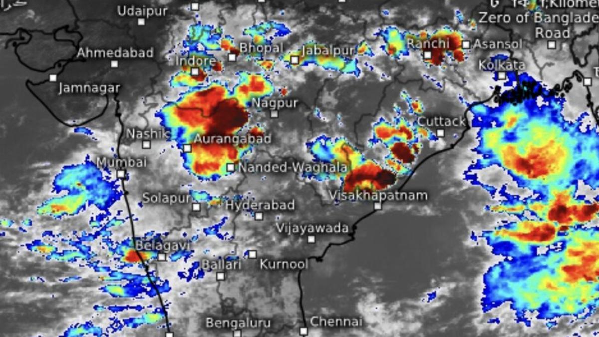
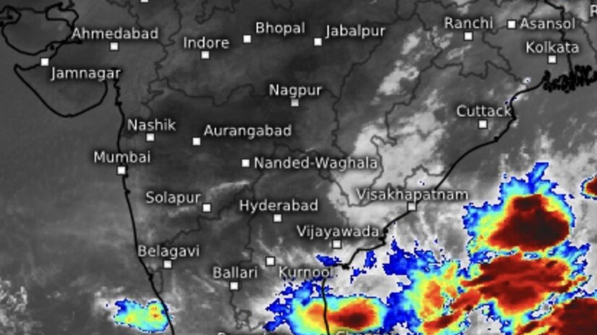
The monsoon may have eased along the west coast, but its vigour remains intact over the Bay of Bengal, where stronger south-westerly flows and expanding cloud bands have developed over the west, west-central and southern Bay, off Tamil Nadu, and concentrated around the Andaman and Nicobar Islands.The initial monsoon surge along the west coast appears to have exhausted itself after an extended onset phase. On Thursday morning, the most intense thunderstorms were confined to the Mangaluru-Kannur belt along the Karnataka-Kerala coast. Elsewhere, rain and thundershowers remained active from Thrissur southward to Thiruvananthapuram and further east to Nagercoil in Tamil Nadu.Next rain phaseRainfall activity is expected to revive along the west coast when the next monsoon pulse arrives around June 22-23, according to guidance from the European Centre for Medium-Range Weather Forecasts (ECMWF). The fresh spell is likely to begin with heavy rain over Coastal Karnataka and Goa before spreading northward across Konkan, Mumbai and south Gujarat up to Surat.Over north-west India, on Thursday, a trough lay extended from Punjab across Haryana, Uttar Pradesh, Bihar and Jharkhand to the plains of West Bengal. The trough is expected to draw moisture inland from the Bay, turning south-westerly winds into south-easterlies over adjoining eastern India and triggering rain and thundershowers.Western disturbanceMeanwhile, a western disturbance entered north-west India on Thursday morning and stretched from Jaisalmer in west Rajasthan towards north and west Gujarat. Cooler westerly winds associated with the system are expected to interact with the prevailing heat over the region, triggering thunderstorms. The disturbance will also interact with moisture-bearing south-easterlies from the Bay across parts of north-west and east India.Isolated heavy rainThe India Meteorological Department (IMD) has forecast isolated heavy rainfall over the Andaman and Nicobar Islands and the plains of West Bengal on Thursday; over hills of West Bengal and Sikkim from Friday for five days; and over Jharkhand, Odisha and Bihar for the next two days. Isolated very heavy rainfall is likely over hills of West Bengal and Sikkim and Odisha on Thursday.Thunder squalls with wind speeds of 50-60 km/hr, gusting to 70 km/hr, are likely over the Andaman and Nicobar Islands, plains of West Bengal and Odisha on Thursday, and over Jharkhand and Bihar during the next two days. Another spell of squally weather is forecast over these regions from Monday.Busy over east IndiaFairly widespread to widespread rainfall is expected over the Andaman and Nicobar Islands and hills of West Bengal and Sikkim during the next five days, over the plains of West Bengal and Jharkhand during the next two days, and over Odisha on Friday.It will be isolated to scattered over the plains of West Bengal for four days; Jharkhand for three days from Sunday; Bihar for five days from Friday; and Odisha for four days from Saturday. Thunderstorm, lightning and gusty winds are expected over the Andaman and Nicobar Islands, West Bengal, Odisha and hills of West Bengal and Sikkim through the period, extending to Jharkhand from Saturday and Bihar over the weekend. Published on June 11, 2026