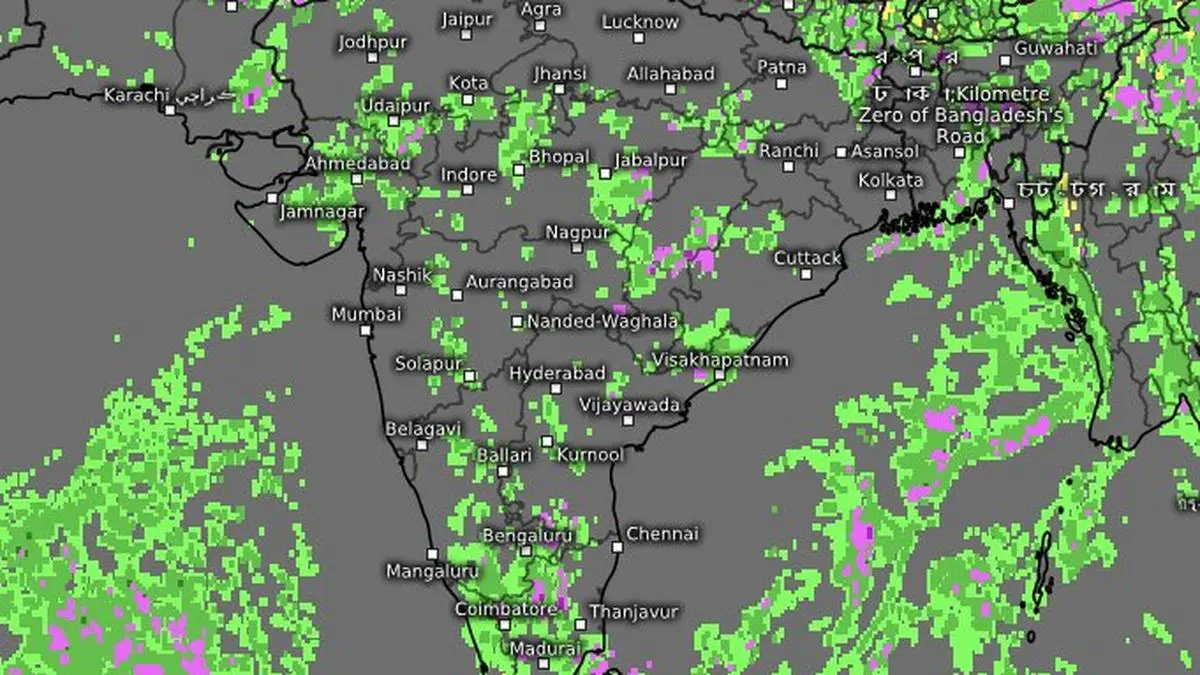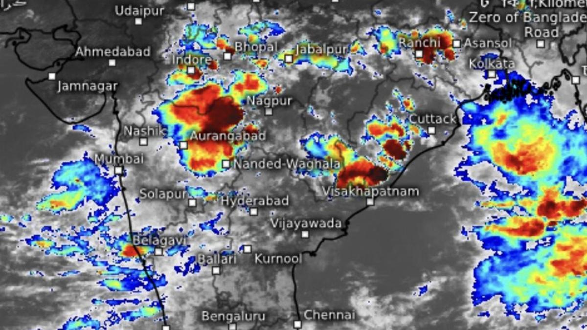
By Wednesday evening, intense thunderstorms (in dark red) drifted out from Mumbai to Madhya Pradesh and northern Maharashtra. Clouds rose tall over Bay of Bengal off Odisha-West Bengal coast as well.
| Photo Credit:
www.meteologix.com/in
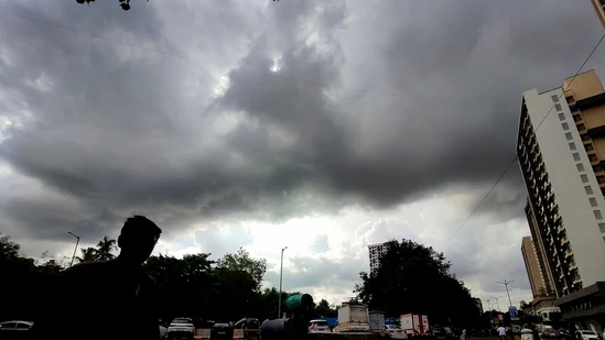
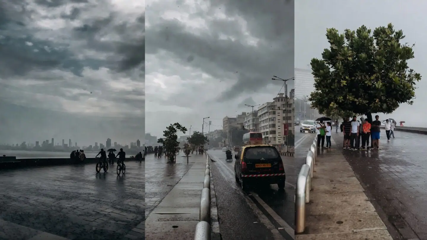
A delayed monsoon finally arrived with a vengeance over Mumbai and its surrounding regions, dumping extremely heavy rain across several locations during the 24 hours ending Wednesday morning. The downpour, which flooded roads and disrupted normal life overnight, may be only the beginning of a varyingly wet spell forecast to persist through the week and into the next.Central India gainsGuidance from the European Centre for Medium-Range Weather Forecasts (ECMWF) indicates that the current wet phase over West India could persist into next week, with adjoining Central India also benefiting, before the monsoon potentially slips back into another dry spell.The intense rain through Tuesday bore the hallmark of El Niño’s influence on the monsoon. By disrupting the normal flow of moisture-laden winds from surrounding seas, it often produces erratic rainfall patterns marked by extended dry spells followed by sudden, high-impact cloudbursts. India Meteorological Department (IMD) has predicted another spell of isolated very heavy rain over Konkan and Goa on Saturday.Replenishing reservesFor West India, however, the deluge could hardly have come at a better time. Mumbai and parts of Maharashtra had been edging toward a water crisis after a sluggish monsoon onset. The intense rainfall may help replenish reservoirs and bring relief to adjoining farming heartland in Central India.Rainfall activity is expected to remain active across West India. Fairly widespread to widespread rain is likely over Konkan and Goa during next six days, while Madhya Maharashtra and Marathwada are expected to see increased rainfall on Friday and Saturday. East Gujarat, Saurashtra and Kutch are also likely to remain under scattered to fairly widespread rain through the period.Extreme heavy rainThe IMD said isolated locations in Konkan-Goa and Madhya Maharashtra recorded extremely heavy rainfall exceeding 20 cm during the past 24 hours. Heavy rain also occurred at a few places across Jharkhand; East Madhya Pradesh; east Gujarat; Vidarbha; Chhattisgarh; Telangana; and Coastal Karnataka.Healthy advanceThe monsoon’s healthy advance over Central India is expected to continue. Isolated heavy rain is forecast over Vidarbha on Thursday and again during the weekend, while Chhattisgarh may witness enhanced rainfall for four consecutive days beginning Friday. East and West Madhya Pradesh are likely to receive scattered to fairly widespread rain over the next six days.Thunderstorms, lightning and gusty winds may stalk parts of Central India. West Madhya Pradesh may experience such activity from Friday onward, while East Madhya Pradesh and Vidarbha are likely to see outbreaks for four days beginning Thursday. Similar conditions are forecast over Chhattisgarh.Published on June 24, 2026