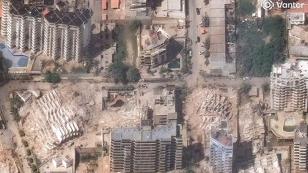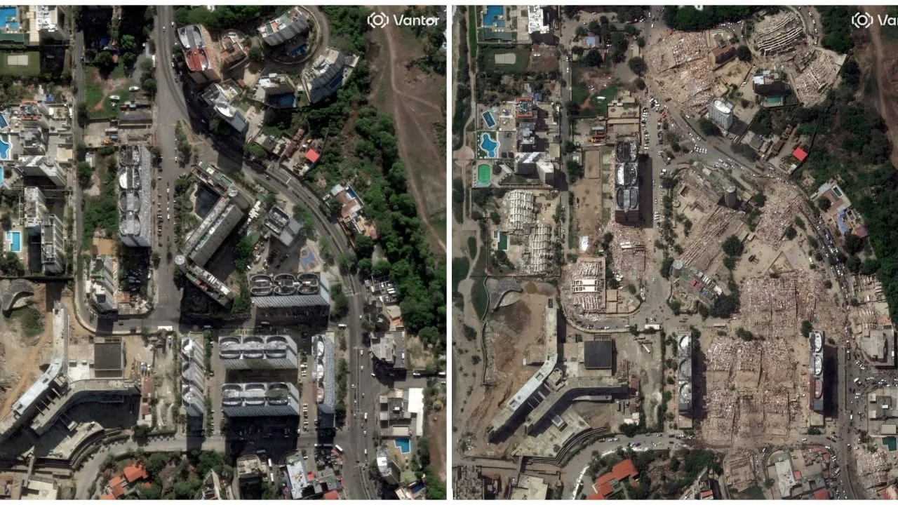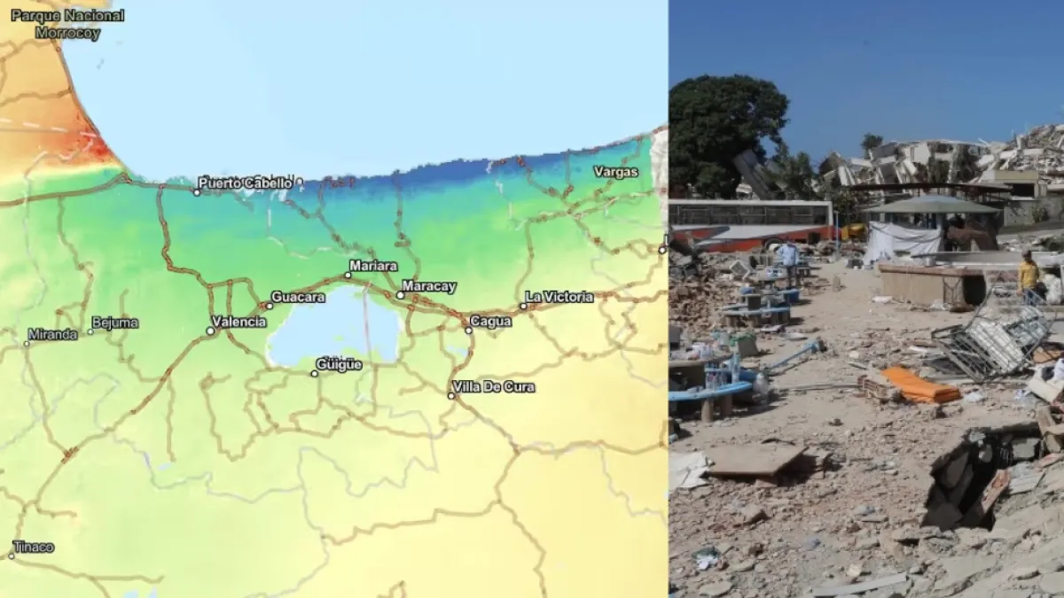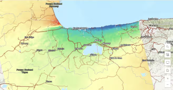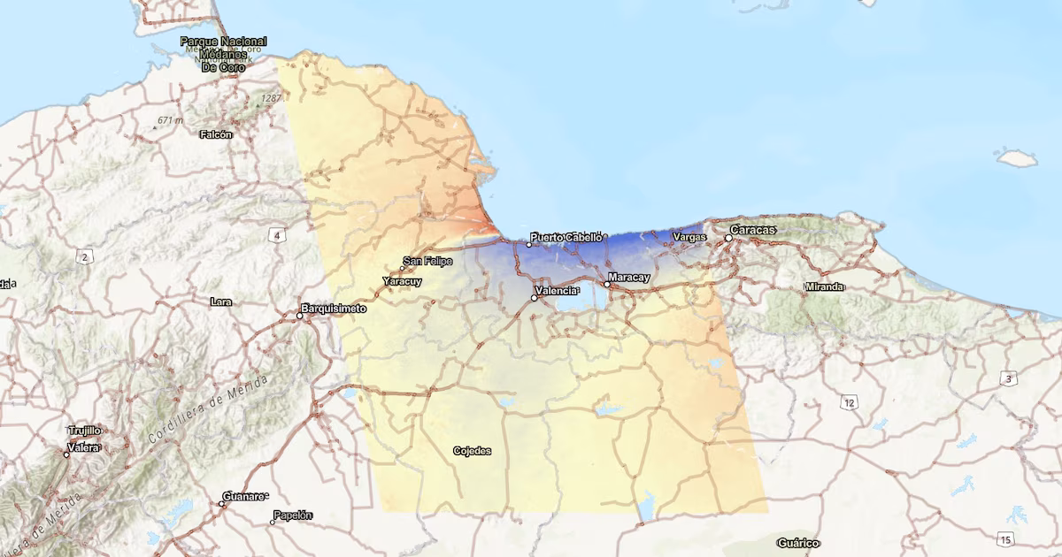
Jul 1, 2026 4:30 AMNew satellite imagery reveals how much terrain has shifted in the wake of the twin quakes.A satellite image shows how the Earth has deformed following Venezuela's pair of earthquakes.Illustration Courtesy of Copernicus Sentinel/ESAThe European Space Agency released a satellite image that shows the upheaval left behind by the pair of earthquakes that rocked Venezuela last week.The image was created using observations from the Sentinel-1 satellites, which are part of the European Copernicus program. These satellites do not take conventional photographs; instead, they use their radars to “illuminate” the Earth’s surface and record the time it takes for the signal to return to the sensor. By comparing two measurements of the same location taken on different dates, scientists can determine whether the ground has shifted, even when that shift is too small to be seen with the naked eye.To create the map, scientists compared an observation taken on June 18—one week before the earthquakes—with another taken on June 25, the day after the pair of earthquakes that were mangitude 7.2 and 7.5 respectively. This comparison allowed them to construct what's known as an interferogram revealing how much the ground deformed following the event.This satellite image shows the area around Caracas, Venezuela, which was struck by a double earthquake on Wednesday, June 24.
Space Lasers Show How Venezuela’s Earthquakes Reshaped the Earth’s Crust
New satellite imagery reveals how much terrain has shifted in the wake of the twin quakes.
562 words~3 min read