HomeAI · summaries
Storia in 5 fonti
Space Lasers Show How Venezuela’s Earthquakes Reshaped the Earth’s Crust
New satellite imagery reveals how much terrain has shifted in the wake of the twin quakes.
Confronto fonti
5 prospettive sulla stessa storiaTimeline cronologica
- ·
jpost.com
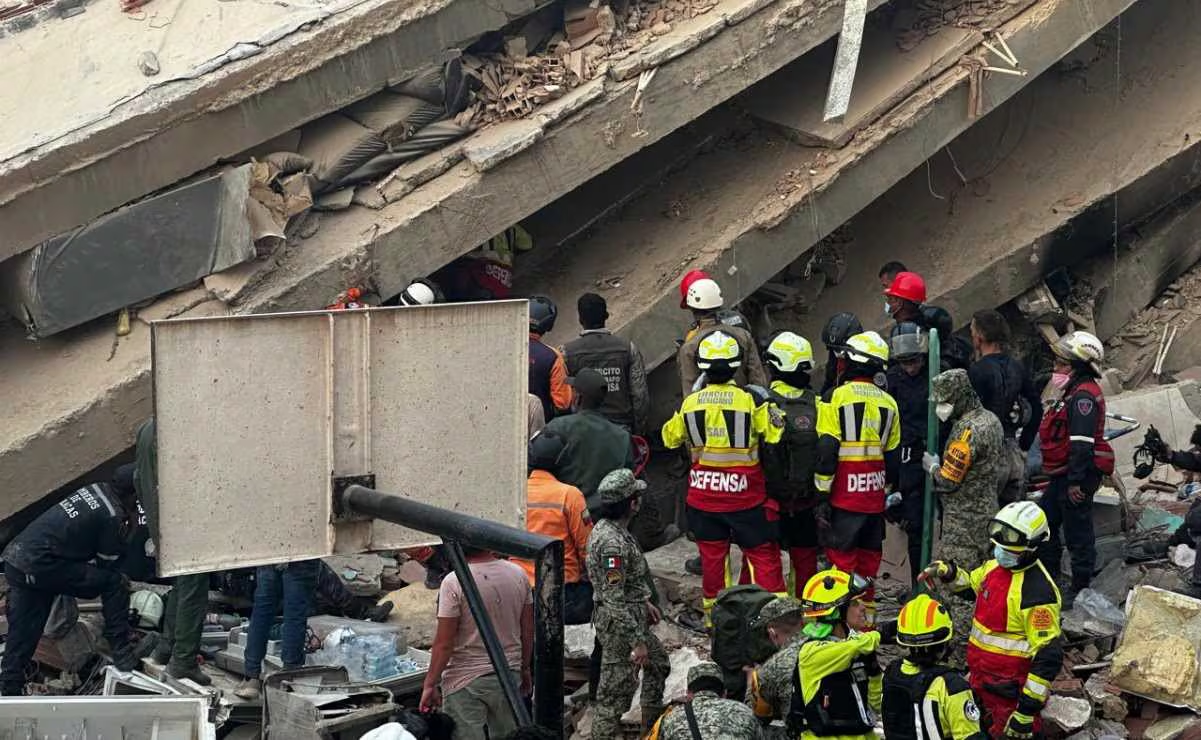
Venezuela earthquake leaves 68,000 missing as satellite images show ruin | The Jerusalem Post
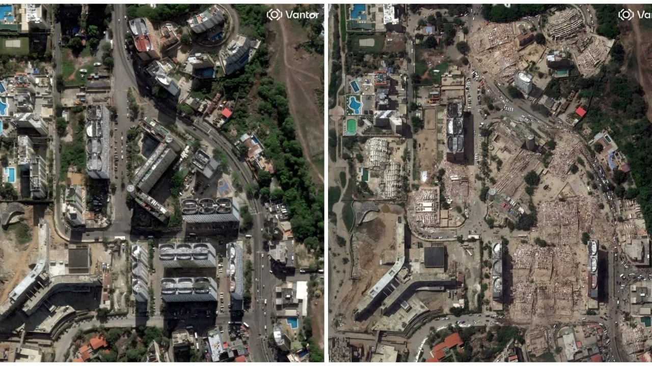
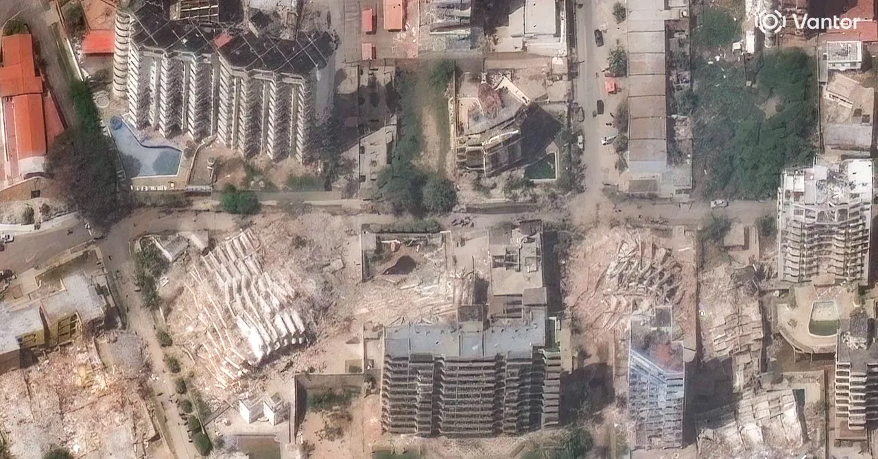
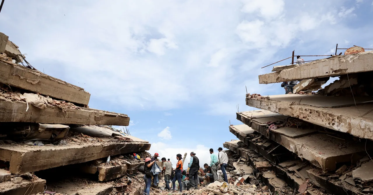
The imagery reveals extensive damage across several areas of the city, including the collapse of high-rise residential buildings in the Playa Grande neighborhood.
- ·
elespectador.com
La NASA muestra cómo se movió la Tierra tras los terremotos que sacudieron Venezuela
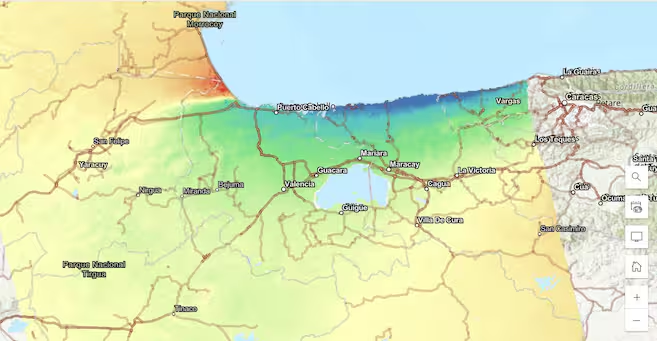
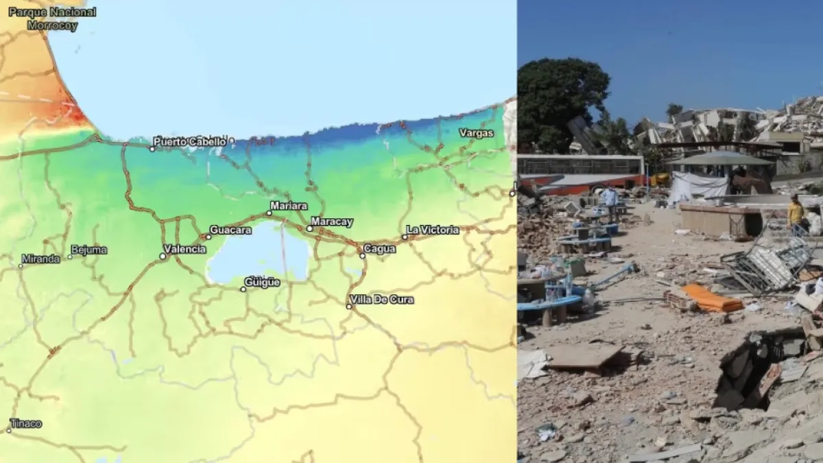
Un mapa de la NASA revela cómo se desplazó la superficie terrestre tras los terremotos que sacudieron Venezuela.
- ·
eluniversal.com.mx
NASA muestra el antes y después del terremoto en Venezuela; imágenes satelitales revelan las zonas con mayores daños
La agencia espacial compartió mapas e imágenes elaborados con información obtenida por la misión NISAR
- ·
wired.com
Satellite Images Show the Destruction Caused by Venezuela's Twin Earthquakes
The maps and images show the extent of destruction and give rescue operations a tool to find any remaining survivors.
- ·
eltiempo.com
La Nasa muestra cómo se movió la Tierra tras los terremotos en Venezuela
El mapa de interferometría revela desplazamientos de hasta 40 centímetros en la corteza de la costa norte tras los sismos del pasado 24 de junio.
- ·
Space Lasers Show How Venezuela’s Earthquakes Reshaped the Earth’s Crust
New satellite imagery reveals how much terrain has shifted in the wake of the twin quakes.