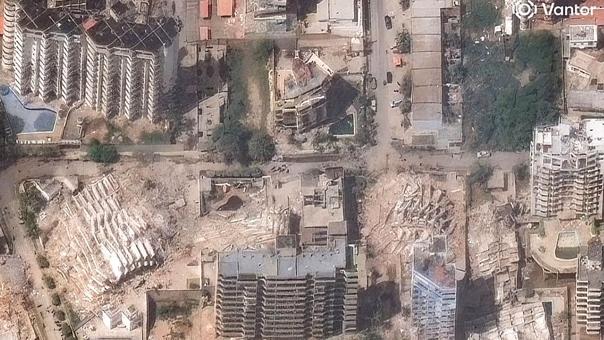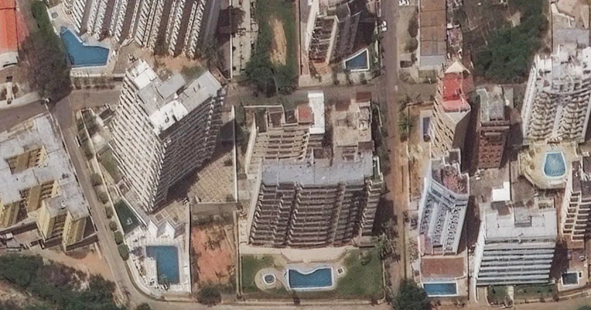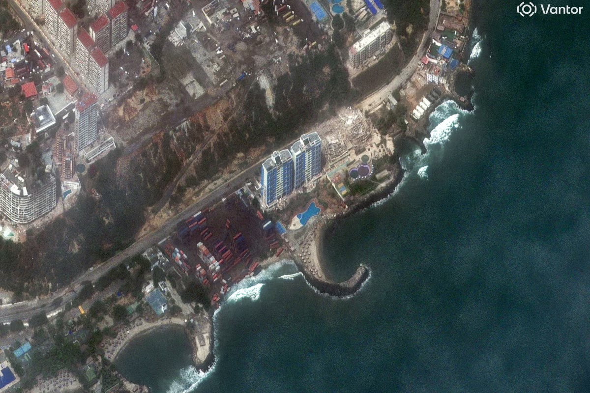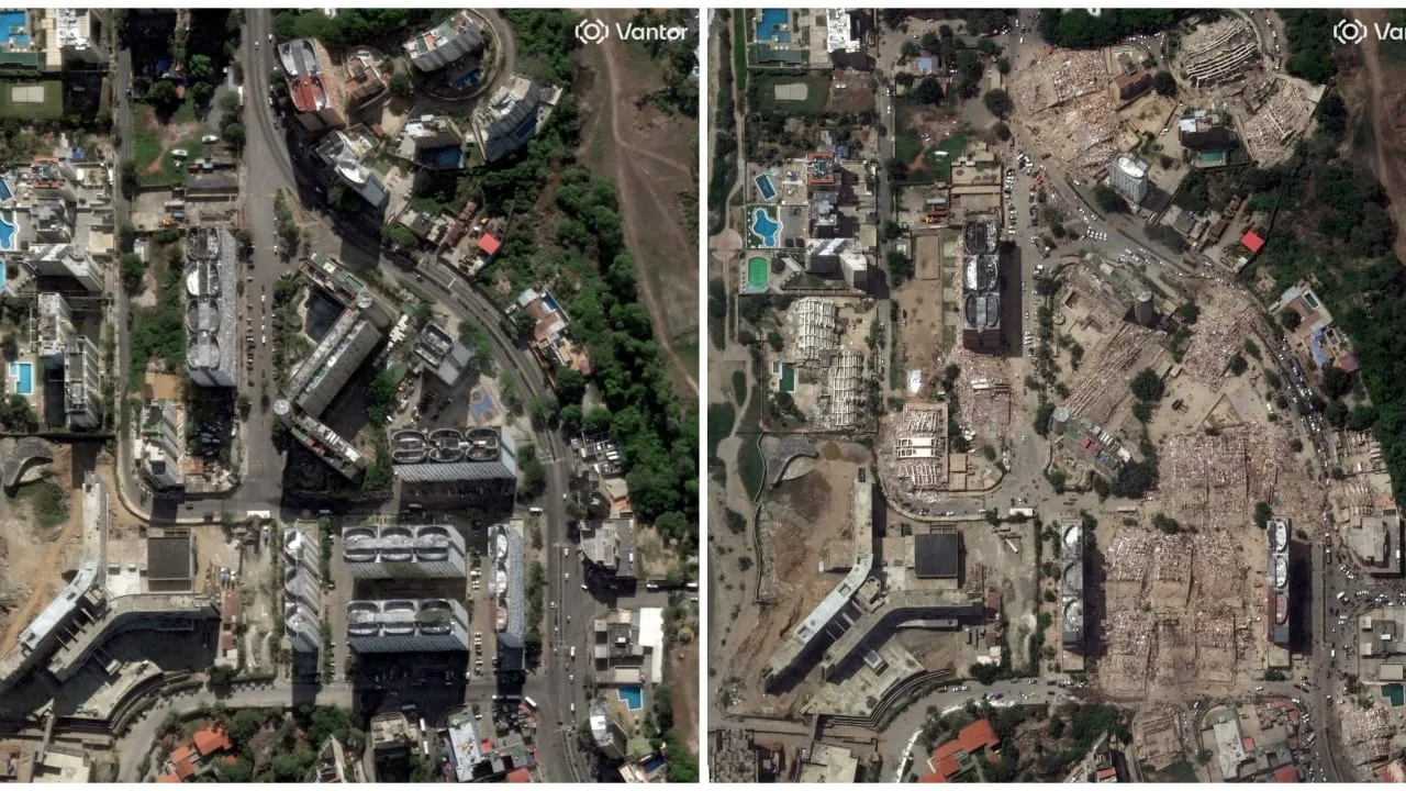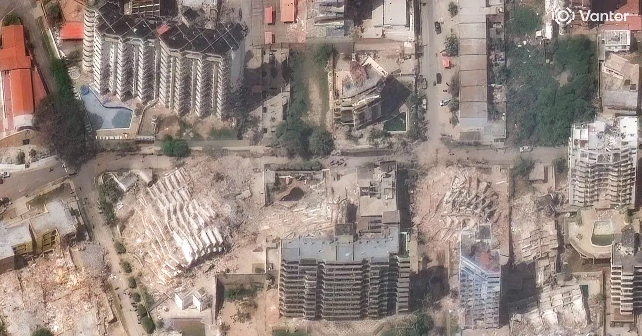
Satellite Technology Is being used to streamline rescue efforts in Venezuela following the two earthquakes that struck on June 24. Space agencies have shared images with emergency authorities and the Venezuelan government that not only reveal the magnitude of the disaster but also allow response teams to identify where to focus their efforts—and the challenges on the ground.Following the twin earthquakes in Venezuela, the Copernicus satellite system activated its emergency mapping mode at the request of the European Commission’s Directorate-General for Civil Protection and Humanitarian Aid Operations. Using imagery collected by Sentinel satellites and sensors, the system has generated 10 products and 25 maps that enable real-time assessment of the extent of damage and how terrain has shifted in 13 areas of interest. In addition, these tools have helped officials identify clear areas that can be used for landing aircraft involved in rescue operations and the delivery of humanitarian aid.Initial data from Copernicus shows severe damage in the cities of La Guaira and Greater Caracas, as well as impacts on communities in Aragua, Carabobo, Falcón, and Miranda. The report notes that, as of June 27, an estimated nearly 1,300 buildings have been affected in the region.A satellite map created by the Copernicus system identifies areas severely affected in Venezuela following the earthquakes of June 24, 2026.
Satellite Images Show the Destruction Caused by Venezuela's Twin Earthquakes
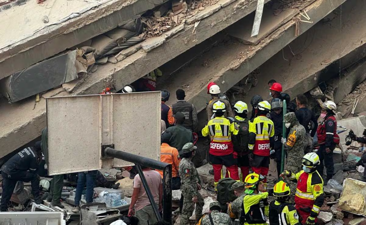
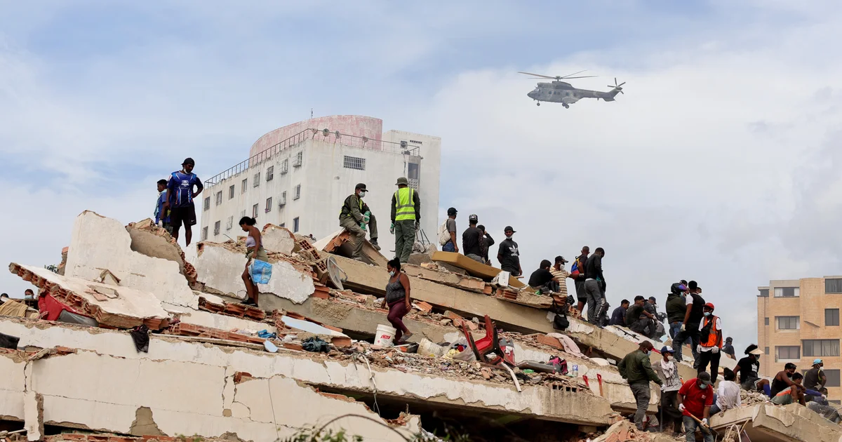
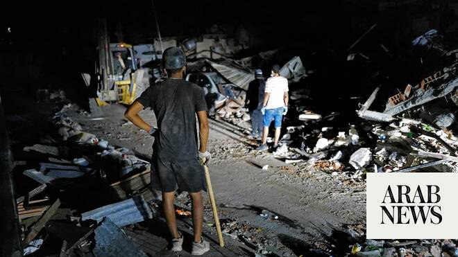
The maps and images show the extent of destruction and give rescue operations a tool to find any remaining survivors.
723 words~3 min read