The area of concern isn't likely to develop into anything significant, forecasters say. Here's a look at what the rest of June may bring.Show Caption
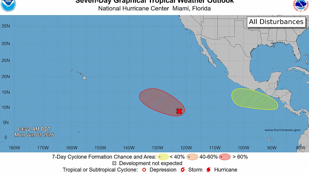
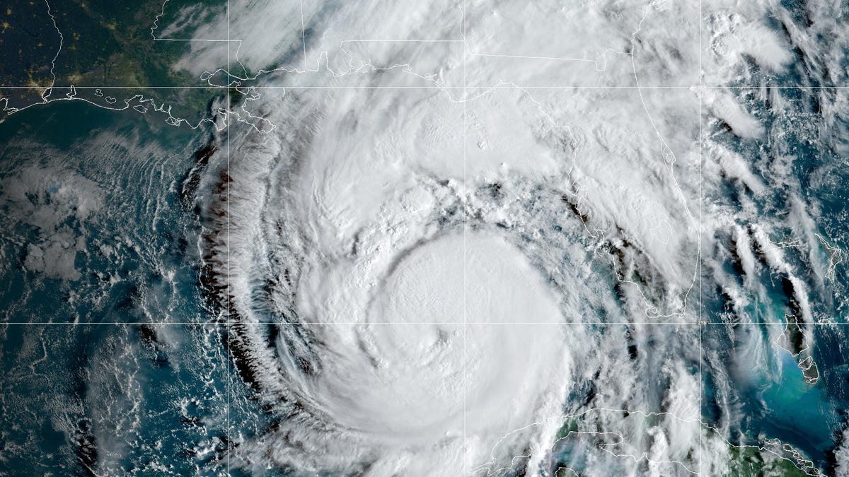
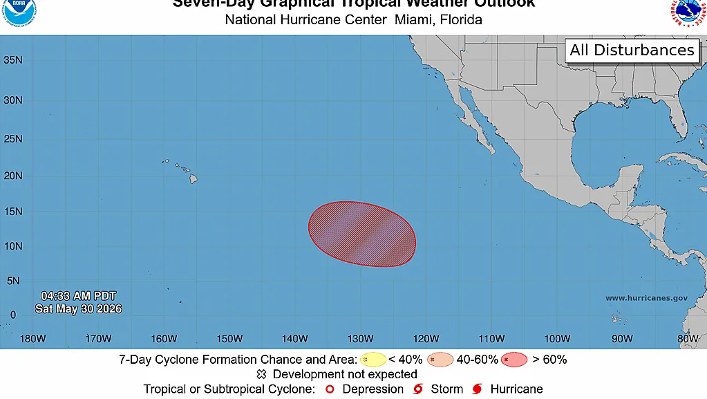
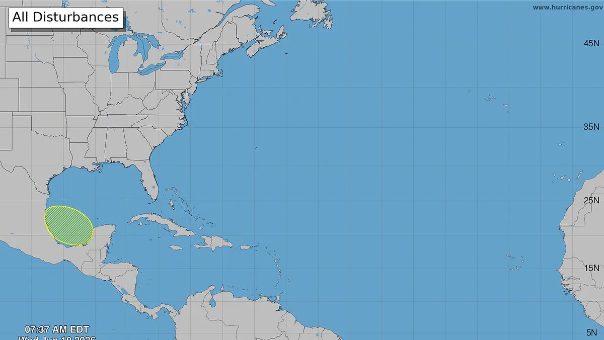
The tropics are stirring.The first area of concern of the 2026 Atlantic hurricane season has appeared on the maps of the National Hurricane Center the morning of Wednesday, June 10.Fortunately, although a weak tropical feature could develop later this week in the Bay of Campeche, the hurricane center said that "conditions are not expected to be favorable for significant development."The official forecast from the hurricane center states that "a trough or weak low-pressure center may emerge from the Yucatan Peninsula into the Bay of Campeche on Thursday [June 11] through Friday night [June 12], accompanied by numerous thunderstorms, strong winds, and rough seas across the west-central Gulf into Sunday [June 14].""The system poses no direct threat to the U.S.," said WPLG-TV hurricane specialist Michael Lowry in a June 10 Substack post.Disturbance can be traced to CristinaThe disturbance itself can be traced to the spin associated with Tropical Storm Cristina in the eastern Pacific that’ll be drifting slowly inland over Central America Wednesday, June 10, into Thursday, June 11, with its remnant spin crossing into the southern Gulf and Bay of Campeche by Friday, June 12, according to Lowry."Regardless of development, the upshot is soupy tropical air spreading over parts of eastern Mexico and South Texas, where it could enhance heavy rainfall – primarily over northeastern Mexico directly – for late weekend into early next week," he said.Quiet end of June likely in the AtlanticMeanwhile, wind shear will continue to act as a deterrent for significant tropical development in the Gulf and Caribbean through the week, according to AccuWeather."Beyond this weekend and through the second half of June, tropical waves emerging from Africa are expected to remain suppressed well to the south, while storm systems associated with severe weather will track well north of the Gulf. As a result, there aren't many signals favoring tropical development," AccuWeather hurricane expert Alex DaSilva said in an online forecast.Periodic wind shear, along with surges of dry air and Saharan dust moving westward from Africa, is likely to continue to suppress tropical development across much of the Atlantic basin for the last two weeks of June, AccuWeather said.Maps from the Climate Prediction Center agree with AccuWeather, showing that tropical activity is not expected for the rest of the month in the Atlantic. However, odds for a tropical system in the Pacific for the last week of June are greater than 60%.Doyle Rice is a national correspondent for USA TODAY, with a focus on weather and climate.