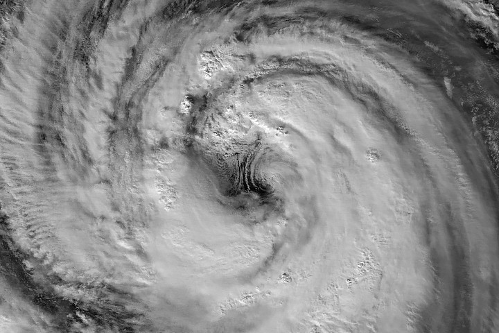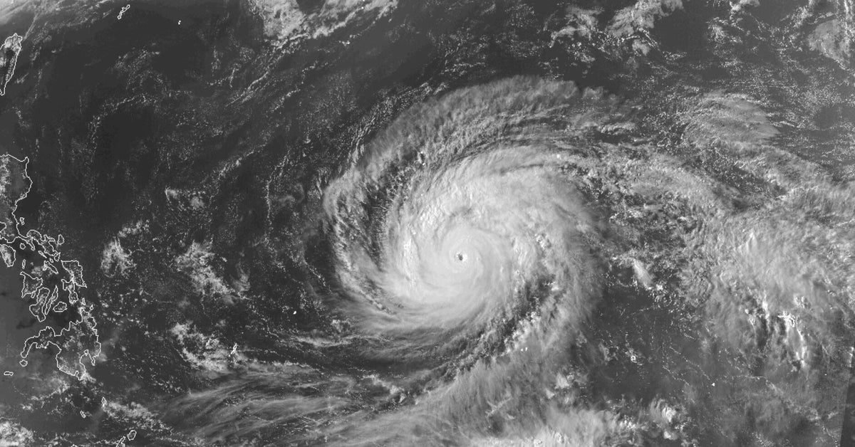
One of the Pacific Ocean's most powerful early season storms did more than bring destructive weather. As Super Typhoon Sinlaku rapidly intensified in April 2026, it also generated enormous atmospheric ripples that stretched high above Earth, offering scientists a rare glimpse into how tropical cyclones can influence everything from weather forecasting to satellite communications.
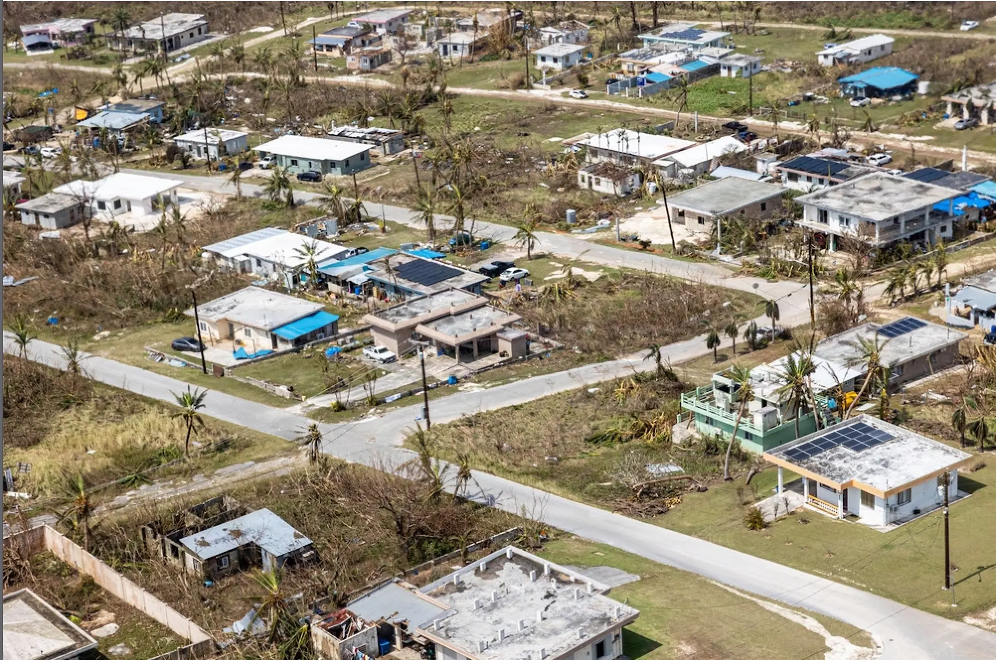
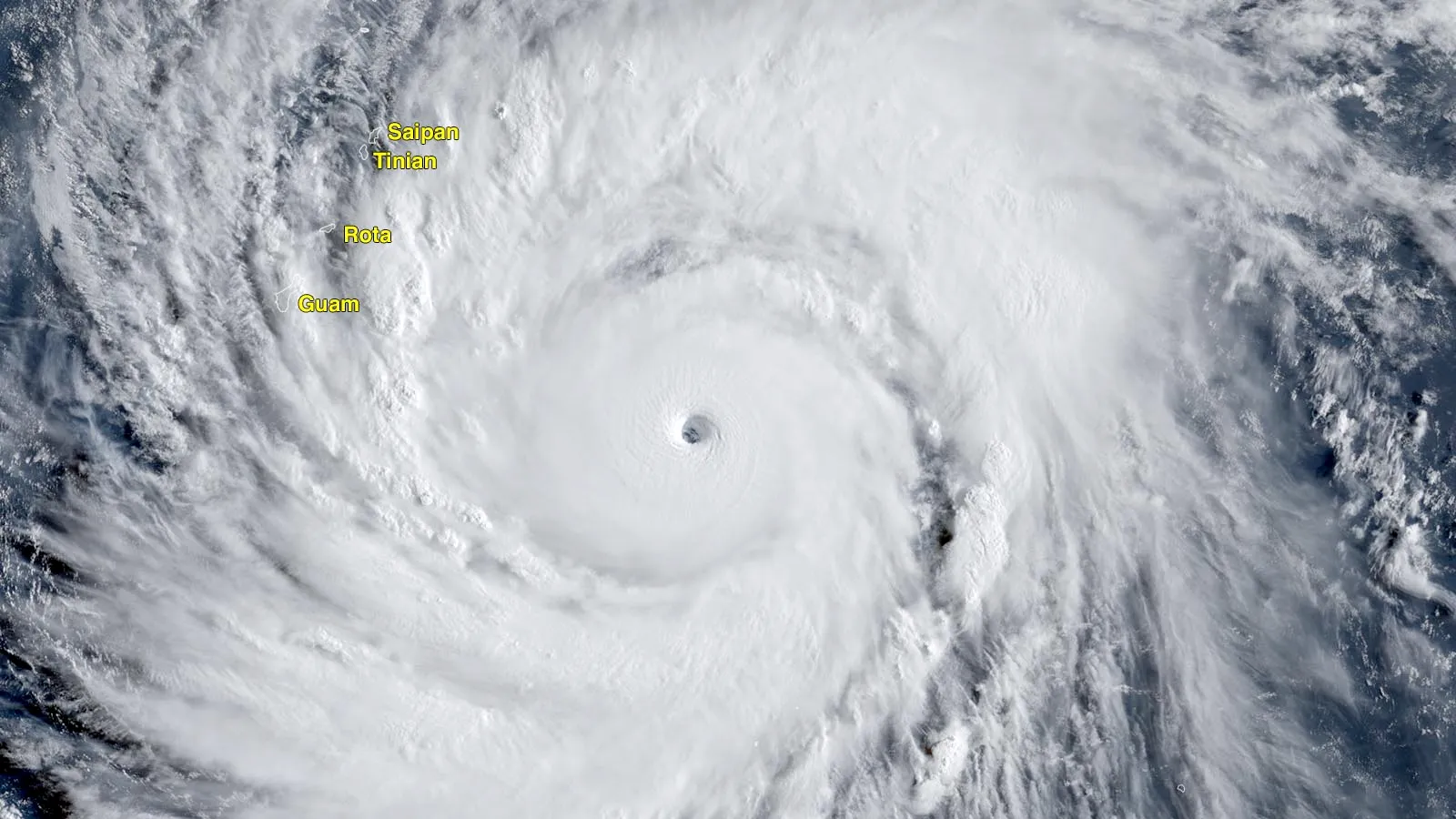
In mid-April 2026, Super Typhoon Sinlaku swept across the North Pacific, delivering heavy rainfall and flooding to the Mariana Islands. The storm reached "violent typhoon" status, the highest classification used by the Japan Meteorological Agency and roughly equivalent to a Category 5 hurricane on the Saffir-Simpson wind scale.
Meteorologists noted that only a small number of storms this intense have developed so early in the year in this part of the Pacific.
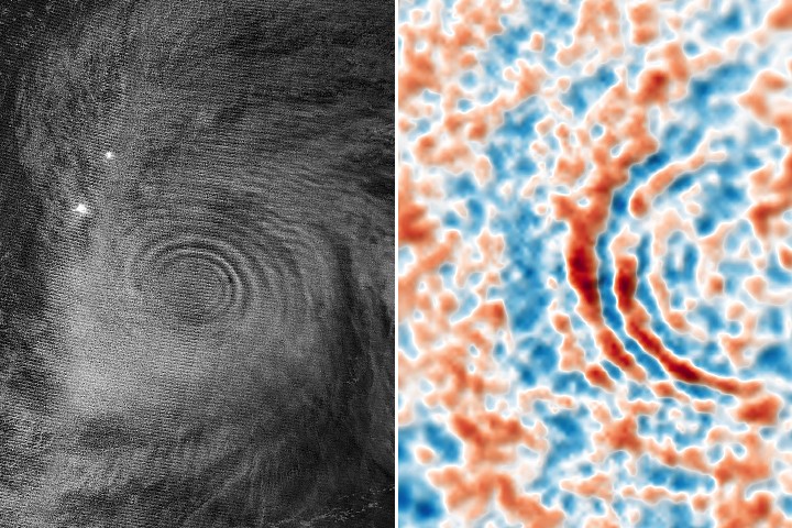
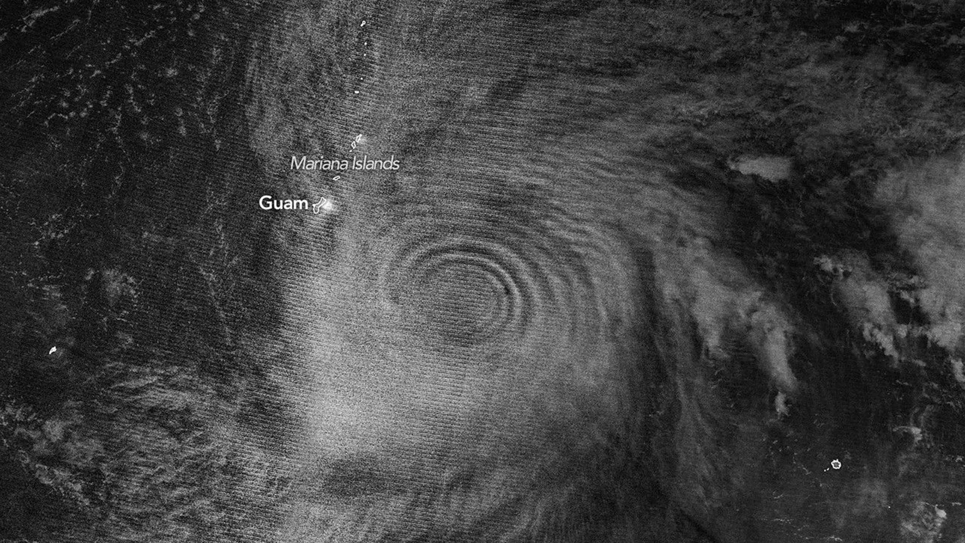
As Sinlaku strengthened over open water, satellites began detecting signs that its effects extended far beyond the storm itself. The typhoon was not only reshaping conditions at the ocean's surface but also disturbing layers of the atmosphere many miles overhead.
Satellites Capture Rare Atmospheric Gravity Waves