Bomb cyclone. Polar vortex. Atmospheric river. There’s no shortage of intense-sounding terms in the world of meteorology. This week, it feels like “super El Niño” headlines are suddenly everywhere.
New forecast data has scientists watching the Pacific Ocean closely and considering whether a rare, unusually strong climate pattern could be taking shape. But what does that actually mean? And how worried should we be?
Below, meteorologists break down what you should know about a potential “super El Niño.”
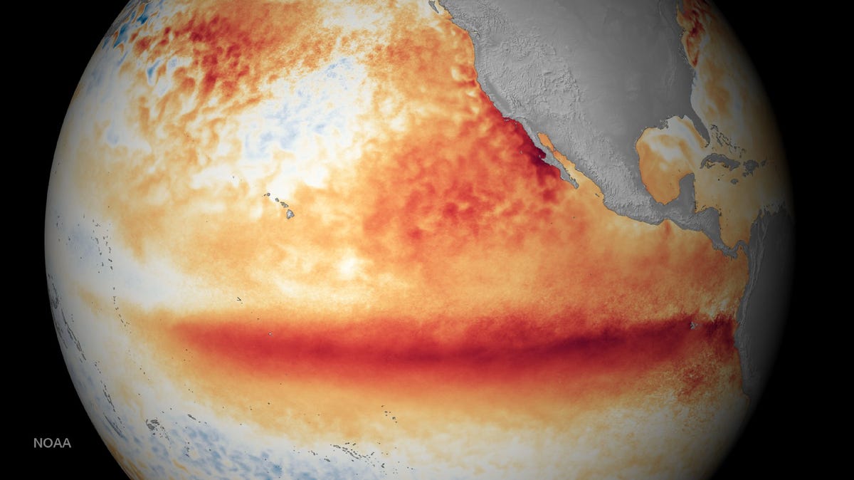
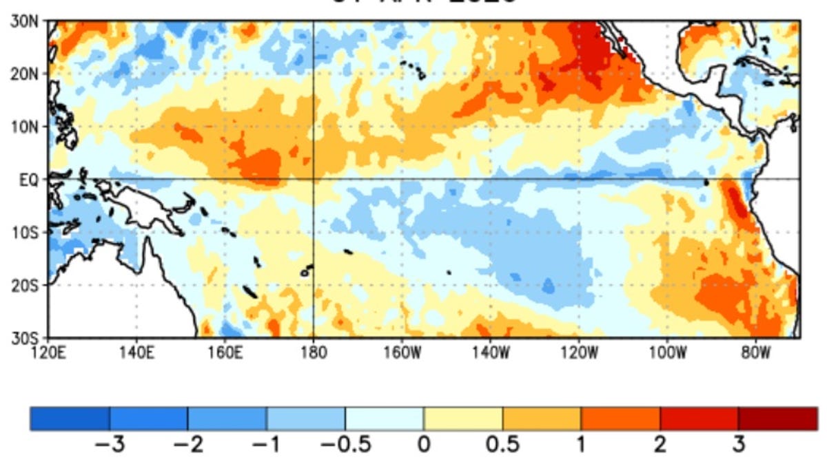
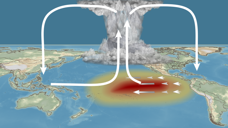
First, what is El Niño?
At its core, El Niño is about ocean temperatures, but it’s really an ocean-atmosphere partnership.