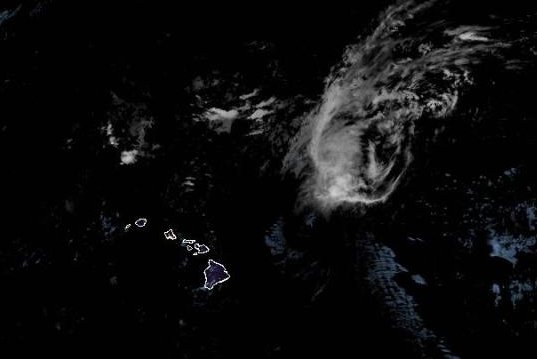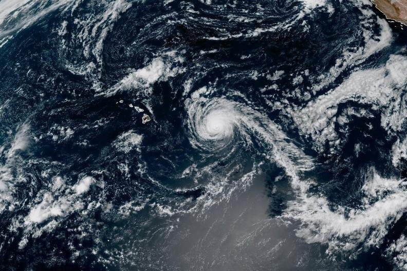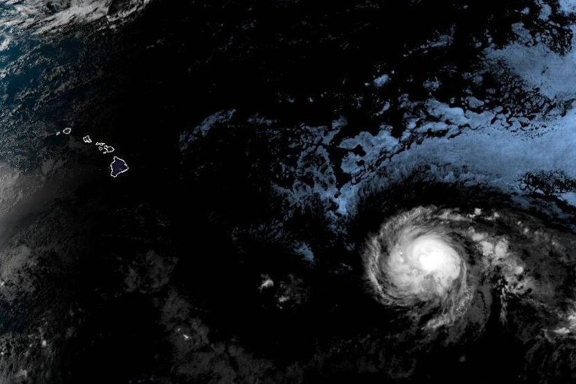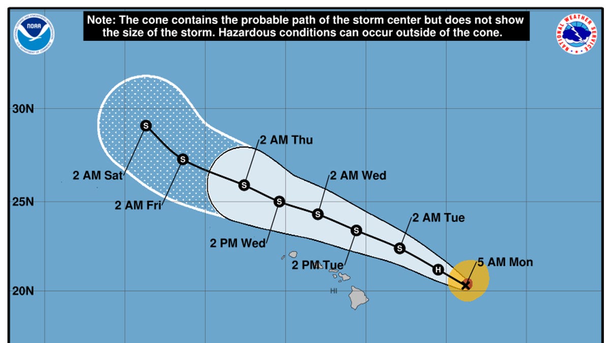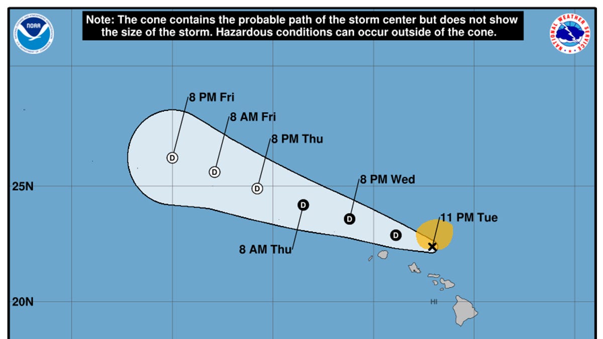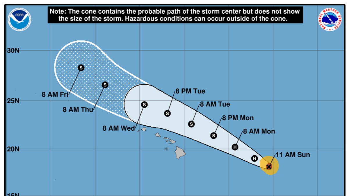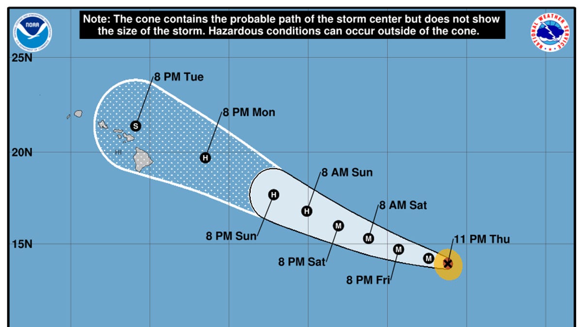
Former Hurricane Kiko, now a tropical storm as it passes north of the Hawaiian Islands on Sept. 9, avoided a direct hit to land but is still churning up life-threatening rip tides and surf conditions, forecasters said.
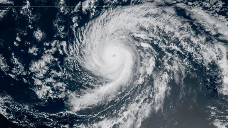
Kiko, once a Category 4 hurricane in the Pacific, has been weakening on its approach to Hawaii in recent days, and rapidly weakened down to a tropical storm with maximum sustained winds of about 60 mph as of early morning on Sept. 9 ET, according to the National Hurricane Center.
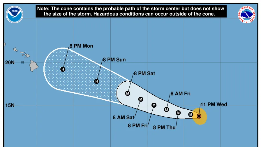
Tropical Storm Kiko was located about 245 miles northeast of Hilo on the Island of Hawaii, or Big Island, and about 375 miles east of Honolulu, on Oahu. It was moving to the west-northwest at a speed of about 14 mph. Its tropical storm-force winds extended out 125 miles.
The storm will pass to the north of the islands on Sept. 9 and 10 while it continues to weaken, still bringing heavy rainfall to Hawaii despite its distance from land. The waves extending from Kiko are expected to peak on Sept. 9 and 10, when surf conditions will be at their most dangerous, the hurricane center said.
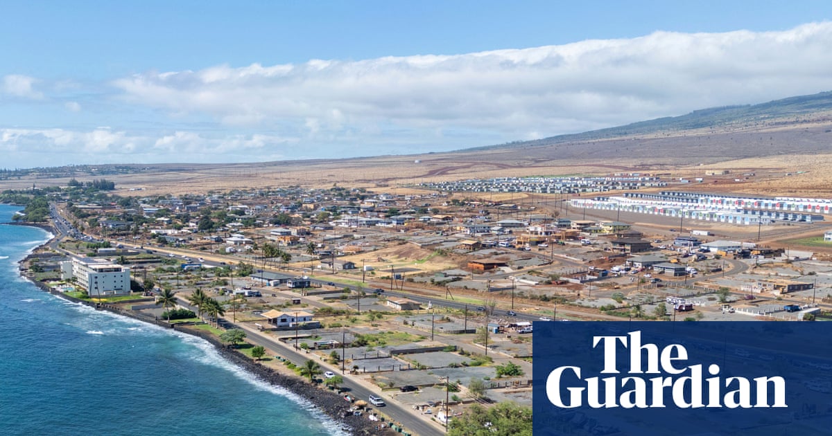
Tropical Storm Kiko is expected to bring downpours, life-threatening surf and even a risk of fires, forecasters said. A high surf warning was in place for Big Island, Maui, Molokai starting on Sept. 8 and for Oahu and Kauai starting on Sept. 9, the weather service said.