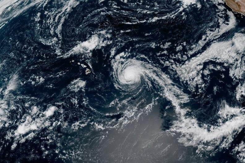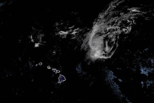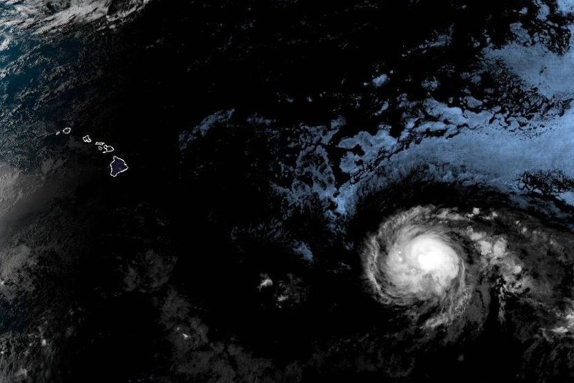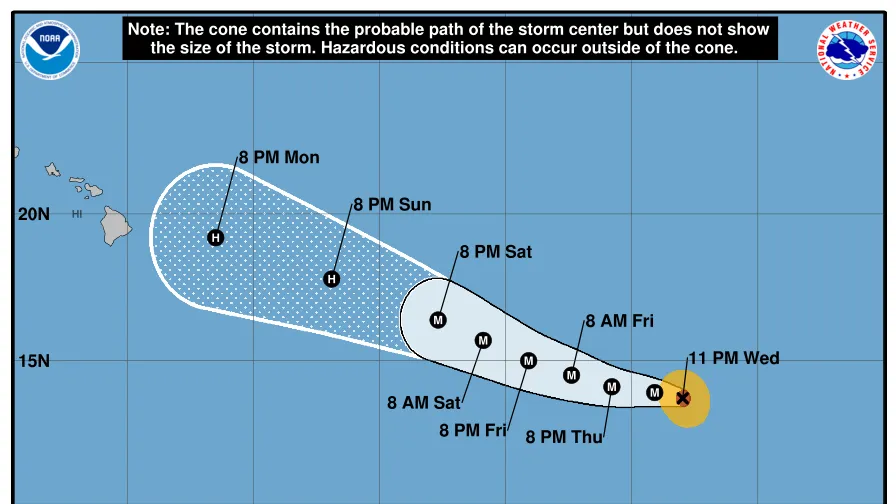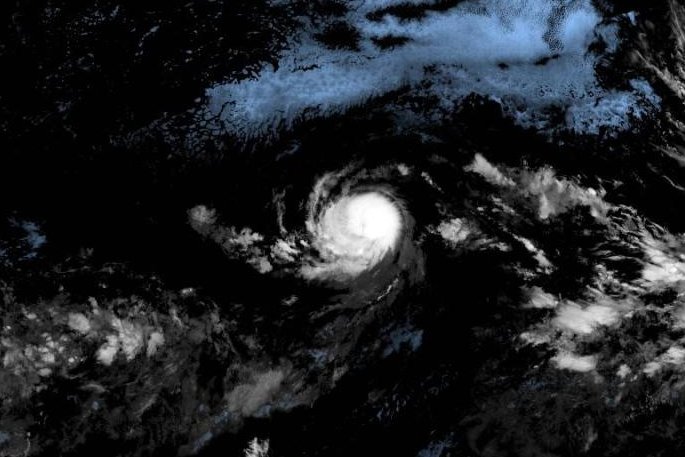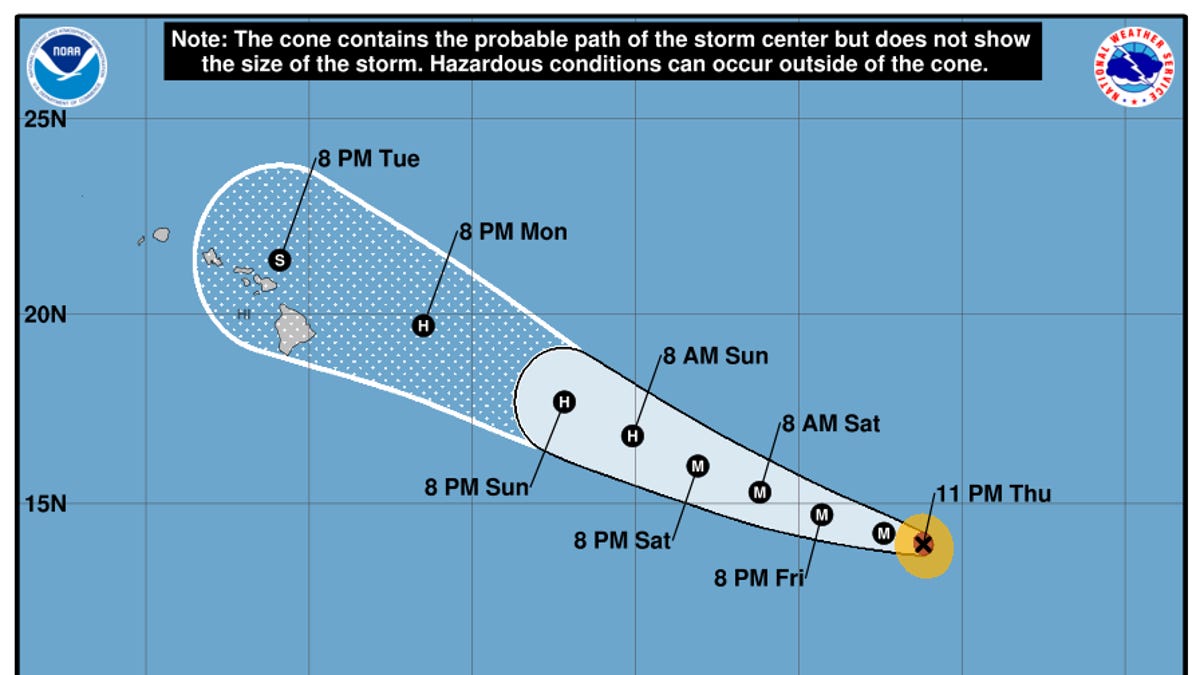
Hurricane Kiko weakened on Sept. 7 as the system is expected to pass north of Hawaii by midweek, bringing potentially life-threatening surf conditions and dangerous rip currents to the islands, forecasters said.
As of 11 a.m. Hawaii Standard Time (HST), the National Hurricane Center said Kiko was about 635 miles east of Hilo on the Big Island. The hurricane was moving west-northwest near 13 mph, and was forecast to track north of the Hawaiian Islands on Sept. 9 and Sept. 10, according to the hurricane center.
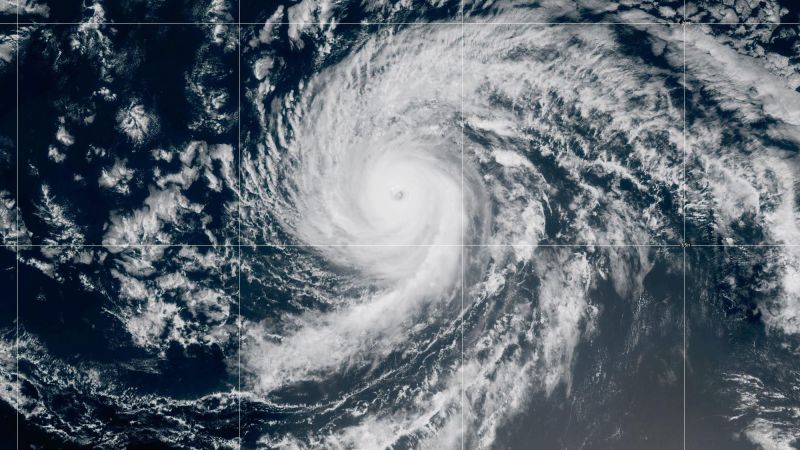
Kiko was maintaining maximum sustained winds of around 110 mph on Sept. 7, down from the 140 mph reported on Sept. 6, the hurricane center said. The agency noted that the hurricane is expected to become a tropical storm by late Sept. 8, decreasing the threat of high winds and heavy rain.
"Reports from an Air Force Reserve Hurricane Hunter aircraft indicate that maximum sustained winds have decreased to near 110 mph ... with higher gusts," the hurricane center said in its 11 a.m. HST advisory. "Additional weakening is forecast during the next few days."
2025 Hurricane Season: An uneasy, uncertain hurricane forecast kicks off September