Home
Storia in 1 fonti
‘Eye in the sky’: Pakistan’s space agency turns to satellites for relief amid devastating floods
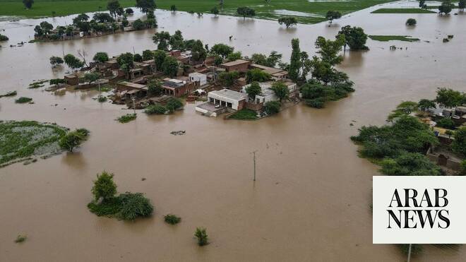
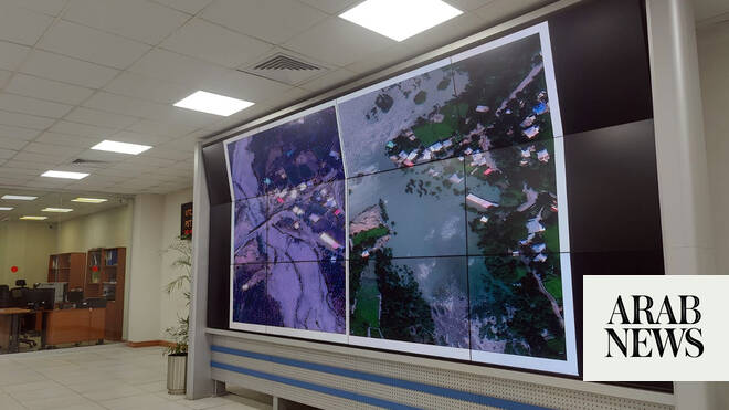
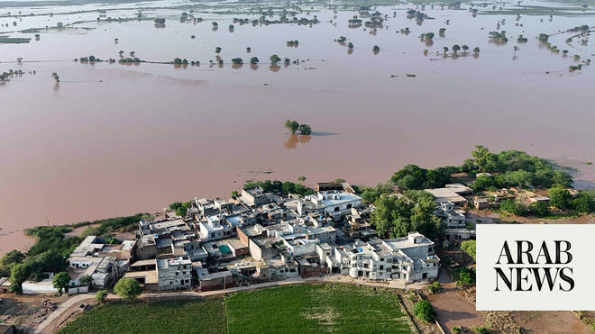
ISLAMABAD: Pakistan’s national space agency SUPARCO is using satellite mapping and real-time imagery to help guide rescue and relief operations, officials said on Friday, as monsoon floods have devastated much of the country, killing over 800 people since the beginning of the season and destroying farms and livestock. The agency established its Space Application Center for Response in Emergency and Disasters (SACRED) in 2014 to provide space-based support for natural disasters, from floods and droughts to glacial lake outburst floods (GLOFs), earthquakes and landslides.
Raccontata da arabnews.com
Timeline cronologica
- ·
Pakistan space agency says satellite data aided flood relief activities
ISLAMABAD: Pakistan’s national space agency SUPARCO on Thursday said it provided satellite images of flood-hit areas to help prioritize the government’s relief and rehabilitation…
- ·
‘Eye in the sky’: Pakistan’s space agency turns to satellites for relief amid devastating floods
ISLAMABAD: Pakistan’s national space agency SUPARCO is using satellite mapping and real-time imagery to help guide rescue and relief operations, officials said on Friday, as…
- ·
Pakistan to use satellites to gauge crop losses, compensate farmers after Punjab floods
KASUR, Pakistan: The administration of Pakistan’s eastern Punjab province will use satellite imagery to assess crop losses from this week’s devastating floods and compensate…