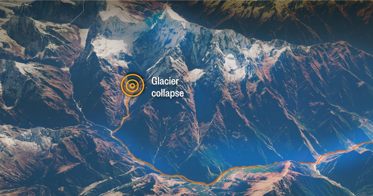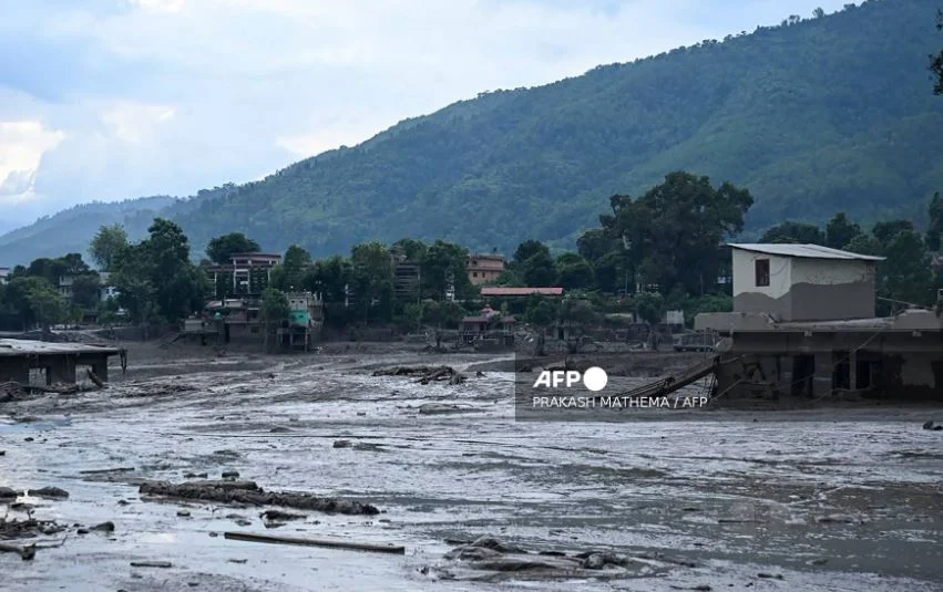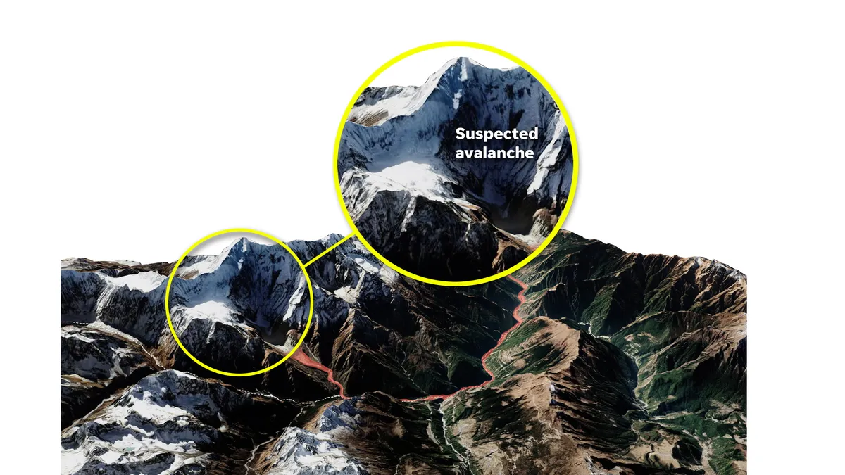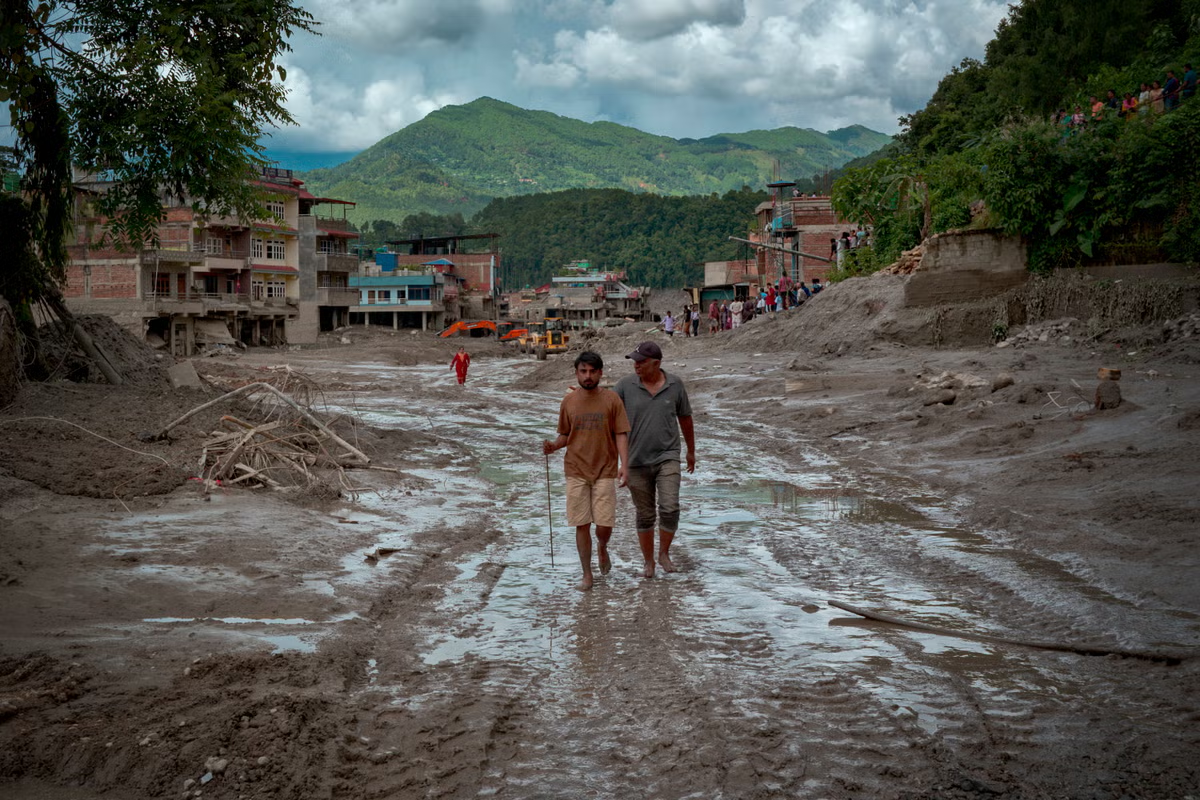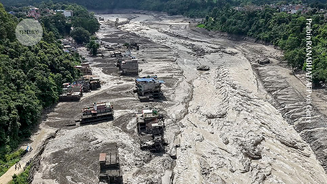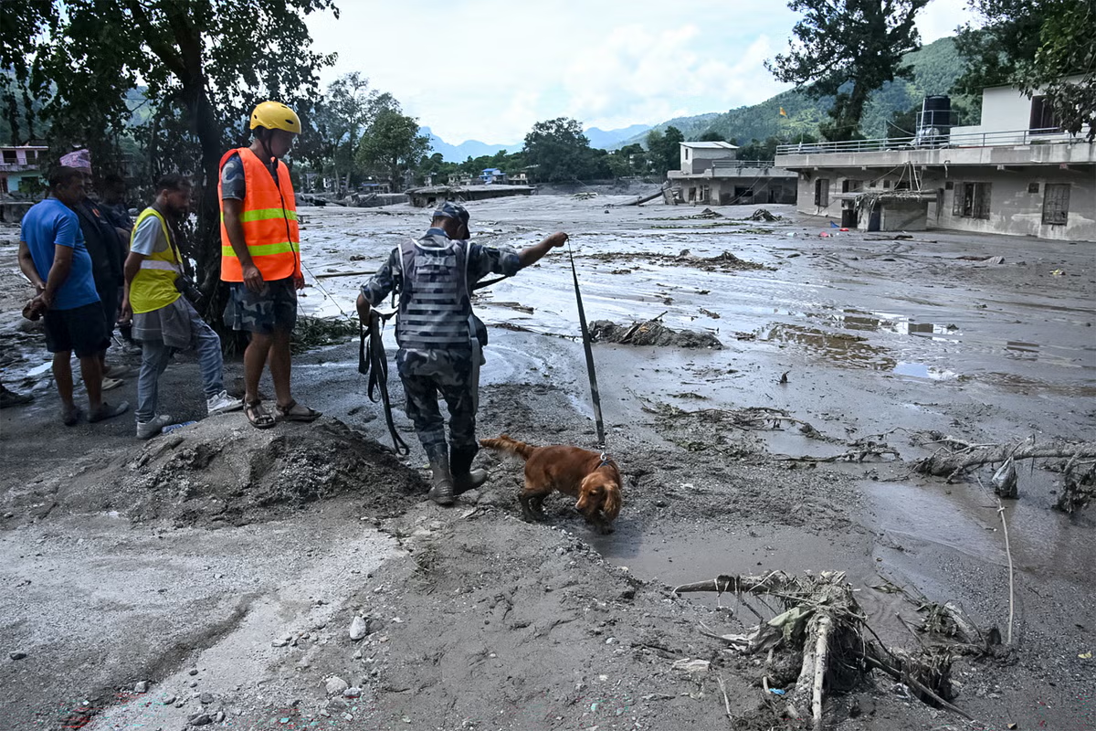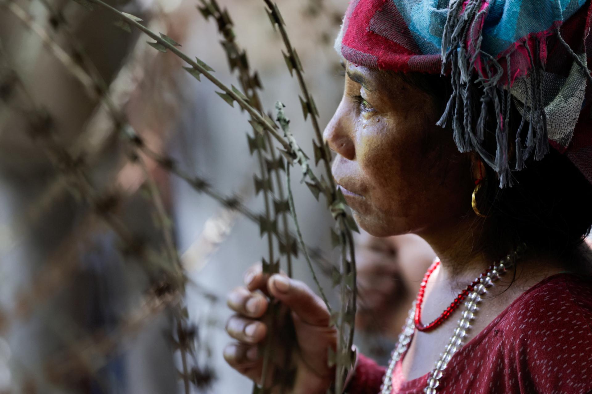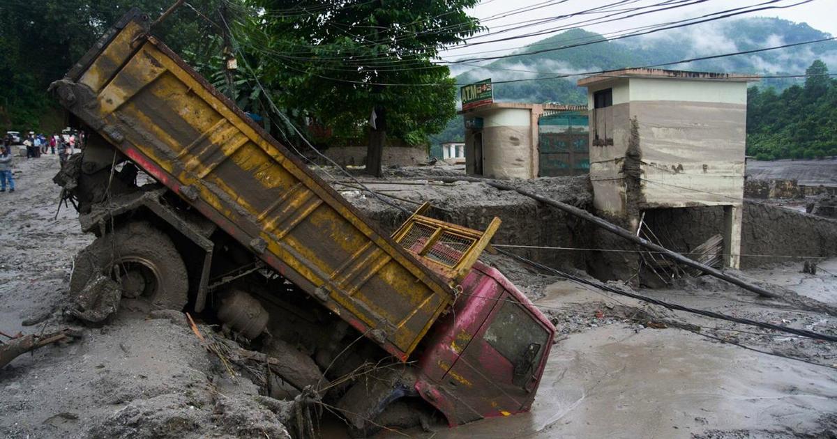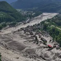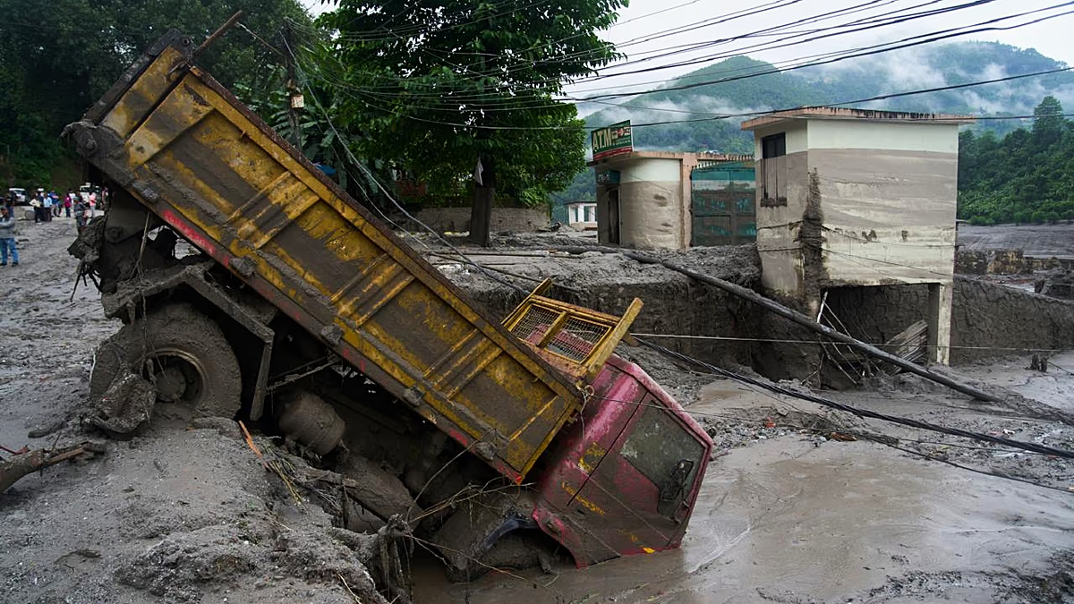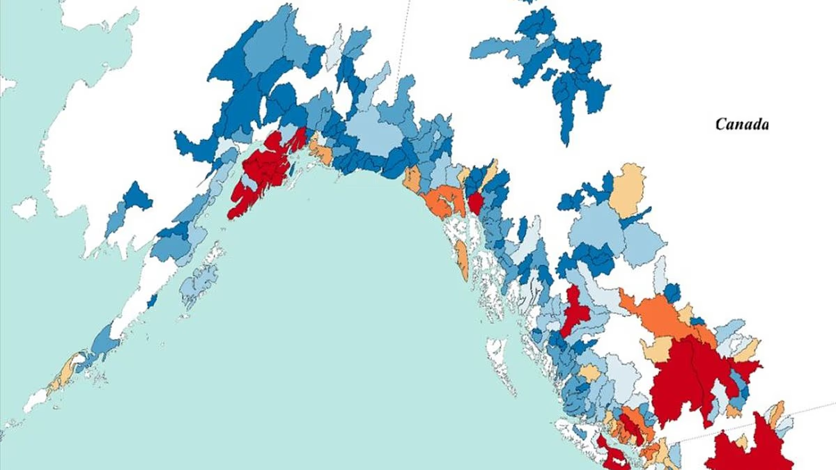
Hundreds of people have been killed, and more than 1,500 are still missing after devastating flash floods swept through the Nepal–Tibet border.Scientists believe the disaster was triggered by the collapse of a glacier on the Langtang–Lirung mountain, which registered as a magnitude 5.2 earthquake.Although it may take months of research to uncover the exact story, experts are already warning that this is 'not a one–off event'.Dr Jonathan Carrivick, an expert on glacial flooding from the University of Leeds, told the Daily Mail: 'Climate change is warming the mountains, causing permafrost and glaciers to melt.'According to the expert, this makes 'the likelihood of these sorts of events – possibly bigger – more frequent.'Overall, researchers estimate that a whopping 15 million people worldwide are living in danger zones. While the Himalaya, Karakoram, Hindu Kush and neighbouring ranges in Asia are most at risk, people living in the US and Canada are also in danger.'North America could experience something similar to what we see in Nepal today,' Dr Carrivick warned. As rescue efforts continue in the flood–hit regions of Nepal and Tibet, scientists have mapped which glaciers around the world could be at risk of a similar disaster. Pictured: Red regions show areas of high Glacial Lake Overflow Flood risk High Mountain Asia is the most threatened region because it is rapidly warming, and hosts rapidly melting glaciers, growing meltwater lakes and some of the world's steepest mountains Hundreds of people have been killed, and more than 1,500 are still missing after devastating flash floods swept through the Nepal–Tibet borderAlthough scientists are still scrambling to understand the disaster, the current evidence suggests that Nepal's deadly floods are the consequence of glacial collapse.Dr Carrivick says: 'This Nepal event appears to have been a massive rock failure that took a large part of the glacier with it.'According to the research group Antarctic Glaciers, which combines the efforts of about 50 leading experts, initial analysis shows that there was a landslide and glacier collapse shortly before the flood.This sent ice and rock cascading down the mountain, mixing with sediment left by previous floods, and temporarily blocking the Lhende Khola River.That caused a large lake to temporarily form before it broke through in a devastating flood.Deadly events exactly like this have happened in the past and are likely to keep happening with increasing regularity as climate change continues.For example, in 2021, a massive rock and ice triggered a deadly debris flow that killed over 200 people and damaged two hydroelectric power plants.Meanwhile, in Canada, a rockslide in 2020 saw 18 million cubic metres of stone cascade into a glacial lake, sending 100–metre–tall waves that scoured a 6–mile (10km) channel. Outside of Asia, glaciers in the Alps are also putting many areas at high risk of Glacial Lake Outburst Floods The researchers note that the Andes is an area of risk that might have been greatly underappreciated in previous research Scientists say that Nepal's flooding was not caused by a Glacial Lake Overflow Flood, but warn that this related risk is increasing all over the world. Pictured: Distribution of people at risk of glacial flooding What caused the flooding in Nepal and Tibet? Scientists say that initial analysis the day after the flooding indicates a landslide and glacier collapse from the Langtang–Lirung mountain.Ice and rock then cascaded down the mountain, mixing with further sediment and water as it travelled down–valley.The landslide temporarily blocked the Lhende Khola River, causing a large lake to build before it broke through the dam and unleashed a massive flood.Early reports suggested an earthquake was the trigger, but data now shows that a major rockfault leading to glacial collapse was the cause. Source: Antarctic Glaciers Scientists have also raised the alarm that mountainous regions are becoming increasingly at risk of a similar threat, known as a glacial lake outburst flood (GLOF).This occurs when meltwater from a glacier forms a large lake at its base that is held back by a thin, unstable natural dam.If the glacier collapses or the meltwater gets too high, that barrier can break, releasing a devastating cascade of water downhill.Scientists do not currently believe that the deadly floods in Nepal and Tibet were caused by a GLOF, since satellite images do not show any major lakes forming in the area prior to the landslide.However, glaciers around the world are now putting more people in danger of this form of flooding, which could prove just as, if not more, deadly than what has been seen in Nepal.In their paper, published in Nature Communications, researchers used the latest modelling to map where this risk was highest.They found that more than half of the 15 million people threatened by GLOFs live in just four countries: India, Pakistan, Peru, and China.Populations in High Mountain Asia (HMA), which includes the Himalaya, Karakoram, Hindu Kush and neighbouring ranges, are most at risk. Scientists currently believe that the floods were triggered by a rock slide that led to glacial collapse on the Langtang–Lirung mountain Geological factors in the Himalayas lead to 'hazard cascades', chain reactions that release huge volumes of ice and water into populated areas – just like the recent disaster in Nepal The countries most at risk of Glacial Lake Outburst FloodingChinaPakistanPeruCanadaIndiaUSAChileItalyNepalColumbia Here, people are the most exposed on average and live closest to glacial lakes, with more than a million people living less than six miles (10km) from one.This region is home to 62 per cent of all people exposed to GLOFs, with three million in India and two million in Pakistan.Co–author Dr Matt Westoby, Associate Professor of Physical Geography at the University of Plymouth, told the Daily Mail: 'High Mountain Asia is one of the fastest warming regions globally.'It hosts rapidly melting glaciers, growing meltwater lakes and some of the world’s steepest mountains.'As the climate warms, shrinking glaciers and thawing frozen ground can destabilise mountain slopes, increasing the risk of rockfalls, landslides and avalanches.'Dr Westoby adds that these can cause 'hazard cascades', chain reactions that release huge volumes of ice and water into populated areas – just like the recent disaster in Nepal.However, the researchers note that the Andes is an area of risk that might have been greatly underappreciated in previous research.The number of glacial lakes in this region has increased by 93 per cent since 1990, compared with just 37 per cent in HMA.Peru ranks as the third most dangerous country globally, and two of the world's three most hazardous river basins are in the Andes: the Santa basin in Peru and the Beni basin in Bolivia.'Co–author Professor Rachel Carr, a glaciologist from Newcastle University, told the Daily Mail: 'It is important to note that it’s not just rural populations at risk: major cities draw their water from Andean glaciers,' says Professor Carr.But it isn't just these highly exposed regions that are at risk, as the researchers show that North America, particularly the Pacific Northwest and Canada, and the Alps are threatened by GLOFs.Even though there is debate over whether GLOFs are becoming more frequent, it is certain that they are becoming more dangerous.This is because the downstream populations are growing, putting more people and critical infrastructure at risk.Part of what makes this so dangerous is that experts cannot say exactly where or when the next devastating flood will strike.Professor Carr says: 'Usually, larger events are rarer and smaller events happen more frequently, but there is a random nature to them, especially when they are triggered by events such as landslides.'Thus it’s likely one of a similar scale [to Nepal] will occur in the future, but when and where is much harder to say.'
Maps reveal glaciers at risk of a disaster similar to Nepal's flooding
Researchers estimate that a whopping 15 million people worldwide are living in danger zones.
1,263 words~6 min read