Data availability
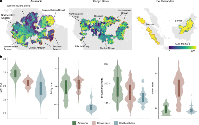
The data supporting the findings of this study are publicly available via Zenodo at https://doi.org/10.5281/zenodo.19474558 (ref. 105). Version 1 contains forest structure and environmental data at the GEDI footprint level, whereas version 2 contains forest structure and environmental data aggregated to 2.5 × 2.5-km grid cells. Source datasets used in this study are publicly available and include NASA GEDI Level 4A AGB density data (https://doi.org/10.3334/ORNLDAAC/2056), WorldClim climate data (https://worldclim.org/data/worldclim21.html), the Global SPEI database (SPEIbase v.2.10 (Earth Engine Data Catalog and Google for Developers)), CHIRPS precipitation data (https://www.chc.ucsb.edu/data/chirps), the CHIRPS-derived MCWD dataset (https://doi.org/10.5281/zenodo.4903340), MODIS MOD09GA version 6 surface reflectance data (https://lpdaac.usgs.gov/products/mod09gav061/), ERA5 reanalysis data (https://cds.climate.copernicus.eu/datasets/reanalysis-era5-single-levels), World Wide Lightning Location Network lightning data (https://doi.org/10.5281/zenodo.10725446), SoilGrids soil data (https://soilgrids.org), OpenLandMap soil data (https://openlandmap.org), SRTM elevation data from NASA Earthdata (https://earthdata.nasa.gov) and GLAD intact forest landscapes and global land cover datasets (https://glad.umd.edu). All processed data required to reproduce the analyses are available in the Zenodo repository.