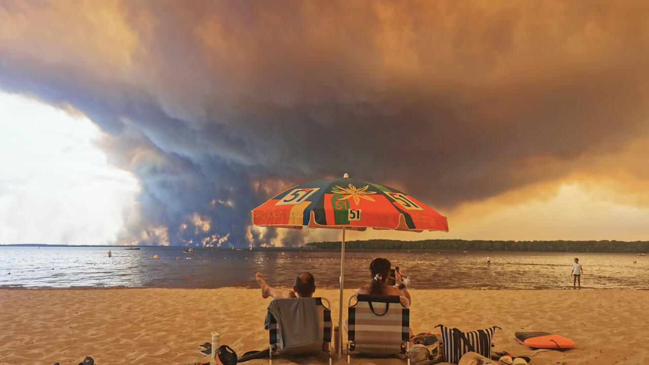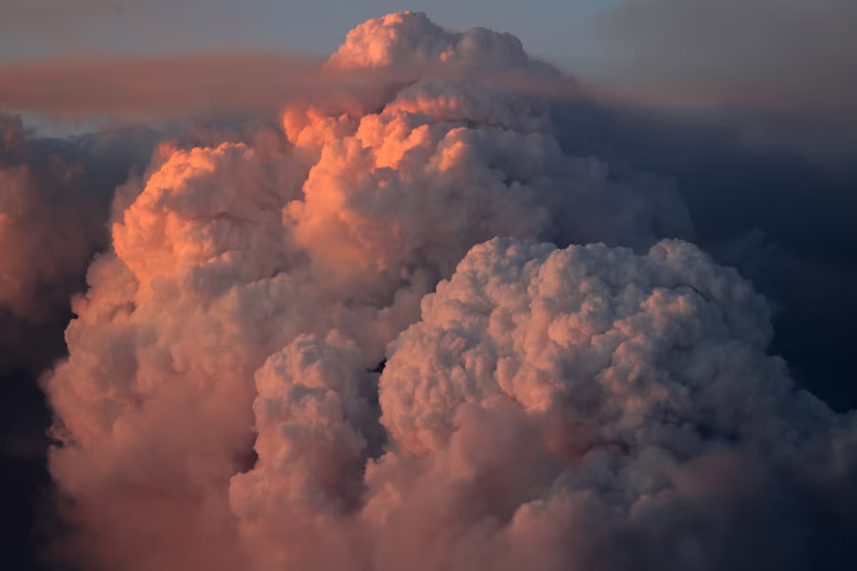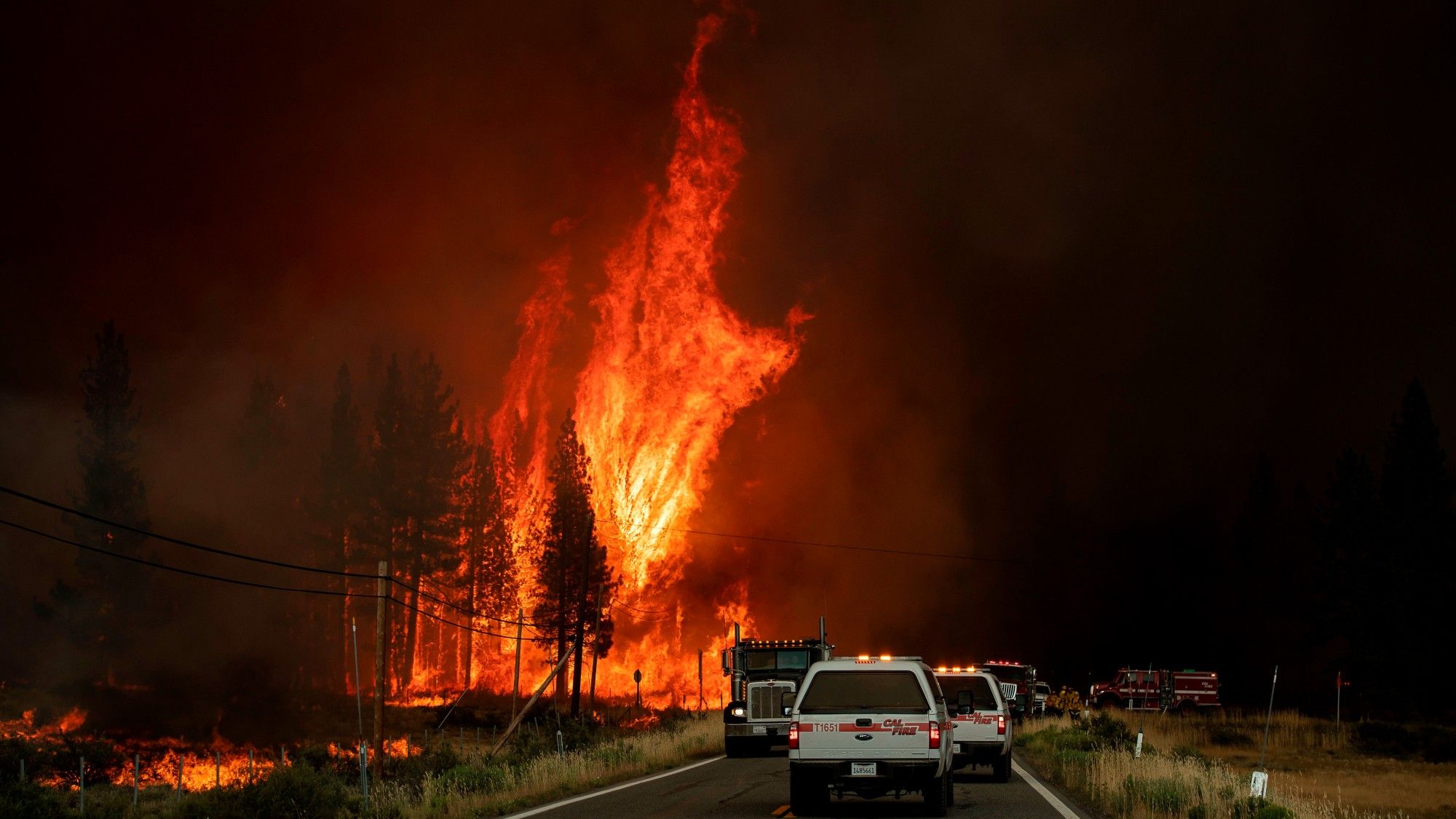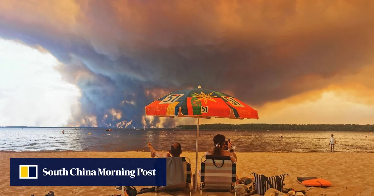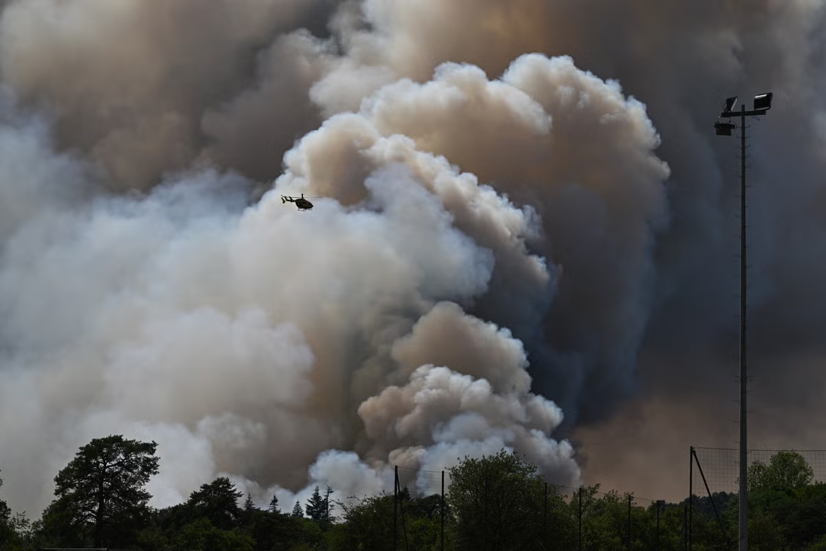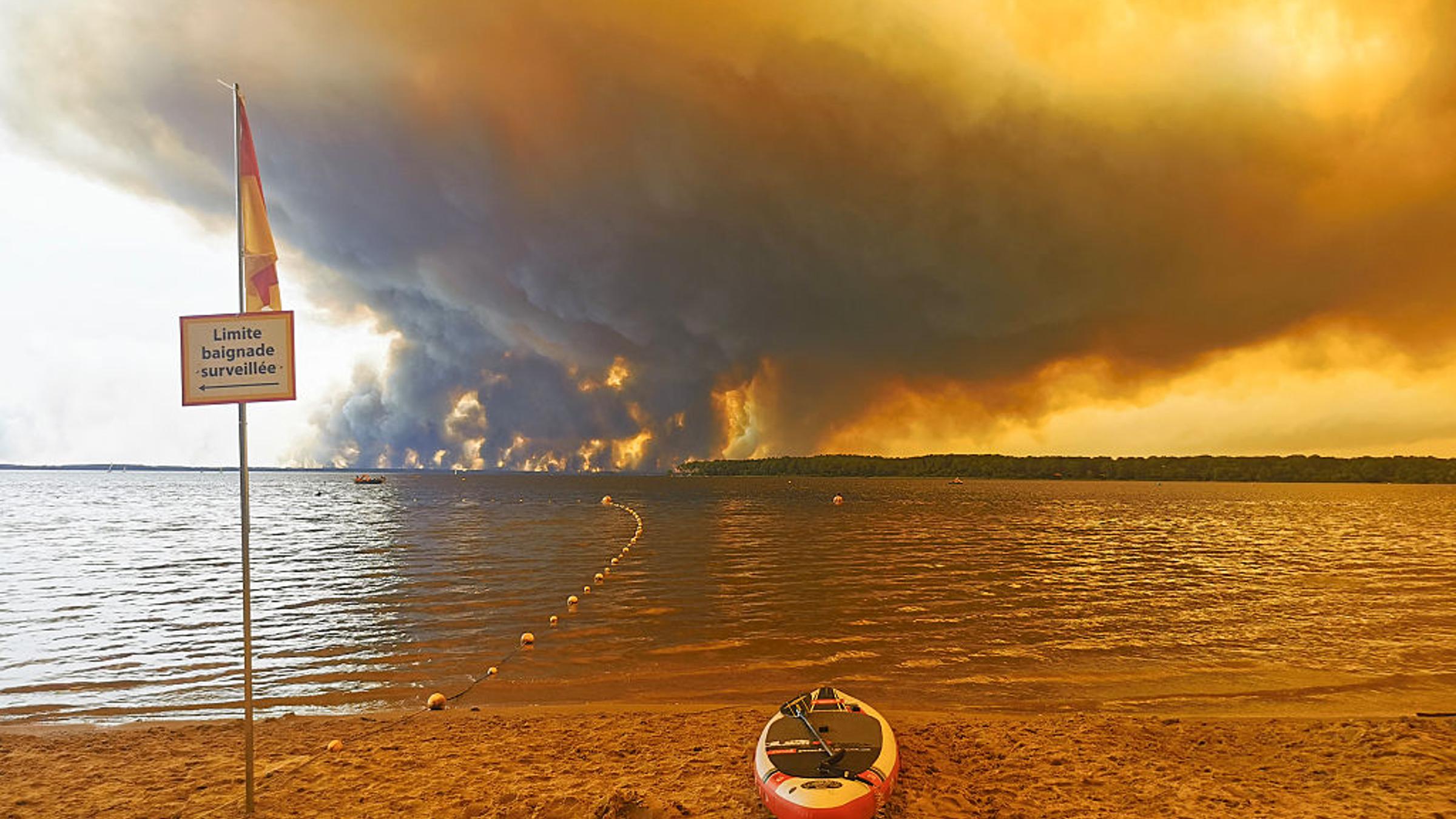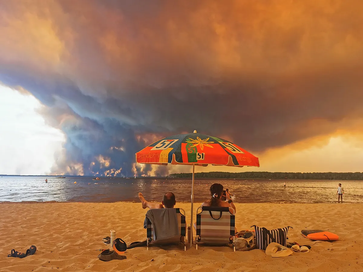
Skip to Content Subscribe Our Offers My Account Manage My Subscriptions FAQ Newsletters Canada Canadian True Crime Canadian Politics Health World Israel & Middle East Financial Post NP Comment Longreads Puzzmo Diversions Comics NP News Quiz New York Times Crossword Horoscopes Life Eating & Drinking Style Sponsored Play for Ontario Travel Travel Canada Travel USA Travel International Cruises Travel Essentials Culture Books Celebrity Movies Music Theatre Television Business Essentials Advice Lives Told Tails Told Shopping Buy Canadian Home Living Outdoor Living Kitchen & Dining Tech Style & Beauty Personal Care Entertainment & Hobbies Gift Guide Travel Guide Amazon Prime Day Deals Savings National Post Store More Sports Hockey Baseball Basketball Football Soccer Golf Tennis Driving Vehicle Research Reviews News Gear Guide Obituaries Place an Obituary Place an In Memoriam Classifieds Place an Ad Celebrations Working Business Ads Archives Healthing Epaper Manage Print Subscription Profile Settings My Subscriptions Saved Articles My Offers Newsletters Customer Service FAQ Newsletters Canada World Financial Post NP Comment Longreads Puzzmo Diversions Life Shopping Epaper Manage Print Subscription HomeNewsCanadaWorldWhat is a fire thunderstorm? How wildfires create these 'dragon clouds' in France — and CanadaWhat makes them dangerous is what happens underneath: Downdrafts that redirect a fire. Lightning that can start new fires. Hail, embers thrown far ahead and updrafts that threaten firefighting aircraftLast updated 11 minutes ago You can save this article by registering for free here. Or sign-in if you have an account.Beachgoers watch on a beach as clouds of smoke rise from a nearby wildfire, in Lacanau, France, on July 24, 2026. Photo by Maximilien Lamy/AFP via Getty ImagesA wildfire near Bordeaux burned hot enough to make its own thunderstorm this week, and the lightning it threw started new fires. It was the first pyrocumulonimbus cloud ever recorded in France, but Canada has seen hundreds of them in the last decade.Enjoy the latest local, national and international news.Exclusive articles by Conrad Black, Barbara Kay and others. Plus, special edition NP Platformed and First Reading newsletters and virtual events.Unlimited online access to National Post.National Post ePaper, an electronic replica of the print edition to view on any device, share and comment on.Daily puzzles including the New York Times Crossword.Support local journalism.Enjoy the latest local, national and international news.Exclusive articles by Conrad Black, Barbara Kay and others. Plus, special edition NP Platformed and First Reading newsletters and virtual events.Unlimited online access to National Post.National Post ePaper, an electronic replica of the print edition to view on any device, share and comment on.Daily puzzles including the New York Times Crossword.Support local journalism.Create an account or sign in to continue with your reading experience.Access articles from across Canada with one account.Share your thoughts and join the conversation in the comments.Enjoy additional articles per month.Get email updates from your favourite authors.Create an account or sign in to continue with your reading experience.Access articles from across Canada with one accountShare your thoughts and join the conversation in the commentsEnjoy additional articles per monthGet email updates from your favourite authorsSign In or Create an AccountorPyrocumulonimbus clouds, the fire-generated thunderstorms contributing to the blazes that forced tens of thousands of people from the region in southwest France this week, are rare in Europe. NASA has called them the “fire-breathing dragon of clouds.”The Gironde prefecture said Thursday that the fire has burned 42,000 hectares near Saumos, southwest of Bordeaux, and has held at that size since Tuesday. About 3,300 firefighters, 1,500 military personnel and 24 aircraft are assigned to it.Get a dash of perspective along with the trending news of the day in a very readable format.By signing up you consent to receive the above newsletter from Postmedia Network Inc.A welcome email is on its way. If you don't see it, please check your junk folder.The next issue of NP Posted will soon be in your inbox.We encountered an issue signing you up. Please try againSophie Brocas, the prefect of Gironde, authorized residents of nine more municipalities to return home Thursday. That brought to 144,000 the number cleared to go back, and the A63 motorway reopened in both directions at 2 p.m., her office said. The prefecture said 231 firefighters have been injured and 240 homes destroyed, and that smoke has left the Nouvelle-Aquitaine region under an episode of degraded air quality. Smaller fires continue to burn in southern France, including one in Brignoles that has forced actor George Clooney and his family to evacuate their estate.The fire clouds form when a wildfire burns hot enough to punch a column of air into an unstable atmosphere, and they behave like thunderstorms because that is what they are.“So a pyrocumulonimbus cloud is a thunderstorm cloud that forms over an active, and usually a very active, wildfire,” said Peter Kimbell, a warning preparedness meteorologist with Environment and Climate Change Canada.The heat works the way the sun does on an ordinary summer afternoon, Kimbell said. Air rises, cools with height and condenses. What makes a fire cloud different is that the fire supplies its own water.“The moisture generated by the upward currents and also by the combustion of forest matter, this combustion actually releases the water vapour as well,” he said.The conditions have to line up. Hot and dry at the surface to produce the fire, then what Kimbell called “fairly good mid-level instability in the atmosphere, so temperatures cooling off with height fairly rapidly.”“So it’s a bit counterintuitive that you’d get thunderstorms above a hot, dry fire, but that’s what happens,” he said. Fire is associated with destruction, not with generating weather of its own.Canada records more of them than any other country. Researchers logged 350 pyrocumulonimbus events here between 2013 and 2023, according to the first worldwide inventory of the phenomenon, published last year in npj Climate and Atmospheric Science. The United States was second with 183, followed by northern Asia with 115 and Australia with 76. Outside those regions, researchers counted 19 events over the same period, primarily in Europe, Africa and South America. The inventory’s record ends in 2023, and no updated count has been published.A new record was set in 2023, the study found, when Canadian fires produced 142 of the 169 pyrocumulonimbus (pyroCb) counted worldwide that year. They formed across five provinces and two territories between early May and late September 2023, with 81 tied to fires in British Columbia and Alberta.What makes them dangerous is what happens underneath. The inventory attributes a specific set of hazards to the storms. Downdrafts that redirect a fire. Lightning capable of starting new ones. Hail, embers thrown far ahead of the front and updrafts strong enough to threaten firefighting aircraft. The study says a pyroCb forming over a fire poses an immediate threat to firefighters and civilians, impeding containment and contributing to increases in fire size and intensity. It also says the storms help spawn fire tornadoes, and that in 2020 the U.S. National Weather Service issued the first tornado warning ever written for one.“These thunderstorms also, the pyroCbs, generate a lot of upward currents, they generate a lot of smoke and ash that travel to pretty great distances and affect the health of people downstream,” Kimbell said.“PyroCbs have always happened. So there’s nothing really new about pyroCbs, but they’re not very common,” Kimbell said. “There’s nothing new about the process, about the phenomenon, just that we’re experiencing them right now.”The inventory backs him up. It found significant year to year swings and no discernible trend across the 11 years it measured. Canada recorded none at all in 2020, then 50 the following year.They are not unique to Canada either, Kimbell said, listing Asia, Russia, Australia “and of course lately in Europe.” Smoke columns rise from wildfires near Fort McMurray, Alberta, in May 2024. Photo by Alberta wildfire/AFP via Getty ImagesCanada is having a heavy wildfire season this year. More than 180 fires were burning in Ontario in mid-July, and the province is on pace for its worst year on record by early estimates. In B.C., the Pear Lake and Fiftynine Creek fires merged into a single 668-square-kilometre fire that destroyed properties.Satellite analysis published by the Cooperative Institute for Meteorological Satellite Studies at the University of Wisconsin showed a large wildfire southeast of Lytton producing several fire clouds on July 7. Cloud tops reached as low as minus 50 degrees C, cold enough to confirm ice had formed at the top. That ice is what separates a fire thunderstorm from an ordinary smoke cloud.For anyone living near a fire, Kimbell said the cloud is not the thing to worry about.“The big issue for people in the vicinity of the wildfire is the wildfire itself,” he said. “If you’re in the vicinity of a wildfire, then if told by the authorities to evacuate, you’re evacuating primarily because of the wildfire.”Our website is the place for the latest breaking news, exclusive scoops, longreads and provocative commentary. Please bookmark nationalpost.com and sign up for our newsletters here. Join the Conversation This website uses cookies to personalize your content (including ads), and allows us to analyze our traffic. Read more about cookies here. By continuing to use our site, you agree to our Terms of Use and Privacy Policy.
What is a fire thunderstorm? How wildfires create these 'dragon clouds' in France — and Canada
Fire clouds form when a wildfire burns hot enough to punch a column of air into an unstable atmosphere. And underneath they are dangerous.
1,521 words~7 min read