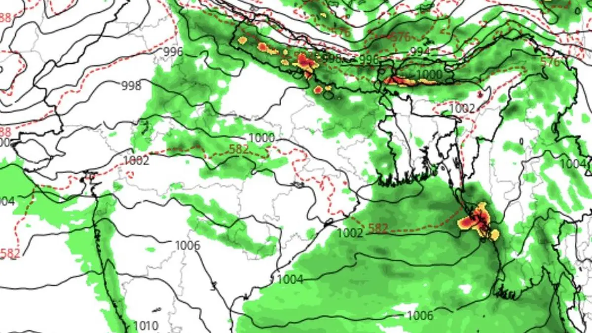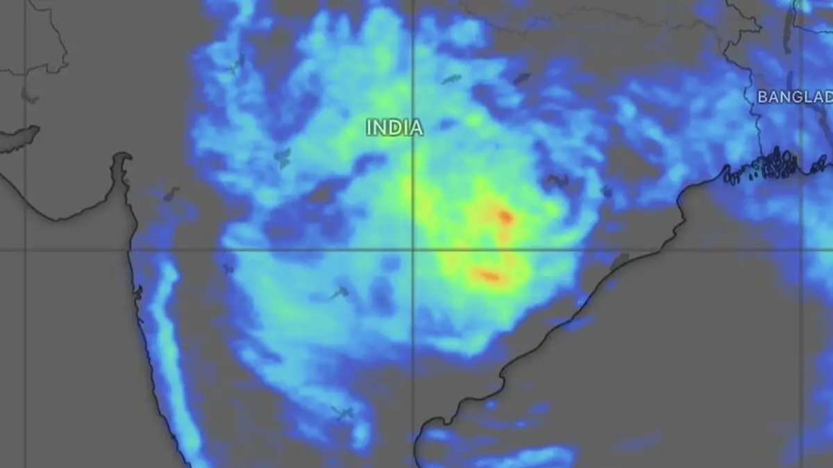
European Centre for Medium-Range Weather Forecasts sees Vidarbha, Chhattisgarh and East Madhya Pradesh being targeted for heavy to very heavy rain (in red, green and blue) through the day on Wednesday.
| Photo Credit:
www.windy.com
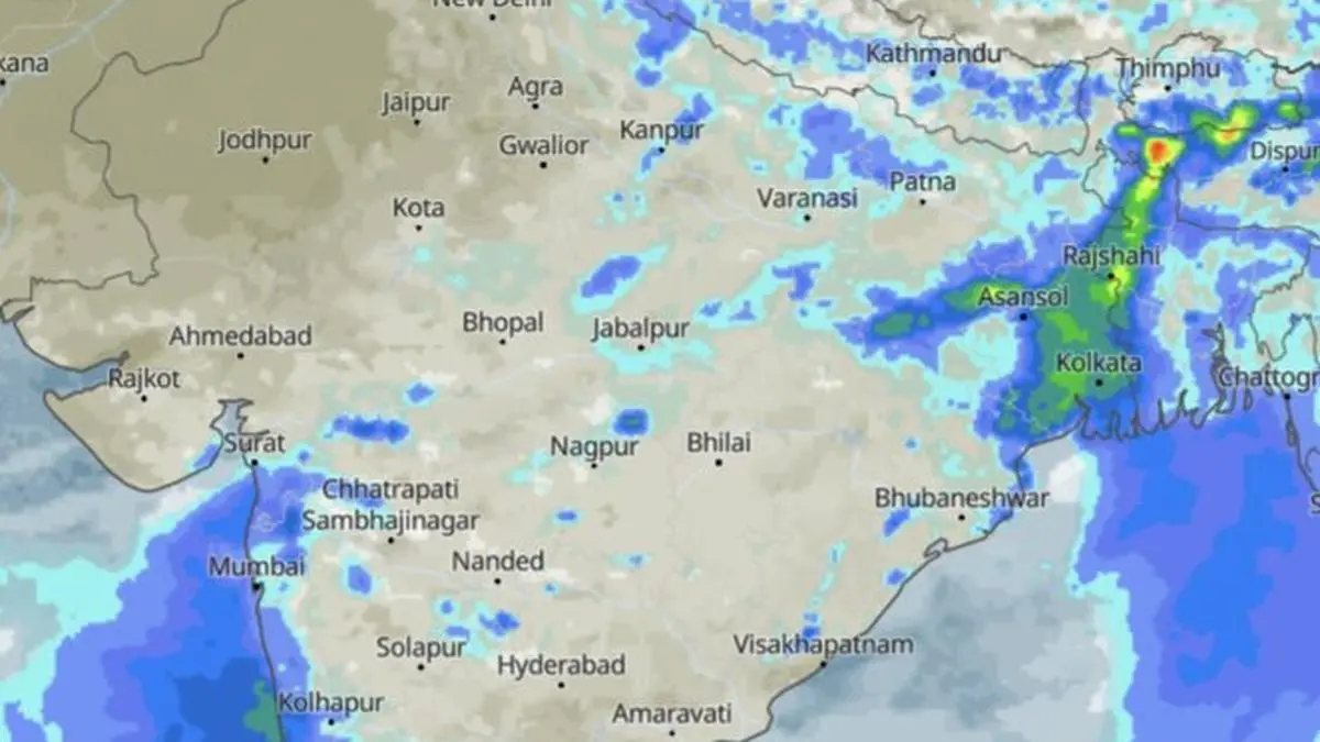
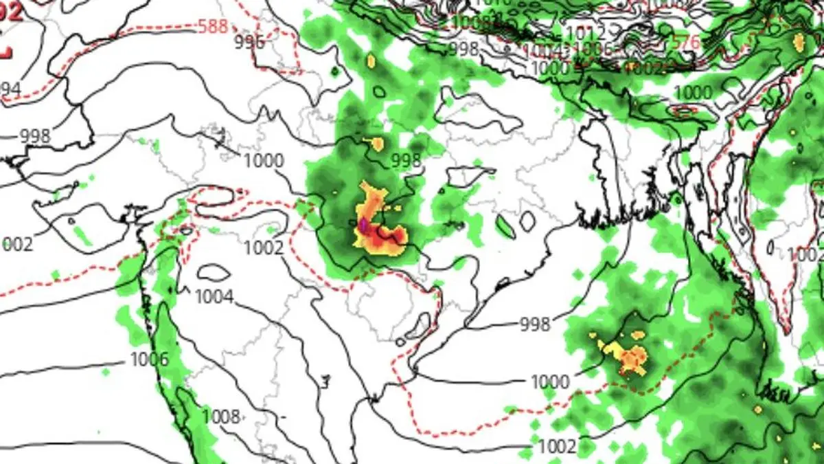
A rare deep depression continued its relentless march across Central India on Wednesday, refusing to lose steam as it tracked westwards after initially moving north-west and then west, dumping torrential rain across Vidarbha, Odisha, Telangana and Chhattisgarh during the 24 hours ending Wednesday morning.Far from weakening over land - a fate that usually befalls such systems - the sprawling weather engine has held on to its intensity, prompting India Meteorological Department (IMD) to concede it would retain its status while unleashing another round of drenching rains over Chhattisgarh, Madhya Pradesh and east Gujarat for two days.Heavy rain forecastAt 8.30 am this (Wednesday) morning, the centre of the deep depression lay over north interior Odisha and adjoining south Jharkhand and Chhattisgarh, about 10 km west-southwest of Jharsuguda; 50 km north of Sambalpur; 60 km east of Raigarh; 100 km west-southwest of Rourkela; and 190 km east of Bilaspur.Satellite maps showed heaviest rainfall occurring through the day today (Wednesday) over contiguous Odisha, Chhattisgarh, Vidarbha and East Madhya Pradesh. Rest of central and west Maharashtra and adjoining Madhya Pradesh may also receive moderate to heavy rain. Cities likely being impacted are Jagdalpur, Kanker, Umerkote, Raipur, Balangir, Basna, Gondia, Bilaspur and Mandla. Slow movementThe deep depression may continue to move almost due west across north interior Odisha and north Chhattisgarh during the next 24 hours. Its unusually slow pace over land is expected to prolong spells of intense rainfall directly beneath its track while continuously drawing abundant moisture from both the Bay of Bengal and, farther west, the Arabian Sea, sustaining widespread downpours.The weather office has forecast heavy to very heavy rainfall at several places, with extremely heavy rainfall at isolated locations over Chhattisgarh and east Madhya Pradesh today (Wednesday); over Vidarbha on Wednesday and Thursday; and over west Madhya Pradesh on Thursday. East Gujarat, already soaked by successive spells of monsoon rain over recent days, is also bracing for extremely heavy rainfall.Flood-like conditionsHeavy rainfall is also likely on Wednesday over Himachal Pradesh, Uttarakhand, Uttar Pradesh, Rajasthan, Punjab, Haryana, Delhi, Maharashtra, Bihar, Jharkhand, West Bengal, Gujarat and the North-Eastern States. Authorities have warned of flooding in low-lying areas as intense monsoon showers continue, with rain alerts in force for Chhattisgarh, Madhya Pradesh, Odisha and Nagaland.The deep depression is being sustained by a favourable monsoon configuration. The monsoon trough stretches from Anupgarh through Pilani (both Rajasthan); Satna (Madhya Pradesh); and the centre of the deep depression before extending to Puri (Odisha) and onward into the north-east Bay. The trough is acting as a vast conveyor belt, routing moisture across north-west, west, central and east India and releasing it in copious quantities.Cyclonic whirlsAdding further energy to the system are cyclonic circulations positioned over south-west Uttar Pradesh, north-west Madhya Pradesh and north-east Assam, which are steering and strengthening the monsoon currents.As if that were not enough, a western disturbance in the form of an upper-air trough stretches roughly from Mudki through Ludhiana and Chandigarh to Joshimath. Acting like an atmospheric barricade, it is forcing moisture-laden monsoon winds to rise, triggering vigorous cloud formation and amplifying rainfall across large parts of northern and Central India.With no immediate signs of the deep depression weakening, much of Central India remains in the firing line for another spell of punishing rain, raising threat of flash floods, water-logging and disruption across the region. Published on July 29, 2026