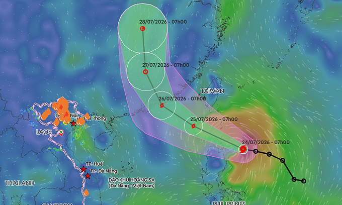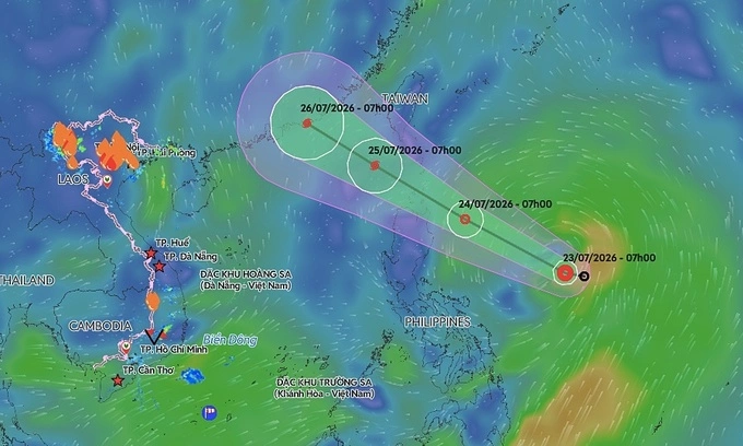
Vietnam's National Center for Hydro-Meteorological Forecasting reported that as of 1 p.m. on Thursday, the depression lay centered over waters east of the Philippines. The system is packing maximum sustained winds of 50-61 kph, with gusts reaching up to 75-88 kph, and is moving at a forward speed of about 25 kph.
By 1 p.m. on Friday, the depression is expected to be positioned roughly 100 km east of Luzon Island in the Philippines. Forecasters anticipate its forward speed will remain at 25 kph. Its winds are expected to strengthen to 61-74 kph, with gusts up to 89-102 kph, at which point it is likely to develop into a tropical storm.
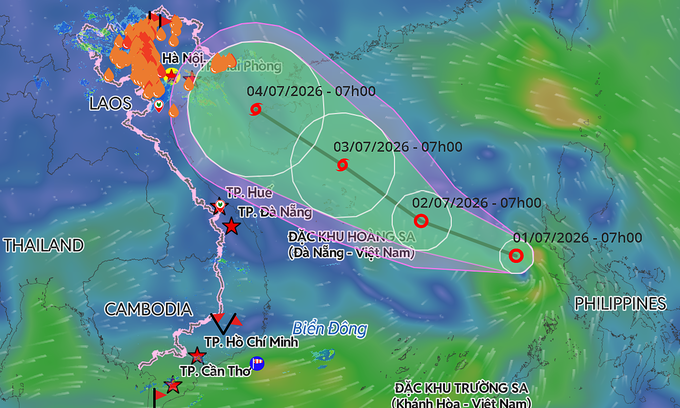
A predicted trajectory of a tropical depression in the East Sea. Graphic by Vietnam Disaster Monitoring System
By 1 p.m. on July 25, the storm's center is projected to hover over the northeastern waters of the northern East Sea. Maximum winds are expected to intensify to 89-117 kph, with dangerous gusts reaching up to 134-149 kph.
Both the Japan Meteorological Agency and the Hong Kong Observatory agree that the depression will intensify into a storm on July 24 before entering the East Sea. However, current projections indicate the system is unlikely to directly affect mainland Vietnam.