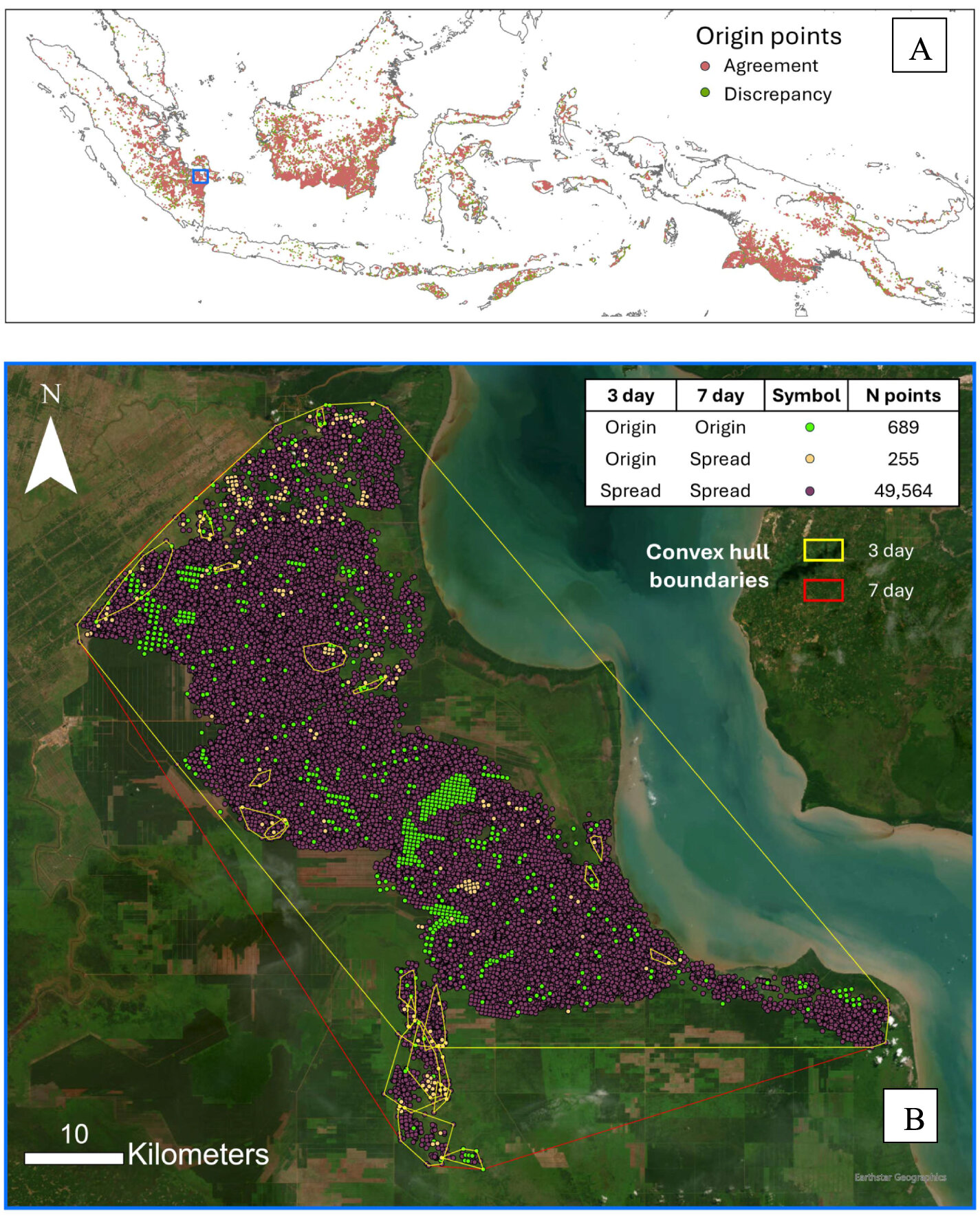
(A) The spatial distribution of the identified origin points across equatorial Southeast Asia in 2015. "Agreement" and "discrepancy" denote origin points identified consistently regardless of the temporal threshold and the ones that were not, respectively. (B) The largest identified fire graph (fire graph 13616) in Ogan Komering Ilir, with the origin and spread points mapped. This complex graph was first identified using the 7 d threshold. The total number of points on the table inset is less than 50 906 points because 398 points with duplicated coordinates were removed from the calculation. Credit: Environmental Research Letters (2026). DOI: 10.1088/1748-9326/ae81ca
How do wildfires grow into catastrophic events? By tracing the earliest detectable origins of the devastating 2015 equatorial Southeast Asian fires, researchers found that most large fires had multiple origin points and identified the ecological, climatic and human factors associated with where fires begin. These findings provide new insights that could help improve fire prevention and understanding of fire risks under climate change across tropical landscapes.
The devastating fires that swept across equatorial Southeast Asia in 2015 burned millions of hectares of land, blanketed the region in haze and caused widespread environmental, health and economic impacts. Despite their scale, relatively little is known about where these fires begin and the environmental and human factors associated with their origins.