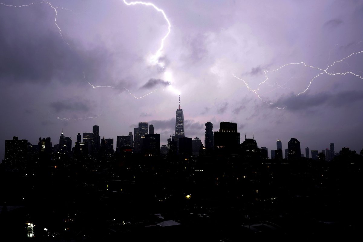
Show Caption
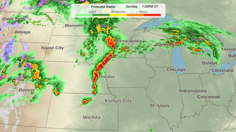
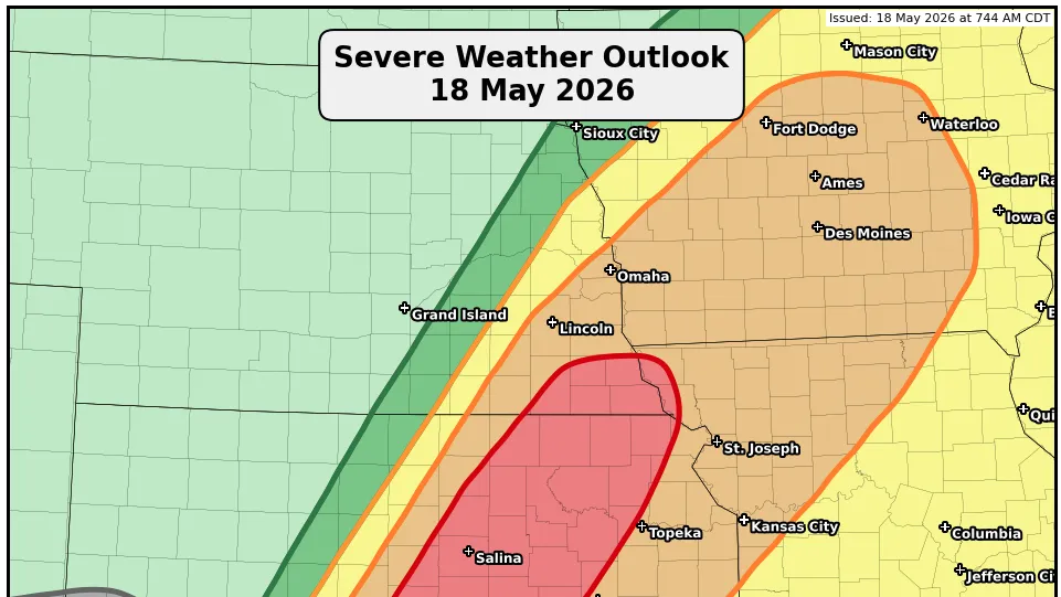
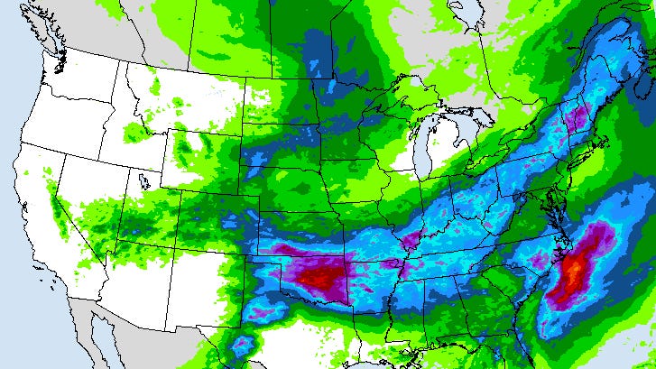
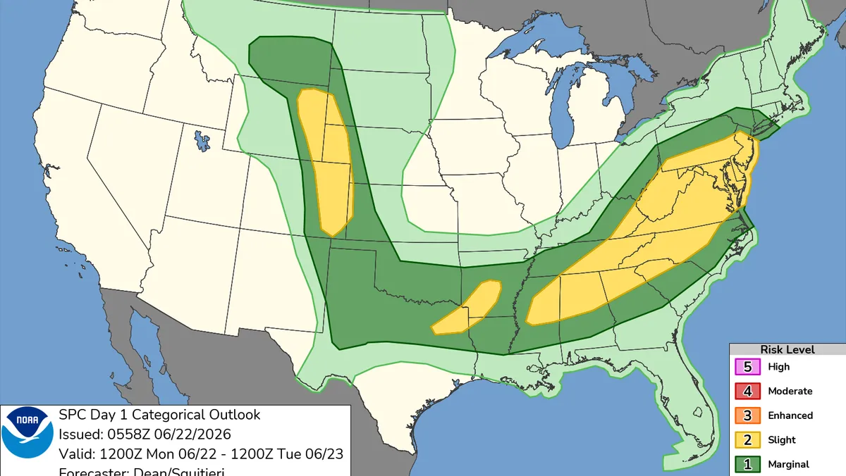
Over 100 million people from the Northeast to the High Plains face a severe thunderstorm threat on Monday.The Mid-Atlantic and Southeast could see damaging winds and isolated tornadoes this afternoon and evening.Scattered storms in the High Plains may produce very large hail and damaging winds.A major heat wave is expanding across the South and West, with temperatures potentially exceeding 100 degrees in some areas.An active early-summer storm pattern is taking shape across the central and eastern United States, with the potential for severe thunderstorms affecting more than 100 million people from the Northeast into the High Plains on Monday, according to the National Weather Service’s Storm Prediction Center.Forecasters say multiple corridors of risk are developing along and ahead of a cold front, where a combination of heat, moisture and wind shear will support scattered severe storms capable of damaging winds, large hail and a few tornadoes."Scattered severe storms appear possible across portions of the Mid-Atlantic into the Southeast, mainly this afternoon and evening," the Storm Prediction Center wrote. "Widely scattered severe storms are expected across the northern and central High Plains, with more isolated severe weather possible from the southern Plains into the lower Mississippi Valley.""For today, the threat of scattered heavy rainfall and severe weather later this afternoon will stretch from New York to Wyoming ahead of a cold front as it taps into a very moist and unstable airmass drawn northward," the short-range public discussion states.Mid-Atlantic, Southeast: damaging winds and isolated tornado riskStorms are expected to develop this afternoon and evening as a weather disturbance moves from the Ohio Valley toward the Mid-Atlantic, according to the Storm Prediction Center.These storms could quickly organize into fast-moving clusters capable of damaging wind gusts. A few storms may briefly strengthen enough to produce isolated tornadoes, especially where a warm front helps enhance spin in the atmosphere.Farther south into the Mid-South, another system moving out of the southern Plains will spark additional storms along a cold front. The main threat there is damaging winds, though a brief tornado can’t be completely ruled out in stronger cells.High Plains: hail and supercell potentialScattered thunderstorms are expected to develop this afternoon and evening across the High Plains in a classic severe-weather setup, according to the Storm Prediction Center.Some of these storms could become supercells capable of producing large to very large hail, damaging wind gusts, and an isolated tornado or two. A few storms may cluster later in the evening, but widespread organized storm systems are not expected.Southern Plains to ArkLaTex: weakening morning storms, renewed activity laterMorning storms from North Texas into the ArkLaTex are expected to weaken through the day.Even so, leftover storm outflow could trigger a few new storms later this afternoon and evening. Any redevelopment would mainly bring localized damaging winds, but widespread or well-organized severe weather is not expected.Heat builds alongside stormsWhile storms move across the country, a major heat wave is also expanding in the South and West.Temperatures will run well above normal from the West Coast through the Southwest, Rockies, Texas, Gulf Coast and Southeast. Some areas in West and Southwest Texas and California’s interior valleys could top 100 degrees.Heat advisories are set to impact more than 21 million people, including parts of the Pacific Northwest and Southern Plains.U.S. weather radarU.S. weather watches and warningsStay informed. Get weather alerts via textBrandi D. Addison covers weather across the United States as the Weather Connect Reporter for the USA TODAY Network. She can be reached at baddison@gannett.com. Find her on Facebook here.