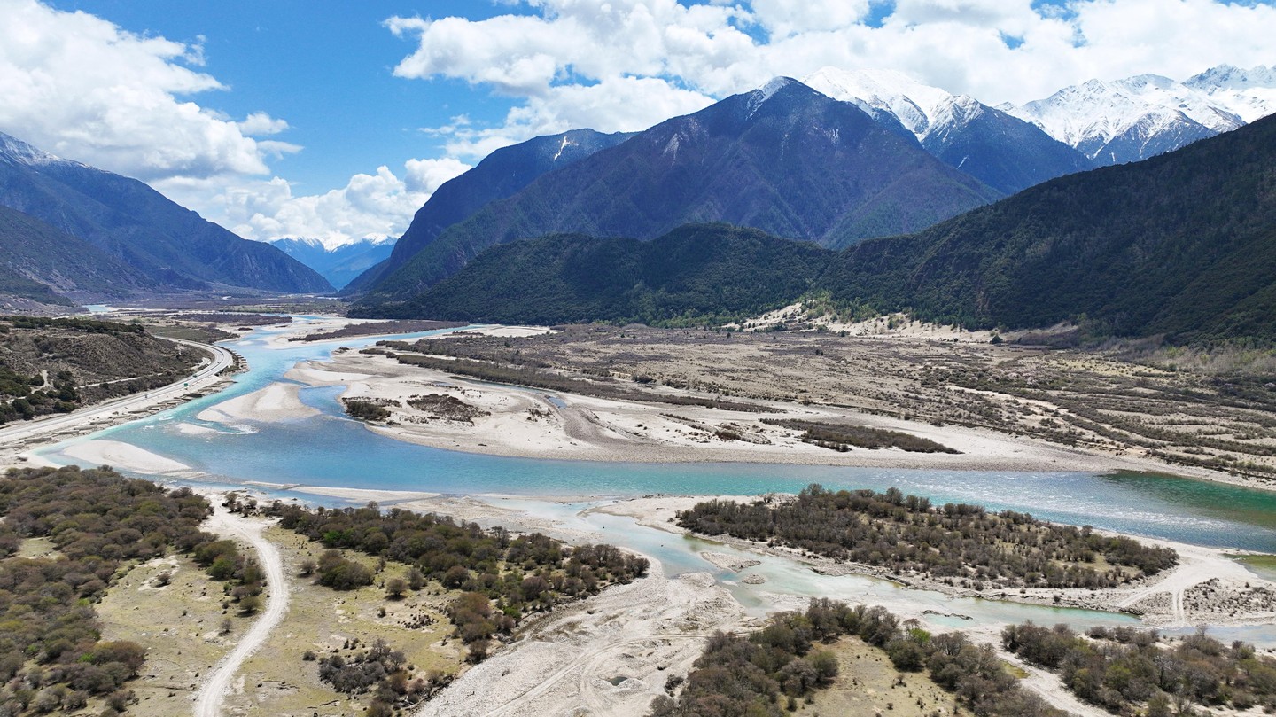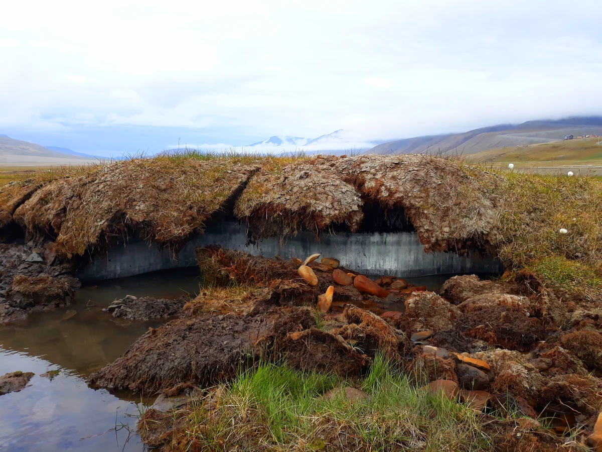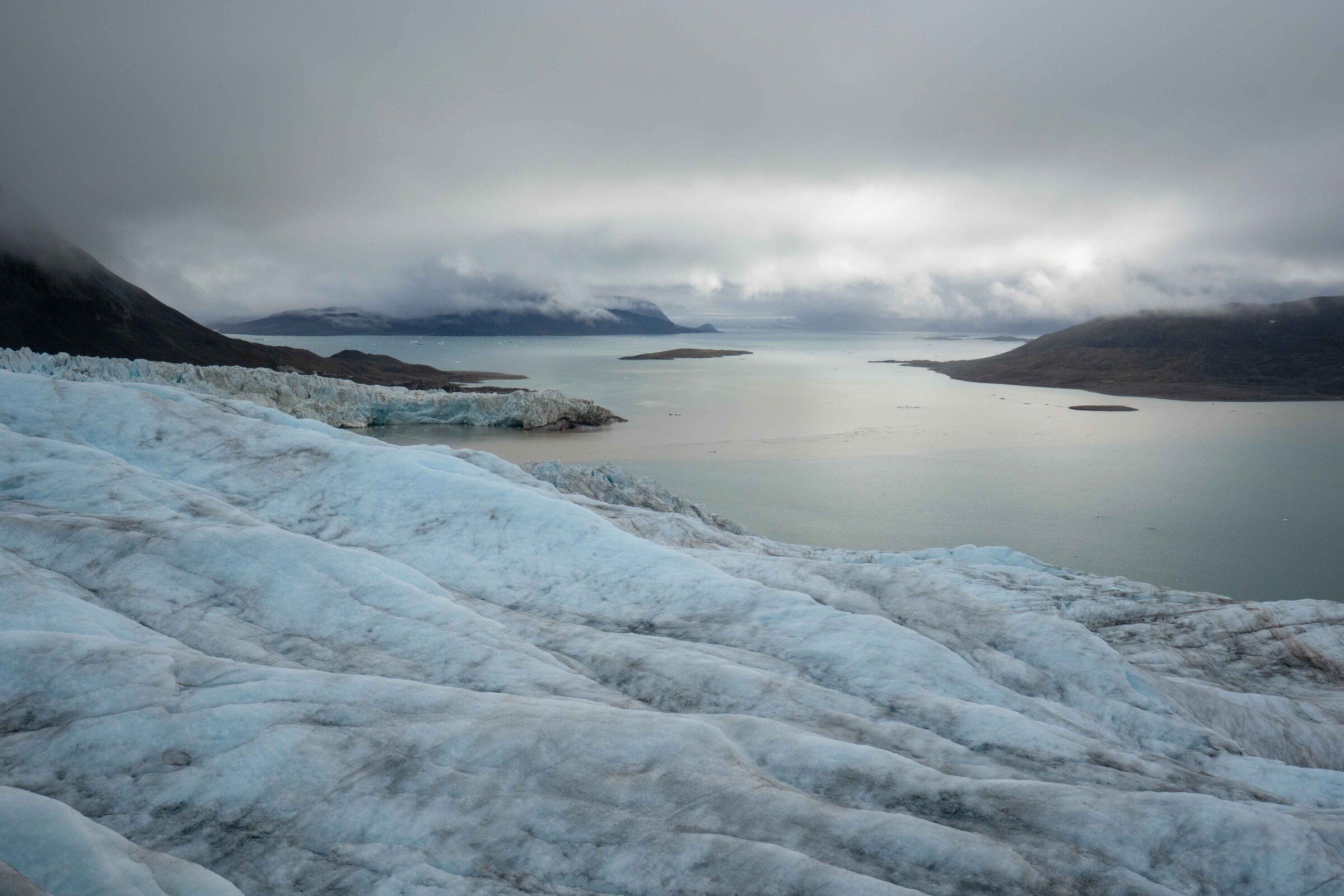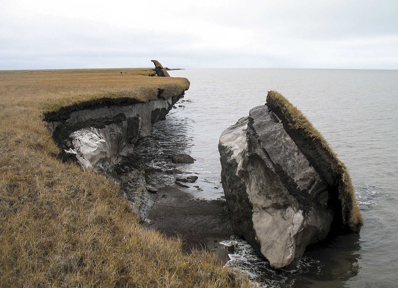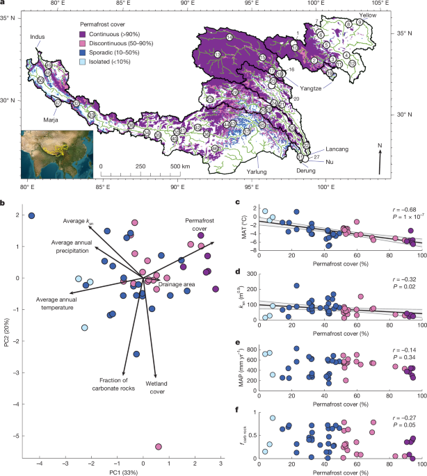
MainRiver networks perfuse and integrate landscapes6, receiving organic carbon (OC) from terrestrial primary production and dissolved inorganic carbon (DIC) \(({\rm{D}}{\rm{I}}{\rm{C}}=\sum {{\rm{C}}{\rm{O}}}_{2({\rm{a}}{\rm{q}})}+{{{\rm{HCO}}}_{3}}^{-}+{{{\rm{CO}}}_{3}}^{2-})\) from soil respiration and chemical rock weathering. This OC is metabolized in rivers and returned to the atmosphere as carbon dioxide (CO2) or methane (CH4), buried in sediments, or transported to coastal oceans. Similarly, DIC can precipitate, outgas or travel downstream7,8. Global carbon inputs to rivers (about 3.2 petagrams of carbon (PgC) yr−1), the resulting riverine carbon emissions (around 2.3 PgC yr−1) and carbon export to the ocean (approximately 0.8 PgC yr−1)8 are on par with the net terrestrial carbon sink (that is, the net primary productivity minus respiration without considering land-use changes; about 3.2 PgC yr−1)9. Consequently, rivers forge important connections between terrestrial, marine and atmospheric carbon pools that modulate the global carbon cycle8. Despite major advances in understanding the role of rivers in the carbon cycle, key knowledge gaps persist regarding the interaction between biological and geological carbon sources and sinks5, as well as their responses to climate change.Of primary concern is the impact of climate warming on the vast OC stocks (approximately 1,014 PgC) stored in the Northern Hemisphere permafrost soils10. Permafrost thaw is mobilizing a portion of this large, near-surface OC reservoir on Earth11. The subsequent breakdown of this ancient, biolabile OC in rivers fuels in situ respiration and methanogenesis, thus amplifying emissions of aged CO2 and CH4, and potentially perturbing the contemporary carbon cycle12,13,14,15,16,17,18. However, permafrost thaw has effects beyond mobilizing ancient OC. In particular, recent studies have demonstrated that multi-decadal increases in DIC fluxes and associated dissolved solutes in permafrost rivers could reflect intensified chemical weathering2,3,4,19,20. Given that landscape-scale weathering fluxes are controlled by a combination of lithology21, hydrology22,23,24, temperature25,26 and exposure of reactive surfaces27,28, climate warming and permafrost thaw could have multifaceted impacts on these fluxes2,3,4. Whereas climate warming can directly increase dissolution kinetics26, the associated permafrost thaw may alter weathering reactions by exposing minerals or by modulating the hydrology and promoting acidic redox conditions in sub-surface environments4. Importantly, weathering reactions in the critical zone affect biogeochemistry through the hydrosphere because groundwater transports weathering products—including carbon—to fluvial ecosystems.The role of weathering reactions for the carbon cycle depends on the nature of the exposed minerals21,29. Weathering of silicate and carbonate minerals by carbonic acid produces alkalinity and draws down CO2 (refs. 30,31). By contrast, weathering of sulfide minerals—such as pyrite—produces sulfuric acid and releases CO2, either by interacting with the alkalinity pool or by dissolving carbonate minerals32,33. In reality, biological and geological CO2 fluxes are intertwined and co-vary across permafrost rivers. For example, acidity produced by respiration of OC could be buffered by alkalinity production from chemical weathering28. These interactions may be particularly important in mountainous landscapes with widespread permafrost coverage that are strongly exposed to climate change and characterized by rapid weathering rates34,35. Efforts to isolate the impact of permafrost thaw on chemical weathering are rare, and no studies have quantified the balance between biological and geological CO2 sources and sinks in rivers draining permafrost landscapes subject to climate warming. These knowledge gaps introduce substantial uncertainties in understanding the contemporary and future role of permafrost landscapes and their rivers within the global carbon cycle8.Here, we examine the balance of riverine CO2 fluxes resulting from OC mineralization and chemical weathering spanning a permafrost gradient on the Qinghai–Tibet Plateau (QTP; Fig. 1a). The QTP is the largest contiguous cryosphere outside the Arctic and Antarctic36, with an estimated OC storage of 50.4 Pg in its permafrost soils37, partly dating back to the late Pleistocene38. The permafrost on the QTP is, on average, warmer and has a higher mean active-layer thickness (about 0.21 m) compared with Arctic permafrost (about 0.10 m), with 44% of permafrost at a mean ground temperature above −0.5 °C, which makes it particularly vulnerable to climate warming39. From the cold plateau in the north and west of the study area, air temperatures increase eastward and southward, and permafrost extent decreases from continuous to discontinuous, sporadic and isolated (Fig. 1a and Extended Data Fig. 1a). By substituting space for time40, this landscape and its rivers potentially hold information about the sensitivity of biogeochemical cycles to climate warming and permafrost thaw over decadal to centennial timescales, timescales of permafrost landscape changes that are impossible to observe with long-term monitoring approaches.Fig. 1: Environmental gradients on the QTP.a, Map of the QTP shown in an Asia North Lambert Conformal Conic projection, showing permafrost cover and sampling locations (open dots). The green lines indicate rivers with catchment areas >1,000 km2. The black outlines mark the main catchments drawn on to the border of China and to the edge of the QTP. The names of the main rivers in each catchment are shown. Numbers in sample points are the sample ID (Supplementary Table 5). b, PCA of the main environmental boundary conditions in the study area, highlighting a permafrost-climate gradient (PC1) and a lithology gradient (PC2). More than 75% of the variance in PC1 was explained by permafrost extent (30%), mean annual air temperature (33%) and mean annual precipitation (14%). The remaining variance was mainly explained by changes in normalized river steepness index (ksn; 18%). The relationship between permafrost extent and ksn was attributable to high permafrost extent on the flat plateau in the northern and eastern parts of the QTP. Lithology (40%), wetland extent (38%) and ksn (11%) contributed most to the variance explained by PC2. The points are coloured by permafrost category. c–f, Environmental variables across the permafrost gradient: mean annual air temperatures (MAT; °C) (c), catchment-averaged steepness index (m0.9) (d), mean annual precipitation (MAP; mm yr−1) (e) and fraction of carbonate rock in the catchment (fcarb rock) (f). The points are coloured by permafrost category. Pearson’s correlation coefficients and P values are shown. The black lines are linear regressions with grey shading showing the 95% confidence interval of the regression. These are plotted only if r ≥ 0.3.A permafrost gradient on the QTPWe repeatedly sampled 50 rivers in the headwaters of the largest river systems of Asia (Yellow, Yangtze, Lancang, Nu, Derung, Yarlung Tsangpo, Marja Tsangpo and Indus Rivers; Fig. 1a) during the ice-free season between April and October over more than 3 years. The sampled headwaters cover a total area of approximately 780,000 km2, span elevations from 1,650 m to 4,820 m above sea level, and drain all major lithologies of the QTP, including a variety of sedimentary, igneous and metamorphic rocks (Extended Data Fig. 1b and Supplementary Tables 1 and 2). We include basins on the cold plateau underlain by continuous permafrost and catchments draining warmer landscapes with discontinuous, sporadic or isolated permafrost cover.Across these landscape-scale environmental gradients, we found that permafrost extent is inversely related to average annual air temperature (principal component 1, PC1; Fig. 1b,c and Extended Data Fig. 1a), consistent with thermal permafrost degradation in response to climate change41. Because permafrost extent tends to be the highest on the flat plateau in the northern and eastern parts of the study area, we also found that permafrost extent declines moderately with the catchment-averaged steepness index (ksn), a proxy for landscape-scale erosion rates42,43 (Fig. 1b,d and Extended Data Fig. 1c). The permafrost gradient does not substantially co-vary with factors that may affect chemical rock weathering (for example, lithology and average annual precipitation; Fig. 1b,e,f and Extended Data Fig. 1b,d). Furthermore, permafrost does not co-vary with wetland coverage, which can affect dissolved organic carbon (DOC) export to rivers44 (Fig. 1b). Thus, our sampled catchments allow us to relate changes in permafrost extent and temperature to river biogeochemistry, mostly independently from other environmental variables that also affect weathering and carbon fluxes.Solute and carbon sources in QTP riversTo assess the concentrations and sources of carbon and inorganic constituents in QTP rivers, we measured CO2 partial pressure (\({p}_{{\mathrm{CO}}_{2}}\)) and emission rates, concentrations of DOC, DIC, major dissolved cations and anions, and isotopes of carbon (δ13C–Δ14C), sulfur (δ34S) and oxygen (δ18O). We found all 50 rivers to be supersaturated in CO2 with respect to atmospheric equilibrium, with a median saturation of 230% (interquartile range 200–270%), and \({p}_{{\mathrm{CO}}_{2}}\) of 650 (580–750) μatm and a median riverine CO2 emission rate of 95 (81–120) mmol m−2 day−1 (Extended Data Fig. 2). These emissions are bracketed by previous observations from QTP rivers (Supplementary Table 3), but remain below the median estimate (594 mmol m−2 day−1) for global rivers8. Concentrations of DOC and DIC are 380 (320–440) μmol l−1 and 1,800 (1,400–2,600) μmol l−1 (Extended Data Fig. 2 and Supplementary Table 2), respectively, whereas total dissolved ion concentrations (4,600 (2,900–5,900) μmol l−1) are dominated by Ca2+ (750 (580–1,000) μmol l−1), Mg2+ (480 (230–840) μmol l−1), Na+ (410 (250–830) μmol l−1), SO42− (430 (260–730) μmol l−1) and HCO3− (2,000 (1,300–2,600) μmol l−1; Extended Data Fig. 2 and Supplementary Table 2). No substantial seasonal trends in either CO2 or dissolved chemistry were apparent over the study period (Extended Data Fig. 3), although water temperatures increased from April to August and runoff increased slightly through summer and into fall (Extended Data Fig. 4).We found that the dissolution of carbonates contributed the most cations (78% (70–86%) of the total cation charge), whereas silicates and evaporites contributed a smaller fraction (6.0% (3.6–9.5%) and 6.3% (1.6–14%), respectively; Extended Data Fig. 5a and Supplementary Table 2). With one exception, samples with more than 25% and up to 78% cation contribution by evaporites occurred exclusively in eight sites of the westernmost Yellow River, Yangtze River and Lancang River, and are probably controlled by evaporitic units within the metasediments45. Coupled isotopic compositions of δ34S-SO42− and δ18O-(SO42−–H2O) identify a mixing trend between riverine sulfate (SO42−) derived from pyrite and evaporite sources (Extended Data Fig. 5b). We infer that sulfate from sulfide oxidation balances 23% (11–36%) of the total cation charges (Extended Data Fig. 5a).Interactions of organic and inorganic carbon poolsBased on dual carbon isotopes (δ13C–Δ14C) and a three-endmember mixing model46, we found that old permafrost- and rock-derived carbon substantially contributes to DOC, DIC and CO2 pools in QTP rivers. DOC is a mix of modern (67 ± 11%) and old permafrost (21 ± 13%) as well as rock (carbonate and petrogenic OC; 12 ± 6%) carbon sources, with an average age of 2,232 14C years (Fig. 2a,b). DIC can be modelled as a mixture of modern (49 ± 19%) and old permafrost (34 ± 19%) and rock (19 ± 8%) sources, with an average age of 3,512 14C years (Fig. 2a,b). Riverine CO2 falls between DOC and DIC in both its δ13C and Δ14C signatures and has an average age of 1,655 14C years, consistent with a mix of modern permafrost (66 ± 11%), old permafrost (22 ± 13%) and rock (12 ± 7%) carbon sources (Fig. 2a,b).Fig. 2: Carbon isotopes and unmixing.a, Δ14C compared with δ13C for measured samples (bordered points) and literature data (unbordered points). Expected carbon isotope ranges for select endmembers are marked with black-dashed lines and boxes (Methods). The threshold of Δ14C age for the Northern Hemisphere permafrost soils is about 2,800 14C years (ref. 50). b, Results from a three-endmember mixing model of Δ14C data. c,d, Δ14C isotopes for paired samples collected at the same time from our study (blue) and compiled from the literature (grey) of Δ14C-CO2 against Δ14C-DOC (c) and Δ14C-DIC against Δ14C-DOC (d). The blue datapoints are from our study, the dark grey datapoints are from the literature data of rivers within our study area, the light grey points are from the literature data on the QTP, but located outside of the studied catchments. The blue dashed line is the 1:1 line. Pearson’s correlation coefficients and P values are shown.Importantly, we observed moderate to strong correlations between concurrently sampled Δ14C-DOC, Δ14C-DIC and Δ14C-CO2 signatures (Fig. 2c,d) and a positive correlation between \({p}_{{\mathrm{CO}}_{2}}\) and DOC across broad spatiotemporal scales (Extended Data Fig. 6a). These patterns suggest a shared source of at least part of the organic and inorganic carbon pools or point to processes that exchange carbon between these pools. We suggest that mineralization of permafrost- and rock-derived DOC generates CO2, thereby maintaining modest CO2 oversaturation in QTP rivers and leading to a correspondence between Δ14C-DOC and Δ14C-CO2 (Fig. 2c). In turn, buffering of part of this respiratory CO2 by alkalinity from rock weathering could explain the correlation between Δ14C-DOC and Δ14C-DIC (Fig. 2d). Finally, downstream decreases in DOC and DIC 14C ages in the Yellow and Yangtze Rivers (Extended Data Fig. 6b,c) are consistent with inputs of aged carbon in the permafrost headwaters followed by mineralization and dilution by modern carbon sources during transit through non-permafrost areas47.Collectively, permafrost rivers on the QTP receive substantial amounts of ancient carbon that is laterally routed from the pedosphere and lithosphere, and this carbon can be converted and released in the form of millennial-aged CO2. Therefore, inputs of both ancient permafrost and rock carbon contribute substantially to aquatic carbon cycling and CO2 emissions46,48, and these old carbon contributions will probably grow as QTP permafrost further thaws.Permafrost extent affects river biogeochemistryStatistical analyses (principal component analysis (PCA) and multiple linear regression (MLR)) showed clear impacts of permafrost extent on river biogeochemistry (Figs. 1 and 3, Extended Data Table 1 and Supplementary Table S4). Concentrations of riverine carbon species and cations from rapidly weathering carbonates, as well as the fraction of old carbon in DIC and CO2 pools (Fig. 3 and Extended Data Fig. 7), consistently increase from isolated to continuous permafrost areas. Conversely, silicate weathering rates decrease with permafrost extent, although this trend is apparent only in the MLR results (Extended Data Table 1). Permafrost extent explains most variance in these biogeochemical variables as inferred from MLR coefficients (Extended Data Table 1). Only CO2 emissions and ion concentrations from evaporite and sulfide weathering seem to be insensitive to permafrost extent (Fig. 3b,g,h and Extended Data Table 1). PC1 includes effects of air temperature and erosion rates, but MLR results suggest that erosion rates (ksn) affect only DIC, and to a lesser extent, silicate cation concentrations, whereas temperature influences ion concentrations from weathering of silicates and sulfides (Extended Data Table 1). However, contrary to expected patterns24,26,28,34, these relationships are negative (Extended Data Table 1), which may be caused by unresolved environmental covariations. Furthermore, none of the carbon and weathering derived ion concentrations correlate with PC2—except DOC (Extended Data Fig. 8), which validates permafrost as the primary driver of biogeochemical variability across our study area. The exception may arise because DOC inputs depend on wetland extent (Extended Data Fig. 9a). In turn, lithology affects sulfide weathering (Extended Data Fig. 9b and Supplementary Table 4), probably by an association of pyrite with carbonate-bearing metasediments in the Yellow, Yangtze and Lancang catchments45.Fig. 3: Geochemical variables across the permafrost-climate gradient (PC1).a–h, \({p}_{{\mathrm{CO}}_{2}}\) (a), CO2 emission rates (b), concentrations of DOC (c), DIC (d), cations from silicate weathering (Cationssil) (e), cations from carbonate weathering (Cationscarb) (f), cations from evaporite weathering (Cationsevap) (g) and sulfate from sulfide (SO4 sulf) (h) plotted against PC1. Points are coloured by permafrost category (see Fig. 1a for colour scale). Geochemical values from sites with more than one sample were averaged before plotting the data for all 50 sampling sites. The error bars reflect standard deviations of these averages. The numbers in each panel show Pearson’s r and the associated P values for the relationship between the response variables and PC1. The black lines are linear regressions with grey shading showing the 95% confidence interval of the regression. These are plotted only if r ≥ 0.3. A set of six datapoints with concentrations of Na+, Cl− and cations from evaporites of 2,300–17,000 µmol l−1 are not shown and considered in the correlation and regression analyses in g. These high values probably reflect the influence of evaporitic units within the metasediments45 in the Yellow, Yangtze and Lancang headwaters.Based on the dominant effect of permafrost shown by our statistical analyses, we propose that concurrently elevated carbonate ion and carbon concentrations in permafrost-rich catchments are caused by enhanced exposure of rocks and carbon within thawing permafrost soils2,3,4 or are linked to increased hydrological connectivity and exposure of rock underneath permafrost soils. These effects may be delayed or reversed for ion concentrations from more slowly weathering silicate minerals (Fig. 3e). Collectively, our findings suggest that warming and permafrost thaw affect the dynamics of lateral transport of both organic and inorganic carbon to rivers, mineralization of carbon to CO2 and chemical weathering in parallel across the QTP (Fig. 3 and Extended Data Table 1). We emphasize that our results do not challenge temperature, precipitation or erosion controls on weathering and carbon fluxes23,24,25,26,27,28,29,34. Rather, the strong permafrost gradient across our studied catchments allowed us to isolate permafrost extent from these other controls and reveal its effects on riverine biogeochemistry.Balance of CO2 emissions and sequestrationTo assess regional-scale impacts of QTP permafrost thaw on riverine carbon fluxes, we upscaled CO2 emissions from individual river reaches to the entire fluvial networks (Methods). Likewise, we estimated CO2 consumed by carbonate and silicate weathering and CO2 produced by sulfide oxidation at the catchment scale. We present these results as carbon fluxes normalized by the catchment area upstream of each study reach. We found that CO2 emissions from river networks increase slightly from isolated (1.2 (1.0–2.2) tC km−2 yr−1) to continuous (2.4 (1.6–3.1) tC km−2 yr−1) permafrost (Fig. 4a). Conversely, CO2 consumption by silicate and carbonate weathering decreases with increasing permafrost extent (Fig. 4a). Relative to river CO2 emissions, net CO2 sequestration from weathering varied broadly from continuous (15% (8–50%)) to isolated (340% (140–530%)) permafrost (Fig. 4b) with an overall median of 78% (7–160%). With the exception of CO2 emissions, all weathering fluxes are a product of runoff and concentration, but permafrost extent can affect weathering fluxes independently of runoff (Supplementary Text 1).Fig. 4: CO2 fluxes across permafrost zones.a, Bar plot showing the median CO2 fluxes for all river basins grouped by permafrost extent. The black lines mark the interquartile ranges. Negative fluxes refer to a CO2 sink and positive fluxes to a CO2 source. Numbers from sites with more than one sample were averaged before plotting the data for all 50 sampling sites. Note that the carbon fluxes do not have to balance, because a part of the carbon drawdown and release by weathering occurs on land and is then transported laterally to streams. b, The ratio of CO2 fluxes from weathering and CO2 emission fluxes. The red lines and black boxes show the median and interquartile range, respectively. The whiskers extend to the most extreme data points within 1.5 times the interquartile range of the quartiles; values beyond are shown as black crosses. CO2 emission is always a carbon source and a positive number. Negative ratios imply that weathering is a CO2 sink, and positive ratios imply that weathering is a CO2 source. For example, a ratio of −1 means that weathering consumes as much CO2 as is emitted by rivers. c–f, CO2 fluxes from riverine emission (c), silicate weathering (d), carbonate weathering (e) and sulfide weathering (f) plotted against PC1. The content of the plots and text boxes follows that in Fig. 3.These geochemical patterns across the QTP shed new light on the role of permafrost thaw for the balance between carbon sources and sinks. Our findings suggest that OC mineralization is most important in the continuous permafrost zone leading, at the present day, to elevated riverine DOC concentrations, \({p}_{{\mathrm{CO}}_{2}}\) and CO2 emissions. Here, CO2 sequestration fluxes from chemical weathering were small relative to river CO2 emissions (Fig. 4b). However, with continued warming, thawing of permafrost is expected to result in a deeper active layer and eventually patchy permafrost cover41. Substituting space for time across our permafrost gradient suggests that CO2 sinks from weathering may become increasingly important, potentially even outpacing riverine CO2 emissions as landscapes undergo this transition over timescales of decades to centuries (Fig. 4). Where warming and permafrost thaw occur alongside elevated runoff, weathering rates could increase even further. We note that carbon fluxes from silicate, carbonate and sulfide weathering are partly offset by carbonate and sulfide precipitation in the ocean31 (Supplementary Text 2). However, imbalances between terrestrial weathering and marine precipitation, for example, due to warming and permafrost thaw, will persist over millennial34 and million-year timescales34,49, and are therefore important to consider within the framework of current climate-change impacts.Next, we assessed the net carbon fluxes from the first- to eighth-order streams of the entire study area (Methods). We estimated the total riverine CO2 emissions at 2.3 ± 0.7 TgC yr−1. In turn, we obtained 1.1 ± 0.2 TgC yr−1 of geogenic CO2 production by sulfide weathering and 1.6 ± 0.3 TgC yr−1 and 0.29 ± 0.07 TgC yr−1 of geogenic CO2 removal by carbonate and silicate weathering, respectively. Thus, the net CO2 consumption by rock weathering is 0.80 ± 0.32 TgC yr−1, which corresponds to 35 ± 17% of the total riverine CO2 emissions. Note that these fluxes from the entire study area are strongly influenced by the large Lancang and Nu catchments, for which weathering is inferred to be a net carbon source. If we consider individual catchments, a median of 78% of riverine CO2 production from respiration of OC is negated by alkalinity production from chemical weathering (Fig. 4b). These ratios could be even higher because areal CO2 emissions are likely to be maximum estimates because of a lack of width data for the first-order streams and CO2 emission rates from the winter (Methods).We estimated downstream DOC and DIC export fluxes summed across the same catchments to 0.87 ± 0.13 TgC yr−1 and 4.2 ± 0.7 TgC yr−1, respectively. We also estimated particulate OC (POC) fluxes from the four largest catchments (about 74% of the study area) to be 0.37 ± 0.26 TgC yr−1. The sum of all downstream carbon export fluxes (5.4 ± 0.7 TgC yr−1) is close to twice the total carbon emissions (CO2 (2.3 ± 0.7 TgC yr−1) + CH4 (0.68 ± 0.14 TgC yr−1)18 = 3.0 ± 0.7 TgC yr−1) from rivers draining these catchments. These numbers suggest that only 35% of the total fluvial carbon budget (DOC + DIC + POC + emitted CO2 + emitted CH4 = 8.4 ± 1.0 TgC yr−1) is mineralized and emitted to the atmosphere, which is a relatively small contribution compared with the rivers across the globe (63%)7. Importantly, downstream DIC export—mainly driven by rock weathering—corresponds to 50% of this total riverine carbon budget in the QTP. From Δ14C mass balance (Methods), we estimated fluxes of old carbon from both permafrost and rocks in the form of DOC, DIC and CO2 to 0.29 ± 0.11 TgC yr−1, 2.1 ± 0.9 TgC yr−1 and 0.8 ± 0.4 TgC yr−1, respectively. Overall, our findings carry significant consequences: (1) the large old carbon loads funnelled (47%) or emitted (35%) by QTP rivers pose yet unknown impacts for downstream and atmospheric biogeochemistry; and (2) CO2 fluxes from rock weathering can modulate the potential for CO2 gas emission associated with warming and permafrost thaw.Implications for the global carbon cycleThe biological component of the carbon cycle (for example, related to ecosystem metabolism)8 has been particularly prominent in permafrost river research, probably because of the substantial lateral OC fluxes from thawing of frozen soils, and the conventional wisdom that biological processes are more reactive to an increased supply of carbon and warming than physicochemical processes such as weathering. Findings from our dual organic–inorganic carbon approach show that weathering of minerals increasingly exposed by permafrost degradation could buffer a notable fraction of CO2 from permafrost-derived OC mineralization, hence coupling inorganic and organic carbon cycles on human-relevant timescales. Furthermore, substituting space for time suggests that the balance between riverine CO2 sources and sinks shifts across a gradient in permafrost extent, thereby providing a glimpse at decadal to centennial changes to carbon cycling on the QTP. At present, permafrost thaw is considered a positive carbon feedback to climate warming, with permafrost rivers acting as CO2 sources15. In sulfide-rich permafrost areas, exposure of sulfide minerals may provide an extra CO2 source and exacerbate the positive permafrost carbon feedback2,4,19. However, where carbonate and silicate weathering dominate—such as over most of the QTP—a substantial portion of the additional CO2 production from permafrost thaw could be compensated by weathering on human timescales. Therefore, stitching together biotic–organic and abiotic–inorganic carbon processes across the cryosphere in the context of climate change is essential to determine the net effect of permafrost thaw on the global carbon cycle, and ultimately, to understand its climate feedback directionality. Our study provides compelling empirical evidence that carbon cycling models should include the key mechanisms underpinning aquatic carbon sources and sinks. We propose to move beyond the canonical focus on biotic–organic carbon processes and to holistically consider the balance of all carbon transformation mechanisms to better understand the coupling of organic–inorganic carbon cycles between the hydrosphere, pedosphere and lithosphere under changing climate.MethodsStudy area and field samplingSpanning about 30% of the entire QTP, this 780,000 km2 study area is situated between the boundary of the Loess Plateau (Gansu Province, 103° E) and the border of China (Tibet Autonomous Region, 78° E), and includes the headwater of eight major river basins: the Yellow, Yangtze, Lancang–Mekong, Nu–Salween, Derung (Irrawaddy), Yarlung Tsangpo–Brahmaputra, Marja Tsangpo (Ganges) and Indus Rivers (Fig. 1a and Supplementary Table 1). This region spans gradients of climate, topography, vegetation cover, permafrost extent and lithology, with elevations between 1,600 and 8,000 m above sea level. The rivers drain the major tectonic terranes of the QTP that contain a wide range of sedimentary, igneous and metamorphic rocks51,52 (Extended Data Fig. 1b). In the northeast of the study area, the Yellow and Yangtze Rivers drain marine carbonate and siliciclastic sediments of the eastern Kunlun–Qaidam Terrane and the Triassic deep-marine sediments of the Songpan–Ganzi flysch complex51. The Lancang, Nu and the southwestern Yangtze catchments drain mostly terrestrial siliciclastic and shallow marine carbonate rocks of the eastern Qiangtang and northern Lhasa Terrane51. In particular, the sediments of the Qiangtang Terrane contain abundant evaporites45. By contrast, the catchments of the Yarlung Tsangpo and Indus Rivers are underlain by a series of plutonic and volcanic rocks of the southern Lhasa Terrane apart from the marine Tethyan sedimentary series of the Himalayas (Extended Data Fig. 1b). Permafrost extent across the study area varies from continuous to isolated with the most extensive permafrost extent concentrated in the Yangtze and eastern Yellow Rivers, and high-elevation areas of all other river basins53. The climate is characterized by a cold and dry winter season and an ice-free season between April and October with heavy monsoon rains during the study period54. Potential glacial influence is minimized by sampling streams at least 20 km downstream from glaciers. Flow distance and tributaries collectively reduce potential biogeochemical signatures of glacial meltwaters.We collected 175 individual samples from 50 rivers across this area during the daytime in spring (May–June), summer (July–August) and autumn (September–October) between 2016 and 2018, and in spring ice-out (early April) in 2023. The Yellow River basin was visited eight times; the Yangtze River basin five times; and the Lancang, Nu and Yarlung River basins were all sampled on four dates, the Derung and Indus River basins twice, and the Marja River basin once. We measured, compiled, interpolated and/or calculated all variables first for each of the 175 samples (Supplementary Table 2) and then calculated mean values and their standard deviations for sites with multiple samples to obtain one estimate for each of the 50 sampling sites (Supplementary Table 5).Topography, hydrology, lithology and climate parametersAll topographic analyses were performed on a 90-m resolution digital elevation model (DEM) from the Shuttle Radar Topography Mission (SRTM)55 using version pre2.5 of the TopoToolbox56. We extracted a river network and estimated, for each sample location, drainage-basin-averaged slopes, Sbsn, and normalized steepness index, ksn, with a reference concavity of 0.45, a segment length of 1,000 m and a drainage-area threshold of 100 km2. For all rivers in the network, we also extracted the stream order (with drainage-area threshold of 5 km2) and calculated the total length of rivers, \({L}_{{\mathrm{riv}}_{i}}\) with a given order, that is, upstream of each sampling point. All these analyses were performed on a DEM projected in ArcGIS-Pro using the inbuilt Asia North Lambert Conformal Conic projection. To provide an estimate of the total surface area of rivers upstream of a sampling point, Ariv, we multiplied the river length in each stream order, \({L}_{{\mathrm{riv}}_{i}}\), with an average width for rivers in that stream order, \({\bar{W}}_{i}\):$${A}_{\mathrm{riv}}=\mathop{\sum }\limits_{1}^{N}{L}_{{\mathrm{riv}}_{i}}{\bar{W}}_{i}$$
Rock weathering can counteract river CO2 emissions induced by permafrost thaw - Nature
Permafrost thaw on the Qinghai–Tibet Plateau increases rock-weathering rates while reducing river CO2 emissions, suggesting geological carbon fluxes may eventually outpace thaw-driven emissions.
11,897 words~54 min read