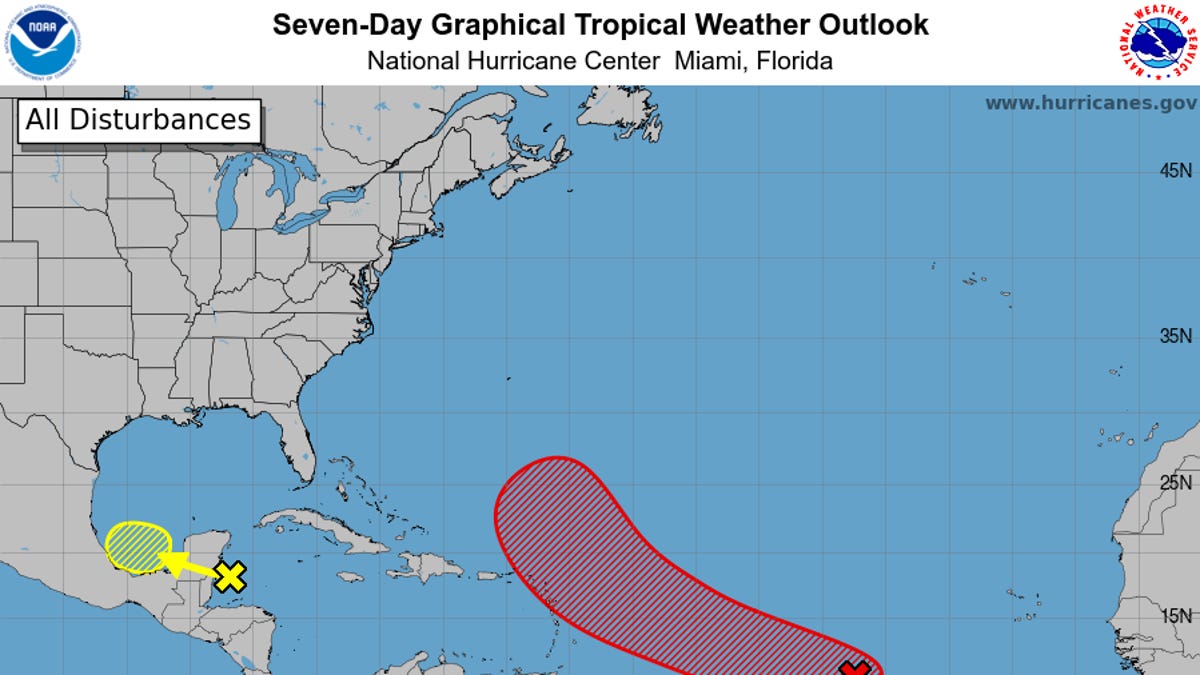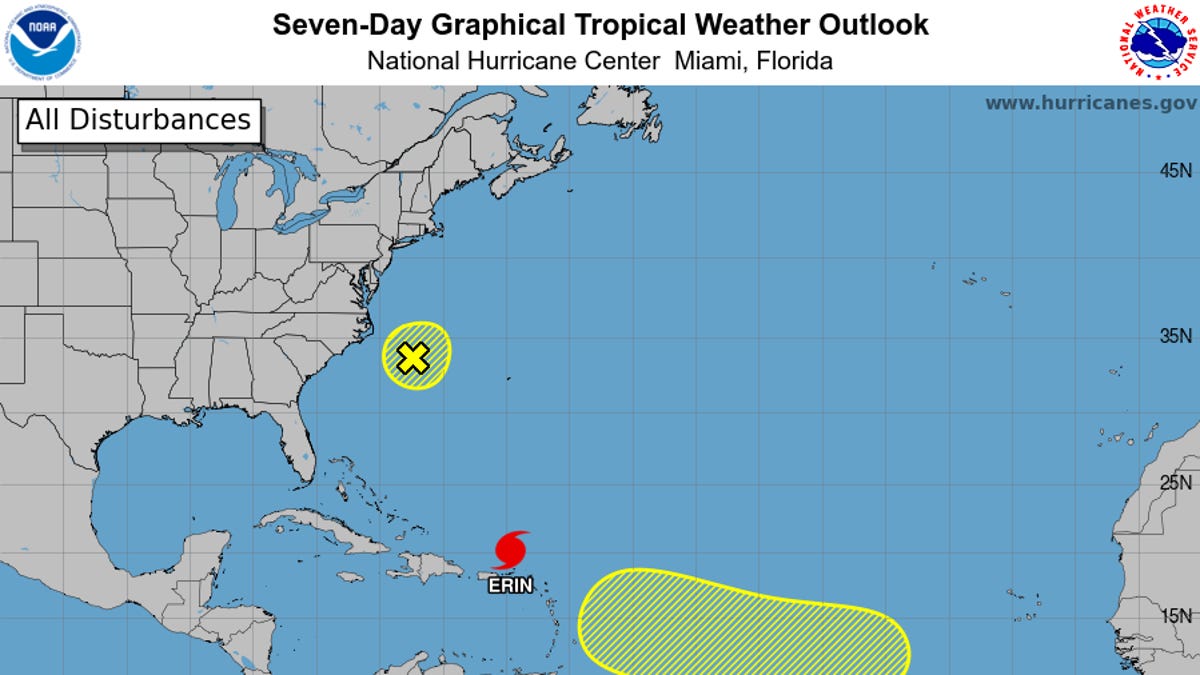
Forecasters are tracking a broad area of low pressure associated with a tropical wave in the Atlantic that has a medium to high chance of developing into a tropical cyclone, the National Hurricane Center said on Oct. 5.
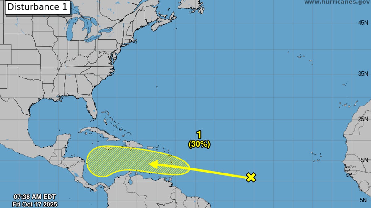
The tropical wave, referred to as Invest 95L (AL95), has a 40% chance of formation over 48 hours and a 70% chance of formation over seven days, according to the National Hurricane Center in Miami. It is forecast to approach the Leeward Islands by late this week.
The broad area of low pressure is producing disorganized thunderstorms and showers several hundred miles south-southwest of the Cabo Verde Islands, the hurricane center said in a tropical outlook issued at 2 p.m. ET.
"Environmental conditions appear conducive for additional development of this system, and a tropical depression is likely to form this week as the system moves quickly across the central tropical Atlantic," the hurricane center said.
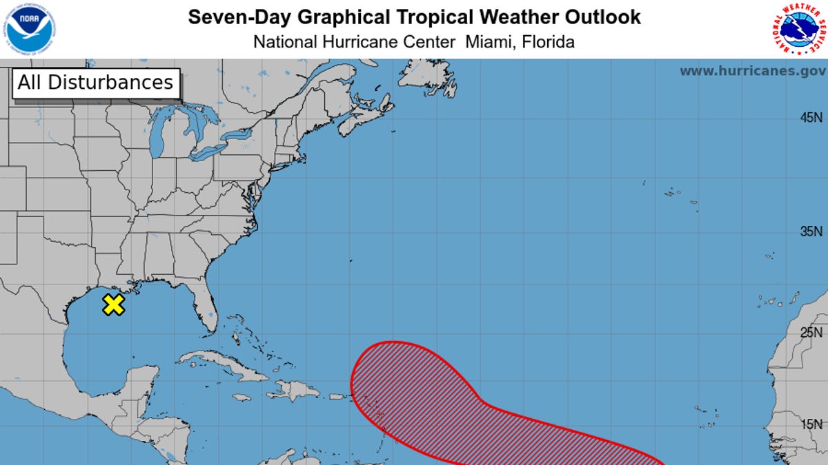
Forecasters are also tracking a weak area of low pressure located over the north-central Gulf, according to the hurricane center. The system is producing showers and thunderstorms near the coasts of Louisiana, Mississippi, and Alabama.