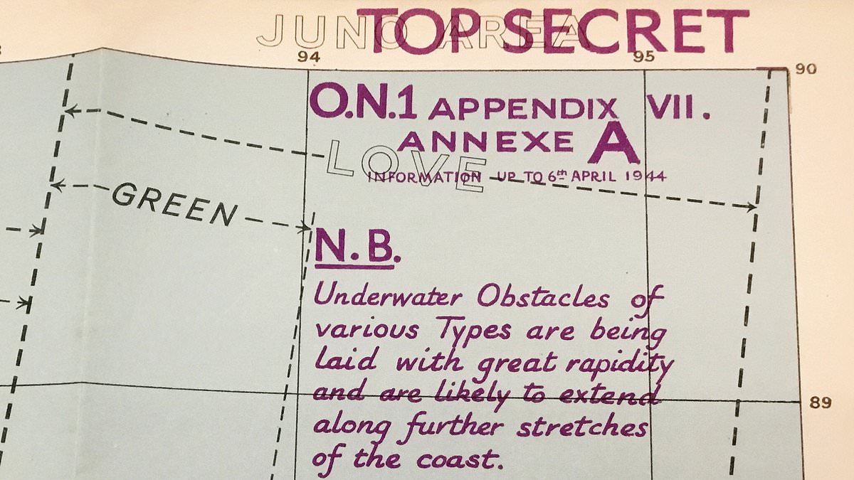
'Secret' maps allegedly used by Allied troops for the D-Day landings have sold at auction for £23,000 - after being found in a cardboard box.
The collection - giving sensitive detail of the five landing beaches codenamed Utah, Omaha, Gold, Juno and Sword during the 1944 invasion of Normandy - was first bought for just £10 from a local auction.
Each map outlined in extensive detail the German defences as well as featuring terrain including hills, woods, villages and roads.
The British military plans pinpointed enemy strong points, barbed wire and even minefields, which are marked in purple ink.
The maps only came to light when their owner was rifling through an assorted box of military ephemera bought as part of a £10 job lot.