See more Daily Mail on Google - save us as a Preferred SourceBy SHIVALI BEST, SCIENCE & TECHNOLOGY EDITOR Published: 03:00 BST, 10 September 2026 | Updated: 03:26 BST, 10 September 2026
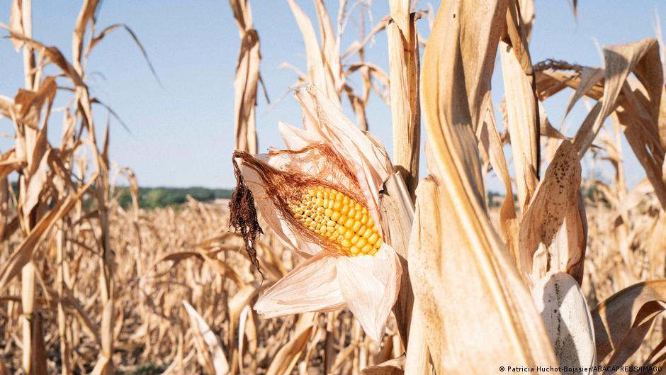
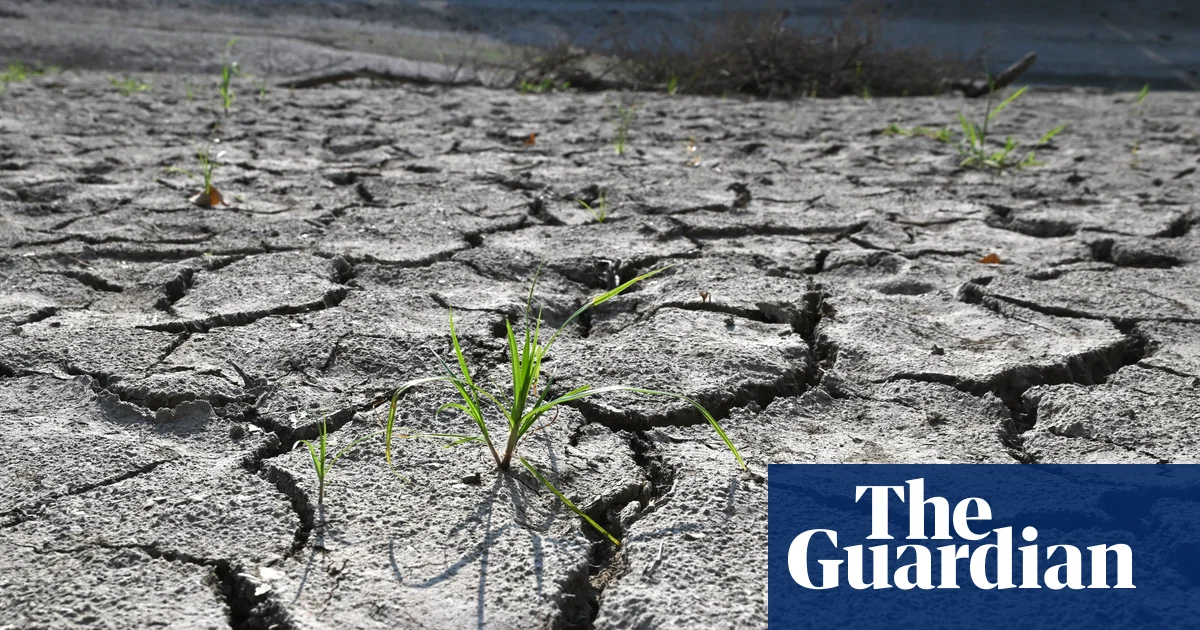
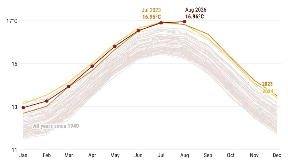
It's official – August was the warmest month ever recorded globally. New data released by the Copernicus Climate Change Service (C3S) has confirmed that the average temperature last month was 16.96°C (62.52°F).That's even higher than the previous record holder, July 2023, which had an average temperature of 16.95°C (62.51°F).In addition, last month saw the average sea surface temperature hit a record high – a sure sign that El Niño is strengthening. 'August 2026 was a remarkable month in the global climate record,' said Samantha Burgess, Strategic Lead for Climate at the European Centre for Medium–Range Weather Forecasts (ECMWF).'It was both the warmest August and the warmest month ever recorded, with global temperatures reaching 1.65°C above pre–industrial levels, marking the return of global temperatures above 1.5°C. 'Combined with record global sea surface temperatures and the warmest summer on record for Western Europe, these observations show how climate change is driving extremes across both the atmosphere and the oceans. 'The impacts of these conditions are increasingly being felt by communities, economies and ecosystems across the world.' It's official – August was the warmest month ever recorded globally. New data released by the Copernicus Climate Change Service (C3S) has confirmed that the average temperature last month was 16.96°C (62.52°F) In addition, last month saw the average sea surface temperature hit a record high – a sure sign that El Niño is strengtheningThe global average surface air temperature last month was 0.85°C (1.53°F) above the 1991-2020 average, and 1.65°C (2.97°F) above the estimated pre-industrial 1850-1900 average. This marks the first month above 1.5°C (2.7°F) since November 2025.In Europe, heatwaves continued to sweep the continent, following an exceptional run of extreme heat that began back in May. Large parts of central and eastern Europe saw widespread dryness, while severe drought conditions were reported in France, the UK, Hungary, Romania, and Serbia. In the sea, surface temperatures (SSTs) hit 21.07°C (69.92°F) - even higher than the previous record of 20.98°C (69.76°F), set in 2023.'SSTs remained exceptionally high across much of the tropical Pacific, where El Niño conditions are present and forecast to further strengthen in the coming months, potentially into one of the strongest El Niño events on record,' CS3 warned. The new figures come just days after scientists from the World Meteorological Organization (WMO) warned that El Niño is 'supersizing before our eyes'. The climate pattern – where Pacific sea surface temperatures become significantly warmer than average – is now 'firmly established' and is set to have huge impacts on rainfall and temperatures globally, triggering floods, drought and extreme heat. In Europe, heatwaves continued to sweep the continent, following an exceptional run of extreme heat that began back in MayJoin the discussionHow should governments and individuals respond to rapidly rising global temperatures and extreme weather?What's your view?Forecasts indicate an 'exceptionally huge likelihood of nearly 100 per cent' that El Niño will cause problems until February – the first time such an unequivocal update has been issued.In the UK, El Niño is likely to make autumn and early winter colder, wetter and stormier, according to the Met Office. UN Secretary-General Antonio Guterres said: 'El Niño is being supersized before our eyes. The science leaves no room for doubt: the planet is in uncharted waters – and those waters are heating up.'Sea surface temperatures are rising, temperatures keep climbing and the world is in the danger zone of extreme weather.'The race now is between rising risks and our commitment to take climate action and protect people. We must win that race.'WHAT IS THE EL NINO PHENOMENON IN THE PACIFIC OCEAN?El Niño and La Niña are the warm and cool phases (respectively) of a recurring climate phenomenon across the tropical Pacific - the El Niño-Southern Oscillation, or ENSO for short.The pattern can shift back and forth irregularly every two to seven years, and each phase triggers predictable disruptions of temperature, winds and precipitation. These changes disrupt air movement and affect global climate. ENSO has three phases: El Niño: A warming of the ocean surface, or above-average sea surface temperatures (SST), in the central and eastern tropical Pacific Ocean. Over Indonesia, rainfall becomes reduced, while rainfall increases over the tropical Pacific Ocean. The low-level surface winds, which normally blow from east to west along the Equator, instead weaken or, in some cases, start blowing the other direction from west to east. La Niña: A cooling of the ocean surface, or below-average SST, in the central and eastern tropical Pacific Ocean. Over Indonesia, rainfall tends to increase, while rainfall decreases over the central tropical Pacific Ocean. The normal easterly winds along the Equator become even stronger.Neutral: Neither El Niño or La Niña. Often tropical Pacific SSTs are generally close to average.Source: Climate.gov