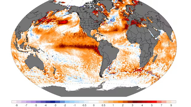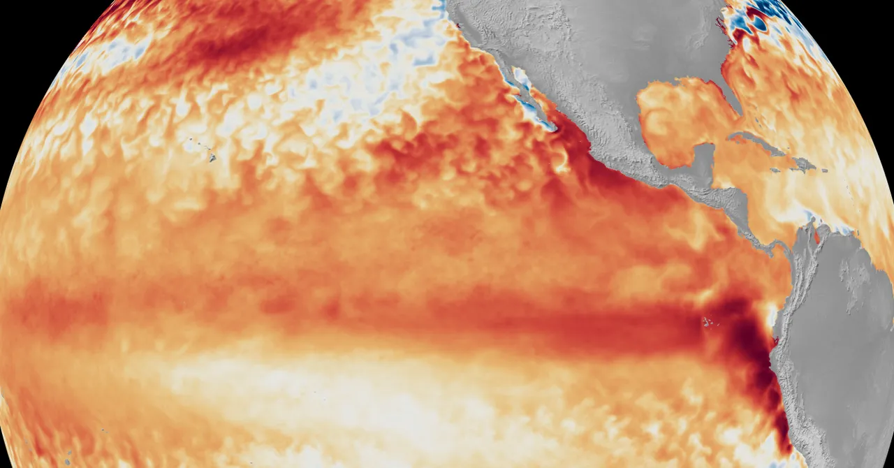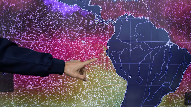
World·PhotosThe El Niño weather pattern won't peak for several months, but some effects are noticeable right now — both in terms of weather and human preparation. Here's a photographic look at some of the ways El Niño is already making its mark.El Niño weather pattern won't peak for several months, but some effects already visibleThomson Reuters · Posted: Aug 31, 2026 2:42 PM EDT | Last Updated: 35 minutes agoListen to this articleEstimated 4 minutesThe audio version of this article is generated by AI-based technology. Mispronunciations can occur. We are working with our partners to continually review and improve the results.Emmanuel Velasquez, head of forecasting and monitoring at the Panama Institute of Meteorology and Hydrology, shows a U.S. National Oceanic and Atmospheric Administration map in Panama City on Aug. 5 of sea surface temperatures indicating unusually warm waters along the Peruvian coast as El Niño warms the eastern Pacific and disrupts marine food supplies. (Enea Lebrun/Reuters)El Niño — the natural climatic chaos agent that pops up periodically and spikes global temperatures — won't peak for several months and should last through next spring, experts say.But there are noticeable effects right now, both in terms of weather and human preparation. Here's a photographic look at some of the ways El Niño is already making its mark.Low water levels in Panama CanalA ship transits the Panama Canal near a hydrometeorological monitoring station on Aug. 27 as a lack of rainfall linked to El Niño affects the water levels in Gamboa, Panama.(Enea Lebrun/Reuters)Panama Canal Authority hydrologist Ricardo Guete shows the low water level on a gauge at the monitoring station in Gatun Lake. The authority will cap daily transits in early September as it gears up for a longer-than-usual El Niño season.(Enea Lebrun/Reuters)Displaced seabirdsBlue-footed boobies rest on rocks near the entrance to the Panama Canal on Aug. 5. Seabirds are appearing in unusual numbers near Panama City as El Niño warms the eastern Pacific and disrupts marine food supplies.(Enea Lebrun/Reuters)Preparations across Latin AmericaGovernments across Latin America are mobilizing firefighters, activating contingency plans and preparing water, energy and transportation systems as El Niño strengthens across the Pacific, raising concerns about drought, extreme heat, flooding and other climate-related disruptions in the months ahead.In Honduras, the Secretariat of Risk Management and National Contingencies declared a red alert in 75 municipalities in the central and southern parts of the country and a yellow alert in another 71 municipalities due to climate conditions affecting crops and livestock. Here, police officers on a motorcycle drive past a cornfield affected by drought on Aug. 26.(Orlando Sierra/AFP/Getty Images)Unlike hurricanes or earthquakes, this climate phenomenon develops gradually over months, which gives governments time to prepare before its most severe impacts arrive. In Peru, recently elected President Keiko Fujimori, left, has made preparing for El Niño a top priority.(Ernesto Benavides/AFP/Getty Images)Here, she speaks with Lima Mayor Renzo Reggiardo on July 9 during a cleaning and desilting operation on the Rímac River as a preventive measure against El Niño, which can cause heavy rainfall. Stones and gravel are removed to keep the channel clear and protect the city's drinking water.Indonesia bakesAcross the Pacific, in Indonesia, salt farmers in West Java province are reaping the benefits of an El Niño-driven drought even as crop farmers brace for a prolonged challenge from the baking heat.(Willy Kurniawan/Reuters)Here, a farmer packs sacks of salt on a dyke during harvest at a salt pond in Pengarengan, Indonesia, on July 30.For most of Indonesia, however, the weather pattern is not a positive. Here, villagers collect spring water with bottles at Gunung Batur village in Cilegon, Indonesia, on July 17, after struggling to access groundwater at their homes. Indonesia's Meteorology, Climatology and Geophysics Agency (BMKG) has warned that the country's dry season will be more intense and prolonged than average — in part due to El Niño.(Bay Ismoyo/AFP/Getty Images)A strengthening El Niño has already broken records for intensity in its early stages, and it will likely spark even more wild weather worldwide as it grows, “adding fuel to a planet already on fire,” United Nations officials have warned.While El Niño is not a direct cause of Indonesia's catastrophic wildfire season, it serves as a catalyst, Indonesia's disaster mitigation agency chief told Reuters, with the additional heat and dryness enabling the fires to spread more quickly. Here, firefighters take a moment to commemorate Indonesia's 81st Independence Day by hoisting the national flag in an area affected by forest and land fires in Palangkaraya on Aug. 17.(Reina/AFP/Getty Images)Meanwhile in Canada, models suggest much of the country can expect a warmer winter than usual due to this El Niño, with British Columbia's normally wet south coast potentially seeing far less precipitation and a much lower snowpack. El Niño also typically means fewer tropical storms in the Atlantic.For how El Niño will affect Canada, watch this video.WATCH | What Canadians can expect from a very strong El Niño:What exactly is a ‘super’ El Niño? And what does it mean for you?May 14|Duration 3:25Some climate models predict 2026 will be an El Niño year — and that it'll be a particularly strong one. CBC’s Nick Logan breaks down what that means, and what Canadians can expect.With files from John Mazerolle, Nick Logan and The Associated Press
Images from around the world this summer show the early effects of El Niño | CBC News
The El Niño weather pattern won't peak for several months, but some effects are noticeable right now — both in terms of weather and human preparation. Here's a photographic look at some of the ways El Niño is already making its mark.
870 words~4 min read