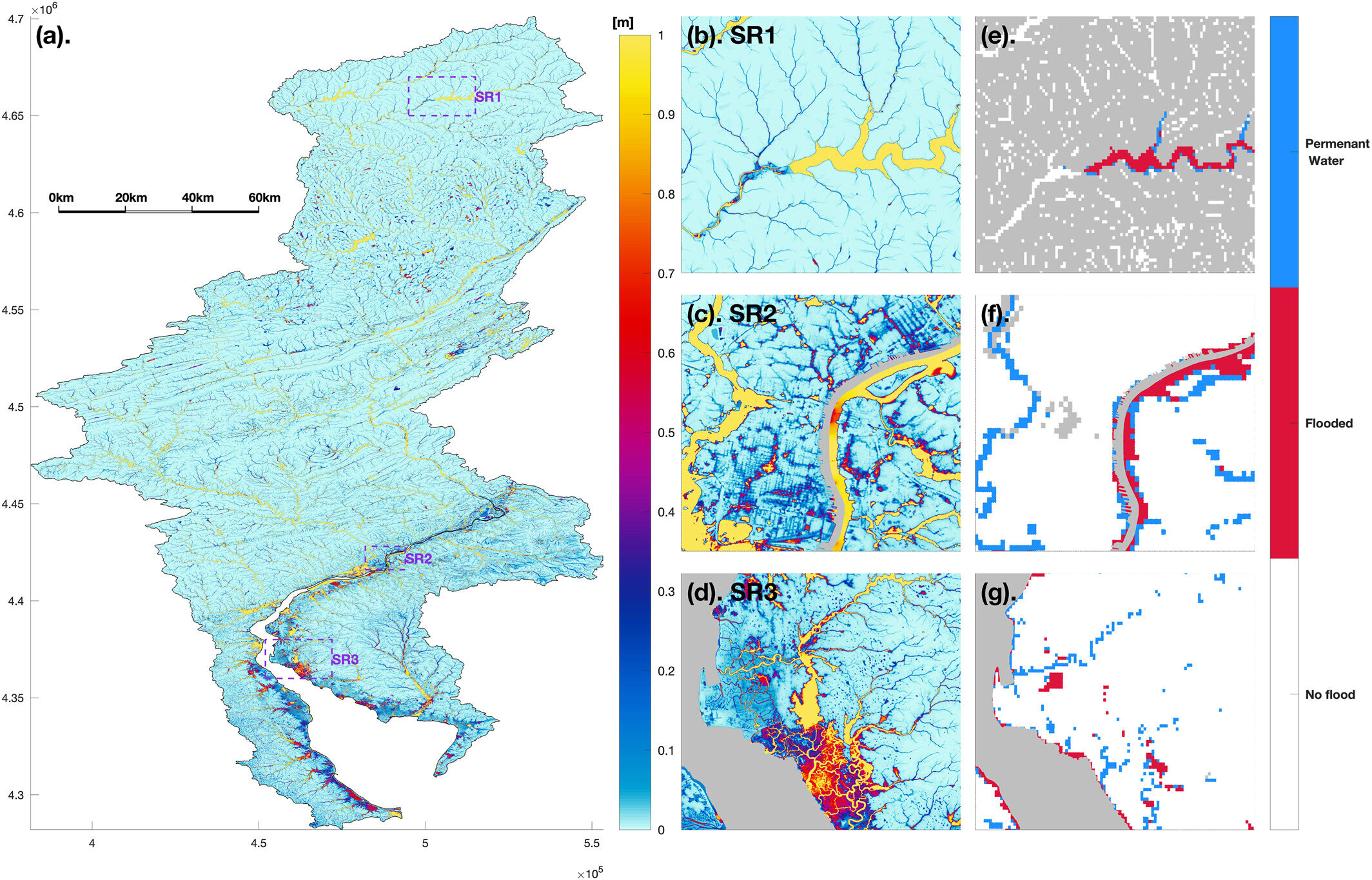
Multi-scale E3SM framework captures inundation distribution across different landscapes. (a) The simulated maximum inundation depth for the entire Delaware River basin, and (b)–(d) for three subregions (SRs) of upstream reservoir (SR1), densely residential area (SR2), and coastal wetland (SR3), respectively. Credit: Geophysical Research Letters (2026). DOI: 10.1029/2026gl122550
Coastal cities are at increasing risk of compound flooding events, such as when heavy rainfall and storm surges occur simultaneously during hurricanes. However, the processes that contribute to urban compound flooding aren't well understood at smaller scales.
To better understand how different drivers of flooding interact near coastal cities, Xu and team used the Energy Exascale Earth System Model (E3SM) with the River Dynamical Core (RDycore) shallow-water equation library to simulate extreme flooding events. Their modeling highlights the importance of rural runoff for urban flooding events, the researchers say, while also underlining the continued role of coastal wetlands in blunting the dangers of compound flooding events. The work is published in the journal Geophysical Research Letters.
The authors simulated Hurricane Irene in the Delaware River basin in 2011. Using the kilometer-scale E3SM configuration allowed them to simulate flood dynamics at the building scale in many cases. They examined how factors such as runoff sources, interactions between rainfall and storm surge, and sea level rise affected flooding in urban areas near the coast.