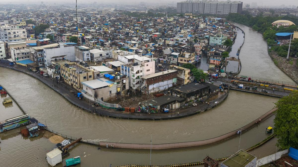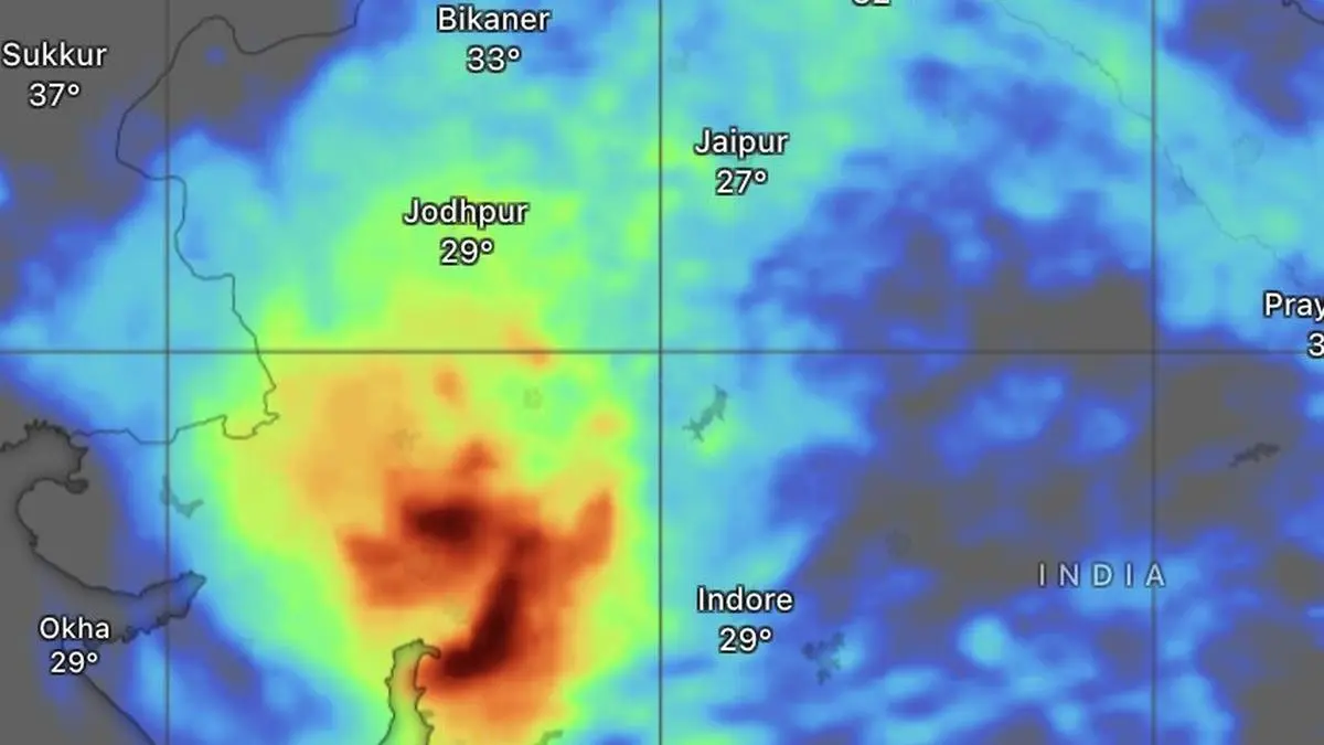
European Centre for Medium-Range Forecasts expects Wednesday’s deluge over south Gujarat to shift towards Vadodara, Godhra, Ahmedabad and Mahesana through Friday.
| Photo Credit:
www.windy.com
One of the most eventful rainstorms in recent memory pummelled South Gujarat as a rare convergence of Arabian Sea moisture and favourable dynamics unleashed cloudbursts of staggering intensity, with Umergam in Valsad district recording an astonishing 106 cm of rain in just 24 hours ending Thursday morning.Rewriting rain chartsThe deluge rewrote rainfall charts across the region. Kaprada (Valsad) measured 79 cm, while neighbouring Silvassa in Dadra and Nagar Haveli received 74 cm. Other phenomenal totals included 66 cm at Khanvel; 63 cm at Daman FMO; 56 cm at Dharampur; 55 cm at Vapi; 54 cm at Daman; 51 cm at Pardi; 46 cm at Nanipalson; 45 cm at Vansda; 39 cm each at Valsad; Khergam and Dolvan; and 36 cm each at Umerpada and Waghai.Aggressive moodIndia Meteorological Department (IMD) said the monsoon will remain in an aggressive mood, forecasting fairly widespread to widespread rainfall over Central, North-West, East and North-East India over the next few days, with occasional widespread showers over South peninsula.The wet spell could gather fresh momentum by the end of July. Numerical weather prediction models indicate the birth of another low-pressure area over the Bay of Bengal, seeded by the remnants of a typhoon crossing the South China Sea. The system is expected to trigger a renewed surge of rain over East India before spreading inland into the opening days of August.Rare configurationMeteorologists attributed the South Gujarat cloudburst to a rare atmospheric configuration in which a temporary easing of El Niño-related suppression of clouds allowed an exceptionally moisture-laden south-westerly flow from the north-east Arabian Sea to sweep inland. The moisture plume interacted with a powerful east-west shear zone stretching from south Gujarat across Madhya Pradesh, north Chhattisgarh, Jharkhand and West Bengal to Bangladesh and onward to Manipur, dramatically amplifying rainfall.Orographic deluge The downpour was further intensified by the rugged northern reaches of the Western Ghats around Saputara, Don Hill and Wilson Hill in the forested Dang and Valsad districts. Moist Arabian Sea winds were forced rapidly up the slopes, squeezing out torrents of rain in a classic orographic deluge rarely witnessed on such a scale.The European Centre for Medium-Range Weather Forecasts (ECMWF) had flagged the potential for exceptionally heavy rainfall over South Gujarat a day earlier. It now projects the heavy rain belt to shift northward through Friday across Vadodara, Godhra, Ahmedabad, Mahesana and adjoining areas.Seasonal trough The monsoon’s seasonal trough, the atmospheric spine driving the rains, extended from Jaisalmer through Kota, Guna, Damoh, Daltonganj and Contai before dipping into the north-east Bay of Bengal. The weather system was reinforced by a western disturbance over Jammu and cyclonic circulations over north-west Madhya Pradesh and south-east Rajasthan, sustaining vigorous monsoon activity across large parts of the country.More areas hit Elsewhere, extremely heavy rainfall of 21 cm or more lashed Konkan and Goa and Madhya Maharashtra during the same 24-hour period. Very heavy rainfall of 12-20 cm occurred over Jammu and Kashmir, East Rajasthan and Madhya Pradesh, while heavy rain of 7-11 cm was reported from West Bengal, Sikkim, Punjab, Nagaland, Vidarbha, Coastal Karnataka and North Interior Karnataka, underlining the monsoon’s renewed vigour. Published on July 23, 2026