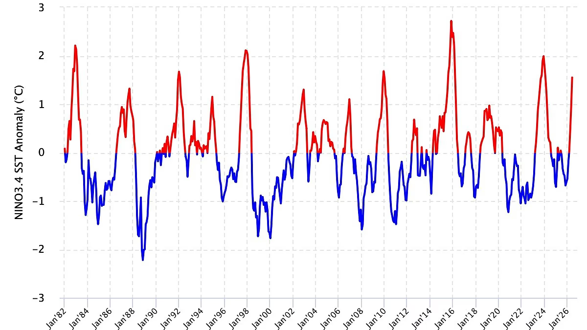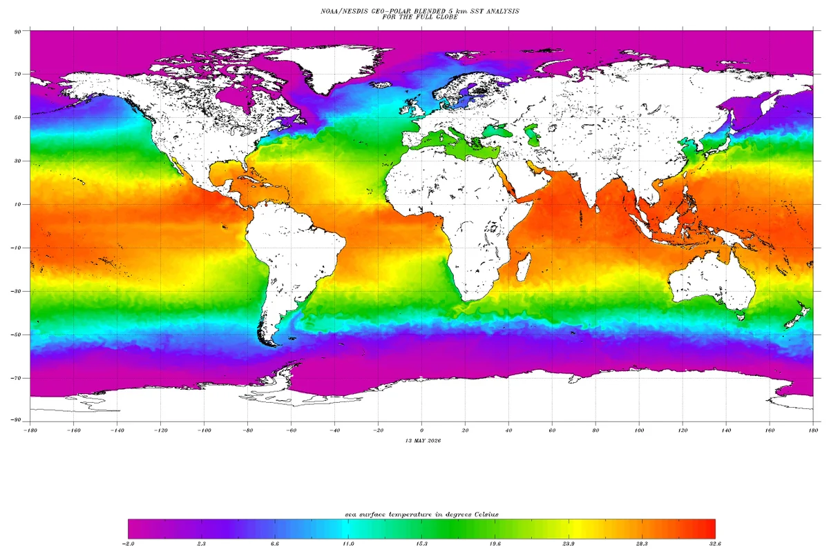
The Climate Prediction Center (CPC), National Oceanic and Atmospheric Administration (NOAA), in its report ENSO: Recent Evolution, Current Status and Predictions, expects El Nino to strengthen through the end of the year, and there is a 97 per cent chance it will linger into early spring 2027.It said that in October-December 2026, there is an 81 per cent chance of having a strong El Nino, and there is a 20 per cent chance that El Nino will be weak instead of very strong.Warming oceansThe report said that El Nino is now established. Sea surface temperatures (SSTs) are above average over the equatorial central and eastern Pacific Ocean, and the atmospheric circulation anomalies over the equatorial Pacific are consistent with El Nino conditions.Between August 2025 and February 2026, below-average SSTs were observed across most of the equatorial Pacific Ocean. Above-average equatorial SSTs have strengthened across the east-central and eastern Pacific Ocean since mid-April 2026, the report added.Over the past four weeks, equatorial SSTs were above average between the Date Line and the eastern Pacific Ocean, while they were below average west of the Date Line.The SSTs in the eastern equatorial Atlantic Ocean were below average, while in the western and eastern Indian Oceans, they were above average. Positive SST anomalies strengthened in the equatorial Pacific, from the dateline to the eastern Pacific.Also, above-average sea surface temperatures (SSTs) have been observed north of the equator in the eastern equatorial Pacific. Above-average SSTs have increased in the east-central and eastern equatorial Pacific OceanThermal ShiftDuring the last four weeks, positive equatorial SST anomaly changes were observed across the east-central and eastern Pacific Ocean, while negative changes were evident in the Atlantic and west-central Pacific Oceans.Negative subsurface temperature anomalies were observed in mid-July 2025 and persisted until December of the same year.Then, from mid-December 2025, positive anomalies began to appear and increased through late April 2026. From late April to late May 2026, positive anomalies decreased. Then they began to increase again from late May 2026.In the past two months, subsurface temperatures have been above average in most of the equatorial Pacific Ocean.Since June 2026, positive OLR (Outgoing Longwave Radiation) anomalies (suppressed convection/rainfall) have persisted over Indonesia, while negative OLR anomalies (enhanced convection/rainfall) have dominated the central and east-central equatorial Pacific, the report said.OLR is the thermal infrared energy emitted from the Earth’s surface, oceans, and atmosphere into space. It acts as a cooling mechanism for the planet and is frequently used as a proxy to monitor atmospheric convection.Published on July 21, 2026
US weather body NOAA predicts 97% chance of strong El Nino lingering into March 2027
NOAA forecasts a 97% chance of strong El Niño lasting into March 2027, with an 81% probability of a very strong event.
418 words~2 min read