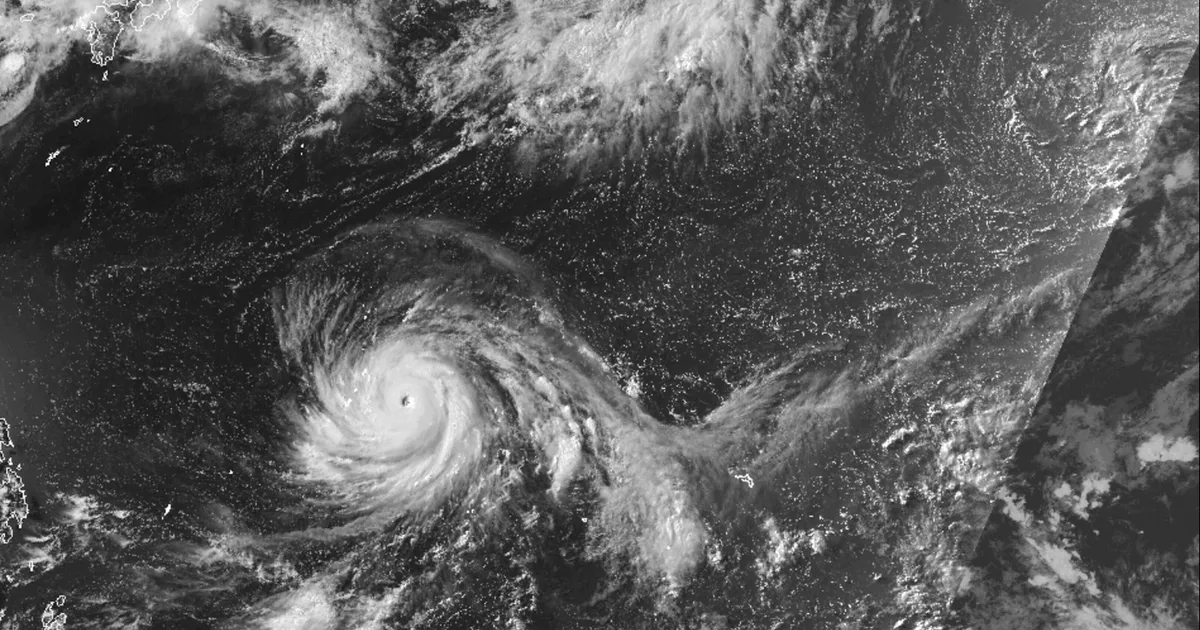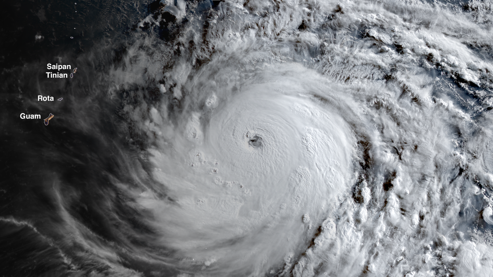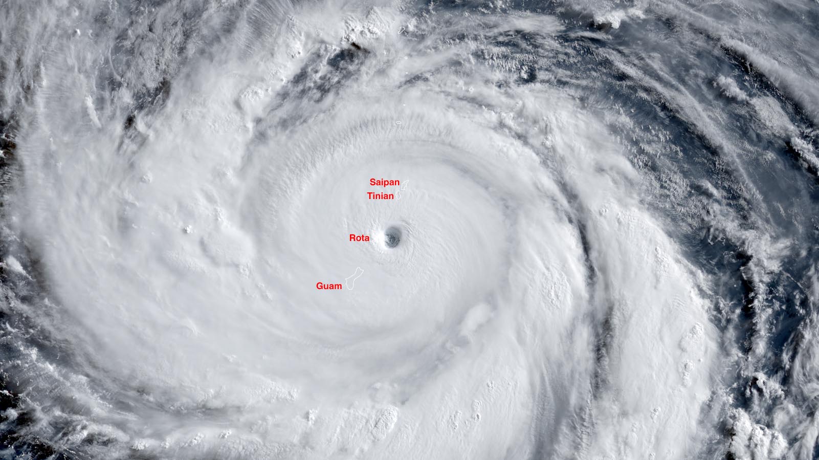
Visible satellite image of Super Typhoon Bavi at 5:30 p.m. EDT Jul 5, 2026, (dawn local time Monday in the Northern Mariana Islands and Guam) as the storm’s eye was moving over Rota Island. At the time, Bavi was at peak strength, with 180 mph (290 km/h) winds. (Image credit: NOAA/RAMMB/Colorado State University)
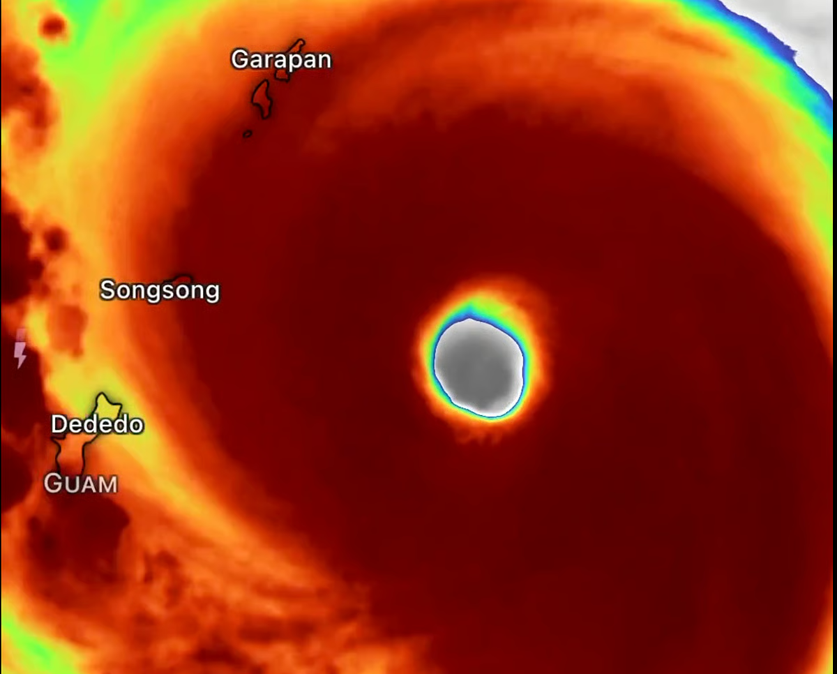
Super Typhoon Bavi blasted through the U.S. Northern Mariana Islands just after sunrise Monday local time (Sunday evening U.S. EDT) as a high-end Category 5 storm with 180 mph (290 km/h) winds, according to the Joint Typhoon Warning Center. Between 6 and 7 p.m. EDT Sunday, the eye of the great storm completely encompassed the small island of Rota (population 1,900), which likely suffered severe to catastrophic damage. Heavy damage was also likely to have occurred south of the eye in northern Guam and to the north, over the islands of Tinian and Saipan. The Japan Meteorological Agency, the official agency responsible for typhoon warnings in the Northwest Pacific, estimated that Bavi’s central pressure at the time was 910 mb, with 125 mph (205 km/h) winds (10-minute average, which is normally substantially lower than the one-minute average used by the Joint Typhoon Warning Center).