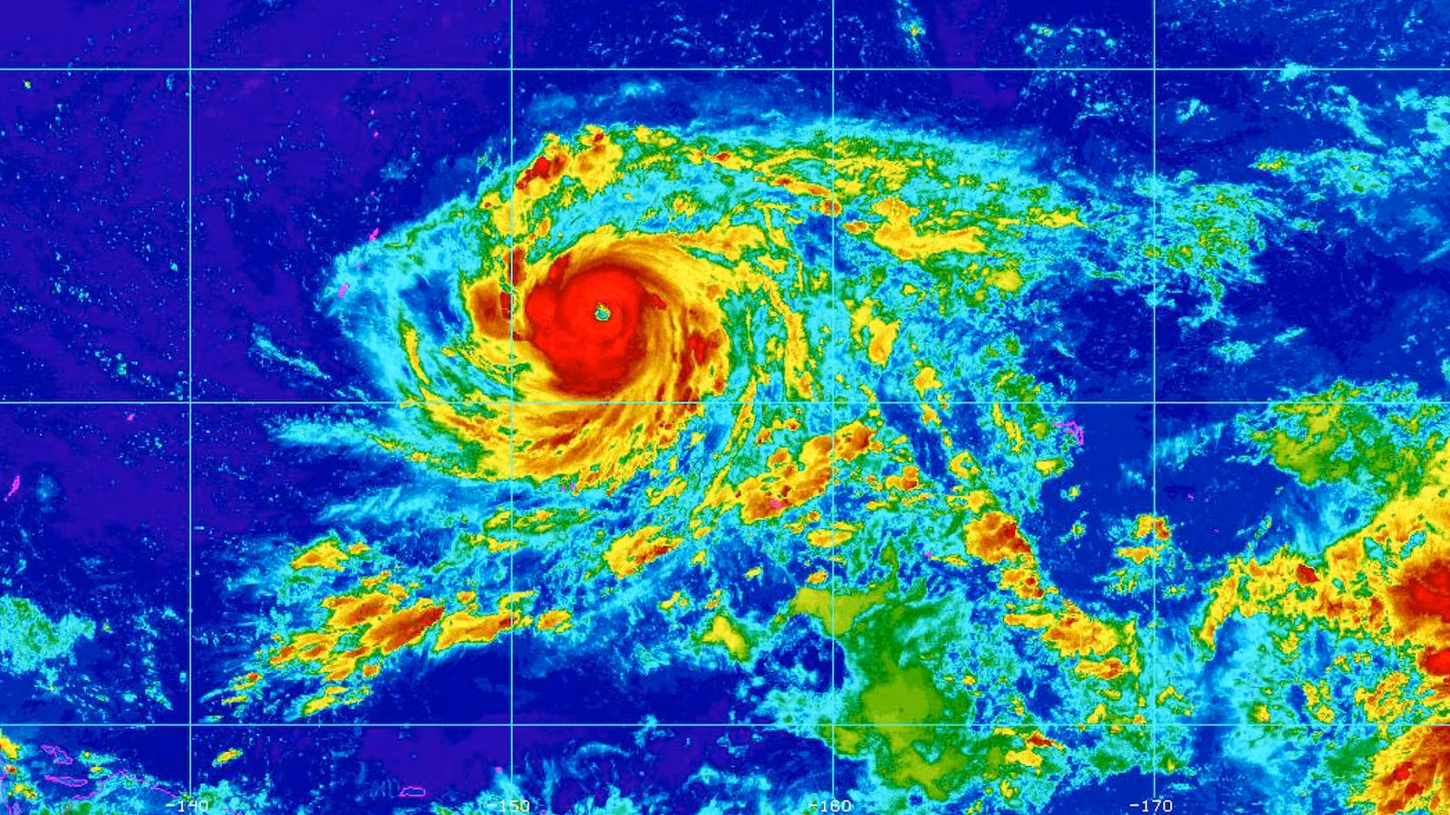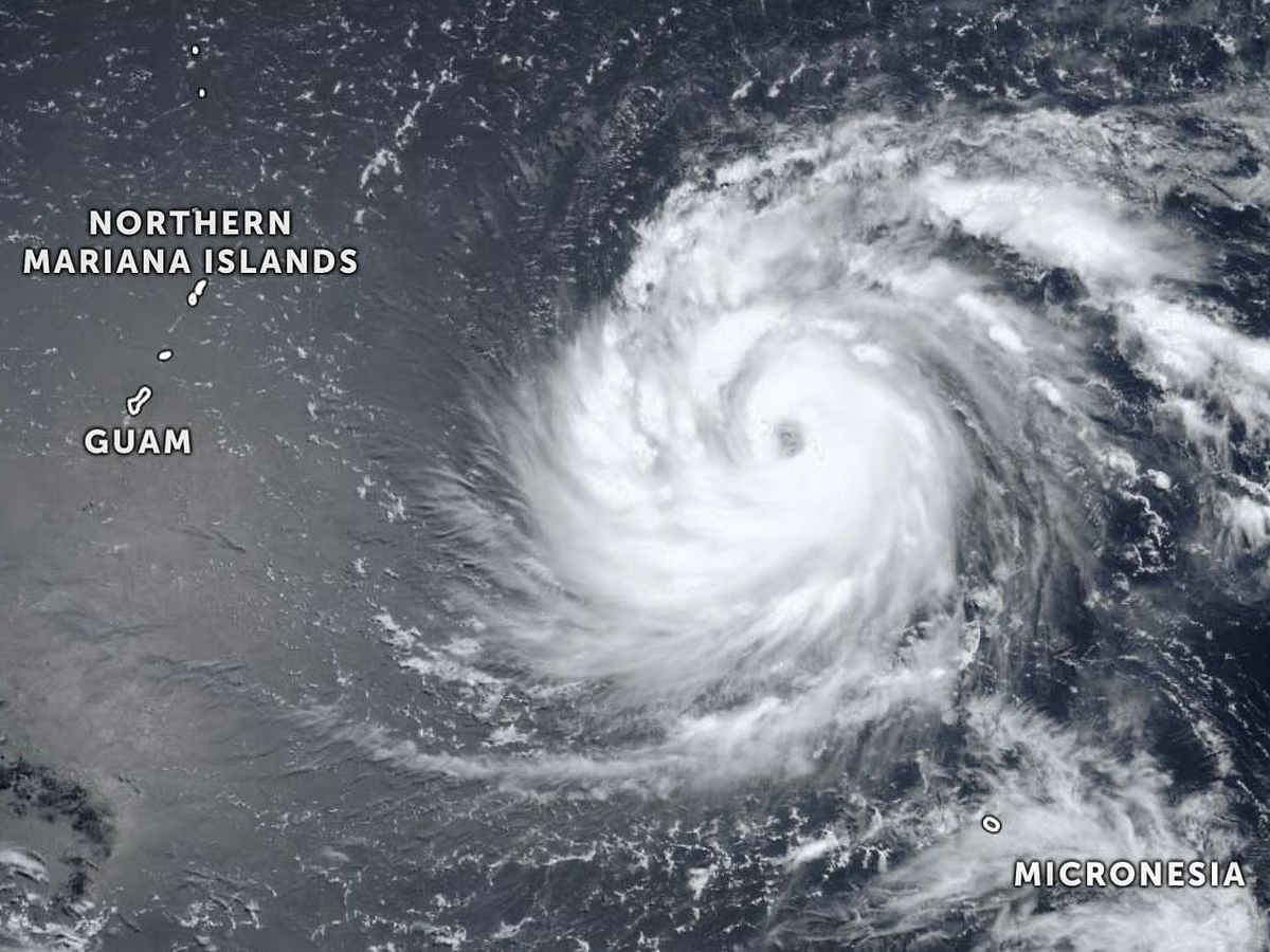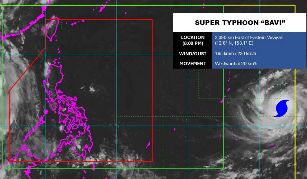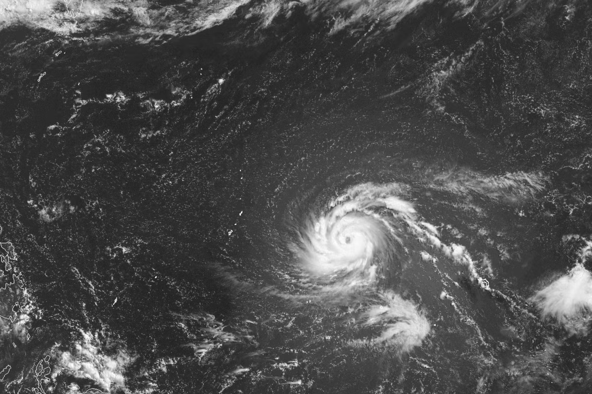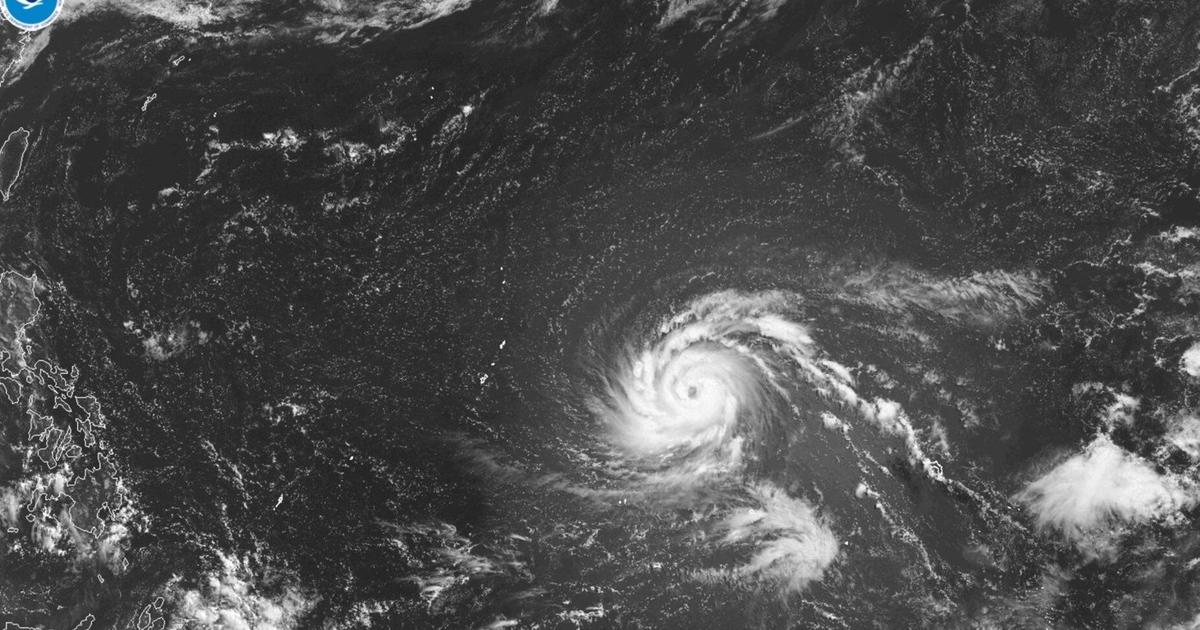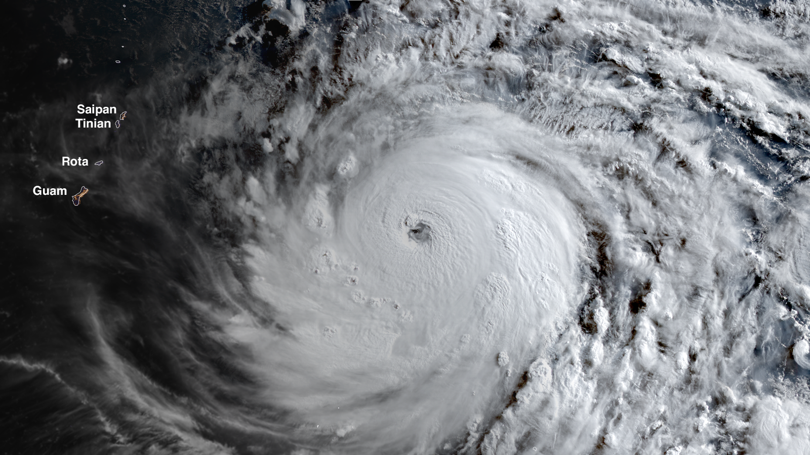
Typhoon Bavi put on a rare display of rapid intensification over the warm Pacific waters east of Guam on Thursday and Friday, becoming the world’s third Category 5 tropical cyclone of the year at 2 p.m. EDT July 3, with 160 mph (260 km/h) winds, according to the Joint Typhoon Warning Center (JTWC). Bavi intensified by 75 mph (120 km/h) in the 24 hours ending at 12Z Friday, and 100 mph (160 km/h) in the 36 hours ending at 18Z Friday — far exceeding the official definition of rapid intensification of a 35 mph increase in winds in 24 hours.
At 21Z Friday, the Japan Meteorological Agency, the official agency responsible for typhoon warnings in the Northwest Pacific, estimated that Bavi’s central pressure was 935 mb, with 110 mph (175 km/h) winds (10-minute average, which is normally substantially lower than the 1-minute average used by the Joint Typhoon Warning Center).
Bavi took advantage of favorable conditions for its extreme rapid intensification: low wind shear of 5-10 knots, sea surface temperatures of 29-30 degrees Celsius (84-86°F), with warm waters that extended to great depth (an ocean heat content over 110 kilojoules per square centimeter).
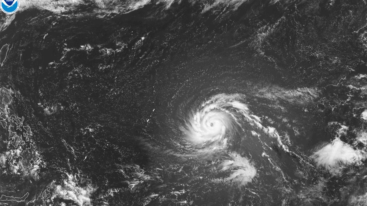
Figure 1. Predicted winds (in knots; multiply by 1.15 to get mph) and sea level pressure (in mb) for Tropical Storm Bavi at 21Z Sunday, July 5, 2026, as predicted by the 12Z Friday, July 3, run of the HAFS-A model. Bavi was predicted to be a Cat 5 storm with 175 mph (285 km/h) winds and a central pressure of 905 mb, passing just south of Tinian Island in the U.S. Northern Mariana Islands. (Image credit: tropicaltidbits.com)