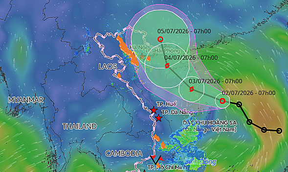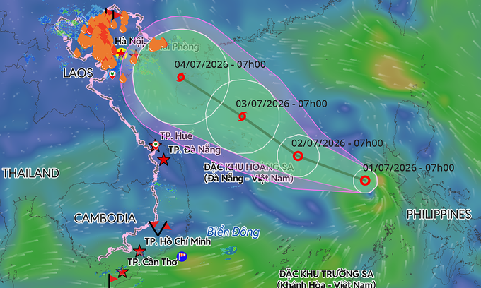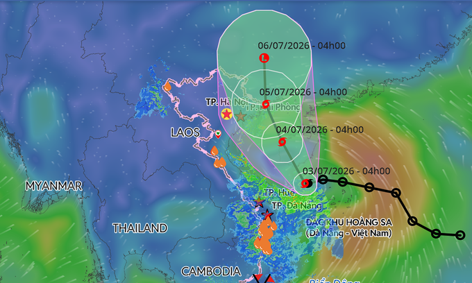
According to the National Center for Hydro-Meteorological Forecasting, the storm lay centered 110 km southeast of China's Hainan Island at 4 a.m. Friday. It was packing maximum sustained winds of 74 kph, with gusts of 89–102 kph, and moving northwest at 10–15 kph.
Forecasters said Maysak is expected to continue tracking north-northwest over the next 24 hours, passing west of Hainan Island. By early Saturday, it is forecast to remain over the island's western region with little change in intensity.
The storm is expected to enter the Gulf of Tonkin by early Sunday before approaching the coast between Quang Ninh and Hai Phong, home to Ha Long Bay and other popular coastal attractions. It will then move into China's Guangxi Province, where it is forecast to weaken into a tropical depression on Monday.
Meteorological agencies in Japan and Hong Kong also predict the storm will maintain winds of around 65 kph over the Gulf of Tonkin before strengthening to about 72 kph as it nears the Vietnam-China border.
The storm is expected to bring deteriorating weather conditions across northern coastal waters. From Friday night, winds in the Gulf of Tonkin will strengthen to 39–61 kph, increasing to 62–74 kph with gusts of up to 102 kph near the storm's center. Wave heights are forecast at 2–4 m, while coastal areas from Quang Ninh to Hung Yen could see waves of 2–3 m.